Monday, March 7, 2011

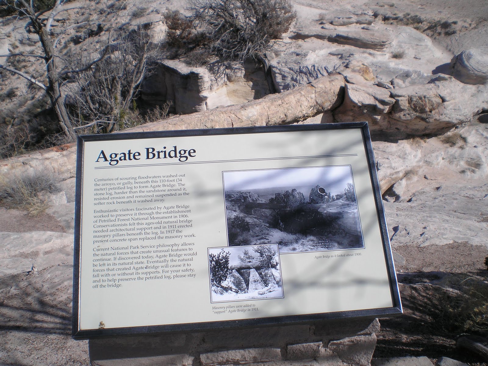
Painted Desert/Petrified Forest National Park

Page, AZ


    Though I visited the Painted Desert/Petrified Forest Natl Park on Th 3 Mar, have moved this to the top post since I've added more photos. [Click 1 or 2 times to zoom in.]


    Some text to follow later -- after lunch & a shwr, hopefully with unlimited Colorado River water. [OK, so a few Angelinos will have to skip watering their lawns for a few days. :-)>]


Links:

  • Natl Park Service web site on the Painted Desert
  • Natl Park Service web site on the Petrified Forest
  • Wikipedia article on the combined park
  • Brief Wikipedia history of Holbrook, AZ
T 8 Mar Route: Page - Big Water, UT - Kanab, UT

Sunday, March 6, 2011

Organ Pipes Cactus Natl Monument

Tucson, AZ


    After driving from Kingman to Wickenburg to Ajo on 12 Feb and finally locating an RV park with WiFi after dark, I headed for Organ Pipes Cactus Natl Monument the next morning. [While I'm posting these photos and some explanatory text today or tomorrow, in about 10 days I'll change the date to 13 Feb.]

    The first photo is of the Kris Eggle Visitor Center, which is named for a NPS ranger who with several Border Patrolmen attempted to apprehend two illegal aliens. One surrendered but the second opened fire with an AK-47, hitting Ranger Eggle below his vest causing a fatal injury.

    The first two photos show good views of an organ pipe cactus; I suspect this one gets more water than the few I saw along the road to the Visitors Center. I also saw one while driving around Tucson, but wondered if the owner obtained his at the "Midnight Cactus Nursery." [Click 1 or 2 times to read "Challenge and Sacrifice."]


    The fourth photo is of a chainfruit cholla at the Visitor Center.


     While driving AZ Highway 86 from Organ Pipes NM to Tucson I came across a historical marker which described a late 1880s gold-mining boom that went bust.


Links:

M 7 Mar Route: Page-Lake Powell (RV) Campground

Death Valley, Part II: Badwater to Julibee & Salsberry Passes

Tecopa Hot Springs, CA

    Even though I finished my drive throught Death Valley Natl Park on 10 Feb I've decided to make this the most recent post; in 7-10 days I'll move it back to 11 Feb.


    If there's one spot in Death Valley which is considered "must-see," it's Badwater at 282 ft below sea level. The first photo looks to the north up Death Valley; note that there is some water of the edge of the salt flat.


Click once or twice to zoom in.


    Snow-capped Telescope Peak, the higest point in both the Panamint Range and Death Valley NP looms over the path out to presumably the lowest point at Badwater.


    Click 1 or 2 times to enlarge.


    The peak on the left is Telescope Pk, 11,049 ft.


    Stopped past Jubilee Pass and just short of Salsberry Pass for a late lunch. Only saw a vehicle roughly every 20 minutes; my guess is that the route from Shoshone over Salsberry Pass is the least-traveled route to/from Death Valley.


    Desert Holly--in bloom. Here's what the DV brochure had to say about this plant: "Death Valley's low moisture, intense sunlight, drying wind, and salt from nearby salt flats limit plant growth. Desert holly typifies plants adapting to deserts. Its silver-colored leaves reflect sunlight and turn on edge to reduce exposure. Dormant in summer, it grows and flowers in winter, pollinated not by insects but by wind. Insects appear when rare rains make spring wildflowers sprout and bloom.
--
    Finally, looking into Nevada from the east side of Salsberry Pass.


Links:

Su 6 Mar Route: Page, AZ

Saturday, March 5, 2011

Flagstaff - Sunset Crater Volcano NM - Wupatki NM - Page, AZ

Page, AZ

    After stopping by the Flagstaff Albertsons, where I bought some Resers Potato Salad, I headed north on US89. Like most other cities some of the big-box stores which formerly may have been concentrated in the downtown area are now along major arteries such as the road to Tuba City and Page.

    Less than 15 miles north of Flagstaff I saw a sign pointing right to the Sunset Crater Volcano Natl Monument. Since I have a Golden Age Pass I decided to take a look-see. While there is a loop road connecting this Natl Monument with the Wupatki Natl Monument to the north, that would have taken a couple of hours. I asked the young lady working the Visitor Center for the NPS where I could get a good shot of the crater, she said there was an outlook about 1.5 miles up the road.


    She was not mistaken -- as you can see from the photo to the right as well as several which follow.


    [Click once or twice to zoom in.]


    The volcano which left the crater erupted sometime beteen 1040 and 1100.


    Photo looking due north up US89.


    One final look back at the San Francisco Mtns north of Flagstaff.


Ruins of Citadel Pueblo.


Links:

Revised Su 6 Mar Route: Page, AZ

M 7 Mar Route: Page, AZ

Friday, March 4, 2011

Visited Painted Desert/Petrified Forest Natl Park Yesterday

Winslow, AZ

    Spent yesterday touring the Painted Desert/Petrified Forest National Park east of Holbrook, AZ. I did stop at the former while driving to Augusta, GA, and Ft Gordon in Nov 1961, but may have only taken a few photos of the Painted Desert at the time.

    However, yesterday I took 40+ photos. I need some time to pick out the 10-12 best photos for 1 or 2 posts. Also, there's some rain/snow headed this way early next week, so I want to move to a lower elevation by Sunday afternoon.

    Was forced to boondock [or, dry camp] last night because I couldn't locate a campground and my gas tank was almost empty. This morning I noticed snow on the mountains to the west, which I believe were mentioned in one of the displays yesterday as the San Francisco Mtns north of Flagstaff. [Click once or twice to zoom in on the mtns directly behind the building in the center of the photo.]

F 4 Mar Actual Route: Winslow - Walnut Canyon Natl Monument - Flagstaff

Sa 5 Mar Route: Flagstaff - Gray Mtn - Cameron - Page

Su 6 Mar Route: Page, AZ - Kanab, UT

Wednesday, March 2, 2011

Vegetation Zones/Changes, Globe to Show Low to Holbrook

Holbrook, AZ

    Since I didn't have time in yesterday's post of the many photos I took during the drive from Globe to Show Low and then on to Pinetop, thought I'd describe the changes in the vegetation as the elevation changed.

    Most of the flora around Globe consisted of Mesquite trees or bushes, prickley-pear cactii, and some large cottonwood trees in some of the damper dry creek beds. The first change as I drove north was that I saw fewer cactii as I gained elevation. Then juniper trees began to appear; a bit higher, and some oak trees were mixed in.

    Once I got past the Salt River Canyon and back up to c4500-5000' some ponderosa pines began to appear. At first they were a bit spindley from lack of moisture, but as I got closer to Show Low (as well as nearer 7000') the size of the trees began to increase.

    I drove from the Show Low Library to the Hon-Dah Casino thinking I'd see a lot of trees along AZ260. Not so! Instead, I saw a tremendous amount of new building along that corridor of new sub-divisions as well as businesses to support them. In fact, there were some relatively new towns such as Lakeside as well as others such as Pinetop, which had grown.

    Stopped at several RV parks along the way, but all had closed their offices except one with a fair amount of snow and muddy roads with directions to see the assistant mgr at the very back of the park. Continue on to the Hon-Dah Casino, but it had closed at 5 p.m. Took 1 of the last 2 flyers from their box and headed back to Pinetop where I had seen a motel which also had RV spaces. While looking at the hours on the door of the Blue Ridge Motel and RV Park I wonder why there was no one there. Finally, a women yelled. "The door's unlocked!"

    Since the sun was beginning to set, I wasn't looking more than for a site with electricity. While the site had a full hookup for $25, I told the woman I likely wouldn't used anything but AC power. When I said, "I don't suppose you have WiFI," she said that she did and suggested the closest site to the office.

    After I connected up the 30amp power cord I fired up my laptop, but got a message to click a button on the router. Went back to the office, but she didn't know much about the WiFi other than that several others had fooled around and gotten it to work where they stayed or parked. Send 1 of my sisters a message using my Yahoo acct and returned to my camper.

    Soon discovered that if one clicked on the bottom of the screen for the Access Point on the router where it said "I prefer to enter the passcode myself," that the router, which had no passcode, got on-line. And the signal was strong enough to allow me to listen to jazz form a couple of different streaming sources until I went to bed at midnight.


    Here are a couple of photos I took this morning. The first shows my rig under a good-sized ponderosa pine -- the largest one I saw in the area. The second shows a meadow across AZ260/North Mountain Rd. (Irene remembered the trees and meadows from her visits to Show Low. [Second photo from Pinetop as well as another taken during the drive to Holbrook to follow later.]

--
    The drive to Holbrook saw another change in the vegetations. Since Show Low is c7000 and Holbrook is c5000 the pine trees disappear, being replaced by juniper trees with an occasional Mesquite tree or bush. The further north I got, the sparser the vegetation. Since the Arizona equivalent of CalTrans was working on Arizone Route #77, the primary route from Show Low to Holbrook, I wasn't able to stop & take many photos other than the one to the right. There were some small towns along the way such as Taylor and Snowflake, but they weren't very big.

    However, Holbrook is on I-40, which in many places replaced the subject of the song written by Bobby Troup especially for Nat King Cole, "Route 66." In Nov 1961 when I was headed for Augusta, GA, and Fort Gordon, I drove from Kingman, AZ, to Santa Rosa, NM, on that famed route. Just to the east is the Petrified Forest Natl Park. Can't recall if I took any 127 Ektachrome slides on my Kodak Starflex camera back then, but I'll now be able to take some higher-quality photos with my digital camera.

    Link to a Wikipedia article on Holbrook.

Th 3 Mar Route: Holbrook - Petrified Forest NP - Holbrook - Joseph City - Winslow

Tuesday, March 1, 2011

Globe to Show Low to Pinetop, AZ

Pinetop, AZ


    The drive from Globe on US60 toward Show Low follows a north-easterly path and climbs over several flattish ridges before reaching the rim of the Salt River Canyon.


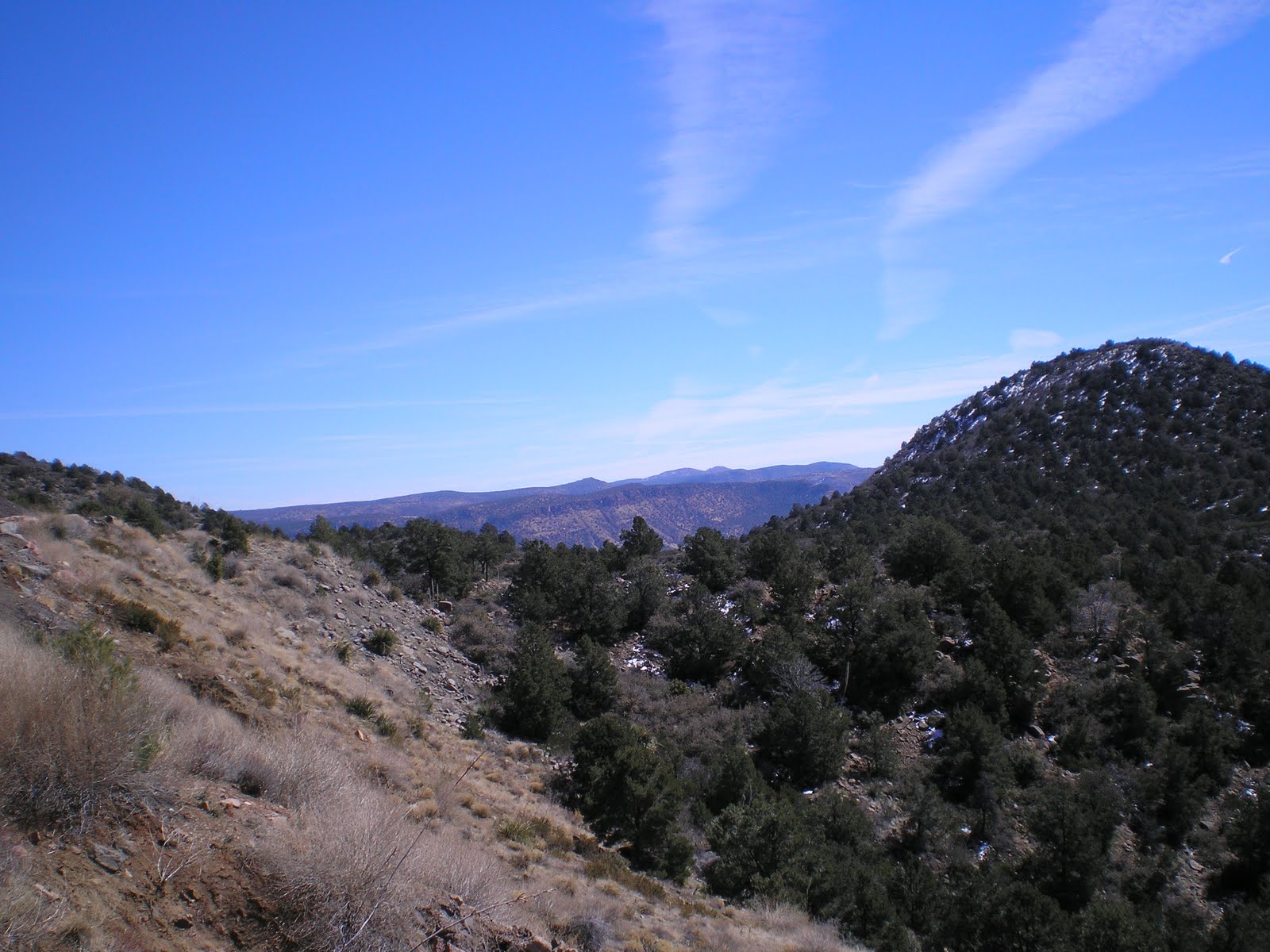
    As you can readily see, there is still unmelted snow on the north and east sides of many of the ridges and peaks. [Click once or twice on a photo to zoom in.]


    While there was no sign indicating a pass, this flat area where the accumulation of roadside snow was somewhat thicker seemed to be a high point on the way to the Salt River; there was a sign marking the 5000' level a bit further down the road.


Salt River Canyon


A view up the Salt River from the shade of a Joshua tree.


Link to Wikipedia article on Show Low.

T 1 Mar Actual Route: Globe - Show Low - Lakeside - Pinetop

W 2 Mar Route: Pinetop - Show Low - Snowflake - Holbrook