Tuesday, October 11, 2011

Four Photos

Oroville, CA
    Here are four photos taken on my drive down CA32 and eventually to Oroville.

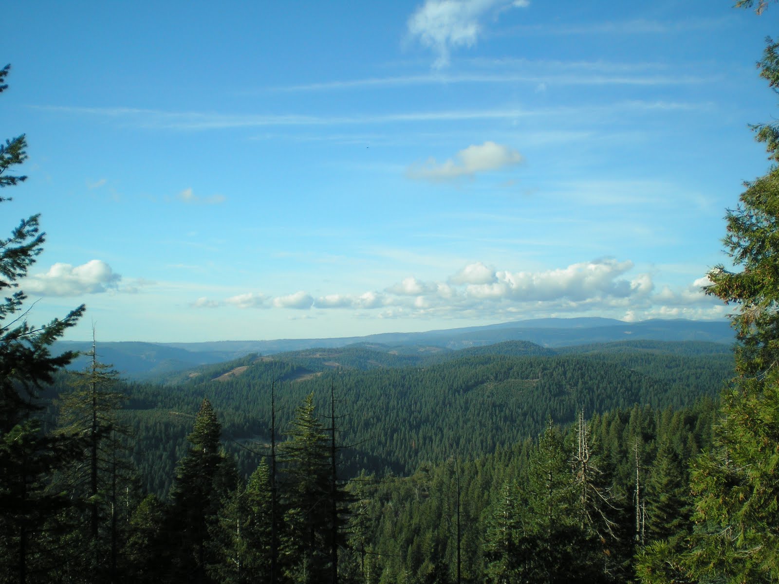
    Though it is obscured in part by clouds associated with an approaching front, Lassen Peak sits in the notch former by two adjacent ridges on the horizon just to the right of the center of this photo, which was taken on the narrow road from CA32 to the USFS Butte Meadows Campground.


    I walked further down the road and now Lassen is still in a notch, but to the left of center.


    Sutter Butes.


    A view of the largest earthen dam in the U.S.: Oroville Dam. [Click 1 or 2 times to zoom in.]
--


Links:

T 11 Oct Actual Route: Orland - Willows - Glenn - Oroville

W 12 Oct Actual Route: Oroville

Th 13 Oct Actual Route: Oroville - Forbestown - Clipper Mills - 9mi W of LaPorte

F 14 Oct Actual Route: LaPorte - E. Quincy - Sierraville - Lwr Little Truckee CG

Sa 15 Oct Actual Route: Lwr Little Truckee CG - Truckee - Martis Crk Reservoir

Su 16 Oct Actual Route: Martis Crk Reservoir - Kings Beach - Lake Forest - Tahoe City

M 17 Oct Actual Route: Tahoe City (Wm Kent CG) - Meeks Bay - Inspiration Point - South Lake Tahoe - Minden - Carson City - Washoe City (David Crk Pk)

T 18 Oct Route: Davis Crk Pk - Minden - Topaz Lake


--

Finding Campgrounds:

N.B. I receive nothing from Trailer Life or Woodalls for including links to their free campground lookups.

Monday, October 10, 2011

McArthur-Burney Falls Memorial State Park

Orland, CA


    Lake Britton, which lies just upstream from Burney Falls. [I did see one rise on this Saturday 10 October morning when the wind died down.]


    Looking generally NE up Lake Britton from the USFS Dusty Campground, which, while created by PG&E is managed by the USFS; it was closed for the season, but the access gate was not only not locked but likely had not been locked for several years.


    A view down the lake toward a RR bridge which is no long in use.


    A "veiled" glimpse of Burney Falls through the trees.


    [Click 1 or 2 times to enlarge] An explanation of what might be called a microclimate.


    A closer look at Burney Falls, which is named after a drifter named Samuel Burney from South Carolina. He was unfortunately in the wrong place at the wrong time. That is, while caring for property owned by Thomas Preadmore, who apparently had mistreated several Indian women, a group of them came looking for revenge. Burney paid the ultimate price -- and, thereafter, many local features were named after him.

    At the bottom of the trail, a clear view of the falls. But, in case you're wondering why the park is named McArthur-Burney Falls Memorial State Park, here's the explanation from the park's brochure. "John and Catherine McArthur arrived in the 1860s, purchased thousands of acres, and opened a mercantile store in the area. In 1917 the newly formed Pacific Gas & Electric Company began buying up land and water rights in the area. [Continued below.]

    A rather large winged insect which was trying to escape my camera's closeup. [More on the McArthurs: "Alarmed residents became concerned that PG&E, in the interests of providing more hydroelectric power, might dam the Pit River and destroy Burney Falls. Frank and Scott McArthur, sons of John and Catherine, purchased 160 acres surrounding the falls, and in 1920 they deeded the property to the State Board of Forestry, requesting only that it be named for their parents."]


    Click once or twice to read the explanation of the porous volcanic rock and Burney Falls.


    When Theodore Roosevelt saw the falls he said it was one of the wonders of the world; see Wikipedia link below. [It's unknown if he used the same expression he used one morning on a camping trip in Yosemite with John Muir and they woke up with snow on their blankets: Bully!]


    "Year round about 100 million gallons a day of clear, cold water flow over the ancient, craggy rock face of the falls."


    A slightly different view of the falls with more sunlight.


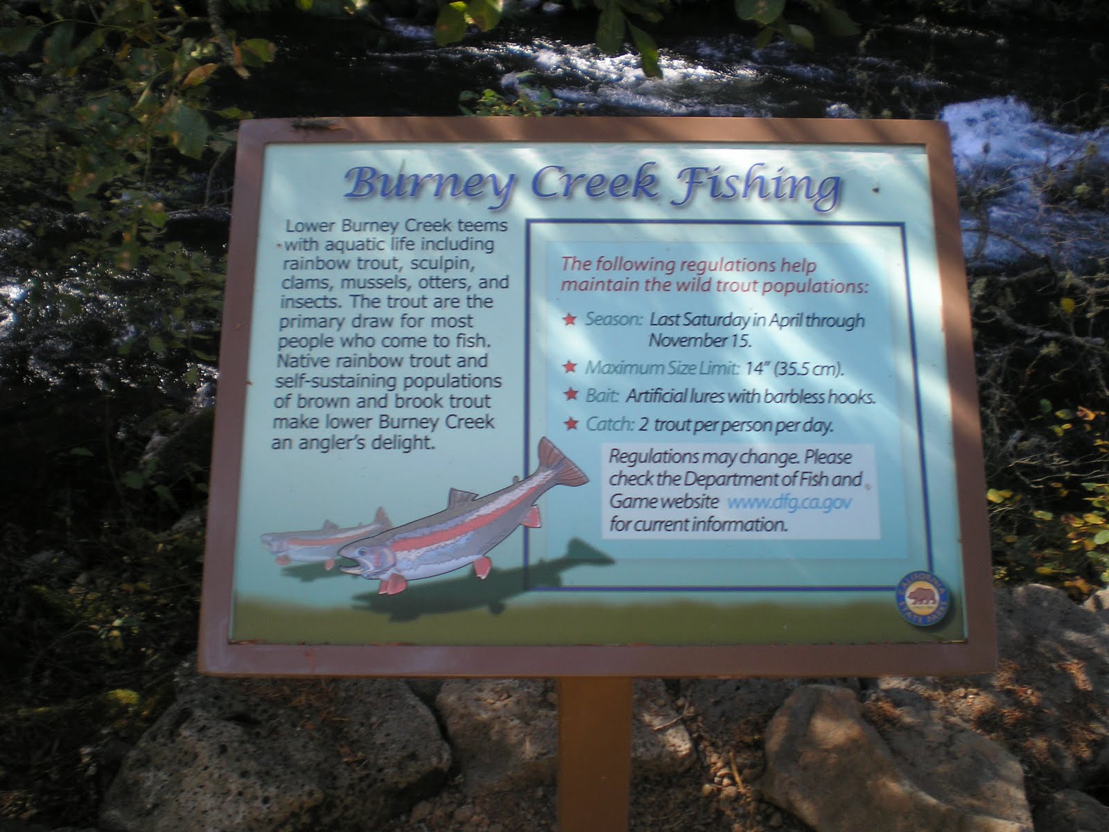
    DFG fishing restrictions for Burney Creek from the base of the falls to Lake Britton.


    Rainbow Bridge, roughly 200 yards below the falls.


    A repeat of the fishing restrictions on Burney Creek from the falls to Lake Britton. However, there is additional information: 1)the stream contains brook and brown trout in addition to native rainbows; and 2)a web address for DFG restrictions, etc.
--
Links:

  • McArthur-Burney Memorial State Park website; it is California's 2d oldest park
  • Wikipedia article on McArthur-Burney Falls
  • Brief RoadTripAmerica piece on Burney Falls

Sa 8 Oct Actual Route: Lake Britton - Burney Falls - Burney - Lassen NP - Gurnsey Crk CG

Su 9 Oct Actual Route: Gurnsey Crk - Chester - Butte Mdws CG

M 10 Oct Actual Route: Butte Mdws CG - Forest Ranch - Chico - Orland Old Orchard RV Park

T 11 Oct Actual Route: Orland - Willows - Glenn - Oroville

W 12 Oct Route: Oroville
--
Finding Campgrounds:

N.B. I receive nothing from Trailer Life or Woodalls for including links to their free campground lookups.

Saturday, October 8, 2011

Lassen Volcanic National Park Redux

Old Orchard RV Park, Orland, CA

    Click 1 or 2 times to see Lassen Peak "dead ahead" on CA 89.javascript:void(0)
    The previous post includes many photos taken on Su 2 Oct [see below] but did not include photos of any geo-thermal areas since they were crowded as others also hasten to see the park before the arrival of the first big storm of the season. Hence, I returned on the following Saturday, 8 Oct, to photograph both Bumpass Hell and the Sulfur Works; but the woman working the NW Entrance told me that if I put on my boots, I'd have to tromp through perhaps a foot of snow to capture images of the former. All of the following photos, save the last, came from the Sulphur Works, which is but a short distance from the SW Entrance.


    The outlet stream from Ridge Lakes -- complete with fumarole.


    One of the branches of Mill Creek with the road in the background and a vent on the side of the yellowish "sand" in the foreground.


    Would you like a warm mud bath? If so, you'd likely emerge after a few seconds somehat "well-done."


    Two small or "baby mud-baths."


    The bluish water smells a bit like rotten eggs -- ie., hydrogen sulfide.


    A plaque listing the 4 other hotspots in Lassen Volcanic NP; only one, Bumpass Hell, can be reached by vehicle; the other three require the use of "shank's mare."


    Connecting the dots, one can see the outline of ancient Mt. Tehama, a volcano which was 8 miles wide at its base and likely reached 11,000 ft. Lassen Peak started as a vent on Tehama [aka Brokeoff Volcano].


    One last look at the Sulfur Works.


    Full Circle. Another photograph of Mount Conard, which was the first feature I "snapped" on the previous Sunday. [Note the nearly-full moon at 1 o'clock.]
--


Links:

Th 6 Oct Actual Route: Shingletown - Anderson - Sacto River RV Park

F 7 Oct Actual Route: Sacto River RV Park - Redding - Burney - Lake Britton

Sa 8 Oct Actual Route: Lake Britton - Burney Falls - Burney - Lassen NP - Gurnsey Crk CG

Su 9 Oct Actual Route: Gurnsey Crk - Chester - Butte Mdws CG

M 10 Oct Actual Route: Butte Mdws CG - Forest Ranch - Chico - Orland Old Orchard RV Park
T 11 Oct Route: Orland - Willows - Glenn - Oroville
--
Finding Campgrounds:

N.B. I receive nothing from Trailer Life or Woodalls for including links to their free campground lookups.

Sunday, October 2, 2011

At Long Last, Lassen National Park!

Shingletown, CA

    As some of you know I've been chomping at the bit to visit Lassen National Park for the first time. It finally opened 2 days after I left my sister's place in Shingletown and eventually traveled north to Oregon on CA97.
    The photo to the right is from the Southwest Entrance road branching north from CA36 and is of Mt Conard (elev: 8240').

    At the left, the top of Lassen Peak (10457'); in the middleground, a craggy mountain called Diamond Peak (7968'); and to the right of the large red fir loaded with cones in the middle of the photo: Bumpass Mtn (8753'). [Incidentally, Bumpass is the name of a former USPS employee -- not what happens when you fall on your posterior!] The yellow-whitish area, caused by sulfate crystals, is still an area of geothermal activity.


    [Click 1 or 2 times to zoom in.] A view back down toward the Kohm Yah-mah-nee Visitor Center through the trees just above the bridge railing below the Sulfur Works.


    Mount Diller (9087') in front with Pilot Pinnacle (8886') behind it as seen from the first large hairpin turn up the road from the Sulphur Works.


    Another view of Mt Diller and Pilot Pinnacle from further up the road.


    A closer shot of Diamond Peak as I look for a place to stop for lunch.


    A clear view of Lassen Peak as well as a parking place where I ate lunch.


    [Click 1 or 2 times to enlarge.] What does the top of Diamond Peak look like to you? A crown where the left side had fallen? A turtle on its back kicking its feet and complaining, "I fell over backwards and can't get up"?


    Lassen Peak uber alles.


    Yet another view of Mt Diller and Pilot Pinnacle.


    Lassen Pk as seen from the Bumpass Parking Lot.


    Lake Helen as seen from near the highest point on the road through Lassen NP.


    A plaque on the downhill side of high point (8512') in the road, which was built in 1925 and maintained and improved by the Civilian Conservation Corps from 1933 to 1940.


    At first glance the lake in the distance might be Juniper Lake, the biggest lake in the park. However, it's too large and almost certainly is Lake Almanor.


    Panning to the left slightly there appears to be another lake in the distance; believe that's the eastern (Big Springs) portion of Lake Almanor.


    I took this shot of the top of Lassen Peak and because there appeared to be a small white structure near the top; however, I should have zoomed in bit before shooting this since I can't make out anything on the top.


    The top of Lassen Peak as seen across Kings Creek's Upper Meadow.


    Summit Lake from a campground closed for the season. (Since there was a controlled burn [management burn in USPS-speak] nearby, the closure was warranted.)


    Hot Rock. No, a thief didn't ditch this "hot rock" as a posse closed in on him; rather, a May 19, 1915 eruption propelled it to the spot where B.F. Loomis took this photo.


    Crescent Crater (8645'), where the "blowout area" is reminiscent of another more recent blowout of another mountain in the Cascade Range: Mount St Hellens in Washington.


    Manzanita Lake, which at one time contained large brown trout -- and, despite the efforts of nimrods, may still harbor a few.


    The larger northeastern portion of Manzanita Lake. Incidentally, fishing at Manzanita is now catch and release only. Artificial lures with a single barbless hook and no power bait. Manzanita Creek above the lake is closed to fishing.


--
Links:

--

Su 2 Oct Actual Route: Lake Almanor - Lassen NP - Shingletown

M 3 Oct Actual Route: Shingletown

T 4 Oct Actual Route: Shingletown

W 5 Oct Actual Route: Shingletown

Th 6 Oct Actual Route: Shingletown - Anderson - Sacto River RV Park

F 7 Oct Actual Route: Sacto River RV Park - Redding - Burney - Lake Britton

Sa 8 Oct Actual Route: Lake Britton - Burney Falls - Burney - Lassen NP - Gurnsey Crk CG

Su 9 Oct Actual Route: Gurnsey Crk - Chester - Butte Mdws CG

M 10 Oct Atual Route: Butte Mdws CG - Forest Ranch - Chico - Orland Old Orchard RV Park
--
Finding Campgrounds:

N.B. I receive nothing from Trailer Life or Woodalls for including links to their free campground lookups.