Wednesday, July 17, 2013

Beartooth Highway, Montana

Beartooth Highway, Montana

Rawlins, WY, Library


    A sign just to the east of Cooke City, MT, which was originally known as Shoo Fly. [Photos taken on 18 July.]


    A look west at the peaks in the NE corner of Yellowstone from the Colter USFS Campground, which was named for the Kentuckian who split from the Lewis & Clark Expedition in Aug 1806 to trap in the Yellowstone area.


    Panning left....


    Looking back toward Yellowstone from a ridge-top as one ascends the Beartooth Highway.


    Not quite above the timberline yet as one ascends US Highway 212 toward Beartooth Pass.


    A couple of lakes just above the timberline; they were not too far from Little Bear Lake, where traffic was stopped as road crews worked on the road during the 3-4 months of good weather.


    Even the thistles are colorful when in bloom here above the timberline.


    Little Bear Lake.


    While I didn't see the sign at the top of Beartooth Pass (elev: 10,947') this view generally SW is on the plateau just past the top of the pass.


    Panning right....


    Panning right a couple more times the object of my attention finally appears.


    Zooming in I neglected to center Beartooth Peak, but it's in the "ragged" U to the left of center. Its shape lends its name to the peak and the highway. [Click once to enlarge; press ESC to return here.]


    Panning farther right, the highest mountain in this photo is Granite Peak (12,807'), the highest point in Montana.


    Beartooth & Granite Peaks as well as a mid-July snowfield, which explains why the road is only open from mid-May to mid-Oct, weather permitting.


    Gottcha, Beartooth!


    Farther to the west, a shot of two alpine lakes.


    Panning to the right from the two lakes above one sees a series of cascades into a larger lake.


    The remainder of the above lake, Upper Twin Lake, & its twin, which drain into Rock Creek.


    Speaking of which, here's Rock Creek as seen from the Rock Creek Vista Point.[Even if your climbing ability exceeds that of a mountain goat, forget about climbing down to the creek with your fishing rod, for I don't see many fishable holes.]


    Looking down Rock Creek and US212; Red Lodge is "around the bend."


    Looking across Rock Creek Valley.


    Looking "up the valley" along what is likely another fork of Rock Creek toward the Absaroka Mtns.


Links:
Return to Top of Page

F 2 Aug Actual Route: Vy Ave W/M - Ft Casper - Indepedence Rock Rest Area - Rawlins Trk-Stp bd

Sa 3 Aug Actual Route: Rawlins Trk-Stp bd - RV World CG

Su 4 Aug Actual Route: RV World CG - McDs - Tom Neuman Truck & RV - Rawlins, WY bd

M 5 Aug Actual Route: RV World CG - McDs - Tom Neuman Truck & RV - Rawlins bd

T 6 Aug Actual Route: Rawlins bd - Rawlins Lib - Tom Neuman Truck & RV - Rawlins bd

W 7 Aug Actual Route: Rawlins bd - Rawlins Lib - Baggs Sr Ctr - CO13 bd

Th 8 Aug Actual Route: CO13 bd - Craig, CO, Lib - Dollar Tree - Craig Walmart

F 9 Aug Actual Route: Craig W/M - Craig Lib - Craig P.O. - Craig W/M

Sa 10 Aug Actual Route: Craig W/M - Craig Lib - McDs - Meeker, CO - Rifle Colo Rest Area - Walmart

Su 11 Aug Route: Walmart - Rifle Lib - Walmart


Finding Campgrounds:

N.B. I receive nothing from Trailer Life, Woodalls, or FreeCampsites.net for including links to their free campground lookups.

Saturday, July 13, 2013

Yellowstone National Park, Part II

Yellowstone National Park - Part II

Rawlins, WY, Library


    Gibbon Falls (84 ft) on the Gibbon River a short distance from the confluence of that river with Firehole River to form the Madison River.


    A plaque explaining how a 5-mile stretch of road was completed in 118 days despite uncomfortable weather.


    A view through the trees of the Grand Canyon of the Yellowstone from North Rim Drive not too far from Canyon Village.


    Panning upstream a bit....


    Another look down the Grand Canyon of the Yellowstone without the trees.


    A descriptive sign on the canyon below Lower Yellowstone Falls. [Click once to enlarge; press ESC to return here.


    Speaking of which, here's a view of Lower Yellowstone Falls. Told a young fellow next to me that it looks the same as in May 1962 -- except it was easier to find a parking place back then.


    A final look downstream at the Grand Canyon of the Yellowstone as I walked back uphill to my rig parked on North Rim Drive.


    All of the above photos were taken on 26 June; the balance were taken when I returned for a third vist on 17 July.


    My rig parked near the Roosevelt Arch at the north entrance to Yellowstone via Livingston & Gradiner, Montana.


    One of the many terraces in the Mammoth Hot Springs area.


    Panning right....


    Superheated water dissolves calcium carbonate which, when it cools, creates a travertine terrace.


    A closer look at one of the building terraces in the Upper Terrace area near Mammoth Hot Springs


    Looking up the hill one can see several terraces.


    Not sure if this is Minerva Terrace, which is featured on the cover of the Yellowstone Natl Pk brochure.


    Steaming terraces against the backdrop of the furrowed northeast side of the Yellowstone River


    Don't see anyone with a beach towel taking a steam bath -- and for good reason! :-)>


    Despite the high temp, "Some Like it Hot." No, not Marilyn, Jack and Tony, but some microorganisms.


    Utah juniper seem more heat-tolerant than do lodgepole pines.


    Note the columns of what may be basalt to the left of Undine Falls on Lava Creek. Its height is not specified.


    Tower Fall, 132 ft, which drops from a hanging valley almost into the Yellowstone River and eventually joins it.


    While stopped in a wideout along the road from the Roosevelt Lodge to the Lamar River, a large male bison found a patch of dirt about 100' from my camper, pawed it up, and rolled in it for a dust-bath. Not long thereafter, that buffalo and another had crossed the road, which attracted almost as many tourists as buffalo droppings attract flies.


    Once the rubber-neckers had left, I got out & zoomed in on the two bisons who at one point had run from the accumulation of gawkers along the road.


    After finishing lunch I drove on to the Lamar Valley, where this plaque described the problems of travel in the early days of the automobile. [Click once to enlarge; press ESC to return here.]


    Where the Buffalo Roam..... The lush valley of the Lamar River.


    Buffalo Ranch, which was used to rebuild the Yellowstone bison herd after poachers in the 1880s cut its size to less than 40 animals.


    While the park service still uses the Buffalo Ranch buildings, they no longer raise bisons, for they're content with a herd of about 2000.


    Looking across the Lamar River toward what is likely Mount Norris, which is just under 10,000 ft.


    One final look up the Lamar River before heading for the NE Engtrance/Exit near Silver Gate.


Links:
Return to Top of Page

Su 28 Jul Actual Route: Devil's Tower Natl Mon CG - Hulett - Sundance - Newcastle - WY/SD Border bd

M 29 Jul Actual Route: WY/SD Border bd - Jewel Cave Natl Mon - Custer - Mt Rushmore Natl Pk - Keystone - Hill City - Wind Cave Natl Park CG

T 30 Jul Actual Route: Wind Cave NP CG - Hot Springs Lib - Edgemont Lib - Lusk Lib - Lusk bd

W 31 Jul Actual Route: Lusk bd - Lusk Lib - Douglas - Casper - Vy Ave W/M

Th 1 Aug Actual Route: Vy Ave W/M - Stalkup RV Superstore - Casper P.O. - Evansville P.O. - Vy Ave W/M

F 2 Aug Actual Route: Vy Ave W/M - Ft Casper - Indepedence Rock Rest Area - Rawlins Trk-Stp bd

Sa 3 Aug Actual Route: Rawlins Trk-Stp bd - RV World CG

Su 4 Aug Actual Route: RV World CG - McDs - Tom Neuman Truck & RV - Rawlins bd

M 5 Aug Actual Route: RV World CG - McDs - Tom Neuman Truck & RV - Rawlins bd

T 6 Aug Actual Route: Rawlins bd - Rawlins Lib - Tom Neuman Truck & RV - Rawlins bd

W 7 Aug Route: Rawlins bd - Rawlins Lib - Baggs Sr Ctr - CO13 bd


Finding Campgrounds:

N.B. I receive nothing from Trailer Life, Woodalls, or FreeCampsites.net for including links to their free campground lookups.

Sunday, July 7, 2013

Wilcoxson's Ice Cream

Wilcoxson's Ice Cream

Devils Tower National Monument, Wyoming

    Ben & Jerry's, Haagen-Das, or Wilcoxson's. Which would you choose?

    Scroll down to see the answer of those living in the northern Rockies.


?


?


    For those who live in certain parts of Montana and Wyoming, the choice is always the latter since it's made by a Livingston, MT, firm which has been in business since 1912.


    When I parked in front of the Ennis, MT, Library to freeload on their WiFi I noticed a sandwichboard sign next door with several ice cream flavors on it. Didn't pay much attention until later.
    After giving up on finding a stable WiFi connection I looked at the ice cream flavors again and noticed the name "Wilcoxson's" at the top.
    Since that's my mother's maiden name I went inside and asked the Sports Bar's cocktail waitress if she knew where Wilcoxson's ice cream was made. She didn't, but someone in back shouted Bozeman.


    Close -- but no cigar! It's principally made in Livingston, Montana. Founder Carl R[ichman] Wilcoxson bought the confectionary business of his former employer Van Zant.
    Here's Carl's obituary.
....
Carl Richman WILCOXSON
--
Obituary
--
Saturday 13 May 1967 The Livingston [MT] Enterprise, Page One
--
Carl R. Wilcoxson Dies After a Short Illness
--
    Carl R. Wilcoxson, 77, died Saturday morning at his home at 301 W. Lewis after a short illness. Funeral Services will be at 2 p.m. Monday at the First Methodist Church with John Pfleiderer of the First Methodist Church officiating. Burial will be in Mountain View Cemetery.
    Mr. Wilcoxson had been in the wholesale and retail ice cream business in Livingston since 1912.
    He was born July 13, 1889 in New Franklin, Mo. He left home at the age of 15 and worked on a South Dakota ranch for three years.
    He came to Livingston in 1909 and worked on the Brawner ranch for a year. In 1910 he went to work for the Van Zant store where he learned his trade.
    He bought the business in 1912 and has operated it since. He also operated the Park Ice and Storage in Livingston from 1918 to 1945.
    He established an ice cream plant in Billings in 1950, which the firm continues to operate.
    He married Esther Swingley March 18, 1914, in Livingston.
    He was a member of the B.P.O. Elks 246, Masonic Lodge No. 32, AF&AM, Livingston Moose Lodge, Livingston Chamber of Commerce and the family is affiliated with the First Methodist Church.
    Surviving are his wife, a son, Harold D. Wilcoxson of Livingston, and a sister, Mrs. Lelia Melin of Livingston. He was preceded in death by one sister, Mrs. Edna Hill.
    The family requests memorials be to Shodair Hospital in Helena.


    It appears that if Carl Wilcoxson and family are related to my maternal grandfather, it would have been in England.


Links:
Return to Top of Page

Th 25 Jul Actual Route: Circle Pk USFS CG Rd bd - Buffalo Lib - Gillette W/M

F 26 Jul Route: Gillette W/M - Moorcroft Lib - Devil's Tower Natl Mon CG

Sa 27 Jul Actual Route: Devil's Tower Natl Mon CG

Su 28 Jul Actual Route: Devil's Tower Natl Mon CG - Hulett - Sundance - Newcastle - WY/SD Border bd

M 29 Jul Actual Route: WY/SD Border bd - Jewel Cave Natl Mon - Custer - Mt Rushmore Natl Pk - Keystone - Hill City - Wind Cave Natl Park CG

T 30 Jul Actual Route: Wind Cave NP CG - Hot Springs Lib - Edgemont Lib - Lusk Lib - Lusk bd

W 31 Jul Actual Route: Lusk bd - Lusk Lib - Douglas - Casper - Vy Ave W/M

Th 1 Aug Actual Route: Vy Ave W/M - Stalkup RV Superstore - Casper P.O. - Evansville P.O. - Vy Ave W/M

F 2 Aug Actual Route: Vy Ave W/M - Ft Casper - Indepedence Rock Rest Area - Rawlins Trk-Stp bd

Sa 3 Aug Actual Route: Rawlins Trk-Stp bd - RV World CG


Finding Campgrounds:

N.B. I receive nothing from Trailer Life, Woodalls, or FreeCampsites.net for including links to their free campground lookups.
--

Wednesday, July 3, 2013

Dick & JoAnne (Bock) Teman, Stevensville, Montana

Dick & JoAnne (Bock) Teman, Stevensville, Montana

Laurel Library, Montana
    Dick Teman (SCHS,'54) and JoAnne (Bock) Teman (SCHS,'57) on the front porch of their Stevensville, Montana ranch house on 3 July. I spent nearly a week with them, except for a few days above Lake Como when the weather got hot. And I got my first taste of antelope. I jokingly said, "Nice to meet a Teman with hair," when I first shook hands with Dick.

    This may be the better of the two photos. My thanks to Dick for shortening one of the tie-downs on my camper as well as making access to my gas tank possible without loosening a tie-down. And thanks to JoAnne for giving me some tangelos raised by brother-in-law Ted Teman (SCHS,'57), who either shaves his head or has his wife, Pat Wells (SCHS,'57) do it for him.


    Since it was 3 July the campgrounds at Salmon Lake on MT83 were full.


    Panning right....


    The upper or north end of Salmon Lake. The campground at nearby Placid Lake was also full, which caused me to "mush on" toward Seeley Lake.
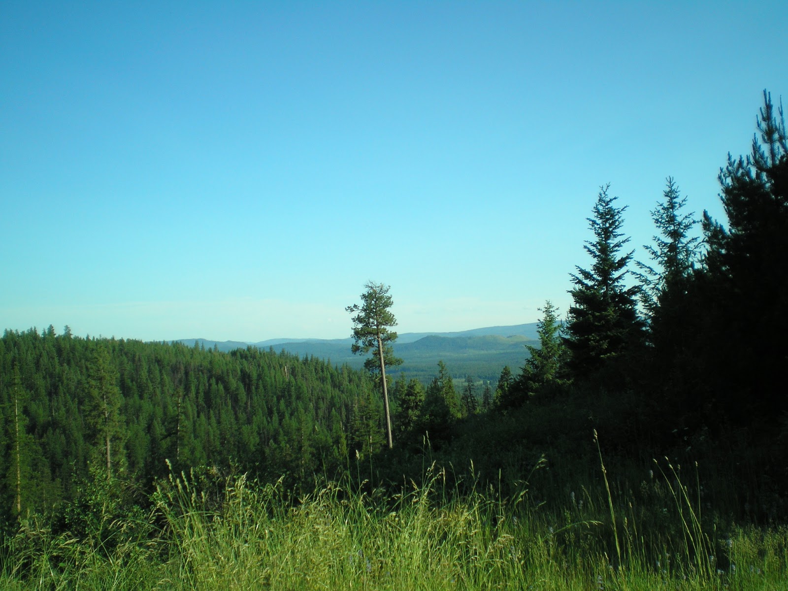


    Because there was no map at the Seeley Lake USFS Ranger Station I chose a Forest Service road and drove til I got to a ridge-top where I could park on level ground. [Click once to enlarge; press ESC to return here.] Seeley Lake is just to the left of the tall, thin ponderosa pine with the dead top.


    The narrow dirt/gravel road with few wide-outs. (Note, flatlanders, the person coming downhill usually backs up to a point where an on-coming uphill-bound vehicle can pass.)


    A rocky peak in the distance contrasts with the intervening ridges covered with ponderosa pines and Douglas fir trees.


    The spot from which I saw the top part of the fireworks at Seeley Lake on the 4th of July while getting into my sleeping bag.


Links:
  • Dictionary.Com entry on tangelo
  • Seeley Lake, MT, Chamber of Commerce website

Return to Top of Page

Su 21 Jul Actual Route: Billings W/M - Hardin McDs - Hardin Truck Stop

M 22 Jul Actual Route: Hardin Truck Stop - Hardin Lib - Little Big Horn National Battlefield Monument - Sheridan W/M

T 23 Jul Actual Route: Sheridan W/M - Sheridan VA Hosp - Buffalo Lib - DeSmet Resv CG

W 24 Jul Actual Route: DeSmet Resv CG - Buffalo Lib - Circle Park USFS CG Rd bd

Th 25 Jul Actual Route: Circle Pk USFS CG Rd bd - Buffalo Lib - Gillette W/M

F 26 Jul Route: Gillette W/M - Moorcroft Lib - Devil's Tower Natl Mon CG

Sa 27 Jul Actual Route: Devil's Tower Natl Mon CG

Su 28 Jul Actual Route: Devil's Tower Natl Mon CG - Hulett - Sundance - Newcastle - WY/SD Border bd

M 29 Jul Actual Route: WY/SD Border bd - Jewel Cave Natl Mon - Custer - Mt Rushmore Natl Pk - Keystone - Hill City - Wind Cave Natl Park CG

T 30 Jul Actual Route: Wind Cave NP CG - Hot Springs Lib - Edgemont Lib - Lusk Lib - Lusk bd

W 31 Jul Route: Lusk bd - Lusk Lib - Douglas


Finding Campgrounds:

N.B. I receive nothing from Trailer Life, Woodalls, or FreeCampsites.net for including links to their free campground lookups.
--