Friday, July 10, 2015

New York's Finger Lakes

New York's Finger Lakes Cortland Library, NY [6 Aug 2015: Correction Made & Additional Link Added]


    While the first link below lists 12 finger lakes, I'll stick with the 5 largest -- in other words: 5 fingers.
    A sign in Geneva, NY, along the northern end of Seneca Lake, the deepest of the 5 middle finger lakes; There's a link below to memories of the Sampson Naval Training Center.
    [Photos taken on 27-29 Aug 2015]


    Looking to the SW one can barely make out much of Seneca Lake's western shore.


    Panning left just the upper end of Seneca Lake is the size of a medium-sized lake.


    From the outskirts of Watkins Glen, which is at the southern end of Seneca Lake. If you look closely, you'll see a large speedboat headed from right to left.


    Note the small waves caused by the wake of the above-mentioned speedboat.
    The 5 biggest Finger Lakes, from east to west, are Skaneateles, Owasco, Cayuga, Seneca, and Canandaigua.


    The next town to the south of Watkins Glen is Montour Falls, which are directly above the white building at the end of the street.


    Zooming in one can see the She-Qua-Ga Falls, as the Indians call it, above the white building. New York has a great number of falls, and all of them which I've seen so far have the same pattern: gradual cascades over what appear to be limestone ledges.


[Return to the top of the page]
Links:

Routes:

    T 25 Aug Actual Route: I-86 Rest Area - Bath, NY, VA Hosp Pharm - Geneseo, NY, Lib - Walmart

    W 26 Aug Actual Route: Geneseo, NY, W/M - McDs - Livonia Lib - Geneseo W/M

    Th 27 Aug Actual Route: Geneseo, NY, W/M - Livonia Lib - Canandaigua - Geneva, NY, McDs - Geneva W/M

    F 28 Aug Actual Route: Geneva, NY, W/M - Waterloo - Seneca Falls Lib - Watkins Glen, NY, NY14 bd

    Sa 29 Aug Actual Route: NY14 bd - Montour Falls Lib - Watkins Glen Lib - Ithaca Best Buy - Walmart

    Su 30 Aug Actual Route: Ithaca, NY, W/M - Lowe's - Robert Treman NY State Park

    M 31 Aug Actual Route: Robert Treman NY SP - Lowe's - Cortland Lib - I-81 Rest Area

    T 1 Sep Actual Route: I-81 Rest Area - Cazenovia McDs - Richfield Sprs - Cooperstown - BBall Hall of Fame - Oneonta W/M

    W 2 Sep Actual Route: Oneonta W/M - Lowe's - Cobleskill, NY, McDs - Amsterdam W/M

    Th 3 Sep Route: Amsterdam W/M - Hm Depot - Gloversville, NY, Lib - Walmart


Finding Campgrounds:

N.B. I receive nothing from Trailer Life, Woodalls, or FreeCampsites.net for including links to their free campground lookups.

Sunday, July 5, 2015

"Grand Canyon of Pennsylvania"

Fort Necessity, Pennsylvania Mansfield Public Library, PA


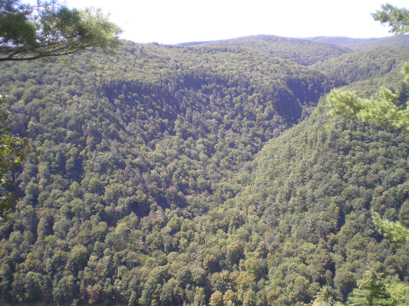
    A first view of the Pine Creek Gorge (aka "Grand Canyon of Pennsylvania") from a viewing point past the Visitor Ctr & Gift Store at the Leonard Harrison State Park.
    [Photos taken on 23 Aug 2015]


    The Pine Creek Gorge is approximately 4,000' from rim to rim.


    Shooting yet lower from the same view point, where the canyon is approximatly 800' deep, one finally catches a glimpse of Pine Creek.


    And looking to the right (up-canyon) one gets a better view of the Pine Creek Gorge.


    Zooming in....


    Looking to the left (ie., down-canyon)....


    Zooming in one can see a road on the left side of Pine Creek.


    Looking up-canyon again one can see the road on the right side of Pine Creek.


[Return to the top of the page]
Links:

Routes:

    Su 23 Aug Actual Route: Mansfield, PA, W/M - Lowe's - Leonard Harrison State Park - Mansfield Lib - Walmart

    M 24 Aug Actual Route: Mansfield, PA, W/M - Lowe's - P.O. - Corning, NY - I-86 Rest Area

    T 25 Aug Actual Route: I-86 Rest Area - Bath, NY, VA Hosp Pharm - Geneseo, NY, Lib - Walmart

    W 26 Aug Actual Route: Geneseo, NY, W/M - McDs - Livonia Lib - Geneseo W/M

    Th 27 Aug Actual Route: Geneseo, NY, W/M - Livonia Lib - Canandaigua - Geneva, NY, McDs - Geneva W/M

    F 28 Aug Actual Route: Geneva, NY, W/M - Waterloo - Seneca Falls Lib - Watkins Glen, NY, NY14 bd

    Sa 29 Aug Actual Route: NY14 bd - Montour Falls Lib - Watkins Glen Lib - Ithaca Best Buy - Walmart

    Su 30 Aug Actual Route: Ithaca, NY, W/M - Lowe's - Robert Treman NY State Park

    M 31 Aug Actual Route: Robert Treman NY SP - Lowe's - Cortland Lib - I-81 Rest Area

    T 1 Sep Actual Route: I-81 Rest Area - Cazenovia McDs - Richfield Sprs - Cooperstown - BBall Hall of Fame - Oneonta W/M

    W 2 Sep Actual Route: Oneonta W/M - Lowe's - Cobleskill, NY, McDs - Amsterdam W/M

    Th 3 Sep Route: Amsterdam W/M - Hm Depot - Gloversville, NY, Lib - Walmart


Finding Campgrounds:

N.B. I receive nothing from Trailer Life, Woodalls, or FreeCampsites.net for including links to their free campground lookups.

Tuesday, June 30, 2015

Fort Necessity, Pennsylvania

Fort Necessity, Pennsylvania Grove Family Library, Chambersburg, PA
    A view of the Fort Necessity Replica on what George Washington called "Great Meadows." It was built when he feared he and his troops would be attacked after an early-morning encounter with some French troops in which 10 of them were killed; he lost one man. The Indians sided with the French.


    [Photos taken on 10 Aug 2015]
    Zooming in, one sees a group of students sifting through dirt looking for artifacts while a ranger stands near the fort's replica in the background.
    On the morning of 3 Jul 1754 the Fort was attacked by about 600 French and 100 Indians. There were considerable casualties on both sides, but Washington's Virginia Milita under control of the British took the worst of it.


    About 8 p.m. the French commander requested a truce to discuss Washington's surrender. To make a long story short, the 21-yr old Colonel surrendered for the first and last time in his life.


    Though there's little in the fort's only building, a storehouse, it was full of food, gunpowder, and other necessities of war as Washington and his troops tried to hold off the French & Indians in what became the 1st battle of the French & Indian War.


    The trenches surrounding the circular fort, which was 53' in diameter.
    The road Washington & his troops started from what is now Cumberland, MD, to Ft Necessity became the basis for what became known as the National Road or Pike.


    A plaque describing the hurried building of Ft Necessity in June & early July of 1754. The 600 French troops & 100 Indians attacked on the morning of 3 July. Due to poor translation of French by a Belgian Washington unknowingly agree to stay away from Gt Mdws for a year, but he accompanied British Gen Edward Braddock as an aide-de-camp in 1755 before Braddock was mortally wounded on 9 July.
[Return to the top of the page]
Links:

Routes:

    Su 16 Aug Actual Route: Chambersburg, PA, W/M - Fayetteville, PA, Gettysburg - N. Gettysburg Laundry - Chambersburg W/M

    M 17 Aug Actual Route: Chambersburg, PA, W/M - Grove Fmy Lib - Gettysburg P.O.- Gettysburg National Battlefield - Chambersburg W/M

    T 18 Aug Actual Route: Chambersburg, PA, W/M - Grove Fmy Lib - Gettysburg P.O.- Gettysburg National Cemetery - Chambersburg W/M

    W 19 Aug Actual Route: Chambersburg, PA, W/M - Grove Fmy Lib - Bedford, PA,Lib - Johnstown, PA, W/M

    Th 20 Aug Actual Route: Johnstown, PA, W/M - Johnstown Flood Natl Monument - State College, PA, Lowe's - Walmart

    F 21 Aug Actual Route: State College, PA, W/M - Williamsport, PA, - Liberty - Blossburg, Mansfield W/M

    Sa 22 Aug Actual Route: Mansfield, PA, W/M - Lib - Lowe's - Mansfield W/M

    Su 23 Aug Actual Route: Mansfield, PA, W/M - Lowe's - Leonard Harrison State Park - Mansfield Lib - Walmart

    M 24 Aug Actual Route: Mansfield, PA, W/M - Lowe's - P.O. - Corning, NY - I-86 Rest Area

    T 25 Aug Actual Route: I-86 Rest Area - Bath, NY, VA Hosp Pharm - Geneseo, NY, Lib - Walmart

    W 26 Aug Route: Geneseo, NY, W/M - McDs - Livonia Lib


Finding Campgrounds:

N.B. I receive nothing from Trailer Life, Woodalls, or FreeCampsites.net for including links to their free campground lookups.

Thursday, June 25, 2015

Mt Davis, Pennsylvania's High Point

Mt Davis, Pennsylvania's High Point Grove Family Library, Chambersburg, PA


    The sign in front of a picnic area created by the Forbes State Forest.


    [Photos taken on 11 Aug 2015]


    A partial view of the Picnic Area near Mt. Davis (3213'), Pennsylvania's High Point.


    Despite what the Wikipedia article says on Mt Davis, a mechanic at a nearby garage said there was a locked gate and a 3/4 mile walk to the top; and a couple at the Picnic Area said it was about a mile to the top. Because of my impaired lungs I drove around to roughly the opposite side of the mountain using the paved roads. To the right is a photo of Pennsylvania's High Point.


    To my right from where I took the above photo of the wooded top of Mt Davis was a fenced family cemetery in the middle of a field where crops are grown.


    The field drains into Youghiogheny Lake.


    Zooming in....[Incidentally, Youghiogheny is an Algonquin word meaning "river which flows in a contrary direction" -- in this case it flows north into the Monongahela River.]


[Return to the top of the page]
Links:

Routes:

    T 11 Aug Actual Route: Keyser, WV, W/M - Cumberland, MD, - Mt Davis, PA, - WV Rest Area

    W 12 Aug Actual Route: WV Rest Area - Chambersburg, PA, Lowe's - Walmart

    Th 13 Aug Actual Route: Chambersburg, PA, W/M - Lowe's - Grove Fmy Lib - Chambersburg W/M

    F 14 Aug Actual Route: Chambersburg, PA, W/M - Grove Fmy Lib - Chambersburg W/M

    Sa 15 Aug Actual Route: Chambersburg, PA, W/M - Grove Fmy Lib - Chambersburg W/M

    Su 16 Aug Actual Route: Chambersburg, PA, W/M - Fayetteville, PA, Gettysburg - N. Gettysburg Laundry - Chambersburg W/M

    M 17 Aug Actual Route: Chambersburg, PA, W/M - Grove Fmy Lib - Gettysburg P.O.- Gettysburg National Battlefield - Chambersburg W/M

    T 18 Aug Actual Route: Chambersburg, PA, W/M - Grove Fmy Lib - Gettysburg P.O.- Gettysburg National Cemetery - Chambersburg W/M

    W 19 Aug Actual Route: Chambersburg, PA, W/M - Grove Fmy Lib - Bedford, PA,Lib - Johnstown, PA, W/M

    Th 20 Aug Actual Route: Johnstown, PA, W/M - Johnstown Flood Natl Monument - State College, PA, Lowe's - Walmart

    F 21 Aug Actual Route: State College, PA, W/M - Williamsport, PA, - Liberty - Blossburg, Mansfield W/M

    Sa 22 Aug Route: Mansfield, PA, W/M - Lib - Ansonia, PA, - Grand Canyon of Penn - Mansfield W/M


Finding Campgrounds:

N.B. I receive nothing from Trailer Life, Woodalls, or FreeCampsites.net for including links to their free campground lookups.

Saturday, June 20, 2015

Moundsville, West Virginia

Moundsville, West Virginia Moundsville, WV
    The aunt who inadvertently got me interested in genealogy was born in Moundsville. Though the library you see to the right is not the one she used as a child, she read more than any of my other aunts; of course, because she had no children, she had more time than those in-laws who did.
    [Photos taken on 9 Aug 2015]

    No, the bridge wasn't twisting in the wind; rather, I drove with one hand and took photos with the other. This view is westward as one leaves Moundsville. My 2010 Road Atlas doesn't show a bridge, but Wheeling & Moundsville are on a panhandle which extends up the western side of Pennsylvannia.


    A view to the right looking up the Ohio River.
     Prior to 15 Aug 1886 when this bridge was built there was a ferry which transported those crossing the Ohio -- though not necessarily at this same location.


    In Ohio looking east at the Moundsville Bridge, which has very little traffic on it.


    OOPS! The red pickup whipped onto the approach from an access road to the right.


    While the Ohio runs north/south here where the bridge was built, it turns east just a short distance downstream, where you can see the wakes of two speedboats.


[Return to the top of the page]
Links:

Routes:

    M 3 Aug Actual Route: Winchester W/M - Lowe's - Harpers Ferry, WV, NHP - Charles Town McDs - Charles Town W/M

    T 4 Aug Actual Route: Charles Town W/M - Dollar Tree - Winchester, VA, Lowe's - Winchester W/M

    W 5 Aug Actual Route: Winchester, VA, W/M - Lowe's - Capon Bridge, WV, Lib - Romney - Keyser W/M

    Th 6 Aug Actual Route: Keyser, WV, W/M - BackBone Mtn, MD, - Grafton, WV, Lib - Grafton W/M

    F 7 Aug Actual Route: Grafton W/M - Clarksburg VA Med Ctr - Morgantown - PA I-79 Rest Area

    Sa 8 Aug Actual Route: PA I-79 Rest Area - Fairmont - Hundred Lib - Moundsville Lib - Walmart

    Su 9 Aug Actual Route: Moundsville W/M - Lib - Wheeling, WV, Lib - Washington, PA, California, PA, Masontown bd

    M 10 Aug Actual Route: Masontown, PA, bd, Uniontown, PA, Ft Necessity Natl Battlefield, Cumberland, MD, - Keyser, WV, W/M

    T 11 Aug Actual Route: Keyser, WV, W/M - Cumberland, MD, - Mt Davis, PA, - WV Rest Area

    W 12 Aug Actual Route: WV Rest Area - Chambersburg, PA, Lowe's - Walmart

    Th 13 Aug Actual Route: Chambersburg, PA, W/M - Lowe's - Grove Fmy Lib - Chambersburg W/M

    F 14 Aug Route: Chambersburg, PA, W/M - Grove Fmy Lib - Chambersburg W/M


Finding Campgrounds:

N.B. I receive nothing from Trailer Life, Woodalls, or FreeCampsites.net for including links to their free campground lookups.

Monday, June 15, 2015

Appomattox Court House National Historic Site

Appomattox National Historic Site, Virginia Eagle Rock, VA, Library
    In order to reproduce the setting where Gen Robert E. Lee surrendered the Confederate States Army of Northern Virginia the National Park Service chose the Appomattox Court House as the center of the reproduced village. However, the actual surrender did not occur at the Court House -- it was done at the McLean House.
    [Photos taken on 5 Jul 2015]


    This was leaning against one of the bottom windows in the McLean House; it summarizes the terms of surrender upon which both General Grant and General Lee agreed: CSA officers could keep their side arrms; all other weapons were to be surrendered; CSA enlisted men and officers could return home with their personal horses and baggage.


    The Weeks Store, which was run by Francis Weeks and served as the Appomattox Post Office. [Appomattox was originally known as Clover Hill.]


    "At midday on April 9, 1865, General Robert E. Lee rode into this yard, dismounted, and disappeared into the McLean House. Grant, surrounded by generals and staff officers, soon followed. After 90 minutes Grant and Lee emerged. To silent salutes of Union officers, Lee rode back through the village -- to his defeated army."
    While the Union Army employed many different tactics in delaying Lee's arrival at Appomattox, his loss of a train of supplies at the Appomattox Train Station to Union Gen George A. Custer left Lee few alternatives.


    The McLean House Parlor where Grant and Lee met to end the hostilities.


    A McLean House bedroom. Wilmer McLean, a sugar speculator, bought the property in Appomattox to be near the railroad in the fall of 1862.


    The McLean House Kitchen, where the black slaves prepared the meals.


[Return to the top of the page]
Links:
  • National Park Service website on the Appomattox Court House National Historic Park
  • Wikipedia article on the Appomattox Court House
  • Town of Appomattox Department of Tourism website


  • Routes:

      M 3 Aug Actual Route: Winchester W/M - Lowe's - Harpers Ferry, WV, NHP - Charles Town McDs - Charles Town W/M

      T 4 Aug Actual Route: Charles Town W/M - Dollar Tree - Winchester, VA, Lowe's - Winchester W/M

      W 5 Aug Actual Route: Winchester, VA, W/M - Lowe's - Capon Bridge, WV, Lib - Romney - Keyser W/M

      Th 6 Aug Actual Route: Keyser, WV, W/M - BackBone Mtn, MD, - Grafton, WV, Lib - Grafton W/M

      F 7 Aug Actual Route: Grafton W/M - Clarksburg VA Med Ctr - Morgantown - PA I-79 Rest Area

      Sa 8 Aug Actual Route: PA I-79 Rest Area - Fairmont - Hundred Lib - Moundsville Lib - Walmart

      Su 9 Aug Actual Route: Moundsville W/M - Lib - Wheeling, WV, Lib - Washington, PA, California, PA, Masontown bd

      M 10 Aug Actual Route: Masontown, PA, bd, Uniontown, PA, Ft Necessity Natl Battlefield, Cumberland, MD, - Keyser, WV, W/M

      T 11 Aug Actual Route: Keyser, WV, W/M - Cumberland, MD, - Mt Davis, PA, - WV Rest Area

      W 12 Aug Route: WV Rest Area - Chamberberg, PA, Lowe's - Walmart


    Finding Campgrounds:

    N.B. I receive nothing from Trailer Life, Woodalls, or FreeCampsites.net for including links to their free campground lookups.

    Wednesday, June 10, 2015

    A Loop Through West Virginia

    A Loop Through West Virginia Eagle Rock, VA, Library

    Link on Sam Snead added 1 Aug 15; he grew up and learned to play in this area.


        West Virginia had been 1 of the 3 states remaining on my Bucket List -- until I realized that US33 from Harrisonburg, VA, was very close to the Spruce Knob, high point in West Virginia. At first it appeared it would be too cloudy, but as I approached the turnoff to US33W I noticed some clearing and quickly decided to head west. [Photos taken on 29 Jul 2015]


        Just past a truck brake check point at the top of the unnamed pass I stopped to put new batteries in my digital camera and noticed several types of butterflies on the blooming thistles and other flowers.


        Zooming in the black & blue butterflies stand out much more than the few yellow & black butterflies which reminded me of the black swallowtail butterflies on the California Coast.


        Since the peaks seemed to be disappearing behind the clouds I took this shot. Spruce Knob (4862') atop of Spruce Mtn is somewhere behind them.


        A first attempt to photograph Falling Springs Falls. Unfortunately the camera zooms in on the trees rather than the falls behind them.


        Rotating the camera 90 degrees only produced a small improvement.


        Moving to the right I finally got a better photo of Falling Springs. Farther down the road I learned there is a road to Fallings Springs -- which explains why I thought I saw people near the base of the falls.


        Though the Cumberland Gap is at the far southwestern end of Virginia, this sign indicates that early settlers used other routes.


        A shot to the left.


        And a view of the valley along the Jack River [now the Jackson River?].


    [Return to the top of the page]
    Links:
    Routes:

      W 29 Jul Actual Route: Harrisonburg, VA, W/M - Franklin, WV, - Monterey, VA - Covington, VA, W/M

      Th 30 Jul Actual Route: Covington, VA, W/M - Eagle Rock, VA, Lib - Troutville - Burglund Outdoors

      F 31 Jul Actual Route: Burglund Outdoors - Eagle Rock, VA, Lib - Covington, VA, W/M

      F 31 Jul Actual Route: Burglund Outdoors - Eagle Rock, VA, Lib - Covington, VA, W/M

      Sa 1 Aug Actual Route: Covington, VA, W/M - Lib - Waynesboro W/M

      Su 2 Aug Actual Route: Windchester, VA, W/M - Lowe's - Walmart

      M 3 Aug Actual Route: Winchester W/M - Lowe's - Harpers Ferry, WV, NHP - Charles Town McDs - Charles Town W/M

      T 4 Aug Actual Route: Charles Town W/M - Dollar Tree - Winchester, VA, Lowe's - Winchester W/M

      W 5 Aug Actual Route: Winchester, VA, W/M - Lowe's - Capon Bridge, WV, Lib - Romney - Keyser W/M

      Th 6 Aug Route: Keyser, WV, W/M - BackBone Mtn, MD, - Grafton, WV, Lib - Grafton W/M


    Finding Campgrounds:

    N.B. I receive nothing from Trailer Life, Woodalls, or FreeCampsites.net for including links to their free campground lookups.