Tuesday, August 23, 2011

Ukiah to Hopland to Lake Sonoma

Lake Sonoma, CA

    With the temperature for Ukiah today predicted to be 98 I decided to head for a large body of water which might provide some coolness if there were a wind over the lake's surface toward whichever campsite I chose. But, alas, the Liberty Glen sites are at widely-varying elevations above the lake (elev: 517') in the coast range just off of a back-country road to Stewart's Point.
    The photo above was taken at a viewpoint just above the dam on Dry Creek just below it's confluence with Warm Springs Creek.
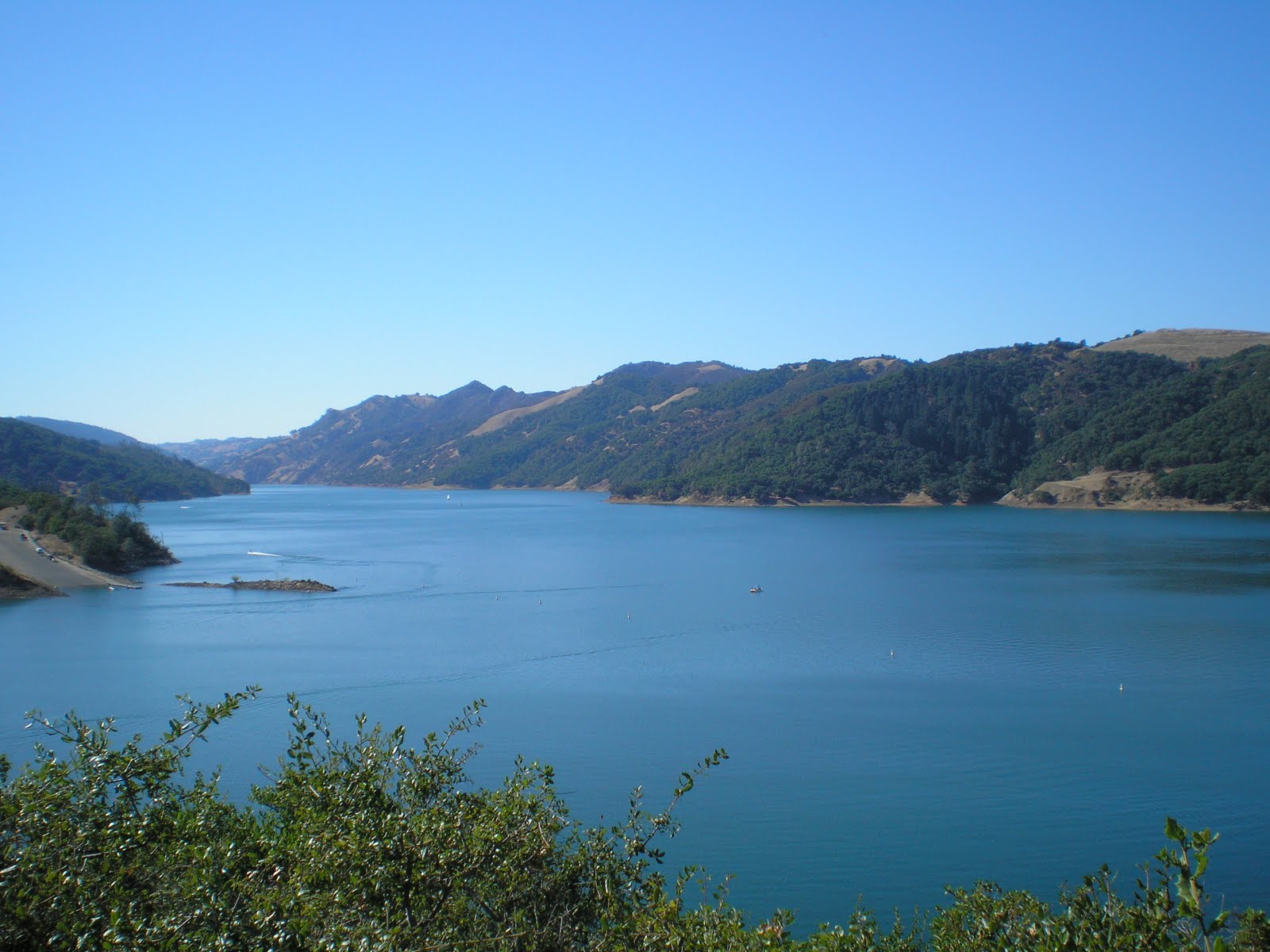


    Here's a look up the lake, which extends for 8 miles along Dry Creek. You can see the large boat landin on the left.


    Panning to the left from the landing you see one of Corps of Engineers specialties during war-time: bridges -- with this bridge over the Warm Springs arm, which extends for 4.5 miles from either the dam or the landing.


    As I was leaving the viewpoint I noticed a flower bed to the right framed with old railroad ties.


    I was surprised to find that the memorial was to a man who lost his life on Lake Sonoma rather than someone who was instrumental in designing, creating, or campaigning for the lake.


    Behind the memorial bench and flower bed I found a window in the trees and vegetation where I could photograph the principal occupation of some of those along Dry Creek: growing grapes and making wine.


    The upper end of the Warm Spring Creek arm of Lake Sonoma.


    A large, dead oak tree on a point where a steep but dry tributary drops down to Warm Springs Creek. [Click 1 or 2 times to zoom in.] Note that even some new growth from the top of some of the nearly horizontal branches is also dead.


    Some kids had taken paddle-boats (or perhaps boats powered by small outboard motors) up the Warm Springs arm. I heard their loud radio before I saw the boats. I never saw them, but judging by the commotion below they may have been skinny-dipping.


    Panning left here's more of the Warm Springs arm.


    A shot of my rig in site #90. Note that many small redwoods have been planted; if they're not pruned too high, they will eventually provide shade for the hot summer months.
    One thing I've noticed about Corps of Engineer campgrounds is that not every site is nearly level; in fact, one has to do a great deal of searching if you don't wish to use blocks or jacks. [The US Forest Service campground sites are usually very close to level, especially those which have recently been resurfaced. Even the Bureau of Land Management sites which have ashphalt pads are often nearer to level than those at CoE sites. (Guess if a landing craft or jeep looks nearly level on a site, that's good enough for the Combat Engineers!)]
--
Links:

T 23 Aug Actual Route: Chekaka CG - Ukiah - Cloverdale - Lake Sonoma

W 24 Aug Actual Route: Lake Sonoma - Healdsburg - Guerneville

Th 25 Aug Route: Guerneville - Sebastopol - Petaluma
--
Finding Campgrounds:

N.B. I receive nothing from Trailer Life or Woodalls for including links to their free campground lookups.

Monday, August 22, 2011

Boonville to Ukiah & Shore Acres, Oregon

Che-ka-ka Campground, Lake Mendocino, CA

    Looking south-east from the first top on SR253 from Boonville to Ukiah; the hills you see are the upper reaches of the Russian River while directly behind me are the upper reaches of the Navarro River.


    A shot of some green acres to the south of Ukiah. While Potter Valley is to the north-east of Ukiah, I'm not sure what the name of the valley where Ukiah sits is called.


--
    The remainder of these photos were taken at Shore Acres south of Charleston, OR, after I left the Sunset Beach State Park. A 5-acre garden and house were the work of Louis J. Simpson, oldest son of Asa Meade Simpson, who was a 49er but decided there was more money to be made in lumbering rather than seeking gold.
    The first house burned down in 1921 and Louis started contruction on an even larger one; but it was never finished since he suffered financially during the depression and was forced to move to a small cottage in Coos Bay. The state eventually bought the property, maintained and upgraded the garden, which contains a great variety of plants, and finally made a state park out of it and the surrounding acres.
    While I did see some mint, that's the only plant similar to what I used to plant: vegetables like carrots, squash, cucumbers, etc. -- though a few of the Shore Acres plants likely can be eaten by knowledgeable flower gardners.
    Here, without captions or text, are the photos taken on Tue 16 Aug at Shore Acres [Oregon] State Park.


--
Links:

M 22 Aug Actual Route: Ft Bragg - Boonville - Ukiah - Chekaka CG on L Mendocino

T 23 Aug Actual Route: Chekaka CG - Ukiah - Cloverdale - Lake Sonoma

W 24 Aug Route: Lake Sonoma - Healdsburg - Guerneville
--
Finding Campgrounds:

N.B. I receive nothing from Trailer Life or Woodalls for including links to their free campground lookups.

Sunday, August 21, 2011

Scotia to Willits to Fort Bragg

Fort Bragg, CA

    While driving south on US101 I decided to take the scenic route along the Avenue of the Giants. Here's the first of four photos not too far from the off-ramp to Redtop.


    A redwood grove where several trees grew from the same root or roots.


    Though the sequoias in various locations on the western slope of the Sierra Nevada are bigger (in terms or weight or volume) the redwoods along the California coast are taller.


    A view toward the Eel River which is blocked by the denseness of the redwoods.


    A donkey engine manufactured by the Willamette Steel & Irons Works in Portland, Oregon, -- probably in the late 1890s or early 1900s. It is located at the site of former Caspar Lumber Company Camp 20 near Chamberlain Creek.
--
Links:

Sa 20 Aug Actual Route: Scotia - Garberville - Willits - Ft Bragg

Su 21 Aug Actual Route: Ft Bragg

M 22 Aug Actual Route: Ft Bragg - Boonville - Ukiah - Chekaka CG on L Mendocino

T 23 Aug Route: Chekaka CG - Ukiah - Cloverdale - Lake Sonoma
--
Finding Campgrounds:

N.B. I receive nothing from Trailer Life or Woodalls for including links to their free campground lookups.

Friday, August 19, 2011

Klamath to Arcata to Stafford RV Park

Stafford RV Park, Scotia, CA


    A foggy day -- not in London-town but on the Humboldt County coast at Big Lagoon, which is not only the name of the fresh-water lagoon but is also descriptive. It is indeed a large lagoon.


    Panning left one cannot quite make out the outlet of Big Lagoon but a rocky point to the south appears thanks to a thinning in the fog.


    Surf and sand dunes to the west of McKinleyville, where I could not find a sign directing me to the library but did see a sign to virtually every church in town. [Does that mean the City Fathers (and mothers) value godliness above literacy? Or, as I told an Arcata librarian, perhaps I just missed the sign pointing to the library.]


    California State Historical Marker #882, the Humboldt Harbor Historical District, which sits on a small knoll south of Eureka just off of US101 and has a good view of Humboldt Bay.


    Look north-west across 101 at Humboldt Bay


    Panning left toward the center of the bay.


    Looking south-west toward the southern end of Humboldt Bay, which is partially obscured by some buildings and a large tree (a Monterey Cypress?) [There was a rather large Cypress south of Brookings in Oregon -- or did they call it a Monterey pine? Whichever -- it was a very large and old tree transplanted from Central California.]
--
Links:

F 19 Aug Actual Route: Klamath - McKinleyville - Arcata - Fortuna - Scotia

Sa 20 Aug Actual Route: Scotia - Garberville - Willits - Ft Bragg

Su 20 Aug Route: Ft Bragg
--
Finding Campgrounds:

N.B. I receive nothing from Trailer Life or Woodalls for including links to their free campground lookups.

Brookings to Crescent City to Klamath

Chinook RV Park, Klamath, CA

    A beach adjacent to several new buildings at Cresent City, CA. Whether the bay has been filled to create the area where you see the RV parked is a question in my mind.


    Panning to the left one sees a cresent-shaped bay which likely gives the town its name.


    Back in Redwood Country. A shot to the southwest from perhaps 10 miles south of Crescent City. [Click 1 or 2 times to zoom in.] Note the coastal mountain lurking in the distance to the right of the snag in the center of the photo.


    I had backed up to take the photo above; for this shot I walked up to the edge of the bank and there's no doubt the tree on the right is a redwood, a change from the Douglas firs of central and southern Oregon or the Sitka spruce around Columbia River.


    Another view of the same offshore rocks from a point further south on US101. It's likely that the mouth of the Klamath River is very rugged since there is no city or town there as is the case for the mouths of the Alsea, Umpqua, and Rogue Rivers further north.
--
Links:

Th 18 Aug Actual Route: Harris Ranch State Pk CG - Harbor - Crescent City - Klamath

F 19 Aug Actual Route: Klamath - McKinleyville - Arcata - Fortuna - Scotia

Sa 20 Aug Route: Scotia - Garberville - Willits - Ft Bragg
--
Finding Campgrounds:

N.B. I receive nothing from Trailer Life or Woodalls for including links to their free campground lookups.

Thursday, August 18, 2011

Gold Beach to Brookings, Oregon

Harris Ranch State Park Campground

    Again I find myself with several photos I took before and after spending the afternoon with the youngest son of our former neighbor on Van Ness Avenue in Santa Cruz; it was great to find someone who knew more about our former neighbors when we moved there in Nov 1954.
    Hence, I'll again post the photos I took and, hopefully, have time as I head south on US101 to add text to them.


W 17 Aug Actual Route: Indian Crk RV Pk - Gold Beach - Brookings - Harris Ranch State Park CG

Th 18 Aug Actual Route: Harris Ranch State Pk CG - Harbor - Crescent City - Klamath

F 19 Aug Route: Klamath - McKinleyville - Arcata - Fortuna - Rio Dell

--
Finding Campgrounds:
N.B. I receive nothing from Trailer Life or Woodalls for including links to their free campground lookups.