Friday, October 21, 2011

Lake Tahoe - Part I

Sonora, CA

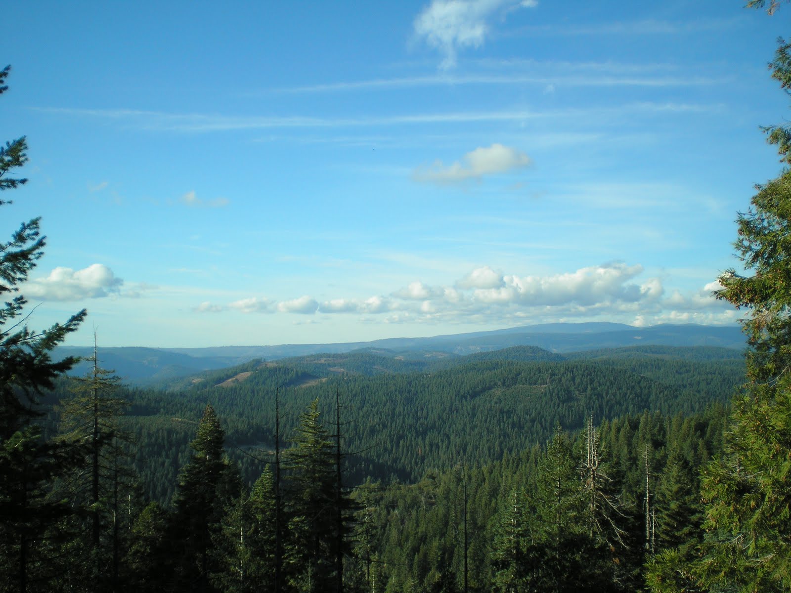
    On 16 October I left the Martis Lake Campground SW of Truckee, in part because it was closing for the season later that day, but principally to spend two days in the Tahoe Basin. As I headed down CA267 I finally got the nerve to park and take the photo you see at the right. [Apparently there are no Vista Points since it would require cutting down more than a few trees.]

    After reaching the edge of Tahoe at Kings Beach, I decided I didn't want to pay $8 just to park briefly and take a few photos. I drove east on CA28, which became NV28 once I crossed the stateline. There were the usual ubiquitous casinos and, since the area just past the casinos was on a hill, I turned around and drove back into The Golden State [or Brass State, given its financial health]. Brockway has a golf course built c1925 which claims to be the home of the first Crosby [Golf Tournament; guess it became a Clambake when Bing moved it to Monterey County].
    The photo just above was taken looking NE from a subdivision on Dollar Point.


    Walked down Observation Point Road and took another shot of the Nevada shore across the blue lake, which is 1646' deep at an elevation of 6229'. [Crater Lake in Oregon, which is c1900' deep, seems much bluer -- perhaps because there has been no development along its shore.]


    Looking generally south from Dollar Point toward Sugar Pine Point.


    From the Gatekeeper's Museum Beach shooting to the SE.


    Panning to the left from the beach at the south edge of the Truckee River outlet from Lake Tahoe.


    Panning further left....


    Mouth of the Truckee River.


    Rubber dam and bridge across the Truckee.


    A plaque explaining The Outlet (aka, Outlet Point). [Click 1 or 2 times to enlarge.]


    Washoe Indians beliefs about Lake Da-ow 'ah-ga.


    The Eternal Battle over Water.


    CA89 bridge over the Truckee.


    No game wardens around to stop Washoe Indians (and other Native Americans) from gill-netting fish.


    Do Sat La Lee, an outstanding basket-weaver, lived at the mouth of the Truckee.


    Wahoes went to the Lake for their summer vacations too.


    [Click once or twice to zoom in.]


    Clarity tests of Tahoe's water using a technique developed by a priest named Pietro Secchi.


    Lake Tahoe map.


    Plaque explaining Gatekeeper's Cabin & Museum.


    Gatekeepers and their cabins.
--


Links:

Th 20 Oct Actual Route: Pines CG - Greeley Hill - Coulterville - Sonora - East of Long Barn

F 21 Oct Actual Route: East of Long Barn - Mi-Wuk Village - Sonora - 3Links CG

Sa 22 Oct Route: 3Links CG - Sonora - Tuolumne - East of Long Barn
--

Finding Campgrounds:

N.B. I receive nothing from Trailer Life or Woodalls for including links to their free campground lookups.
Thursday, October 20, 2011

Anderson Valley K-V Crew

Boon-Dock East of Long Barn, CA

    A view from the Vista Point a few miles east of the Groveland District Ranger Station on CA120. It overlooks the canyons not only of the Tuolumne River, the source of San Francisco's water through its Hetch Hetchy Project, but also several forks of Cherry Creek, which is also part of the Hetch Hetchy System.
    [Click 1 or 2 times to see more granitic mountains in the Emigrant Wilderness to the north.]

    I had intended to drive to Anderson Valley, which is where the Anderson Valley K-V Crew hung out at night and weekends during the late 50s, except for those of us who went fishing on weekends. But, as you can see from the plaque to the right, I ended up in Coulterville, a former gold-mining town.
    The K-V Crews got their name from the two congressmen who wrote the act creating them: Congressman Knutson, perhaps a Senator, and, more than likely, Sen. Arthur H. Vandenberg (R-MI). The 1930 Act provided for reforestation by the US Forest Service; during the 1930s 2.25 billion seedlings were planted by the Civilian Conservation Corps. Twenty years later the demand for knotless plywood caused the USFS to create K-V crews to prune certain pine trees. If ponderosa and sugar pines were pruned up 10, 14, or 16 feet, depending on the trees size, once the cambium had healed in 2 or 3 years much of the lumber peeled for plywood at a later date would be knotless. At that time knotless plywood brought 6 to 7 times more than knotty plywood.
    Our boss on the Anderson Valley K-V Crew on the Groveland District was Earl Wothe. It's not surprising that Earl died at a relatively early age (69) as he was overweight and, if memory serves, had asthma; because of the latter, he often worked as the timekeeper at fire-fighting camps.
    Here's his obituary.
....
Earl WOTHE
--
Obituary
--
Monday 2 December 1985 Sonora Union Democrat
--
    Earl H. Wothe, 69, of Groveland died Saturday in a Martinez hospital after a long illness.
    Mr. Wothe, a native of Kentucky, had lived in California since 1936. He managed a chain store in Laguna Beach before moving to Tuolumne County in 1950.
    He was attracted to the Mother Lode, he once told a Uunion Democrat reporter, because he could buy 10 acres of land for $500.
    After settling on property on Smith Station Road, he began a 25-year career with the U.S. Forest Service's Groveland Ranger District. He started as the Smith Station lookout, a job his wife, Dorothy, took over until her retirement about two years ago.
    Mr. Wothe worked in reforestation projects and in 1958 started the Groveland district's small sales program. He administered sales of forest products ranging from Christmas trees and pine cones to manzanita stems.
    When he retired in 1975, he had the longest tenure of any forest service employee on the Groveland district.
    Mr. Wothe was an Army veteran of World War II. He belonged to the Odd Fellows Lodge in Big Oak Flat.
    He is survived by his wife, Dorothy, of Groveland; a son, J. Lee of Pollock Pines; a daughter, Judy Wight of Groveland; a sister, Mary Straus of Kentucky, and three grandchildren.
    A service is pending at the Heuton Memorial Chapel.
--
Links:

--

W 19 Oct Actual Route: Sonora Junction - Bridgeport - Lee Vining - Yosemite - Pines CG (Groveland District of Stanislaus NF

Th 20 Oct Actual Route: Pines CG - Greeley Hill - Coulterville - Sonora - East of Long Barn

F 21 Oct Actual Route: East of Long Barn - Mi-Wuk Village - Sonora - 3Links CG

Sa 22 Oct Route: 3Links CG - Sonora - Tuolumne - East of Long Barn
--

Finding Campgrounds:

N.B. I receive nothing from Trailer Life or Woodalls for including links to their free campground lookups.

Tuesday, October 18, 2011

Davis Creek CG to Genoa to Sonora Junction

Bridgeport, CA

    It finally happened: I lost some photos. Had been using a couple of batteries in my digital camera which were marginal, but the problem was obscured because I often downloaded photos to my laptop as soon as the camera's memory was full.
    However, today I neglected to download the photos I took in Genoa, Nevada's oldest town yesterday after I took the last photo which would fit in memory.


    After leaving Genoa, I got gas in Minden and forwarded some things from their library, and drove south. All USFS campgrounds appear to be closed for the season; hence, I parked just past the access road to Sonora Bridge CG on a wide-out CalTrans had created on CA108.
    These two photos are what I saw this morning from my camper: the West Fork of the Walker River. Looked for rises, but did not see any even though the stream likely has some fish left in it. Did see one fisherman who must have been a newbie since he was carrying his aluminum rod case in a backpack.
    Note that the aspen and willows have turned yellow; hope to get some photos of such in Yosemite later today.

--
Links:

T 18 Oct Actual Route: Davis Crk Pk - Carson City - Minden - Topaz Lake - Sonora Junction

W 19 Oct Actual Route: Sonora Junction - Bridgeport - Lee Vining - Yosemite - Pines CG (Groveland District of Stanislaus NF

W 20 Oct Actual Route: Pines CG - Greeley Hill - Coulterville - Sonora - East of Long Barn

Th 21 Oct Route: East of Long Barn - Mi-Wuk Village - Sonora - 3Links CG
--

Finding Campgrounds:

N.B. I receive nothing from Trailer Life or Woodalls for including links to their free campground lookups.

Thursday, October 13, 2011

Oroville to East Quincy

Lower Little Truckee CG, Tahoe NF, CA


    The spillway at Oroville Dam, the largest (ie. tallest) earth-fill dam in the United States.


    Not quite sure why the automatic focus did perform better on this shot of a parking area c9 miles west of LaPorte; perhaps I was afraid of backing into the small tractor whose tracks you can make out amongst the gravel and rocks.


    Red fir and a small ponderosa pine [aka, yellow pine] along the left side of the road while the somewhat less symmetric, scraggily tree on the right side of the road is a sugar pine, even though there are no cones, big or little, at the ends of the branches. Elevation here is in the 4000-6000' zone where sugar pines thrive in the Sierra Nevada.


    As I got back into the pickup I noticed a mountain in the distance in the side-view mirror. Not sure what it is, but it is likely one of the higher mtns to the north of Oroville. Note, however, that there are a lot of sugar pines with cones on the left side of the road.


    A plaque on the western outskirts of LaPorte. Gold was discovered in the area in 1850, but the name was changed from Rabbit Creek to LaPorte in 1857. [Check the Links below for an explanation/history.]


    Just outside the eastern edge of LaPorte is a junction. The left road takes one to Little Grass Valley Reservoir while the road on the right had this plaque by it. The fact that bankers in LaPorte rather than Quincy handled the financing may mean that LaPorte was experiencing a boom at the time. [Again, check below for more on the history of the town.]


    Clearly, timber country! My cousin in Oroville, a timber faller, is well-located.


    Pilot Peak (elev: 7457'), which has a USFS lookout atop it. The Quincy-LaPorte Road crosses the ridge near the bare spot on this photo.


    A look down into the valleys of the Feather River and it tributaries. The deepest canyon is the one in the istance, the Middle Fork of the Feather River where there are numerous small towns along CA70 & CA89.


    Large burn.


    Two bridges over Nelson Crk, 1890 & ?


    A look from the other end of the older Nelson Crk bridge.


    Went back to P/U & got a can of white spray paint & left the following graffiti. [Actually, this is one name I do not consider graffiti.] Looking at the name again, it was probably done with a brush, perhaps before spray cans of paint became available.
--
Links:

Su 16 Oct Actual Route: Martis Crk Reservoir - Kings Beach - Lake Forest - Tahoe City

M 17 Oct Actual Route: Tahoe City (Wm Kent CG) - Meeks Bay - Inspiration Point - South Lake Tahoe - Minden - Carson City - Washoe City (Davis Crk Pk)

T 18 Oct Actual Route: Davis Crk Pk - Carson City - Minden - Topaz Lake - Sonora Junction

W 19 Oct Route: Sonora Junction - Bridgeport - Lee Vining - Yosemite


--

Finding Campgrounds:

N.B. I receive nothing from Trailer Life or Woodalls for including links to their free campground lookups.

Tuesday, October 11, 2011

Four Photos

Oroville, CA
    Here are four photos taken on my drive down CA32 and eventually to Oroville.

    Though it is obscured in part by clouds associated with an approaching front, Lassen Peak sits in the notch former by two adjacent ridges on the horizon just to the right of the center of this photo, which was taken on the narrow road from CA32 to the USFS Butte Meadows Campground.


    I walked further down the road and now Lassen is still in a notch, but to the left of center.


    Sutter Butes.


    A view of the largest earthen dam in the U.S.: Oroville Dam. [Click 1 or 2 times to zoom in.]
--


Links:

T 11 Oct Actual Route: Orland - Willows - Glenn - Oroville

W 12 Oct Actual Route: Oroville

Th 13 Oct Actual Route: Oroville - Forbestown - Clipper Mills - 9mi W of LaPorte

F 14 Oct Actual Route: LaPorte - E. Quincy - Sierraville - Lwr Little Truckee CG

Sa 15 Oct Actual Route: Lwr Little Truckee CG - Truckee - Martis Crk Reservoir

Su 16 Oct Actual Route: Martis Crk Reservoir - Kings Beach - Lake Forest - Tahoe City

M 17 Oct Actual Route: Tahoe City (Wm Kent CG) - Meeks Bay - Inspiration Point - South Lake Tahoe - Minden - Carson City - Washoe City (David Crk Pk)

T 18 Oct Route: Davis Crk Pk - Minden - Topaz Lake


--

Finding Campgrounds:

N.B. I receive nothing from Trailer Life or Woodalls for including links to their free campground lookups.

Monday, October 10, 2011

McArthur-Burney Falls Memorial State Park

Orland, CA


    Lake Britton, which lies just upstream from Burney Falls. [I did see one rise on this Saturday 10 October morning when the wind died down.]


    Looking generally NE up Lake Britton from the USFS Dusty Campground, which, while created by PG&E is managed by the USFS; it was closed for the season, but the access gate was not only not locked but likely had not been locked for several years.


    A view down the lake toward a RR bridge which is no long in use.


    A "veiled" glimpse of Burney Falls through the trees.


    [Click 1 or 2 times to enlarge] An explanation of what might be called a microclimate.


    A closer look at Burney Falls, which is named after a drifter named Samuel Burney from South Carolina. He was unfortunately in the wrong place at the wrong time. That is, while caring for property owned by Thomas Preadmore, who apparently had mistreated several Indian women, a group of them came looking for revenge. Burney paid the ultimate price -- and, thereafter, many local features were named after him.

    At the bottom of the trail, a clear view of the falls. But, in case you're wondering why the park is named McArthur-Burney Falls Memorial State Park, here's the explanation from the park's brochure. "John and Catherine McArthur arrived in the 1860s, purchased thousands of acres, and opened a mercantile store in the area. In 1917 the newly formed Pacific Gas & Electric Company began buying up land and water rights in the area. [Continued below.]

    A rather large winged insect which was trying to escape my camera's closeup. [More on the McArthurs: "Alarmed residents became concerned that PG&E, in the interests of providing more hydroelectric power, might dam the Pit River and destroy Burney Falls. Frank and Scott McArthur, sons of John and Catherine, purchased 160 acres surrounding the falls, and in 1920 they deeded the property to the State Board of Forestry, requesting only that it be named for their parents."]


    Click once or twice to read the explanation of the porous volcanic rock and Burney Falls.


    When Theodore Roosevelt saw the falls he said it was one of the wonders of the world; see Wikipedia link below. [It's unknown if he used the same expression he used one morning on a camping trip in Yosemite with John Muir and they woke up with snow on their blankets: Bully!]


    "Year round about 100 million gallons a day of clear, cold water flow over the ancient, craggy rock face of the falls."


    A slightly different view of the falls with more sunlight.


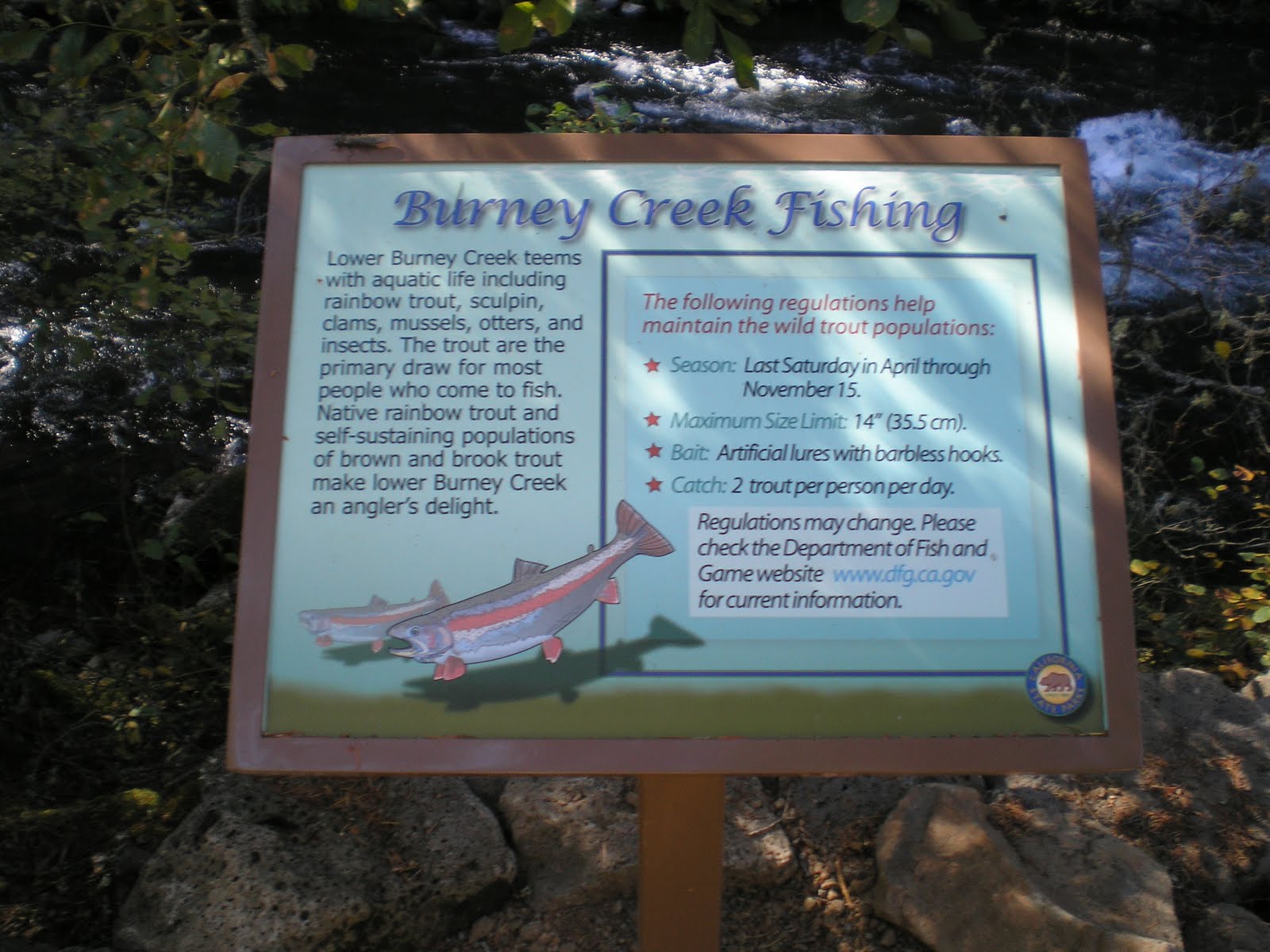
    DFG fishing restrictions for Burney Creek from the base of the falls to Lake Britton.


    Rainbow Bridge, roughly 200 yards below the falls.


    A repeat of the fishing restrictions on Burney Creek from the falls to Lake Britton. However, there is additional information: 1)the stream contains brook and brown trout in addition to native rainbows; and 2)a web address for DFG restrictions, etc.
--
Links:

  • McArthur-Burney Memorial State Park website; it is California's 2d oldest park
  • Wikipedia article on McArthur-Burney Falls
  • Brief RoadTripAmerica piece on Burney Falls

Sa 8 Oct Actual Route: Lake Britton - Burney Falls - Burney - Lassen NP - Gurnsey Crk CG

Su 9 Oct Actual Route: Gurnsey Crk - Chester - Butte Mdws CG

M 10 Oct Actual Route: Butte Mdws CG - Forest Ranch - Chico - Orland Old Orchard RV Park

T 11 Oct Actual Route: Orland - Willows - Glenn - Oroville

W 12 Oct Route: Oroville
--
Finding Campgrounds:

N.B. I receive nothing from Trailer Life or Woodalls for including links to their free campground lookups.