Monday, June 11, 2012

Preview of Mount Ranier National Park Photos

Buena, Washington


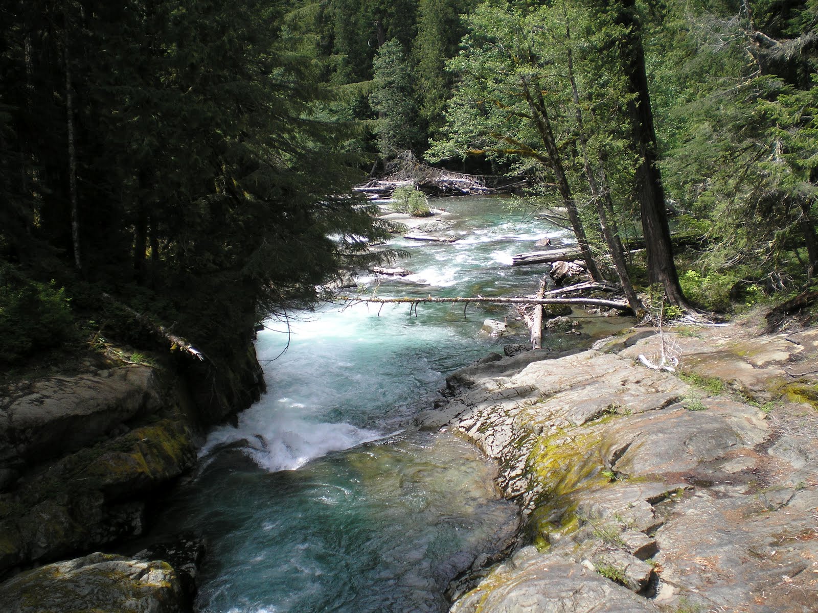
    Laughingwater Creek just prior to the Stevens Creek Entrance Kiosk.


    Clearly this water comes from melting snow.


    A first view of the top of Mt Ranier through the clouds.


    Walking down the road and zooming in....


    Wild strawberries on Backbone Ridge.


    Explanation of the effect of glaciers. [Click once to enlarge; press ESC to return here.]


    Box Canyon from the bridge.


    A closer view of the top of Mount Ranier, which has 26 glaciers.


    One large switchback on the Stevens Creek Road across the canyon.


    A look back down the Stevens Creek Canyon.


    A white trilium, the Ohio State Flower


    The snowy eastern side near Chinook Pass on WA410.
--


Links:

--
[For Routes & CG Finders see a post below.]

Friday, June 8, 2012

Fort Lewis Memorial Park

Naches, Washington

    As can see from what is likely a replica of the original main gate at Fort Lewis, it started life as Camp Lewis.
    Because my State Farm insurance cards are either at the Montpelier, UT, post office or somewhere else in the western U.S. postal system, I didn't have the 3 items needed to drive into Ft Lewis or to the American Lake Officers' Beach Club. So I visited Ft Lewis Memorial Park, which is very near the old main gate.


    [Click once to enlarge; press ESC to return here.] While Ft Lewis is named after Captain Merriwether Lewis, the park also credits other in the 1804-6 Lewis & Clark Expedition.


    The namesake of Ft Lewis, Merriwether Lewis, and his Newfoundland dog Seaman.


    The plaque on Capt. Lewis' monument, which was dedicated in 2005, the selected year of the bicentennial celebration of the Expedition.


    A recap of Capt Lewis's life as well as the fact that Camp Lewis was first located on American Lake in 1917 and then designated a permanent fort in 1927.


    Seaman was no lap-dog [unless you're the Jolly Green Giant].


    First Sergeant John Ordway, third in the Chain of Command in the Corps of Discovery.


    Sgt Ordway was the only Regular army sergeant in the Expeditionary Corps.


    Explanation of a First Sergeant's duties. Essentially they are career soldiers who are considered the "backbone of the army."


    Sgt Ordway's life ended in or near New Madrid, Missouri, the location of the greatest U.S. earthquakes in recorded history in 1811-1812. The cause of death was not the earthquake, but he must have lost all of his tillable land.


    The two most colorful shrubs in the Fort Lewis Memorial Park were rhododendrums. [I passed many growing in yards and apparently in the wild along the roads, but didn't back-track; think the best ones were in a yard in the small town of Neilton, WA.]
--
Links:

--
[See below for Routes & Campground Finders.]

Wednesday, June 6, 2012

Selected Olympic Peninsula Photos

Centralia, WA, Library

    Here are a few of the photos I took while traveling around Olympic National Park from Sequim Bay to Lake Quinault.
    The mouth of Sequim Bay as seen from the Sequim Bay State Park boat launching and parking area.


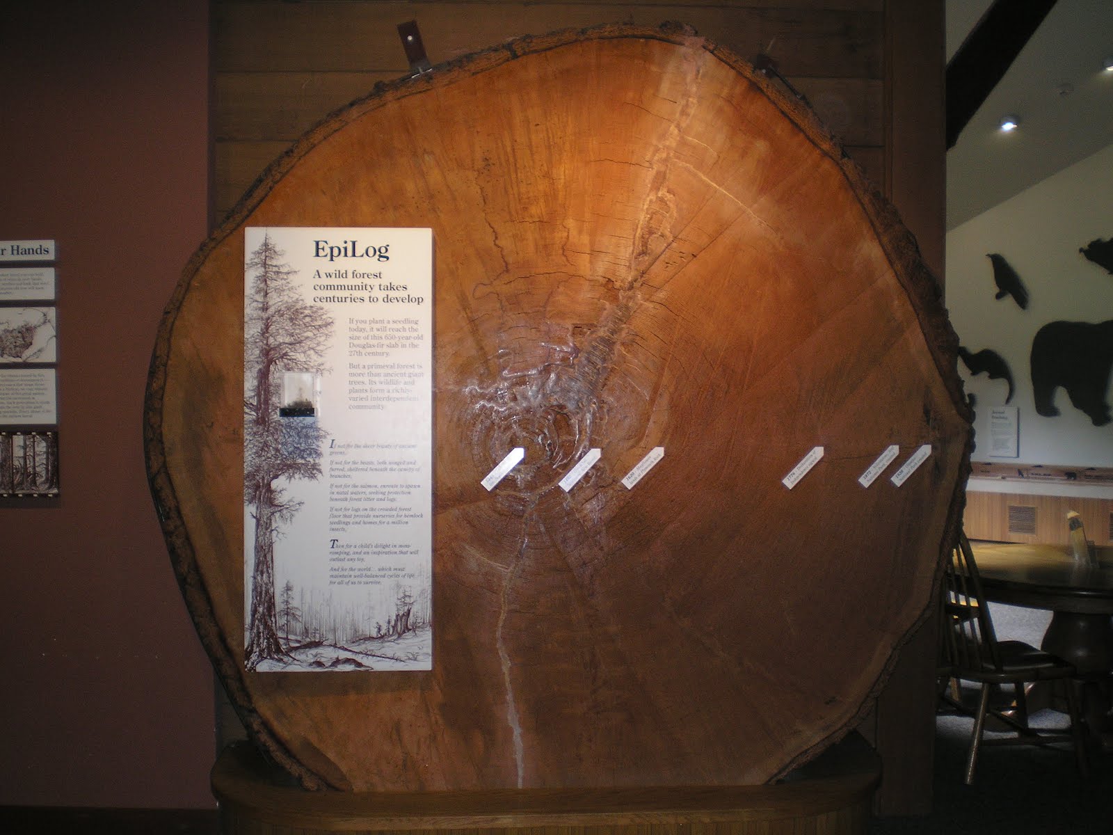
    A king-sized Douglas fir log at the Hurricane Visitor Center in Olympic Natl Park.


    The fir began growing in 1349 and was c650 years old when it either fell or was cut.


    [Click once to enlarge; press ESC to return here.] If memory serves, dendrology is the study of tree rings. During dry years the rings are closer together. Suspect that the 11- and 22-year drought cycles are as clear in the log as in bristlecone pine logs in the White Mountains of California.


    The Port Angeles Harbor.


    The Strait of Juan de Fuca as seen from the Salt Creek Recreation Area Park.


    Tidepools and small island from near Tongue Point at Salt Creek Park.


    Camp Hayden bunker where large guns protected the Strait of Juan de Fuca.


    Explanation of the defense of the strait into Puget Sound; for more on Camp Hayden check out the links below.


    A photo from the East Beach picnic area at the bend in Crescent Lake.


    Another view from US101 on the south shore of Crescent Lake.


    A view up US101 from c1.5 miles south of Ruby Beach.


    Lake Quinault from US101.


    Panning left...the NW edge of Lake Quinault.


    A look back at the upper end of Grays Harbor as one leaves Aberdeen on US12.
--


Links:

--

Su 3 Jun Actual Route: Port Angeles Walmart - Salt River Rec Area

M 4 Jun Actual Route: Salt River Rec Area - Camp Hayden Bunker - Sappho - Clearwater Road bd

T 5 Jun Actual Route: Clearwater Road bd - Queets - Lake Quinalt - Hoquiam - Aberdeen Walmart

W 6 Jun Actual Route: Aberdeen Walmart - Elma - Oakville - Eagle RV Pk

Th 7 Jun Actual Route: Eagle RV Pk - Rochester - Centralia - Tenino - Yelm bd

F 8 Jun Actual Route: Yelm bd - Yelm Lib - Nisqually - Ft Lewis - Spanaway - Alder Lake

Sa 9 Jun Actual Route: Alder Lake - Elba - Morton - Randle - bd near Packwood

Su 10 Jun Actual Route: bd near Packwood - Packwood Lib - Mt Ranier NP - Ohanapecosh CG

M 11 Jun Actual Route: Ohanapecosh CG - Cayuse Pass - Chinook Pass - Little Naches USFS CG

T 12 Jun Actual Route: Little Naches USFS CG - Cliffdell - Niles - Naches - Yakima - Buena bd

W 13 Jun Actual Route: Buena bd - Toppenish - Mabton - Prosser Lib - Richland Walmart

Th 14 Jun Actual Route: Richland Walmart - Kennewick - Pasco Lib - Pasco Walmart

F 15 Jun Actual Route: Pasco Walmart - Walla Walla VA Hospital - Walla Walla Walmart

Sa 16 Jun Actual Route: Walla Walla Walmart - Milton-Freewater, OR - Pendleton

Su 17 Jun Route: Pendleton - Emigrant Springs State Heritage Area

--

Finding Campgrounds:

N.B. I receive nothing from Trailer Life, Woodalls, or FreeCampsites.net for including links to their free campground lookups.

Tuesday, June 5, 2012

Hoh River to Lake Quinalt, Washington

Hoquiam, WA, Library


    Will post the 5 photos I took today, T 5 Jun, but remove them once I have the photos I too at Sequim Bay State Park, Salt Crk County Park, and Cresent Lake while circumnavigating Olympic Natl Park.


    The photo above looks north from about1.5 miles south of Ruby Beach, which, during WWI apparently had a coast artillery battery according to a ranger at the Kalaloch Ranger Station; the photo to the right is a shot of the coast to the south.


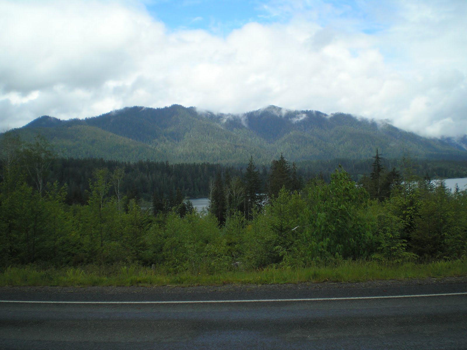
    Lake Quinalt from US101.


    Panning left....


    Looking south along US101 at my rig; remnants of a recent rain remain on or near the tops of several ridges.
--


Links:

  • To follow
--
[For routes and CG finders see the post below.]

Wednesday, May 30, 2012

Oak Harbor to Port Townsend, Washington

Price Ford, Port Angeles, WA


    Deception Pass Bridge. Note that the pass is not a mountain pass but rather a passage between two islands in the Puget Sound. One of those islands is Whidbey Island, the largest of the 9 islands in Island County.


    [Click once to enlarge; press ESC to return here.]The bridge was completed in 1935 at a cost of $490,000; today it costs more than that just to paint it. Original guard rails were constructed by the Civilian Conservation Corps in the 1930s.


    The mouth of Deception Pass[age] into a more open stretch of Puget Sound.


    My late father liked to identify many plants and animals by their Latin names. However, since this plant is prevalent in the logged-over areas near the former Caspar Lumber Company Camps, he called it Scotch Bloom.


    A look from the Oak Harbor Library parking lot across the harbor to the snow-capped mountains of the Olympic Peninnsula.


    Zooming in....


    Panning left for more of the Oak Harbor harbor.


    Some of the yachts in their slips at the harbor.


    A Boater's Guide to Puget Sound on the wharf at Oak Harbor.


    A first shot from the Coupeville to Port Townsend ferry.


    Panning right during the 35-minute crossing, the snow on the mountains in the Olympic Peninnsula is now much more visible.


    Panning further right one can now make out Port Townsend. [Click once to enlarge; press ESC to return here.]


    The wake of the ferry looking back toward Whidby Island and the Coupeville terminal.


    Mount Rainier in the distance?


    Two large, older brick buildings stood out as we approached Port Townsend. One was this building: the post office, which, with lights on inside, still appears to be in use.


    The larger of the two buildings was the Jefferson County Court House. Not only is it still in use, but the clock and associated bells still work.


    A view of the clock tower. In fact, as I walked around the court house, the bell sounded 6 times just as I finished my circumnavigation.


    Here's a ferry returning to the Coupeville terminal from Port Townsend, part of whose harbor is visible. [See link below for a link to all WDOT ferry schedules.]


    The Port Townsend ferry terminal with a ferry parked to the right of the three loading lanes on the left. [You can find information on ferrying costs on the WDOT site below.]
--
Links:

--

W 30 May Actual Route: Mt Vernon RV Pk - Oak Harbor - Coupeville/Port Townsend Ferry - Port Townsend bd

Th 31 May Route: Port Townsend bd - Sequim - Sequim Bay State Park

F 1 Jun Actual Route: Sequim Bay State Park - Sequim - Port Angeles - Heart O' the Hills NPS CG

Sa 2 Jun Actual Route: Heart O' the Hills NPS CG - Port Angeles Walmart

Su 3 Jun Actual Route: Port Angeles Walmart - Salt River Rec Area

M 4 Jun Actual Route: Salt River Rec Area - Camp Hayden Bunker - Sappho - Clearwater Road bd

T 5 Jun Actual Route: Clearwater Road bd - Queets - Lake Quinalt - Hoquiam - Aberdeen Walmart

W 6 Jun Actual Route: Aberdeen Walmart - Elma - Oakville - Eagle RV Pk

Th 7 Jun Route: Eagle RV Pk - Rochester - Centralia - Tenino - Yelm Walmart

--

Finding Campgrounds:

N.B. I receive nothing from Trailer Life, Woodalls, or FreeCampsites.net for including links to their free campground lookups.