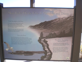
A plaque on Mono Diggings taken on 19 October at the Vista Point just south of Conway Summit on US395 overlooking Mono Lake. [Click 1 or 2 times to zoom in.]
Things to see and do in and around Mono Lake.
"In the Rainshadow of the Sierra."
The western portion of Mono Lake with the northern end of the snow-capped White Mountains in the distance. [Oh -- what fire?]
Panning left one can see the largest island in Mono Lake: Paoha, where many birds used to nest until dropping water levels uncovered the land bridge to the northern shore; one Paoha was accessible, the varmits didn't waste any time in feasting on the bird eggs.
The northeastern portion of Mono Lake, which, according to my June 1999 AAA map, had an elevation then of 6372'.
At the picnic area near the tufa towers, a plaque explaining how the Piutes, in most cases, were forced to change their lives with the arrival of white men.
"Strange Water, Strange Tufa."
No -- I wasn't falling to my right when I took this photo, but there was a strong north wind.
The largest concentration of tufa towers are on the south shore of the lake.
--
Links:
- Wikipedia article on Mono Lake
- The Mono Lake Story
- More Mono Lake History
Sa 22 Actual Oct Route: 3Links CG - Sonora - Tuolumne - East of Long Barn
Su 23 Oct Actual Route: East of Long Barn - Mi-Wuk Village - Tuolumne - Sonora - East of Long Barn
M 24 Oct Actual Route: East of Long Barn - Tuolumne - East of Long Barn
T 25 Oct Actual Route: East of Long Barn - Sonora - Tuolumne - East of Long Barn
W 26 Oct Actual Route: East of Long Barn - Sonora - East of Long Barn
Th 27 Oct Route: East of Long Barn - Sonora - East of Long Barn
--
Finding Campgrounds:
- RV Campgrounds from TrailerLifeDirectory.com
- Family Camping Directories from Woodalls.com


No comments:
Post a Comment