Las Cruces Library, NM
One of my goals during my travels has been to take photos of the highest peaks in each state I visit; what follows are the High Points in most of the western states as well as Texas and the Rocky Mtn states north to the Canadian border. The previous post of State High Points was on 30 Mar 2014; it's the bottom link below. Since that post I got as far north as Fargo, ND, before heading south through parts of the Mid-West and South-East.
OOPS!! Forgot the drive I made to to Kenton, OK, near Black Mesa, Oklahoma's high point; it's the 5th photo in Link# 12 below.

North Dakota's White Butte (3,506') roughly 30 miles north of Bowman in the SW corner of the state. See Link # 9 below.
Since my backpacking days are over here's a link to the Wikipedia article on Eagle Mountain (2,301') in Minnesota.

Since there was no sign pointed toward the clump of trees just inside the Iowa border I wasn't certain I had a photo of Hawkeye Point (1,671'); but a woman at the Magazine Mtn Ranger Station in Arkansas had a book which had the same barn or silo you see in this photo. See Link #10 below.

Looking north from the top of Taum Sauk Mountain (1,772') in Missouri's St. Francois Mtns toward St. Louis; Cape Girardeau on the Mississippi is to the south-east. See Link #11 below.

Arkansas' Magazine Mountain (2,753') complete with sign and a rock replica of the state. See my previous post on Magazine Mountain here.
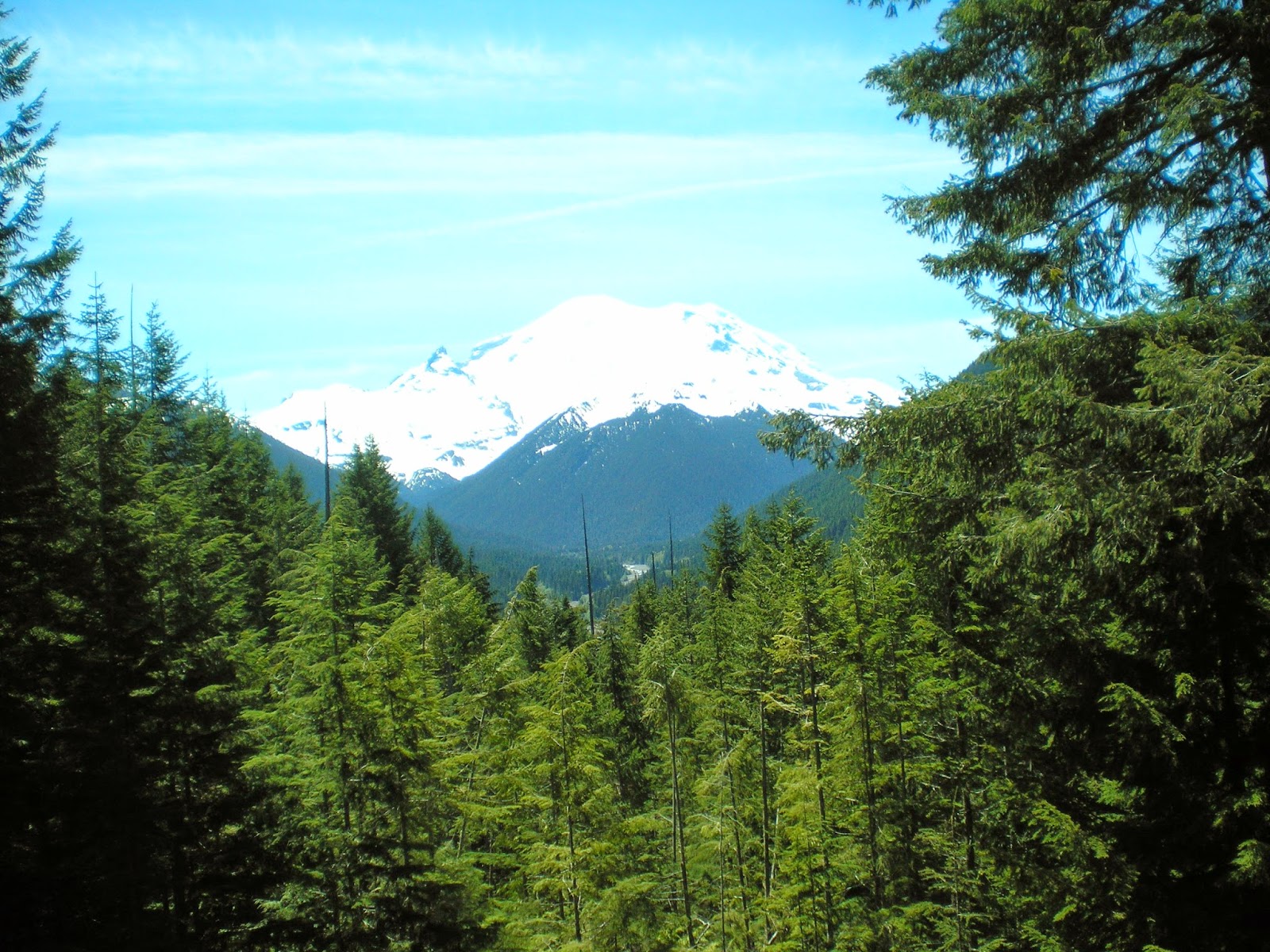
A view of Washington's Mt. Rainier (14,414') taken on 12 Jun 2012.
Natl Park Service website.
The highest peak in Oregon is Mt. Hood at 11,249'; I have no photo of it yet; see the 1st link below.

California's Mt Whitney (14,494') as seen from Inyo County's Portagee Joe Campground. For more info see the 2d entry in the Links below; it has an excellent photo on a National Park Service page called "Climbing Mt. Whtiney."

Nevada's Boundary Peak (13,147') as seen from US Hwy 6 not too far from Montgomery Pass.
More info.
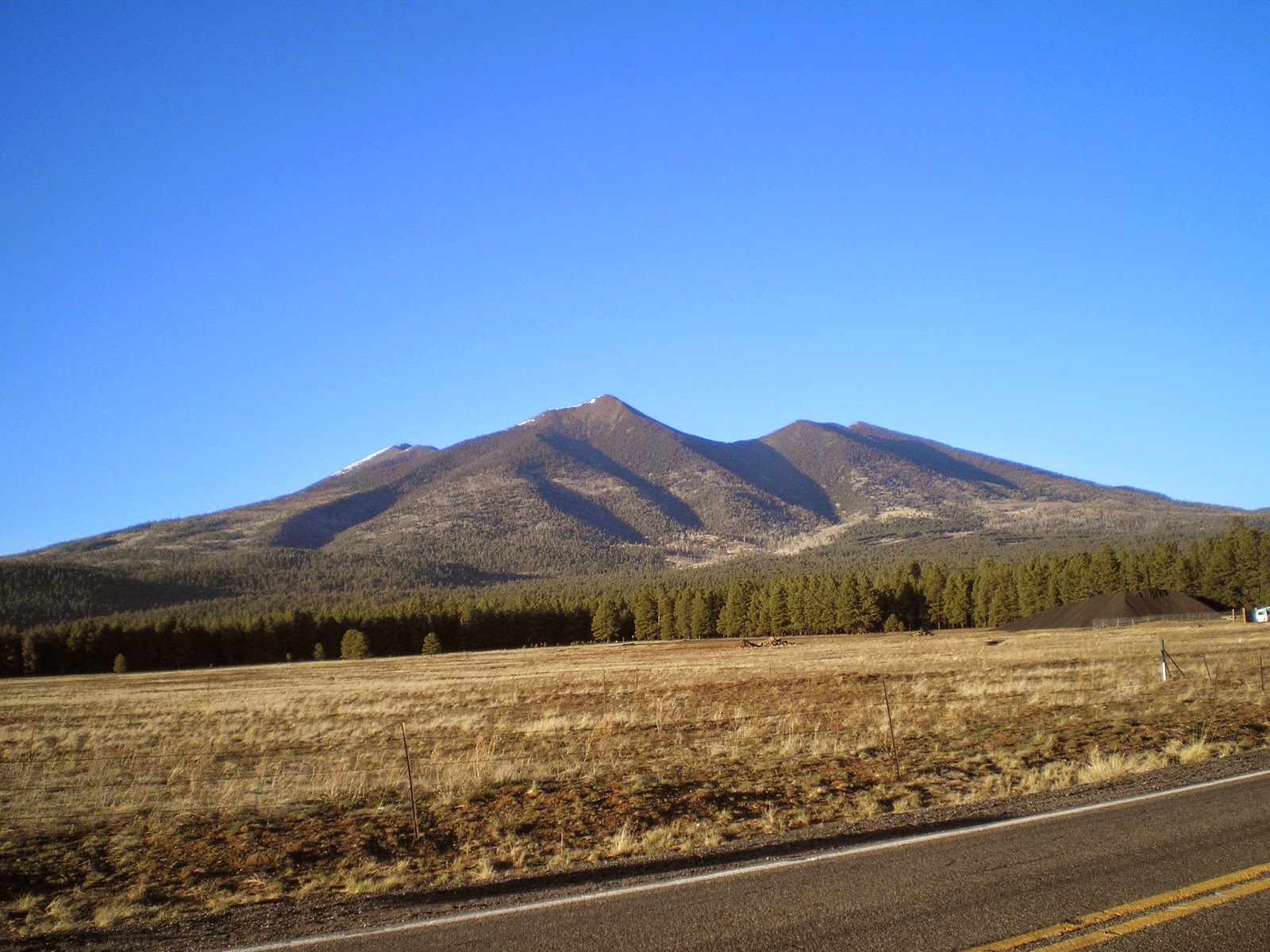
Arizona's Humphrey's Peak (12,637') in the San Francisco Mtns just north of Flagstaff.
See the 3d link below for more info.

New Mexico's Wheeler Peak (13,159') to the north-east of Taos.
More info.
I drove around the Ashley Natl Forest hoping for a clear view of Utah's Kings Peak (13,534'), but there was never a clear shot until I was back on the nearest highway. See the 4th link below for a good photo.
See 5th link below for a photo of Idaho's Borah Peak (12,662 or 12,668')
See the 6th link below for a photo of Colorado's Mt Elbert (14,440')
And Wyoming's Gannett Peak (13,809') is the 7th link below.

Montana's Granite Peak (12,807') as seen from the Beartooth Highway.
More info.

Guadalupe Mtn (8,751'), TX, in Guadalupe Mtns Natl Park.

While reading my 2008 World Almanac I noted Mt Harney, the highest point in South Dakota and realized I had a photo of it taken after I visited Mt. Rushmore. See Link #8 below for more info.
[Return to the top of the page]
Links:
- Wikipedia article on Mt. Hood, OR
- Climbing Mt. Whitney
- Wikipedia article on Arizona's Humphrey's Peak
- Wikipedia article Utah's Kings Peak
- Wikipedia article on Idaho's Borah Peak
- Wikipedia article on Colorado's Mt Elbert
- Wikipedia article on Wyoming's Gannett Peak
- Wikipedia article on South Dakota's Harney Peak
- Wikipedia article on North Dakota's White Butte
- Wikipedia article on Hawkeye Point
- Wikipedia article on Taum Sauk Mountain
- My Clayton Lake, NM, to Black Mesa, OK, post on 14 May 2013; 5th photo is of Black Mesa
- Wikipedia list of states by elevation
- 30 Mar 2014 post titled Some State High Points
Routes:
T 28 Oct Actual Route: Carlsbad W/M - McDs - Hobbs, NM, Lowe's - Applebees - Hobbs W/M
W 29 Oct Actual Route: Hobbs W/M - Seminole, TX, Lib - Lamesa Lib - K-Bob's - Walmart
Th 30 Oct Actual Route: Lamesa, TX, W/M - Lamesa Lib - Big Spr VA Hosp - Sterling City - Sherwood Wy W/M
F 31 Oct Actual Route: Sherwood Wy W/M - San Angelo, TX, Lib - Visitor Ctr - Lib - Sherwood Wy W/M
Sa 1 Nov Actual Route: Sherwood Wy W/M San Angelo, TX, Lib - Dollar Tree - Sherwood Wy W/M
Su 2 Nov Actual Route: Sherwood Wy W/M San Angelo, TX, Visitor Ctr - Big Lots - Sherwood Wy W/M
M 3 Nov Actual Route: Sherwood Wy W/M - San Angelo Lib - Sherwood Wy W/M
T 4 Nov Actual Route: Sherwood Wy W/M - VA Clinic - Visitor Ctr - San Angelo Lib - Sherwood Wy W/M
W 5 Nov Actual Route: Sherwood Wy W/M - Visitor Ctr - San Angelo Lib - VA Clinic
Th 6 Nov Route: VA Clinic - San Angelo Lib - Sherwood Wy W/M
Finding Campgrounds:
- RV Campgrounds from TrailerLifeDirectory.com
- Family Camping Directories from Woodalls.com
- Free campsites website
- Info on finding BLM Campgrounds


