Showing posts with label Shiprock. Show all posts

Monday, December 31, 2012

Top Twelve Photos of 2012

Gila Bend, AZ


    Here's what I feel is the best photo I took during 2012.
    Shoshone Falls, which is mispronounced as "Show-Shown" by the locals, is just up the Snake River from Twin Falls, Idaho.
    More Twin Falls Photos.


    Photo of the HooDoos at Bryce Canyon National Park in Utah; taken on 8 Apr 2012.
    More Bryce Canyon Photos.


    Mount Rainer, Washington, as seen from the north-east; taken on 10 Jun 2012.
    More Mt Rainier Photos and yet additional photos.


    Mount Lassen, California, the southern-most volcano in the Cascade Range, looks considerably different after the 2011/2012 winter than it did in 2011; this photo was taken on 18 Jul 2012. (Lassen NP did not open until August the previous year.) This photo was taken on 18 Jul 2012.
    More Lassen NP Photos.


    Grosvenor Arch in Utah south of Kodachrome Basin State Park; it is named for the founder of the National Geographic Society. Taken 7 Apr 2012. [Reached by a gravel road not advisable for travel by large RVs or 5th-Wheelers.]
    More Grosvenor Arch & Kodachrome Basin Photos.


    Strait of Juan de Fuca from Washington's Salt Creek County Park just after sunset. Photo taken 3 Jun 2012. [There are remnants of a former Coast Artillery Battery near the park as well as an RV Park.]
     Additional Juan de Fuca & Olympic Peninsula Photos.


    Rock formations at Kodachrome Basin State Park in Utah. Taken on 7 Apr 2012.
    Additional Photos of Kodachrome Basin State Park.


    Vista Point atop 9200' Sherman Pass with Olancha Peak just to the right of my rig. [N.B.Forest Service road not advised for large Class A RVs or large 5th-Wheelers.]


    Iconic Half Dome in Yosemite NP as seen from Olmstead Point along CA120, the Tioga Pass Road. Taken 7 Oct 2012.


    Devils Postpile NM, reached via Mammoth Lakes Road from US395. [N.B. There are travel restrictions during the summer and early fall on the Minaret Summit Rd to the Monument through the end of September.] Taken 5 Oct 2012.


    In an article in Century magazine John Muir spoke of a valley on the South Fork of the Kings almost as grand as that on the Merced River in Yosemite. The photo was taken from the Canyon View(point) on the way to Roads End past Cedar Grove. Taken on 21 Oct 2012.


    Number 12: you recommend one. Send me an e-mail with your recommendation for the 12th photo. If others send in photos which I prefer, will still keep a link to your recommendation along with your name.


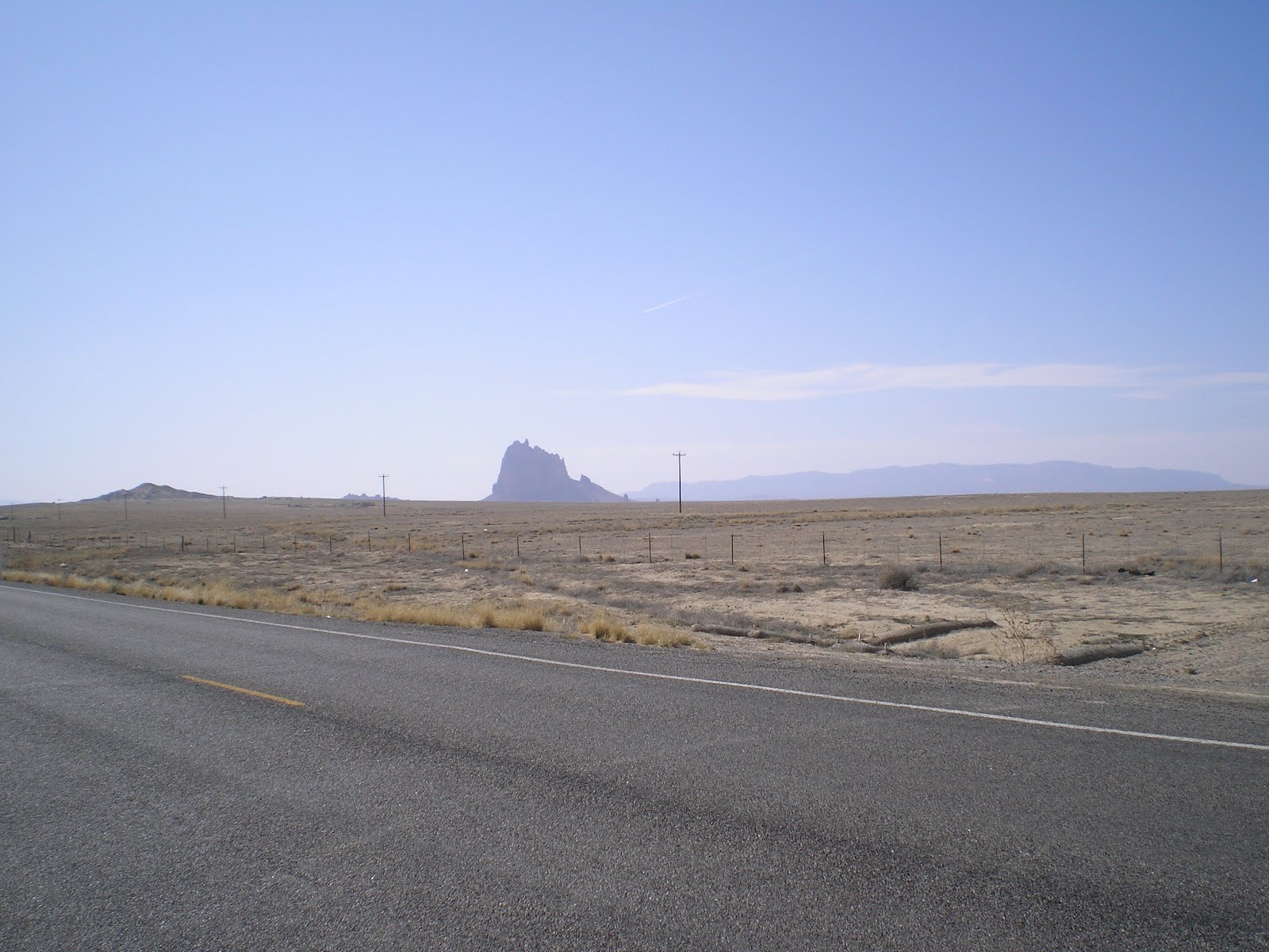
    From Trevor Glenn of Mi-Wuk Village, CA: a photo of Shiprock in northwestern New Mexico.
--


Links:

--
Su 13 Jan Actual Route: Ajo Hwy bd - Tucson VA Hosp - Ajo Hwy & Mission Rd McD - Ajo Hwy bd
M 14 Jan Actual Route: Ajo Hwy bd - Mission Br Lib - Ajo Hwy bd
T 15 Jan Actual Route: Ajo Hwy bd - Mission Br Lib - Wilmont TJ's - Ajo Hwy bd
W 16 Jan Actual Route: Ajo Hwy bd - Mission Br Lib - So Tucson - Benson - Willcox - Sagebrush MH & RV Park
Th 17 Jan Actual Route: Sagebrush MH & RV Park
F 18 Jan Actual Route: Sagebrush RV Pk - Bowie - Lordsburg, NM, - Deming - Wagon Wheel RV Pk
Sa 19 Jan Actual Route: Wagon Wheel RV Pk - Deming - Wagon Wheel RV Pk
Su 20 Jan Actual Route: Wagon Wheel RV Pk - Las Cruces Walmart
M 21 Jan Actual Route: Las Cruces Walmart - Big Lots - Las Cruces Walmart
T 22 Jan Route: Las Cruces Walmart - Dollar Tree - Library - Las Cruces Walmart
--

Finding Campgrounds:
N.B. I receive nothing from Trailer Life, Woodalls, or FreeCampsites.net for including links to their free campground lookups.

Wednesday, March 28, 2012

Farmington, NM to Shiprock to Towaoc, CO

Ute Mtn Casino RV Park, Towaoc, CO


    A view of Shiprock (elev: 7178') to the southwest from US64 not too far past a rock outcropping [not pictured] called Hogsback.


    Shiprock as seen from the road to the First Wash Assembly of God Church (Pastor Lee officiating) off of US491 north of the town of Shiprock, which, incidentally, is in the Navajo Nation [Reservation].


    I drove south on US491 and took this photo of Shiprock from the ESE.
    It's my opinion that Shiprock is to New Mexico as Half Dome is to California. (Of course, some natives of the New Mexico might complain that I have not seen all of its state's mountains.)


    A final look at Shiprock from the Navajo Nation road #18 to Red Valley, AZ, and Lukachuka in the Chuska Mountains. David Brower, one-time head of the Sierra Club, and others climbed Shiprock in 1939. [See Wikipedia article link below.] Of course, if the Navajo Nation Police catch you climbing on Shiprock, they just might stake you out in the desert sun -- with water just out of your reach. :-)>


    Crossing the NN road I took a photo of the mesa and two mountains to the SSE. One of the mountains may be Beautiful Mountain (elev: 9388'), for they are 3 or 4 times further away than Shiprock.


    As I approached the junction of US491 and US160 I saw the other side of this "interesting rock formation." And since I crossed a wash called Chimney Rock Wash, this must be one of the many Chimney Rocks in the U.S. (It looks like two adjacent chimneys from the south.)
--


Links:

--

T 27 Mar Route: Ruins RV Park - Farmington - Mom & Pop RV Park

W 28 Mar Actual Route: Mom & Pop RV Park - Shiprock - Ute Mtn Casino RV Pk, CO

Th 29 Mar Actual Route: Ute Mtn Casino RV Pk, CO - Cortez - Hovenweep Natl Monument

F 29 Mar Route: Hovenweep Natl Monument - Blanding, UT - KampPark RV Park

--

Finding Campgrounds:

N.B. I receive nothing from Trailer Life, Woodalls, or FreeCampsites.net for including links to their free campground lookups.

Sunday, March 25, 2012

Four Corners to Mesa Verde National Park

Aztec, New Mexico, Library

    Because I was too tight-fisted to pay the $3 fee to enter the Navajo Nation's Four Corners Monument I took a couple of photos outside of their gate and from US160 just past Four Corners.
    This photo looks to the southwest into Arizona


    And this photo is along US160 into Colorado.


    About a mile up US160 from Four Corners I stopped and shot this view into Utah to the northwest.


    A shot to the southeast into New Mexico; note the large rock in the center of the photo. It's called Shiprock, and is visible for a long distance from every direction except from the west in Arizona, where the Chuska Mountains block the view.


    An interesting rock formation just west of the junction of US160 and US491.


    A photo to the northeast from the junction of US160 & US491.


    From a corner near the Cortez Library, a photo of the Sangre de Cristo Mountains.


    The previous photos were taken on the way to Cortez, CO. The remainder were taken within Mesa Verdi National Park, which is about 9 miles from Cortez.
    A plaque at Park Point, the highest point in Mesa Verdi at 8,572 ft, explains the importance of the lookout atop Park Point, which was built in 1939 by the Civilian Conservation Corps and can help spot smoke from a fire at distances up to 100 miles.


    From Park Point a look to the southwest at the Chuska Mountains, which lie across the New Mexico/Arizona border.


    Now it's clear why many of the U.S. Forest Service Colorado campgrounds don't open until April or May -- after the snow melts.


    Agricultural land north of Cortez, including Totten Lake, and mountains in the southeast corner of Utah in the the distance.


    Mountains in the southwestern corner of Colorado, with the tallest being Sleeping Ute Mountain (elev: 9964') on the Ute Mountain Indian Reservation.


    A plaque outlining the "grand view" to the SSE -- including the major landmark of NW New Mexico, Shiprock (elev:7178').


    Unfortunately, the clouds obscure a view of Shiprock in the center of this photo.


    Unfortunately, one can no longer enlarge these photos by clicking on them once or twice because of a change at Blogger about two months ago; this plaque is beneficial in that it gives the elevations of many of the mountains visible from Park Point.


    Another shot of the Cortez to Dolores area with a complete view of McPhee Reservoir -- which explains why many of the Cortez residents have boats.


    A look back up to the Park Point Lookout.


    A plaque on the best-preserved cliff dwelling at Mesa Verdi: the Spruce Tree House. Here's the text.
    "These people [Puebloan, apparent ancestors of the Pueblo and Hopi Indians] lived on Mesa Verdi for 700 years. They built large cliff dwelling only during their last 100 years; then they gradually left.
    The pit house may have gradually evolved into the kiva or ceremonial chamber.
    Spruce Tree House was discovered in 1888. It has 114 rooms and 8 kivas. About 100 to 150 people lived here at its height."

    Spruce Tree House. Because of poor "map recon" on my part (it was a 40-mile round-trip from the entrance kiosk to the Spruce Tree Museum), I was unable to take more photos. [Just made it out to the only gas station in Mancos with the fuel level almost to the left of "E."]
    Plan to return the Mesa Verdi next year.
--
Links:

--

Sa 24 Mar Actual Route: c8 mi east of Red Mesa (boon-dock) - Four Corners - Towaoc, CO - Cortez Lib - Towaoc (Ute Mtn Casino RV Pk)

Su 25 Mar Actual Route: Towaoc - Cortez - Mesa Verdi Natl Park - Mancos - Durango RV Park

M 26 Mar Actual Route: Durango RV Pk - Cedar Hill - Aztec Runins Natl Mon - Aztec Library - Ruins RV Park

T 27 Mar Route: Ruins RV Park - Farmington - Mom & Pop RV Park

W 28 Mar Route: Mom & Pop RV Park - Shiprock - Ute Mtn Casino RV Pk, CO

--

Finding Campgrounds:

N.B. I receive nothing from Trailer Life, Woodalls, or FreeCampsites.net for including links to their free campground lookups.