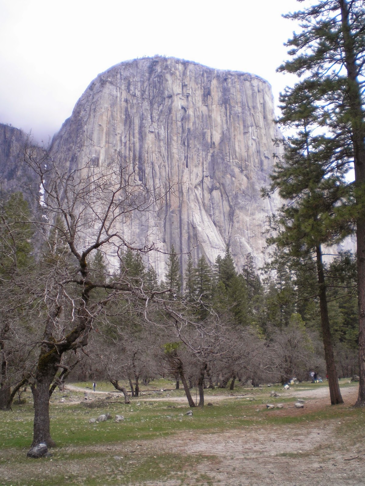
Tuesday, March 31, 2015

Newly Updated State High Points

Newly Updated State High Points

Quincy Library, Florida

    Some of you may laugh when I tell you that my new state high point is here in Florida; the perception is that the state is as "flat as the proverbial pancake." But when I and two other Signal Corps Lieutenants signed out for a three-day pass during the Christmas holidays in 1961 it was clear on the third day that the stretch from Tampa/Saint Petersburg to Gainesville was slightly uphill.

    [As an aside, the two memorable things about the three-day trip are both associated with 17; that is, regular gasoline was 17.9 cents/gallon and, even better, a one-pound bag of tangerines only cost 17 cents. Don't know if any of the many seeds we spit out of the windows ever germinated, but we tried to expand the tangerine crop!]


    The sign in front of the small, but well-kept park reads "Lakewood Park, Walton County, Florida's Highest Point 345 Feet."


    Another sign within the park states that Lakewood Park is funded by the Walton County Board of Commissioners and the Florida Recreation Development Assistance [Agency]."


    While the two photos immediately above of Britton Hill (aka Lakewood Park) don't look like a hilltop, here's a photo looking to the left in front of the park. Note that the road drops from view (since it's downhill in virtually every direction).

In case you're driving a Class-A RV or large 5th Wheeler I suggest U park your rig in Paxton and use your toad; as I was heading back to Paxton a garbage truck appeared; both it and my F250 had their rt wheels on the grass shoulders as we passed each other.


    One of my goals during my travels has been to take photos of the highest peaks in each state I visit; what follows are the High Points in most of the western states as well as Texas and the Rocky Mtn states north to the Canadian border. The previous post of State High Points was on 20 Sep 2014; it's the bottom link below. Since that post I got as far north as Fargo, ND, before heading south through parts of the Mid-West and South-East.

    OOPS!! Forgot the drive I made to to Kenton, OK, near Black Mesa, Oklahoma's high point; it's the 5th photo in Link# 12 below.


    North Dakota's White Butte (3,506') roughly 30 miles north of Bowman in the SW corner of the state. See Link # 9 below.


    Since my backpacking days are over here's a link to the Wikipedia article on Eagle Mountain (2,301') in Minnesota.


    Since there was no sign pointed toward the clump of trees just inside the Iowa border I wasn't certain I had a photo of Hawkeye Point (1,671'); but a woman at the Magazine Mtn Ranger Station in Arkansas had a book which had the same barn or silo you see in this photo. See Link #10 below.


    Looking north from the top of Taum Sauk Mountain (1,772') in Missouri's St. Francois Mtns toward St. Louis; Cape Girardeau on the Mississippi is to the south-east. See Link #11 below.


    Arkansas' Magazine Mountain (2,753') complete with sign and a rock replica of the state. See my previous post on Magazine Mountain here.
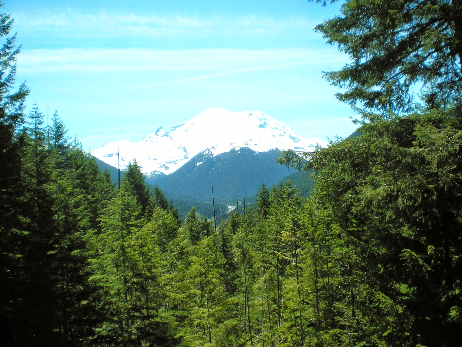


    A view of Washington's Mt. Rainier (14,414') taken on 12 Jun 2012.
    Natl Park Service website.


    The highest peak in Oregon is Mt. Hood at 11,249'; I have no photo of it yet; see the 1st link below.


    California's Mt Whitney (14,494') as seen from Inyo County's Portagee Joe Campground. For more info see the 2d entry in the Links below; it has an excellent photo on a National Park Service page called "Climbing Mt. Whtiney."


    Nevada's Boundary Peak (13,147') as seen from US Hwy 6 not too far from Montgomery Pass.


    More info.
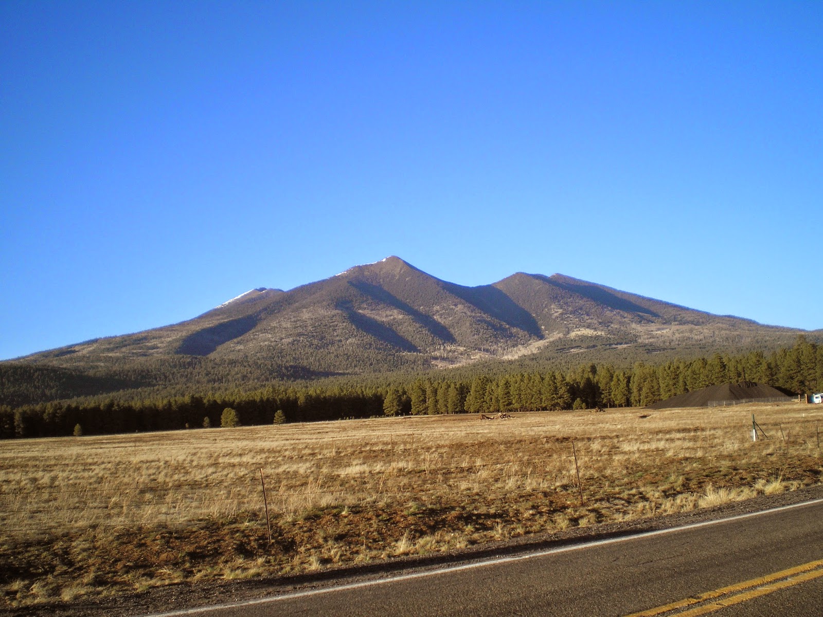


    Arizona's Humphrey's Peak (12,637') in the San Francisco Mtns just north of Flagstaff.
    See the 3d link below for more info.


    New Mexico's Wheeler Peak (13,159') to the north-east of Taos.

    More info.


    I drove around the Ashley Natl Forest hoping for a clear view of Utah's Kings Peak (13,534'), but there was never a clear shot until I was back on the nearest highway. See the 4th link below for a good photo.


    See 5th link below for a photo of Idaho's Borah Peak (12,662 or 12,668')


    See the 6th link below for a photo of Colorado's Mt Elbert (14,440')


    And Wyoming's Gannett Peak (13,809') is the 7th link below.


    Montana's Granite Peak (12,807') as seen from the Beartooth Highway.

    More info.


    Guadalupe Mtn (8,751'), TX, in Guadalupe Mtns Natl Park.


More info


    While reading my 2008 World Almanac I noted Mt Harney, the highest point in South Dakota and realized I had a photo of it taken after I visited Mt. Rushmore. See Link #8 below for more info.


[Return to the top of the page]
Links:
  1. Wikipedia article on Mt. Hood, OR
  2. Climbing Mt. Whitney
  3. Wikipedia article on Arizona's Humphrey's Peak
  4. Wikipedia article Utah's Kings Peak
  5. Wikipedia article on Idaho's Borah Peak
  6. Wikipedia article on Colorado's Mt Elbert
  7. Wikipedia article on Wyoming's Gannett Peak
  8. Wikipedia article on South Dakota's Harney Peak
  9. Wikipedia article on North Dakota's White Butte
  10. Wikipedia article on Hawkeye Point
  11. Wikipedia article on Taum Sauk Mountain
  12. My Clayton Lake, NM, to Black Mesa, OK, post on 14 May 2013; 5th photo is of Black Mesa
  13. Wikipedia list of states by elevation
  14. 20 Sep 2014 post titled Updated State High Points

Routes:

M 27 Apr Actual Route: I-10 Rest Area - Live Oak Lib - P.O. - Walmart

T 28 Apr Actual Route: Live Oak Walmart - Lowe's - Live Oak W/M

W 29 Apr Actual Route: Live Oak Walmart - Lowe's - Gainesville, FL, VA Hosp - Walmart

Th 30 Apr Actual Route: Live Oak Walmart - VA Hosp - Ocala I-75 Rest Area

F 1 May Actual Route: Ocala I-75 Rest Area - Inverness Lib - Floral City Lib - Lutz Walmart

Sa 2 May Actual Route: Lutz W/M - Lutz Br Lib - Walmart

Su 3 May Actual Route: Lutz W/M - Lutz Br Lib - Sarasota Walmart

M 4 May Actual Route: Sarasota W/M - North Port, FL, W/M

T 5 May Actual Route: North Port W/M - North Port Br Lib - Punta Gorda Lib - Naples W/M

W 6 May Actual Route: Naples W/M - Naples McDs - Monroe Jcn - Homestead Hm Depot

Th 7 May Route: Homestead Hm Depot - MurphyUSA Gas - Key Largo - Homestead


Finding Campgrounds:

N.B. I receive nothing from Trailer Life, Woodalls, or FreeCampsites.net for including links to their free campground lookups.

Sunday, March 15, 2015

Misc Photos -- Some Old, Some New

Misc Photos -- Some Old, Some New Laurel, MS, Lowe's

    This lake was the site of a prior U.S.A. Windsurfing Championship. However, other than that it was in a mid-western state, I can't recall where.

    [Photos taken during 2014]


    As the sign says, this is "Windsurfing Beach", site of the 2014 U.S.A. Windsurfing National Championships. A check on-line states that this is Lake Okabena in Worthington, Minnesota.


    Panning right it appears that there are fish in this lake -- though the boat is a bit far away to determine if the occupants are fishing.


    Panning to the far right one can see what undoubtedly is among the higher-priced real estate in Worthington.


    I can't remember where this sunset photo was taken other than that it wasn't in New Mexico.


    Waited a bit long to take this, but it appears I was at a campground.


    From Portland, Texas, looking back toward Corpus Christi. The large bridge over Corpus Christi Bay is just to the right of the amusement park building and the U.S.S.Lexington is to the left.     [Portland photos taken 2 Apr 2015]


    Shooting into the sun I didn't quite center the Lexington.


    Another ship, this one likely still on active duty, heads toward the Lexington while beach-goers test the sand and surf.


    Port Comfort's beach facilities five miles across a causeway from Port Lavaca, Texas; the former had a closed branch library with working WiFi even though it was Easter weekend.


[Return to the top of the page]
Links:
  • Wikipedia article on the decommissioned aircraft carrier U.S.S. Lexington
  • U.S. Navy website on the U.S.S. Lexington

Routes:

Th 23 Apr Actual Route: Crestview W/M - Lib - Florala, AL - Paxton, FL, - Marianna W/M

F 24 Apr Actual Route: Marianna W/M - Lowe's - Quincy Lib - Walmart

Sa 25 Apr Actual Route: Quincy W/M - Lib - Walmart

Su 26 Apr Actual Route: Quincy W/M - Tallahassee W/M - I-10 Rest Area

M 27 Apr Actual Route: I-10 Rest Area - Live Oak Lib - P.O. - Walmart

T 28 Apr Actual Route: Live Oak Walmart - Lowe's - Live Oak W/M

W 29 Apr Actual Route: Live Oak Walmart - Lowe's - Gainesville, FL, VA Hosp - Walmart

Th 30 Apr Actual Route: Live Oak Walmart - VA Hosp - Ocala I-75 Rest Area

F 1 May Actual Route: Ocala I-75 Rest Area - Inverness Lib - Floral City Lib - Lutz Walmart

Sa 2 May Route: Lutz W/M - Lutz Br Lib - Walmart


Finding Campgrounds:

N.B. I receive nothing from Trailer Life, Woodalls, or FreeCampsites.net for including links to their free campground lookups.

Sunday, February 15, 2015

The Resurrection of RAOGK & My 2015 Travel Plans

The Resurrection of RAOGK & My 2015 Travel Plans San Angelo, TX, Library
    Random Acts of Genealogical Kindness, whose acronym is RAOGK, was a group of volunteer researchers who did lookups, took photos, examined public records, and found headstones, among other things, from 1999 until its demise in Nov 2011.
    It was founded by Bridgett and Doc Schneider just as I became interested in genealogy after attending a large Lemmon Clan reunion in 1999 near Fort Bragg, birthplace of my father and his nine siblings. While assembling the history of the family I received a good deal of help from RAOGK volunteers.
    To repay their kindness I did lookups at the Santa Cruz, CA, Library for 6.5 years and, since there was microfilm of the San Francisco Chronicle and San Jose Mercury (or their predecessors) I did lookups for San Francisco for about a year and Santa Clara County three different times for a total of perhaps two years.
    For a brief history of RAOGK see the first link below.
....
    The second link below is to the new RAOGK, which is being resurrected by Don Nichols. With the old model you sent an e-mail to RAOGK headquarters and they forwarded it to us volunteers. However, by requiring one to register to use the new RAOGK Don hopes to discourage spam-meisters from capturing our e-mail addresses for their nefarious purposes.
    If you were previously a volunteer I encourage you to do as I have and volunteer again for the new RAOGK so that you can "repay" other genealogy researchers for all of the help you have received in your research.
....
    And if you're in a large urban area where there is a large overhang of unsatisfied lookup requests, it might be prudent to convince some other like-minded friends to volunteer with you. For instance, Orange County in Southern California rarely had an RAOGK volunteer. One day I noticed that there was a new volunteer. When I asked her in an e-mail if she was new, she told me she had been swamped by 27 requests the 1st day she was listed. Two or three volunteers might have been able to handle the initial tidal wave, after which there would presumably be fewer requests.
    And when I asked a new volunteer in Santa Clara County in the Bay Area if he'd continue doing lookups for at least six months, he assured me that he would. However, he quit two weeks later, complaining that his retirement was being ruined by having to do so many lookups every day.
    As indicated above I did Santa Clara County [aka "Silicon Valley"] lookups three different times utilizing microfilm of the San Jose Mercury News in the library of an adjacent county.
....
    2015 Travel Plans. And now that the weather is beginning to warm up here at San Angelo in West Central Texas I plan to start traveling again -- heading down to the Gulf Coast, east to the west coast of Florida, down to Naples, and then across the state to Miami. If the weather is good, I'll make the trip down to Key West. [I saw most of the perimeter of the Florida on a three-day pass from Ft. Gordon near Augusta, GA, during the Christmas holidys in 1961.] Thereafter, I'll slowly make my way north through the Southeast, making sure I visit Mammoth Cave National Park in Kentucky and the Cumberland Gap, among other places of scenic or historic interest.
[Return to the top of the page]
Links:

Routes:

T 7 Apr Actual Route: Baytown W/M - Winnie - Beaumont Br Lib - Walmart

W 8 Apr Actual Route: Beaumont W/M - Lowe's - Vidor - Orange, TX, Lib - Sulphur, LA, W/M

Th 9 Apr Actual Route: Sulphur, W/M - Iowa McDs - Lafayette Visitor Ctr - Walmart

F 10 Apr Actual Route: Lafayette W/M - Visitor Ctr - Sams's Club - Visitor Ctr - Walmart

Sa 11 Apr Actual Route: Lafayette W/M - Lafayette Visitor Ctr - Walmart

Su 12 Apr Actual Route: Lafayette W/M - lafayette Visitor Ctr - Baton Rouge - Hammond Lowe's - Walmart

M 13 Apr Actual Route: Hammond W/M - Lowe's - McComb, MS - Columbia W/M

T 14 Apr Actual Route: Columbia W/M - Lib - Columbia W/M

W 15 Apr Actual Route: Columbia W/M - Hattiesburg Lowe's - Laurel Lowe's - Laurel W/M

Th 16 Apr Route: Laurel W/M - McD's - Laurel Lib - Laurel Lowe's - Laurel W/M


Finding Campgrounds:

N.B. I receive nothing from Trailer Life, Woodalls, or FreeCampsites.net for including links to their free campground lookups.

Saturday, January 31, 2015

How I Find Free WiFi (Updated)

How I Find Free WiFi (Updated)

[Last Revised: 5 Mar 2015 - - revisions/updates in bold)]

San Angelo Library, TX
    One of the weekend volunteers at the San Angelo Visitor Center asked me how it compared with those around the periphery of the Texas. I had to confess that I had only been to two: Langtry (so named by Judge Roy Bean) and Wichita Falls.
    I finally found a map where all 12 of the Texas Visitor Centers are located; here's a link to a list of the Texas Visitor Centers.
....
    The San Angelo Visitor Center is once again leaving its WiFi on 24/7 with a router name of "SAChamber-Guest" [omit quotes]; the passcode is "sachamber [all lower case]. If you wish info on San Angelo, their business hours as follows: Weekdays: 8:30am - 5pm; Saturday: 9am - 4pm; & Sun: 12noon - 4pm.
....
    On Thanksgiving 2013 I decided to check some of the "Big Six" here in San Angelo to see how many left their WiFis running while they were closed. In 2013 only one, Home Depot turned their WiFi off while they were closed; and their WiFi is not yet operating as of M 2 Dec.
....
    After spending Halloween Eve in Austin, Texas, during a couple of strong thunderstorms, I was reminded of another source of free WiFI: FedEx. While it's usually not as strong as any of the Big Six listed below, it has the advantage of numerous locations -- especially in big cities such as Austin.
    After hunkering down at a 7/11, eating a sandwich for dinner, and watching the run-off from the roof of the attached Chrvron gas station, I finally drove to the McDonalds farther up Jollytime from the 7/11. However, because there was a nearby Humana office also using AT&T WiFi, it was impossible to log on to Mcdonald's WiFi. When I stopped in at the 7/11 again, the previous clerk had been replaced. While we were talking, a woman who came in to buy some wine mentioned that Krispy Kreme Donuts had free WiFi.
    In driving up Jollytime I missed the Krispy Kreme, but found another McDonalds; however, I wasn't able to park near enough to log on due to the heavy business they were doing. As I drove around the shopping center I noticed a FedEx. A young fellow in San Antonio had told me that all of their offices have free WiFi. You generally need to be nearer their office than with those which follow in the next paragraph. I'm now adding FedEx to those with nationwide stores and changing the name I used in the next paragraph.

    I found out in Nov 2013 that WiFi at Sam's Club is a permanent fixture expected to be in all of their outlets by the end of that month.

    Since libraries are most likely to have WiFi I often look up the website of the next county seat's library along my planned route. But if I neglect to do that, there are now six national chains from which either to look up a library or each other. Here are The Big Six.

  • McDonalds
  • Starbucks
  • HomeDepot
  • Lowe's
  • Sam's Club
  • FedEx

    While Lowe's has the strongest WiFi, mainly because that's needed to cover their large parking lots, I've listed McDonalds first since one often sees their billboards when approaching a new town or city.
    Also, you can sometimes see the "Golden Arches" in case you missed their billboard.

    While Starbucks parking lots are often crowded around noon and again in the evening and they usually have two handicapped parking spots in front of their stores, their WiFi is usually as strong as McD's, if not stronger.

    As one might expect, HomeDepot's WiFi is almost as strong as Lowe's WiFi.
--
    Prior to some point in 2012 one could download a list of all of a state's McDonalds restaurants with WiFi by clicking on "Find WiFi Hotspots" on their homepage.
    Now, however, if one wants such a list, he has to "roll his own" by looking up restaurants with WiFi at the following link and then saving them to a text file.
....
McDonalds' Restaurant with Free WiFi
....

    In late July of 2014 McDonalds modified its WiFi, dropping Wayport_Access in most cases but retaining "attwifi" in some cases and named their routers "McDonalds Free Wifi."
    However, in my version of Windows 8 one rarely see 2 boxes which ask if I know the UserID and Passcode or need to open a web browser to complete the connection. While I've found some suggestion on-line such as using Google's Chrome browser, resetting the IP Interrupts, etc., nothing I've tried so far works with 100% certainty. Am I the only one with this problem or have you had a similar problem accessing routers using ATT Wifi?
    McDonalds has now corrected the lack of the query whether you needed to open a browser to access their WiFi.
    While I've not made such lists for the other members of "The Big Six," I sometimes look them up ahead of time if I'm headed for a city which is large geographically.

--

    But there are substitutes for the Big Four which I'll call the "Big Four Subs." They include the following.
  • Visitor Information Centers
  • Some Grocery Store Chains
  • Senior Centers
  • Some Regional & National Restaurant Chains
  • Some Hotels & Motels

    I was told at Judge Roy Bean's Visitor Center in Langtry, Texas, that all of their Vistor Centers have WiFi. Colorado's Ft Collins Visitor/Info Center had a desktop one could use for 20-30 min but no WiFi for my laptop. Utah's Visitor Center at Dinosaur Rd and US40 had WiFi, but I only learned that by asking -- which is what I suggest you do when you stop at a Visitor Info Ctr in any state.

    Safeway is the dominant grocery store chain in California and on the west coast. Their stores built or remodeled in the last 6-7 years usually have WiFi -- especially if they have a Starbucks counter/kiosk in the store. Ditto for their Vons stores in Southern Calif. & Arizona.(It may be that Albertsons stores with Starbuck counters or kiosks also have WiFi.) Finally, only about 5% of Safeway/Vons' stores have 110v a.c.; if, like me your laptop battery is nearly comatose, you'll have to look elsewhere.

    The advantage of Senior Centers is that you're just as likely to find them in a small town as in a bigger city. For instance, I've used the Baggs, Wyoming, Senior Ctr WiFi twice while they were closed. Of course, you may have to "come in through the back door" by logging onto their router, usually Linksys or NetGear. In both Grand Coulee, WA, & Kemmerer, CO, I didn't use their WiFi but asked them where the library was.

    While I have gotten on-line while parked outside a Wendys, Burger King, Dennys, Hardees, WhatABurger, & Golden Chick, I don't believe any of those have a policy of WiFi at every restaurant.

    The last two are chains in Texas or the southeast where the franchisee decides whether or not to offer free WiFi.

    A contractor named Tim Kelly, whom I met in Las Cruces, NM, told me about the WiFi at HomeDepot & Lowe's. He also pointed out that not all motels or hotels have passcodes. [In fact, recently I parked behind one to get the address of the Gunnison, CO, Library; then I used Mapquest to find my way there.]

Veterans Day 2011 Field Check

    Driving around San Angelo on Mon 11 Nov I checked as many fast food & restaurant chains as possible. Scholtzkey's, which was recommended by one of the librarians, has a program which blocks those without passcodes; hence, it's not free; however, their website (Find Your Schlotzkey's) has the ability to show only those outlets(c300) with WiFi. One might categorize their restaurant as at the upper end of the casual dining restaurants.

    Many of the fast food restaurants either had passcodes or their WiFi was too weak for me to log on. When I stopped at Wendy's on Sherwood Way between a Walmart Supercenter and a Sam's Club, I was able to log onto the free WiFi of the 3d largest burger purveyor (by sales); and their web site allows one to search for only those Wendy's with WiFi.

    But when I first tried to log in at Wendy's, WiFi for its neighbor, Sam's Club, barged in. Have never tried other Sam's Clubs for free WiFi, but I shall when I begin traveling again. Sam's Club WiFi did not work 2 days ago, but it did on Su 17 Nov eve.

    One technique I've used is to search for a "store locator" using a restaurant chain's name; there are 2 links below to fast food and casual dining restaurants. Some, such as Wendy's, allow you to search for only those outlets which have WiFi.

Texas Visitor Centers [aka "Texas Travel Information Centers" on the TDOT "Safety Rest Area" map]
  1. Amarillo
  2. Austin
  3. Denison
  4. El Paso
  5. Gainsville
  6. Harlingen
  7. Langtry
  8. Laredo
  9. Orange
  10. Texarkana
  11. Waskom
  12. Wichita Falls

    The San Angelo Chamber of Commerce runs a Visitor Center with rest rooms which are open until 4 or 5 p.m., depending on the day of the week. Thanks to my complaints, it appears that all of the volunteers who man the Center now know the passcode for the San Angelo Chamber of Commece guest router; see above.


A Few Words about Libraries

    It would be convenient if all libraries left their WiFi's on 24/7 and did not use passcodes. But, skinflint that I am, I would likewise turn the routers off when the library closed if I were the librarian.

    And why is it that the smaller towns have libraries with passcodes whereas libraries of larger cities rarely use them? As I told the librarian at the Big Pine, TX, library, "You would think the libraries in larger cities have more secrets to hide than do those in small towns." And why is it that I arrive in small towns with closed libraries which have passcode-protected WiFi on Sundays when some big-city libraries are open?


    Do you have corrections, suggestions, or additions? Send them to my Hotmail e-mail address and after I check them out I shall add them to this article giving you credit. Especially want to find more companies like "The Big Six."
Return to Top of Page
Links:

Routes:

F 13 Mar Actual Route: Sherwood Way W/M - Lib - Wash Pot - Sherwood Way W/M

Sa 14 Mar Actual Route: Sherwood Way W/M - Lib - Visitor Ctr - Big Lots - Sherwood Way W/M

Su 15 Mar Actual Route: Sherwood Way W/M - nVisitor Ctr - Sherwood Way W/M

M 16 Mar Actual Route: Sherwood Way W/M - Angelo Automotive - Big Spr VA Hosp Pharm - Comanche Trail City Pk

T 17 Mar Actual Route: Comanche Trail City Pk - Big Spr VA Hosp Pharm - Bargain Shop - Sherwood Way W/M

W 18 Mar Actual Route: Sherwood Way W/M - West TX RV Rpr - Lib - Visitor Ctr - Walgreens - Sherwood Way W/M

Th 19 Mar Actual Route: Sherwood Way W/M - Lib - Visitor Ctr - Walgreens - Big Lots - Sherwood Way W/M

F 20 Mar Actual Route: Sherwood Way W/M - Lib - Visitor Ctr - Lib - Sherwood Way W/M

Sa 21 Mar Actual Route: Sherwood Way W/M - Lib - Visitor Ctr - Sam's Club - Walgreens - Sherwood Way W/M

Su 22 Mar Actual Route: Sherwood Way W/M - Visitor Ctr - Lib - Sherwood Way W/M

M 23 Mar Actual Route: Sherwood Way W/M - Lib - San Angelo State Park

T 24 Mar Route: San Angelo SP - Eden,TX, - Menard


Finding Campgrounds:

N.B. I receive nothing from Trailer Life, Woodalls, or FreeCampsites.net for including links to their free campground lookups.

Thursday, January 15, 2015

My Top 20 Libraries

My Top 20 Libraries

[Last Revised: 7 Mar 2015; Moab replaces Las Cruces]

San Angelo, TX, Library

    Because I do not have a cell phone the first question I ask upon entering a library is "Do you have free WiFi? (I've been traveling full-time since 22 Nov 2010 and have visited perhaps 310-320 libraries.) My first question eliminates two big-city libraries: Lubbock's main library in Texas and Cheyenne's main library in Wyoming. [As I left the former I spotted a Lowe's Home Improvement Store; see my most recent post of "How I Find Free WiFi".]

    And since genealogy is one of the primary interests while I travel I often visit libraries located in the county seats. As you might expect libraries in larger cities often have more resources than those in smaller towns. And there are differences between what the citizens of one state are willing to pay to support their libraries when compared with citizens of other states. [Oregon citizens spend the most money on their libraries.]

    While I don't have a check-list I use when I visit libraries, I've been using libraries since I got a library card in 1947 (which I still have); and when teaching Freshman English I often taught the students how to use the high school library. When I find genealogy resources I tend to be more favorably impressed than if there are few, if any, such resources. And a few libraries have the Library Edition of Ancestry.Com; that is, while you're using the library's WiFi you can search the many files to which Ancestry.Com has access.


Top 20 Libraries * = Ancestry.Com

  1. Livermore, CA (1188 S. Livermore Ave, Livermore, CA 94550)
  2. Artesia, NM (205 W. Quay Ave., W. Richardson Ave, Artesia, NM 88210)
  3. Corpus Christi, TX (805 Comanche, Corpus Christi, TX 78401)
  4. Cortez, CO (202 N Park St, Cortez, CO 81321)
  5. *Stockton [Chavez], CA (605 N. El Dorado St, Stockton, CA)
  6. *San Angelo, TX (33 W. Beauregard Ave, San Angelo, TX 76903)
  7. Kerrville, TX (741 Water St, Kerrville, TX 78028)
  8. Moab, UT (257 E Center St, Moab, UT 84532)
  9. Sonora, CA (480 Greenley Rd, Sonora, CA 95370)
  10. Pendleton, OR (502 SW Dorion Ave, Pendleton, OR 97801)
  11. Redding, CA (1100 Parkview Avenue, Redding, CA)
  12. Tillamook, OR (1716 3rd Street, Tillamook, OR 97141)
  13. Bend, OR (601 Northwest Wall St, Bend, OR 97701)
  14. Healdsburg, CA (139 Piper Street, Healdsburg, CA 95448)
  15. Menlo Park, CA (800 Alma St, Menlo Park, CA 94025)
  16. Klamath Falls, OR (126 S. 3rd St, Klamath Falls, OR)
  17. Orland, CA (912 #rd St, Orland, CA 95963)
  18. Rawlins, WY (215 W Buffalo St, Rawlins, WY 82301)
  19. Panguitch, UT (25 S. 200 East, Panguitch, UT 84759)
  20. Riverton, UT (12860 S 1830 W, Riverton, UT 84065)

[Return to the top of the page]
Links:
  1. Livermore, CA, Public Library
  2. Artesia, NM, Public Library
  3. Corpus Christi, TX, Public Library
  4. Cortez, CO, Public Library
  5. Stockton Chavez Library
  6. San Angelo, TX, Public Library
  7. Kerrville, TX, Public Library
  8. Moab, UT, Public Library
  9. Sonora Public Library
  10. Pendleton, OR, Public Library
  11. Redding, CA, Public Library
  12. Tillamook, OR, Public Library
  13. Bend, OR, Public Library
  14. Healdsburg, CA, Public Library
  15. Menlo Park, CA, Public Library
  16. Klamath Falls, OR, Public Library
  17. Orland, CA, Public Library
  18. Rawlins, WY, Public Library
  19. Panguitch Public Library
  20. Riverton, UT, Branch Library

Routes:

T 17 Feb Actual Route: Sherwood Way W/M - Lib - - Visitor Ctr - Sherwood Way W/M

W 18 Feb Actual Route: Sherwood Way W/M - Lib - - Visitor Ctr - Sherwood Way W/M

Th 19 Feb Actual Route: Sherwood Way W/M - Lib - - Visitor Ctr - Sherwood Way W/M

F 20 Feb Actual Route: Sherwood Way W/M - Eldorado - Sonora, TX - Del Rio W/M

Sa 21 Feb Actual Route: Del Rio W/M - Del Rio Ford - Hm Depot - Del Rio W/M

Su 22 Feb Actual Route: Del Rio W/M - Hm Depot - Lib - Hm Depot - Del Rio W/M

M 23 Feb Actual Route: Del Rio W/M - Hm Depot - Lib - Hm Depot - Del Rio W/M

T 24 Feb Actual Route: Del Rio W/M - Hm Depot - Sonora - San Angelo Lib - Sherwood Way W/M

W 25 Feb Actual Route: Sherwood Way W/M - Lib - Visitor Ctr - Sherwood Way W/M

Th 26 Feb Route: Sherwood Way W/M - Lib - Visitor Ctr - Wash Pot - Sherwood Way W/M


Finding Campgrounds:

N.B. I receive nothing from Trailer Life, Woodalls, or FreeCampsites.net for including links to their free campground lookups.

Monday, December 1, 2014

Lava Beds National Monument, CA

Lava Beds National Monument, CA San Angelo, TX, Library
    While I had no trouble driving my three-quarter ton pickup with a large slide-in camper to Lava Beds Natl Monument, the road was somewhat rough. Here's what the USPS website says: "[The] south entrance into the park is paved, but in very poor repair. Drive slowly and carefully around the potholes. The Forest Service is hoping to repair it if funding is available." See 1st link below for more info.

    [Photos taken 13-14 Jun 2011]


    One of the many lava tube caves. The lava came from the Medicine Lake Shield Volcano to the south. [See the 2d link below]


    This arch was formed by the different rates of cooling of the lava flow. The Spanish in New Mexico call barren lava malpais whereas the Modoc Indians called the many lava formations in Lava Beds National Monument "burnt-out fires." [Richard H. Dillon gave his 1973 book on California's Modoc Indian War that title.]


    Schonchin Butte (5302'), a cinder cone for the Medicine Lake Volcano, is named for the Modoc Indian Chief. As is usually the case the chief is an older leader whereas the war chief is younger; the Modoc War Chief was Kientpoos, but he was known principally by his nickname: Captain Jack.


    A forest fire in the distance; incidentally, there is a fire lookout atop Schonchin Butte.


    Another of the lava tube caves near the Visitor Center.
    The Modoc Indian War began in 1872 when the Modocs felt they were being mistreated by the Klamath Indians on a reservation near Klamath Falls, OR. The Modocs left twice before taking refuge in volcanic formations just south of Tule Lake, CA; those formations became known as Captain Jack's Stronghold.


    A view of Schonchin Butte from the southwest with the lookout clearly visible.


    A look up the trail from the east, which the Rangers had to climb to the lookout carrying supplies for their overnight stays in their backpacks; hwr, the current lookouts no longer stay overnight.


    A snow-capped peak in Central Oregon's Cascade Mountains.


    A portion of "Captain Jack's Stronghold."


    Tule Lake as seen from atop Captain Jack's Stronghold.


    Tule Lake again as seen from the trail through Captain Jack's Stronghold. [N.B. Wear shoes or boots which protect your ankles; though I did walk the half-mile route in low-cuts, I had to be extremely careful to avoid hitting my ankle bones.]


    Canby's Cross, erected by Major Gen Canby's troops near the spot where Captain Jack shot and killed Canby under a white flag of truce. Captain Jack had been shamed into the act by younger hotheads who in essence called him a "Squaw Woman."
    The inscribed text reads "Gen Canby USA[rmy] was murdered here by the Modocs April 11 1873."
    Canby was the only Army General killed during the Indian Wars. (George Armstrong Custer, while at least a brevet [battlefield] brigadier general during his last stand, but had a permanent rank of Lt Colonel.)


[Return to the top of the page]
Links:
Routes:

T 3 Feb Actual Route: Sherwood Way W/M - Lib - S/A VA Clinic - Sherwood Way W/M

W 4 Feb Actual Route: Sherwood Way W/M - Lib - Sherwood Way W/M

Th 5 Feb Actual Route: Sherwood Way W/M - Lib - Sherwood Way W/M

F 6 Feb Actual Route: Sherwood Way W/M - Lib - Visitor Ctr - Sherwood Way W/M

Sa 7 Feb Actual Route: Sherwood Way W/M - Lib - Visitor Ctr - Sherwood Way W/M

Su 8 Feb Actual Route: Sherwood Way W/M - Lib - Visitor Ctr - Big Lots - Sherwood Way W/M

M 9 Feb Actual Route: Sherwood Way W/M - Lib - Sherwood Way W/M

T 10 Feb Actual Route: Sherwood Way W/M - Lib - Sherwood Way W/M

W 11 Feb Actual Route: Sherwood Way W/M - Lib - Sherwood Way W/M

Th 12 Feb Route: Sherwood Way W/M - Lib - Sherwood Way W/M


Finding Campgrounds:

N.B. I receive nothing from Trailer Life, Woodalls, or FreeCampsites.net for including links to their free campground lookups.

Tuesday, November 25, 2014

Index #3 to National Parks & Monuments I've Visited

Index #3 to National Parks & Monuments I've Visited

N - Z

San Angelo, TX, Library

    Click here for an explanation of the indexes to the National Parks & Monuments I've visited.
    [Where I'm unable to find a post of the photos I've taken I'll use the U.S. National Park Service web pages for that Park or Monument; also, the one link below is the main National Park Service web site.]


[Return to the top of the page]
Links:
Routes:

Su 30 Nov Actual Route: Van Horn Trk Stp - Kent, TX, - Ft Stockton McDs - Walmart

M 1 Dec Actual Route: Ft Stockton W/M - McCamey, TX, Big Lake - San Angelo Lowe's - Sherwood Way W/M

T 2 Dec Actual Route: Sherwood Way W/M - San Angelo Lib - West Texas RV Serv - Dollar Tree - Sherwood Way W/M

W 3 Dec Actual Route: Sherwood Way W/M - San Angelo Lib - Visitor Ctr - Sherwood Way W/M

Th 4 Dec Actual Route: Sherwood Way W/M - San Angelo Lib - Big Lots - Sherwood Way W/M

F 5 Dec Actual Route: Sherwood Way W/M - W.Texas RV Service - San Angelo Lib - Sherwood Way W/M

Sa 6 Dec Actual Route: Sherwood Way W/M - W.Texas RV Service - San Angelo Lib - Visitor Ctr - Sherwood Way W/M

Su 7 Dec Actual Route: Sherwood Way W/M - Visitor Ctr - Sherwood Way W/M

M 8 Dec Actual Route: Sherwood Way W/M - San Angelo, TX, Lib - San Angelo State Park

T 9 Dec Actual Route: San Angelo State Park - San Angelo Lib - Sherwood Way W/M


Finding Campgrounds:

N.B. I receive nothing from Trailer Life, Woodalls, or FreeCampsites.net for including links to their free campground lookups.