Thursday, September 25, 2014

San Augustin Pass to Cloudcroft New Mexico

San Augustin Pass to Cloudcroft, New Mexico

San Angelo, TX, Library


    On the east side of San Augustin Pass (5,719'), over what some call the Organ Mtns and others call the San Augustin Mtns near Las Cruces.

    [Photos taken 25 Oct]


    Panning slightly to the left....


    If you look closely, you can see some buildings on the east side of the mountains, protected from the hot, late afternoon sun.


    Turning to the left here's a view toward Alamagordo, which is too far away to see; nor is White Sands Natl Monument visible, but you can see the photos I took there earlier this year in the first link below.


    From the Mexican Canyon Trestle Overview looking back toward Alamagordo and the Organ or San Augustin Mtns.


    Cloud-Climbing Railroad.     A spur of the El Paso & Northeastern to Cloudcroft operated until 1947.


    Restoring the Mexican Canyon Trestle. The U.S. Forest Service with help from New Mexico's Rails-To-Trails and local volunteers restored the trestle in 2009-2010; it was originally built in 1898.


    Riding the "Balley-Claire." The Balley-Clair was an excursion car about the size of a box-car but with open sides. It cost $3 to ride from Alamagordo to Cloudcroft.


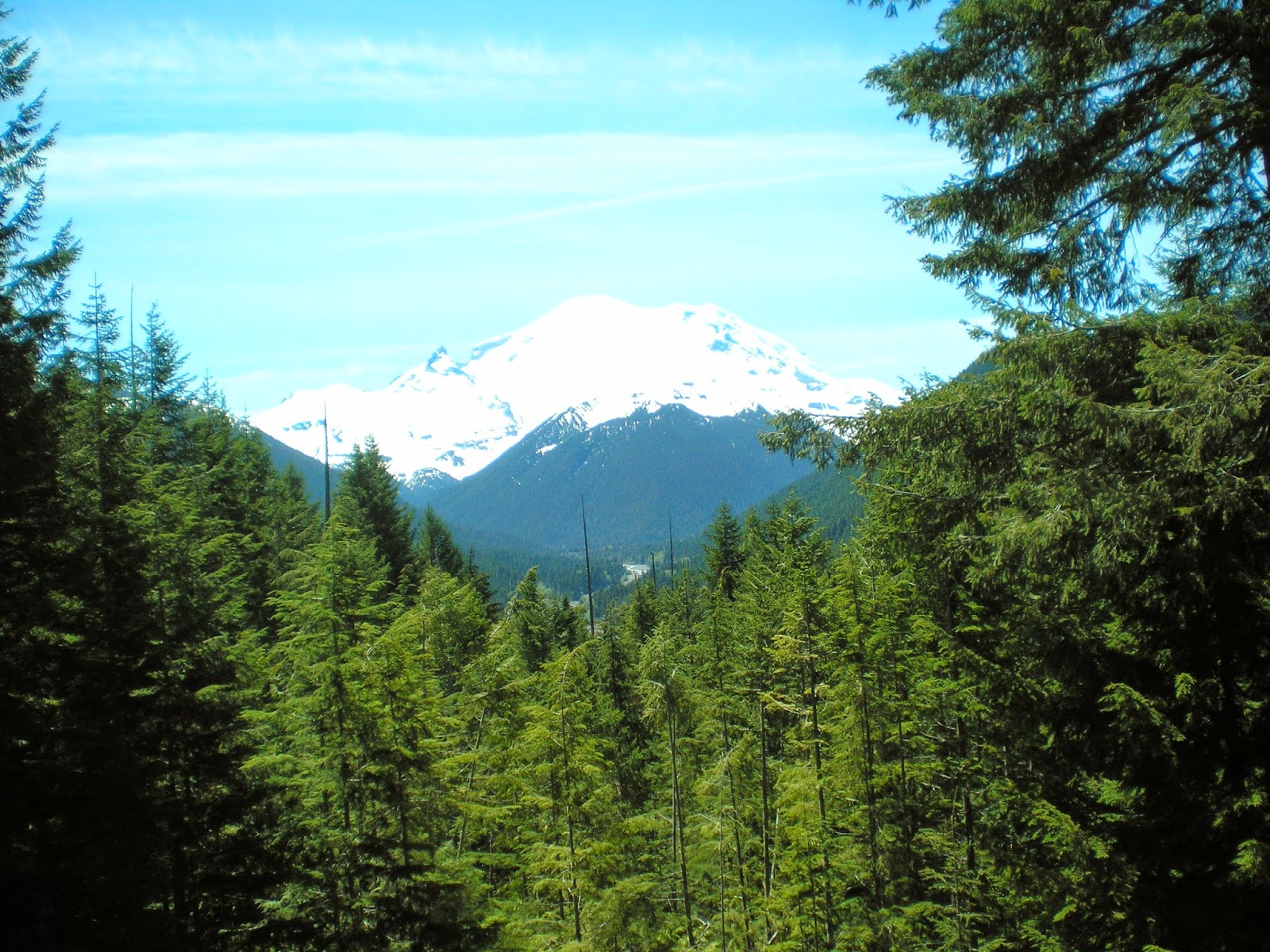
    While the ponderosa pines on the western slope of the Sierra Nevada in California receive more rain and tend to be larger, the second-growth pines here compare favorably with those in the state with the alleged largest forest of ponderosas: Arizona.


    Early during the 20th century there was a TB Sanatorium for babies at Cloudcroft nickamed "Baby San."


    The restored Mexican Canyon Trestle. Note the barricade at the left end; it's clearly not open to the public -- especially to acrophobes!


[Return to the top of the page]
Links:
Routes:

W 5 Nov Actual Route: Sherwood Wy W/M - Visitor Ctr - San Angelo Lib - VA Clinic

Th 6 Nov Actual Route: VA Clinic - San Angelo Lib - Sherwood Wy W/M

F 7 Nov Actual Route: Sherwood Wy W/M - San Angelo Lib - P.O. - Sherwood Wy W/M

Sa 8 Nov Actual Route: Sherwood Wy W/M - Visitor Ctr - San Angelo Lib - Sherwood Wy W/M

Su 9 Nov Actual Route: Sherwood Wy W/M - Visitor Ctr - Sherwood Wy W/M

M 10 Nov Actual Route: Sherwood Wy W/M - Library - San Angelo State Park

T 11 Nov Actual Route: San Angelo State Park - Sherwood Wy W/M - Hm Depot - Sam's Club -Walmart

W 12 Nov Actual Route: Sherwood Wy W/M - San Angelo VA Clinic - Lib - Sherwood Wy W/M

Th 13 Nov Actual Route: Sherwood Wy W/M - Lib - Visitor Ctr - Sherwood Wy W/M

F 14 Nov Route: Sherwood Wy W/M - Lib - Sherwood Wy W/M


Finding Campgrounds:

N.B. I receive nothing from Trailer Life, Woodalls, or FreeCampsites.net for including links to their free campground lookups.

Saturday, September 20, 2014

Updated State High Points

Updated State High Points

Las Cruces Library, NM

    One of my goals during my travels has been to take photos of the highest peaks in each state I visit; what follows are the High Points in most of the western states as well as Texas and the Rocky Mtn states north to the Canadian border. The previous post of State High Points was on 30 Mar 2014; it's the bottom link below. Since that post I got as far north as Fargo, ND, before heading south through parts of the Mid-West and South-East.

    OOPS!! Forgot the drive I made to to Kenton, OK, near Black Mesa, Oklahoma's high point; it's the 5th photo in Link# 12 below.


    North Dakota's White Butte (3,506') roughly 30 miles north of Bowman in the SW corner of the state. See Link # 9 below.


    Since my backpacking days are over here's a link to the Wikipedia article on Eagle Mountain (2,301') in Minnesota.


    Since there was no sign pointed toward the clump of trees just inside the Iowa border I wasn't certain I had a photo of Hawkeye Point (1,671'); but a woman at the Magazine Mtn Ranger Station in Arkansas had a book which had the same barn or silo you see in this photo. See Link #10 below.


    Looking north from the top of Taum Sauk Mountain (1,772') in Missouri's St. Francois Mtns toward St. Louis; Cape Girardeau on the Mississippi is to the south-east. See Link #11 below.


    Arkansas' Magazine Mountain (2,753') complete with sign and a rock replica of the state. See my previous post on Magazine Mountain here.


    A view of Washington's Mt. Rainier (14,414') taken on 12 Jun 2012.
    Natl Park Service website.


    The highest peak in Oregon is Mt. Hood at 11,249'; I have no photo of it yet; see the 1st link below.


    California's Mt Whitney (14,494') as seen from Inyo County's Portagee Joe Campground. For more info see the 2d entry in the Links below; it has an excellent photo on a National Park Service page called "Climbing Mt. Whtiney."


    Nevada's Boundary Peak (13,147') as seen from US Hwy 6 not too far from Montgomery Pass.


    More info.


    Arizona's Humphrey's Peak (12,637') in the San Francisco Mtns just north of Flagstaff.
    See the 3d link below for more info.


    New Mexico's Wheeler Peak (13,159') to the north-east of Taos.

    More info.


    I drove around the Ashley Natl Forest hoping for a clear view of Utah's Kings Peak (13,534'), but there was never a clear shot until I was back on the nearest highway. See the 4th link below for a good photo.


    See 5th link below for a photo of Idaho's Borah Peak (12,662 or 12,668')


    See the 6th link below for a photo of Colorado's Mt Elbert (14,440')


    And Wyoming's Gannett Peak (13,809') is the 7th link below.


    Montana's Granite Peak (12,807') as seen from the Beartooth Highway.

    More info.


    Guadalupe Mtn (8,751'), TX, in Guadalupe Mtns Natl Park.


More info


    While reading my 2008 World Almanac I noted Mt Harney, the highest point in South Dakota and realized I had a photo of it taken after I visited Mt. Rushmore. See Link #8 below for more info.


[Return to the top of the page]
Links:
  1. Wikipedia article on Mt. Hood, OR
  2. Climbing Mt. Whitney
  3. Wikipedia article on Arizona's Humphrey's Peak
  4. Wikipedia article Utah's Kings Peak
  5. Wikipedia article on Idaho's Borah Peak
  6. Wikipedia article on Colorado's Mt Elbert
  7. Wikipedia article on Wyoming's Gannett Peak
  8. Wikipedia article on South Dakota's Harney Peak
  9. Wikipedia article on North Dakota's White Butte
  10. Wikipedia article on Hawkeye Point
  11. Wikipedia article on Taum Sauk Mountain
  12. My Clayton Lake, NM, to Black Mesa, OK, post on 14 May 2013; 5th photo is of Black Mesa
  13. Wikipedia list of states by elevation
  14. 30 Mar 2014 post titled Some State High Points

Routes:

T 28 Oct Actual Route: Carlsbad W/M - McDs - Hobbs, NM, Lowe's - Applebees - Hobbs W/M

W 29 Oct Actual Route: Hobbs W/M - Seminole, TX, Lib - Lamesa Lib - K-Bob's - Walmart

Th 30 Oct Actual Route: Lamesa, TX, W/M - Lamesa Lib - Big Spr VA Hosp - Sterling City - Sherwood Wy W/M

F 31 Oct Actual Route: Sherwood Wy W/M - San Angelo, TX, Lib - Visitor Ctr - Lib - Sherwood Wy W/M

Sa 1 Nov Actual Route: Sherwood Wy W/M San Angelo, TX, Lib - Dollar Tree - Sherwood Wy W/M

Su 2 Nov Actual Route: Sherwood Wy W/M San Angelo, TX, Visitor Ctr - Big Lots - Sherwood Wy W/M

M 3 Nov Actual Route: Sherwood Wy W/M - San Angelo Lib - Sherwood Wy W/M

T 4 Nov Actual Route: Sherwood Wy W/M - VA Clinic - Visitor Ctr - San Angelo Lib - Sherwood Wy W/M

W 5 Nov Actual Route: Sherwood Wy W/M - Visitor Ctr - San Angelo Lib - VA Clinic

Th 6 Nov Route: VA Clinic - San Angelo Lib - Sherwood Wy W/M


Finding Campgrounds:

N.B. I receive nothing from Trailer Life, Woodalls, or FreeCampsites.net for including links to their free campground lookups.

Monday, September 15, 2014

Lemmon/Sallinen Get-Together, Roswell, New Mexico

Lemmon/Sallinen Get-Together, Roswell, New Mexico :

Belen, NM, Library


    Paul Spillers and his wife Deanna Lawrence Spillers at their home in Roswell, NM.


    [Photos taken: 17 Oct]


    [Left to Right:] Darrel Roberts, son of Bea Lemmon Roberts,Paul Spillers, Deanna Spillers, daughter of Ken Lawrence, and Ken Lawrence, grandson of Oscar and Mable Sallinen.


    [Left to Right:] Robert Lemmon, Paul Spillers, Deanna Spillers, and Ken Lawrence, son of Ethel Sallinen Lawrence.


    Darrel Roberts, The Road Genealogist, and Ken Lawrence.


    Robert and Ken discover that their birthdays were 5 days apart 59 years ago. [If you believe that latter number, perhaps I can interest you in a suspension bridge between the home of Yankees and the former home of the Dodgers. :-)>]


    Robert and Ken talk in the background as Ken supports the wall and Darrel peruses some photos that Deanna took.


[Return to the top of the page]
Links:
Routes:

M 13 Oct Actual Route: Sherwood Wy W/M - Visitor Ctr - Big Spr McDs - Comanche Trail City RV Park

T 14 Oct Actual Route: Comanche Trail City RV Park - Big Spr McDs - VA Hosp - Lamesa McDs - Seminole Lib - W/M

W 15 Oct Actual Route: Seminole W/M - Hobbs Big Lots - Lib - Lowe's - Walmart

Th 16 Oct Actual Route: Hobbs W/M - Loco Hills - Artesia Lib - Roswell Walmart

F 17 Oct Actual Route: Roswell W/M - McDs - Library - Spillers Res - Roswell W/M

Sa 18 Oct Actual Route: Roswell W/M - McDs - Hondo - Ruidoso - Carrizozo - Vy of Fire BLM CG

Su 19 Oct Actual Route: Vy of Fire BLM CG - Carrizozo - Socorro Lib - Walmart

M 20 Oct Actual Route: Socorro Walmart - McDs - Belen Lib - Albuquerque - Hillerman Br Lib - Wyoming Blvd W/M

T 21 Oct Actual Route: ABQ Wyoming Blvd W/M - Hillerman Br Lib - MurphyUSA Gas - Belen Lib - Belen W/M

W 22 Oct Route: ABQ Wyoming Blvd W/M - Hillerman Br Lib - Wyoming Blvd W/M


Finding Campgrounds:

N.B. I receive nothing from Trailer Life, Woodalls, or FreeCampsites.net for including links to their free campground lookups.

Wednesday, September 10, 2014

Fort Mandan, North Dakota

Fort Mandan, North Dakota :

San Angelo, TX, Library

    Fort Mandan, the replica of 1804-1805 winter encampment on the Missouri River of the Corps of Discovery led by Meriwether Lewis and William Clark, was built by the McLean County Historical Society in 1972.

    [Photos taken 22 Jun]     The Fort Mandan replica is virtually identical to the Fort Clapsop replica near Astoria, Oregon, where Lewis & Clark made their encampment for the winter of 1805-1806. (Because the plans for it were lost, the plans for Fort Mandan were used; the primary difference is that there are many different types of trees available near the mouth of the Columbia River from which to build.)


    A zoom through the gates of the fort, which was built of cottonwood trees.


    It's unclear whether the McLean County Historical Society used any power tools in cutting the dry cottonwood logs.


    Looking at the chimneys I wonder what was done inside above the rocks which formed the fireplaces.


    While all of the rooms at the fort look similar, as one might expect the two captains and first seargeant had somewhat larger quarters.


    A room for three of the Corps members; while the "bunkbed" to the left was for two, there was a loft above the ceiling of the room and the fort's roof.


    Here's a room showing the ladder to the loft.


    One of the reasons Lewis & Clark needed larger quarters was to store the specimens they had collected for President Jefferson.


[Return to the top of the page]
Links:
Routes:

Sa 11 Oct Actual Route: Sherwood Wy W/M - Lib - Sherwood Wy W/M

Su 12 Oct Actual Route: Sherwood Wy W/M - Visitor Ctr - Dollar Tree - Sherwood Wy W/M

M 13 Oct Actual Route: Sherwood Wy W/M - Visitor Ctr - Big Spr McDs - Comanche Trail City RV Park

T 14 Oct Actual Route: Comanche Trail City RV Park - Big Spr McDs - VA Hosp - Lamesa McDs - Seminole Lib - W/M

W 15 Oct Actual Route: Seminole W/M - Hobbs Big Lots - Lib - Lowe's - Walmart

Th 16 Oct Actual Route: Hobbs W/M - Loco Hills - Artesia Lib - Roswell Walmart

F 17 Oct Actual Route: Roswell W/M - McDs - Library - Spillers Res - Roswell W/M

Sa 18 Oct Actual Route: Roswell W/M - McDs - Hondo - Ruidoso - Carrizozo - Vy of Fire BLM CG

Su 19 Oct Actual Route: Vy of Fire BLM CG - Carrizozo - Socorro Lib - Walmart

M 20 Oct Actual Route: Socorro Walmart - McDs - Belen Lib - Albuquerque - Hillerman Br Lib Wyoming Blvd W/M


Finding Campgrounds:

N.B. I receive nothing from Trailer Life, Woodalls, or FreeCampsites.net for including links to their free campground lookups.

Friday, September 5, 2014

Second Thoughts on the Torch Crank Light

Second Thoughts on the Torch Crank Light : See important note below -- above Links

San Angelo, TX, Library

    In a 30 June post earlier this year I labeled the Torch Crank Light the Most Useful Christmas Present I've ever received. [See the 1st link below.] Now I'm having second thoughts -- especially about its durability.


    Initially I charged the light's internal battery using the hand crank; however, it broke off in Mar 2013. Two different members of Goal Zero's support told me that was rare. I told them that when I was next in the Salt Lake Area I'd drop by to get another Crank Light.


    On 9 April I located Goal Zero's plant/showroom in Bluffdale, UT, just south of Riverton and the saleswoman gave a new Crank Light.


    She also gave me a new box containing both the d.c. & a.c. adapters. On 17 Aug the d.c. adapter did not seem to charge the light's battery very well; since it was dark I decided to wait til the next day to determine the problem. The next day I had my F250 serviced at the Cape Girardeau, MO, Ford dealer & immediately headed north to avoid an oncoming hailstorm. When I attempted to plug in the d.c. adapter I found parts I thought the dealer's serviceman had left in the +12v socket. (Since there are devices to test the truck's battery using that socket, I thought the parts I found in the socket had been left by the serviceman.) Later that evening I learned that the parts were from the d.c. adapter. Unfortunately, I didn't gather all of the parts together and eventually lost some of them.

    Conclusions: 1)GoalZero apparently has a quality control problem with the assembly of its Torch Lights in China and 2)The Torch Light is designed for intermittent or emergency use and not everyday use.


    In an e-mail dated 7 Oct 2014 Andy Earl of Goal Zero stated that the Torch Crank Light has been discontinued. He suggested I check out the Torch 250.
[Return to the top of the page]
Links:
Routes:

F 26 Sep Actual Route: Sherwood Wy W/M - Lib - Sam's Club - Sherwood Wy W/M

Sa 27 Sep Actual Route: Sherwood Wy W/M - Lib - Sam's Club - Sherwood Wy W/M

Su 28 Sep Actual Route: Sherwood Wy W/M - Lib - Sam's Club - Sherwood Wy W/M

M 29 Sep Actual Route: Sherwood Wy W/M - Jim Bass Ford -Lib - Sam's Club - Sherwood Wy W/M

T 30 Sep Actual Route: Sherwood Wy W/M - Lib - Sherwood Wy W/M

W 1 Oct Actual Route: Sherwood Wy W/M - Lib - Visitor Ctr - Sherwood Wy W/M

Th 2 Oct Actual Route: Sherwood Wy W/M - Lib - Sherwood Wy W/M

F 3 Oct Actual Route: Sherwood Wy W/M - Lib - Sherwood Wy W/M

Sa 4 Oct Actual Route: Sherwood Wy W/M - Lib - Sam's Club - Sherwood Wy W/M

Su 5 Oct Actual Route: Sherwood Wy W/M - Visitor Ctr - Sam's Club - Sherwood Wy W/M


Finding Campgrounds:

N.B. I receive nothing from Trailer Life, Woodalls, or FreeCampsites.net for including links to their free campground lookups.