Wednesday, March 30, 2011

Fallon to Mina to Montgomery Pass, NV, to Bishop, CA Photos

Bishop, CA


    While I have moved the photos I took while driving from the Fallon, NV, to Bishop, CA, on 22 Mar to the top post, will put it back in sequence 4 or 5 days after I add some descriptive text to these photos.


W 30 Mar Route: Bishop

Th 31 Mar Actual Route: Bishop - Big Pine - Independence


Saturday, March 26, 2011

The Laws RR Museum

Bishop, CA


    Visited the Laws Museum this afternoon; it was once an important stop on the Carson & Colorado Railroad which was incorporated in May 1880 and completed from Mound House, NV, near Carson City, to Laws, CA, approximately 4.5 miles by road to the NE of Bishop, in Mar 1883. The first run was on 1 Apr 1883.

    The shot was taken after I had walked by the camera display, the trading post, the general store [which had a 20s-40s, art-deco poster advertising Warren Gum (I had a brother & an uncle with that given name)], the stove display, the print shop, the pioneer bldg, the fire station, the medical bldg, the textile bldg, and the original 1883 agent's house. The white on the ground in front of the old tractors is likely salt used to melt snow.

    A wanted poster for The Wild Bunch, which included Butch Cassiday & the Sundance Kid; believe it was on the Assay Office. [If you click 1 or 2 times to zoom in.]


    A view of the rolling stock donated by Southern Pacific, the successor to the Carson & Colorado RR, circa July 1964.


    An oil wagon likely similar to the one our maternal great-grandmother Martha Elizbeth Farley Shackelford's second husband, Sam Colbaugh, drove near Big Springs, TX.


    [If you click 1 or 2 times, you may be able to zoom in on the plaque in the center.] It explains that the North Inyo County School was move to Laws with financial help from two pioneer families: Verne & Sybil Summers and Thomas N. & Kathleen Murphy Wonnacot. The plaque to Maud Truscott was moved from a Bishop elementary school auditorium to Laws.

    Here's a closeup of Tom & Kathleen Wonnacot; Kathleen's last position was as Dean of Girls at Bishop Un HS.


    A closer view of Baldwin Engine #9, "The Slim Princess," built in 1901 -- a narrow-gauge, steam-powered locomotive.


    Former Catholic Church in Bishop.


    The Laws Depot. [Click 1 or 2 times to zoom in.]


--
Links:

Sa 26 Mar Actual Route: Bishop - Laws Museum - Bishop

Su 27 Actual Route: Bishop

M 28 Actual Route: Bishop

T 29 Actual Route: Bishop

W 30: Bishop

W 31: Bishop - Big Pine - Independence

Friday, March 25, 2011

Two Mountaineer Obituaries: Norman Clyde & Smoke Blanchard

Bishop, CA

    Here are two obituaries from The Inyo Register of well-known and influential mountain climbers whose ashes were scattered in the mountains they so deeply loved.
--
Norman Asa CLYDE
--
Obituary
--
Thursday 4 January 1973 [Bishop, CA] Inyo Register, p. 17
--
Norman Clyde, Famed Mountaineer, Author, Dies At Age Eighty-Seven
--
    Norman Asa Clyde, famed western mountain climber, explorer, author and photographer, died Dec. 23 at Inyo County Sanitorium in Big Pine at the age of 87.
    Clyde, who resided alone for many years at a secluded ranch west of Big Pine, had moved to the sanitorium 2 years ago following several lengthy illnesses.
    Born in Philadelphia, Penn., in 1885, to Charles and Isabelle (Purvis) Clyde, he was eventually to become one of the most widely-known figures in the lore of the west, despite his inclination toward privacy.
    Educated at five different universities, (held an AB degree and a sciences doctorate from Geneva College of Pennsylvania) he attended the University of Wisconsin, the University of California at Los Angeles and Berkeley, and the University of Southern California.
    Clyde ascended more than 1000 peaks in his lifetime, most of them by himself, ranging from Baja, California to the Canadian Yukon, and was an acknowledged expert on high-altitude flora and fauna (particularly the Hudsonian and Arctic Alpine zones of the Sierra Nevada) and contributed to knowledge the geological history and structure of mountain ranges of the Western United States.
    More than 200 of Clyde's climbs were first ascents, including new routes. In 1926 while exploring Glacier Park, Montana, he was reported to have conquered 36 peaks in 36 days. A member of the San Francisco Chapter of the Sierra Club, he rescued numerous lost and injured persons, sometimes lomg after other searchers had given up.
    His extensive mountaineering exploits brought him fame not only for peaks ascended, but also as author of several books on various aspects of the mountains, more than 300 magazine articles and numerous essays.
    Clyde was at various times a zoological collector for the University of California, a guide, a climbing and ski mountaineering leader with the Sierra Club, and had in recent years climbed with the Seattle Mountaineers and Alpine Club of Canada.
    A noted linguist and classical scholar, Clyde was a recipient in 1962 of the Geneva College Distinguished Service Award, among other awards and honorary degrees through the years.
    He was from 1898 to 1910 a high school teacher in North Dakota, Arizona, Utah, and California, and was at one time principal of the Independence schools.
    Clyde was known as the "Old Gaffer and "The Pack that walks like a man," in mountaineering and literary circles.
    Jules Eichorn, in a prologue to the recently-published Norman Clyde of the Sierra Nevada; Rambles Through the Range of Light said, "I first saw Clyde standing in the sun in front of the Glacier Lodge, a jut-jawed, blue-eyed, ruddy complexioned animated block of granite, somewhat resembling a soldier -- mainly, I think, because of his campaign hat, which never (as I learned) left his head....Here was a man who had made up his mind what he had to do and would never swerve from his objectives...."
    Clyde held membership in the California Academy of Sciences, the National Rifle Association, the American Alpine and Appalachian clubs, the Sierra Club, and many other organizations.
    Only know survivor to date is a sister, Mrs. H.E. McKelvy of Gibsonia, Penn.
...........................................................................................................................
William Earl "Smoke" BLANCHARD
--
Obituary
--
Friday 30 June 1989 [Bishop, CA] Inyo Register, p. 2
--
By Heidi Walters, Inyo Register Staff
--
    A tale of a truck-driving mountain climber who leaned toward Buddhism might sound like a tall one to some.
    To the many friends of Smoke Blanchard, the tale might be tall but only in intrigue and truth, and wide in complexity and thought.
    Smoke, 74, died a week ago at the Antelope Valley Hospital in Lancaster after suffering major head injuries in an automobile accident near Ridgecrest. He is survived by a son, Bob Blanchard of Bishop, two step-daughters, girlfriend Keiko Ishikowa, and many, many friends.
    Some of his friends, in trying to describe Smoke, have drawn a picture of an individual who had a basic outline but one that was flexible, that could change according to the circumstances and place.
    "Smoke was a pretty unusual person and yet he appeared very ordinary on the outside -- and he liked it that way," says long-time friend Doug Robinson, of Bishop and Santa Cruz. "His Buddhist philosophy was, seeming to be no one special, walking down the street in his work clothes."
--
Special to Many
--
    But for all his modest, unassuming, simple exterior, Smoke was someone special to many throughout the world. Although friends say he could be gruff at times -- especially with those who defile the natural world with beer cans and other trash, or those who ignore the beauty and dangers of the mountain world -- for the most part they say he was soft-spoken and tolerant.
    Perhaps Smoke's greatest influence was on the mountaineering community. He mingled with old timers like Norman Clyde and Jules Eichorn, and he tossed ropes to and swapped stories with modern climbing luninaries as well.
    But pomposity never entered into it -- Smoke loved to teach the ways of the mountains to anyone who cared to learn.
    Gordon Wiltsie, a climber, writer, and Eastern Sierra local -- like many of Smoke's friends -- says Smoke was "what a mountaineer should be: just being in the mountains and teaching others."
--
Lived As a Bodhisattva
--
    "In Buddhist terms, I see him as a bodhisattva -- somebody who dies, becomes enlightened, and comes back to work as a teacher," Wiltsie says. "He was someone who learned the magic of the mountains -- the spell -- and was always taking the knowledge back to teach people."
    From the sounds of it, Smoke shared the nirvana of the mountains with people throughout his life. From Nepal to Japan to India to the mountains of Oregon, Alaska, California and beyond, Smoke climbed, walked, drove, rode his bicycle and made friends.
    And somewhere in between, for about 25 years, he drove a truck -- hence the name "Smoke," after the black smoke from the truck's stacks; although others say his name came from his pipe-smoking habit of years past. But during those years on the road, his mind whirled as fast as the speeding wheels with thoughts of Eastern philosophy, the Japanese language, religion, poetry -- anything and everything.
--
'Flying in a Straitjacket'
--
    In a book he wrote and published in 1985 called Walking Up and Down in the World: Memories of a Mountain Rambler, Smoke describes the sensation of guiding a truck across the highways of America:
    "By definition the driver is confined to the cab. It is a strange mixture of freedom and bondage, like flying in a straitjacket." Later, on the same subject: "I earned a wage for using 10% of my mind while having the free-wheeling use of the other 90 percent. I wouldn't have traded with a king."
    But while trucking offered Smoke long hours of thinking, perhaps being in the mountains offered more soul-satisfying thinking time.
    He liked to climb and walk alone. In a letter to Robinson a few months ago, Smoke describes a hike he took: "I go up a route less traveled and come down a route where I see no one."
    But he also liked to climb and walk with others, listening to their tales. As James Wilson, owner of Wilson's Eastside Sports in Bishop and a friend of Smoke's puts it: "He liked people a lot, especially if they were good walkers and good talkers."
--
'Mountain Picnic-Pilgrimage'
--
    And, unlike many mountaineers, his philosophy of mountaineering excluded elitism and was simple: to enjoy it.
    As he wrote in his 1985 book: "For half a century I have tried to promote that mountaineering was best approached as a combination of picnic and pilgrimage. Mountain picnic-pilgrimage is short on aggression and long on satisfaction."
    One of Smoke's favorite mountain picnic-pilgrimage spots was the Buttermilks west of Bishop.
...........................................................................................................................
Links:

  • Wikipedia acticle on Norman Clyde
  • Phil Pister's remembrances of Norman Clyde
  • While initially on another subject, Hrvjoe Galic's research contains numerous, well-documented bits of information on Norman Clyde
  • American Solo Mountaineering article on Norman Clyde
  • Wikipedia article on Smoke Blanchard
  • Research Notes of author of above-linked Wikipedia piece on Smoke Blanchard

Sa 26 Mar Actual Route: Bishop - Laws Museum - Bishop

Thursday, March 17, 2011

Hawthorne to Schurz to Fallon, NV

Fallon, NV


    A photo of the left side of Walker Lake across US95. As mentioned previously, Walker and Pyramid Lakes are the two largest remaining remnants of Lake Lahontan, which once covered much of Northwestern Nevada.


    A shot to the south-east looking at part of what is now called the Hawthorne Army Ammunition Depot. [I'm fairly certain that during the 1966-67 school year it was operated by the navy; in fact, one of the links in the previous post confirms that.]


    A look toward the upper end of Walker Lake, which I mistakenly said was c22 miles long; now believe 18 miles is correct. I was misled by Twenty-Mile Beach, which is a State Beach and boat-launching site about 2 miles from the upper end of the lake. [Perhaps the 20 miles was measured from a point to the north rather than from Hawthorne or the southern-end of the lake.]


    One can't make out the Ammunition Depot unless he clicks 1 or 2 times to zoom in on the view to the SSE.


    Up ahead, the fat or widest part of the lake to circumnavigate.


    The confluence of the Walker River, which originates on the eastern side of the Sierra Nevada and flows into Nevada, and the northern end of Walker Lake.


    A look back at Mt. Grant, officially listed as 11,239' but which mountain-climbers maintain is nearer 11,270'.


Links:

  • Excellent web site on the Lahontan National Fish Hatchery Complex; contains links to related sites
  • Story of Walker Lake; includes several good photos
  • Wikipedia article on Fallon, NV
  • Ascent of Mt Grant with excellent photos by a climber named Scotty

F 18 Mar Actual Route: Bonanza Casino RV Park, Fallon, NV

Sa 19 Mar Actual Route: Bonanza Casino RV Park, Fallon, NV

Su 20 Mar Actual Route: Bonanza Casino RV Park, Fallon, NV

M 21 Mar Actual Route: Bonanza Casino RV Park, Fallon, NV

T 22 Mar Route: Fallon - Middlegate - Gabbs - Mina - Basalt, NV - Benton, CA - Bishop

Wednesday, March 16, 2011

Goldfield to Tonopah to Mina to Hawthorne, NV

Whiskey Flats RV Park, Hawthorne, NV

    As mentioned in a previous post, I spent the the night of T 15/W 16 Mar boon-docked at the junction of two roads near a mining area past the Gold Field Cemetery. No, I wasn't worried about ghosts; rather I was worried about the high winds.

    Thought about putting 2 or more jacks down to stabilize the camper against the high winds, but it was too cold to say outside long. There weren't many radio stations on the FM dial, but I did receive the FM version of the only station I could receive during the day when I taught at Bishop Un HS: KIBS, Voice of the High Sierras. [Other AM stations began skipping in after sundown.]

    The forecast for Mammoth Lakes north to Topaz Lake called for high winds, with gusts up to 100mph over ridge tops and gusts up to 70mph elsewhere. The forecast for the Tonopah area, where KIBS has some sponsors, said the winds would last until 8am Wednesday morning. Got 3.75 hrs sleep before having to get up to drain off some of the beer I had with dinner. But then I couldn't go back to sleep because of the rocking motion caused by the winds. [For you Santa Cruzans, think of it as trying to sleep while riding the Looff Merry-Go-Round at the BeachBoardwalk.]

    Ate the earliest breakfast yet since I started traveling during the last third of Oct 2010: 6am. Rinsed the dishes in cold water because I felt the wind was too strong to light the water htr. [I don't leave it on overnight because the heater hasn't worked since the refrigerator was repaired to run on LP-Gas.] Then drove to the Goldfield Library, where I sent a sibling an e-mail that I was driving back through Tonopah and on to Hawthorne. [Didn't mention the lack of sleep since that might have caused excessive worry.]

    Before I even got to Tonopah, which is c27 mi N of Goldfield, began to feel sleepy. But I discovered that if I turn the Hot/Cold knob toward Cold and open the vents, the cold air from outside on my legs did a fairly good job of keeping me from nodding off.

    And the stop at Mina, where I learned at its only RV Park that the WiFi was satellite-based & cost big bucks, also served to keep me awake longer. Also made it through a few dust storms. [N.B. Much of the interior of Nevada was once covered by Lake Lahontan, with Walker Lake just north of Hawthorne and Pyramid Lake north of I-80 being the only remnants other than numerous salt flats.]
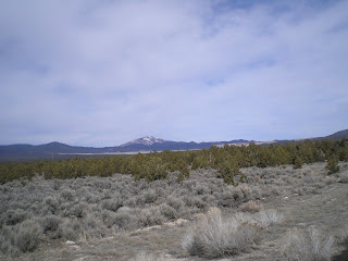
    Drove though Hawthorne and noted that the older parts of the town where the El Capitan Casino and Joe's Tavern, also a Casino, looked much as they did in 1966-67. But the lot where the Hawthorne Club stood was vacant. I watched the dealer/part-owner deal seconds one time when there was a full table. [I want to say the table was filled with active-duty naval personnel, but note that the Ammunition Depot is an Army facility -- perhaps it was back then also.] In any event, I never played Blackjack at the Hawthorne Club again; besides, I was too well-know, especially at Joe's Tavern, so I took my "act" to Reno shortly thereafter.

    At the far end of town were some businesses which were not there in 66/67: a McDonald's and a Safeway (though there may have been a smaller store in town) [Actually the food back then in the El Capitan Restaurant was rather good, but I preferred not to play there because of the "amateurs" flown in from Central California.]

    The Library's WiFi worked well, but the one RV Park with WiFi, Whiskey Flats, didn't show up on Mapquest despite an address on US95 and Google Maps showed it half-way up Walker Lake, which I'd estimate to be 22-miles long.

    Asked a librarian where the Safeway store was located (their Store Locator showed a store in Hawthorne) and she said just up US95 from McDonald's. Bought some things I needed such as bread, carrots, celery (which was $2.99 a head) and low-sodium garbanzo beans -- though I prefer Trader Joe's garbanzo beans in sea salt because of the taste and larger size.

    As I drove out of the Safeway parking lot I looked up US95 and saw what appeared to be a business named "WH***** Something." Turned left instead and discovered that it was the Whiskey Flats RV Park. Cost was $24.75 without cable TV but otherwise a full hookup. The restrooms were clean and 1 of the 3 showers was the same kind which impressed me so much at a Motel 6 in Kingman, AZ. [I took showers all of my life using 2 knobs -- not one. Always seem to scald myself or get a shot of ice-cold water; and there was a heater that went on when the lights were turned on -- not an open barn door through which a cold wind could quickly cool off your hot bod after you stepped out of a hot shower.]

    While I recommend the Whiskey Flats RV Park, if you're even tighter-fisted than I, there are likely some other older and cheaper RV parks in Hawthorne.

Links:

W 16 Mar Actual Route: Goldfield - Tonopah - Coaldale Jcn - Mina - Hawthorne

Th 17 Mar Actual Route: Hawthorne - Fallon

Tuesday, March 15, 2011

Ely to Tonopah to Goldfield, NV

Near the Goldfield, NV, Cemetery

    The drive today from Ely, NV, to Tonapah and then Goldfield was a traverse of several basins separated from each other by ranges of mountains. And that's why the interior of the state of Nevada is considered a prime example of the Basin & Range geography of the western United States.

    After crossing Murray Summit, c6720', just west of Ely I pulled over to the left shoulder & took the photo to the right. While there is still some snow on the hill to the left as well as the mountain range in the distance, more is expected later this week. In fact, each night as I climbed into the cab-over and my sleeping bag, I listened to an AM station [530KHz?] which gave road conditions and overnight weather forecasts for the 3 US Highways which part ways at Ely: US6, US 50, & US93, (Just a reminder, even-numbered US & Interstate Highways run east-west while odd-numbered routes run north-south.)

    As I descended into the next valley or basin I pulled over to take some photos and noticed what appeared to be a dam, which is visible above the healthy stand of junipers at the right center of the snapshot. Don't have I-net access right now, but will look up the name of the dam as well as the creek which damed to form which lake or reservoir.


    This next shot is of the mountain range to the SW of the dam in the previous photo.


    And this photo was taken to the left of the one above. Note that the junipers have thinned a bit in spots allow the sage-brush to spread.


    Note the flat up ahead from this snap taken in the drainage which descends into the Railroad Valley at Currant. [Click 1 or 2 times to zoom in.]


    Currant was essentially a ghost -- though the restaurant appears to have closed only 2 or 3 years ago. The primary biz in the RR Valley is not cattle ranching but rather oil drilling and refining.


    There is also some mining underway in the RR Vy as is evident from the large white piles roughly due north of where I stopped.


    And this is a view of the mountain range to the east of the RR Vy.


    A look back at the Railroad Valley where a hardy few are scratching out a living raising cattle, mining, or drilling and refining oil.


    The broad pass from the RR Valley to the next basin; like Blackrock Summit all of the passes were above 6000'.


    I ask you, where can you stand in the middle of a US Highway and take a photo up or down the middle of the road without risking become road-kill? [Yes, US50 from Ely to Austin is called the loneliest highway in the U.S., but I only saw 7 vehicles headed east until I got to within 30 miles of Tonopah.


    The climb to Warm Springs Summit, the 2d to last basin before one reaches Tonopah.


    I stopped for lunch about 28 miles east of Tonopah at a Rest Stop; there were signs warning truckers not to enter the portion of the rest area set aside for cars or pickups. But since there were no signs prohibiting overnight parking, the Rest Area might do in a pinch for RVers caught late at night headed east on US6. RVers with large vehicles could park in the area set aside for semis. The pit toilet did not have any odor until one entered the concrete building -- though that might change during hotter weather.

Links:

  • History of Tonopah, Queen of the Silver Mines
  • Wikipedia article on Tonopah

T 15 Mar Actual Route: Ely - Currant - Warm Springs - Tonopah - Goldfield

Monday, March 14, 2011

Zion National Park Photos

Ely, NV


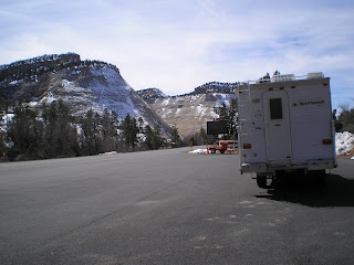
    Here's a Photo Gallery of Zion Natl Park shot on 9 March as I drove from the Eastern Entance to Zion Canyon, up to the end of that road, and then through Springdale (where that city's library's WiFi wasn't working) and along the Virgin River/Riverbed, where the last 2 photos were taken.


    The 2d photo of "The Checkerboard," just inside the East Entrance, was provided by Van Ness Neighbor Tom Pennello, a fan of the canyon country in Utah and Nevada.

T 15 Mar Route: Ely - Currant - Warm Springs - Tonopah, NV