Wednesday, July 27, 2011

McBride Sprs CG to Weed to Juanita Lake CG

Juanita Lake USFS CG, Siskiyou County, CA


    The water at the McBride Springs Campground appears to be snow melt. It's the coldest water I've ever seen during 53 year of backpacking with the exception or 2 or 3 trips during late Oct or early Nov when there was already snow on the ground.
    Here's a 3 p.m. view of Mount Shasta from the spot north of Weed where I stopped to eat lunch. Note that the Weed landfill is closed. [Are they shipping their garbage to SF? :-)>]


    Lake Shastina, 3000 ft, located to the north-west of Mt Shasta, 14,162 ft. The view is from US97, a busy truck route from Weed, California to Klamath Falls, Oregon.


    After taking the above photo I turned around and noted that Mt Shasta was cloudless.


    California State Historical Marker # 517. [Click 1 or 2 times to enlarge, making the words more readable despite the bird droppings. (Incidentally, the Marker begins with "As early as 1852 wagon trains of overland emigrants crossed 600 feet to the north....")


    The first of 4 historical plaques by CalTrans at a Vista Point not far from Grassy Lake Summit (elev: 5101'). If you're interested in the many routes emigrants took to California, I'd recommend George R. Stewart's The California Trail.


    Indian beliefs about Mt Shasta.


    Some new info re Mt Shasta (at least for me). Has anyone ever heard of a French explorer name La Perouse? He apparently witnessed the 1786 eruption of Mt Shasta from his ship off the coast of Northern California.


    Mount Shasta's long evolution and its place in the Pacific Ocean's "Rim of Fire."


    So when will the next eruption be? And where was the earth's most massive landslide?


    A final view [I think] of Mt Shasta from the location of the above CalTrans plaques. As noted above the black butte to the left is not called Black Butte, a very common name here in California as well as in the southwestern U.S., but rather "Whaleback Mountain."
--
Links:
[To follow later]

W 27 Jul Actual Route: McBride Springs CG - Mt Shasta - Weed - US97 - Juanita Lake USFS CG

Th 28 Jul Actual Route: Juanita Lake CG - Klamath Falls - Chiloquin Jcn - Walt's RV Park (on the Williamson River)

F 29 Jul Actual Route: Walt's RV Park - Chiloquin - Crater Lake NP

Sa 30 Jul Actual Route: Crater Lake - Diamond Lake

Su 31 Jul Actual Route: Diamond Lake - Chemult - LaPine - Bend - Tumalo St Pk CG

M 1 Aug Route: Tumalo St Pk CG - Bend - Sisters

Tuesday, July 26, 2011

Shingletown to Shasta Lake to Mt Shasta

McBride Springs CG


    After a few stops in Redding at the VA Clinic and a gas station I headed north. Unfortunately, there are very few Vista Points on I-5 where one can take photos of Shata Lake. I drove down one road (Turntable Rd) to take the photo you see to the right. The mountains with snow in the background are in Lassen NP, which only opened recently.


    A first view of Mt Shasta from I-5 perhaps 10-15 miles north of Shasta Lake; as you can see, this view is from a gravel shoulder and not a Vista Point. [Click 1 or 2 times to zoom in.]


    A Vista Point which, until I parked to take another photo of Mt Shasta, was populated by idling semis. [Don't know how the truckers can sleep with so much diesel exhaust in the area, but I guess they either learn or croak!]


    A shot to the southwest from McBride Springs CG to the Castle Crags State Park west of Dunsmuir. [Click 1 or 2 times and look along the ridge-line in the center of the photo.]


    Mt Shasta as seen from the USFS McBride Springs Campground.


--
Links:

  • Wikipedia article on Mount Shasta, California's 5th highest peak
  • Extensive history of Mount Shasta

W 27 Jul Actual Route: McBride Springs CG - Mt Shasta - Weed - US97 - Juanita Lake USFS CG

Th 28 Jul Route: Juanita Lake CG - Klamath Falls - Chiloquin Jcn - Walt's RV Park (on the Williamson River)

Thursday, July 21, 2011

Point Arena to Navarro Beach Campground

Orland, CA


    Here are a couple of photos I took early on T 19 Jul at the Ocean Cove Campground before the fog rolled in.


    The Ocean Cove CG is about 4 miles north of Fort Ross at a right-angle left turn (with a slow to 15mph sign) in the Shoreline Highway (SR1).


    A shot looking south from just north of Cuffy's Cove -- or just south of the mouth of the Navarro River.


    A view of what's left of the Navarro Inn; note that the efforts so far have nearly reached the goal necessary for a California Cultural and Historical Grant. [Click 1 or 2 times to enlarge.]


    Since 1945 I recall seeing a large "Navarro Inn" on the roof of Captain Fletcher's Inn. Now there's a sign on the roof of the building next door which is an appeal for aid: "Help Save the Inn."


    The Inn as it looked just before sundown on T 21 July.


    A view of the beach at the mouth of the Navarro River -- complete with an Arch Rock. Such formations are seen at other west-coast beaches as well as in the mountains of the south-west.


    The mouth of the Navarro, with the Arch Rock still visible after sundown.


    Unfortunately there were no large waves from an "Angry Sea." Rather, there were whimp waves from a placid sea.
....


    Here are four photos of Clear Lake taken on W 21 Jul from just past Lucerne on the north shore and looking west.


    ...panning left and shooting to the SSW...


    ...looking south and catching a speed boat towing a water skier...


    ...looking toward the eastern end of the lake.
--


Links:

Sa 23 Jul Actual Route: Shingletown

Su 24 Jul Actual Route: Shingletown

M 25 Jul Actual Route: Shingletown

T 26 Jul Actual Route: Shingletown - Redding - Shasta Lake - Dunsmuir - Mt Shasta - McBride Springs USFS CG

W 27 Jul Route: McBride Springs CG - Mt Shasta - Weed - US97 - Juanita Lake USFS CG

Monday, July 18, 2011

Duncans Mills to Cazadero to Fort Ross

Ocean Cove Campground, c4 miles north of Fort Ross

    Because I could not access the Internet from the Casini Ranch Family Campground I drove to the Guerneville Branch of the Sonoma County Library and posted what I had written Sunday night at Casini. After buying some gas I drove back toward the coast, planning to turn right at some point and drive to Cazadero.
    While I saw a sign for Old Cazadero Rd just as I left Guerneville, my quick glance at the route on MapQuest seemed to put it past Duncans Mills. That proved to be the case, and I drove through what is a combination of summer camps and private summer or full-time homes before taking Fort Ross Road toward the coast.
    After a quick lunch I continued the journey to the coast; however, I guessed wrong at 1 or more intersections where Fort Ross was nowhere to be seen on the road signs. But I finally arrived 5 minutes before the closing time of 4:30 p.m.

    Despite what the sign in front of the Visitor Center says, the primary reason the Russians established Fort Ross was to hunt sea otters; and the secondary reason was to raise crops which could be used at their settlement in what is now Sitka, Alaska. [Click 1 or 2 times to zoom in]


    As I walked down the path from the Visitor Center to the fort itself I passed what appeared to be an apple tree; closer examination revealed some small apples. (And there were two even older apple trees within the fort; their apples were also very small.) The Russians, who occupied Fort Ross from 1812 to 1841, also planted pears, plums, and cherries. While I did see a plum tree, I did not see any other types of fruit trees.

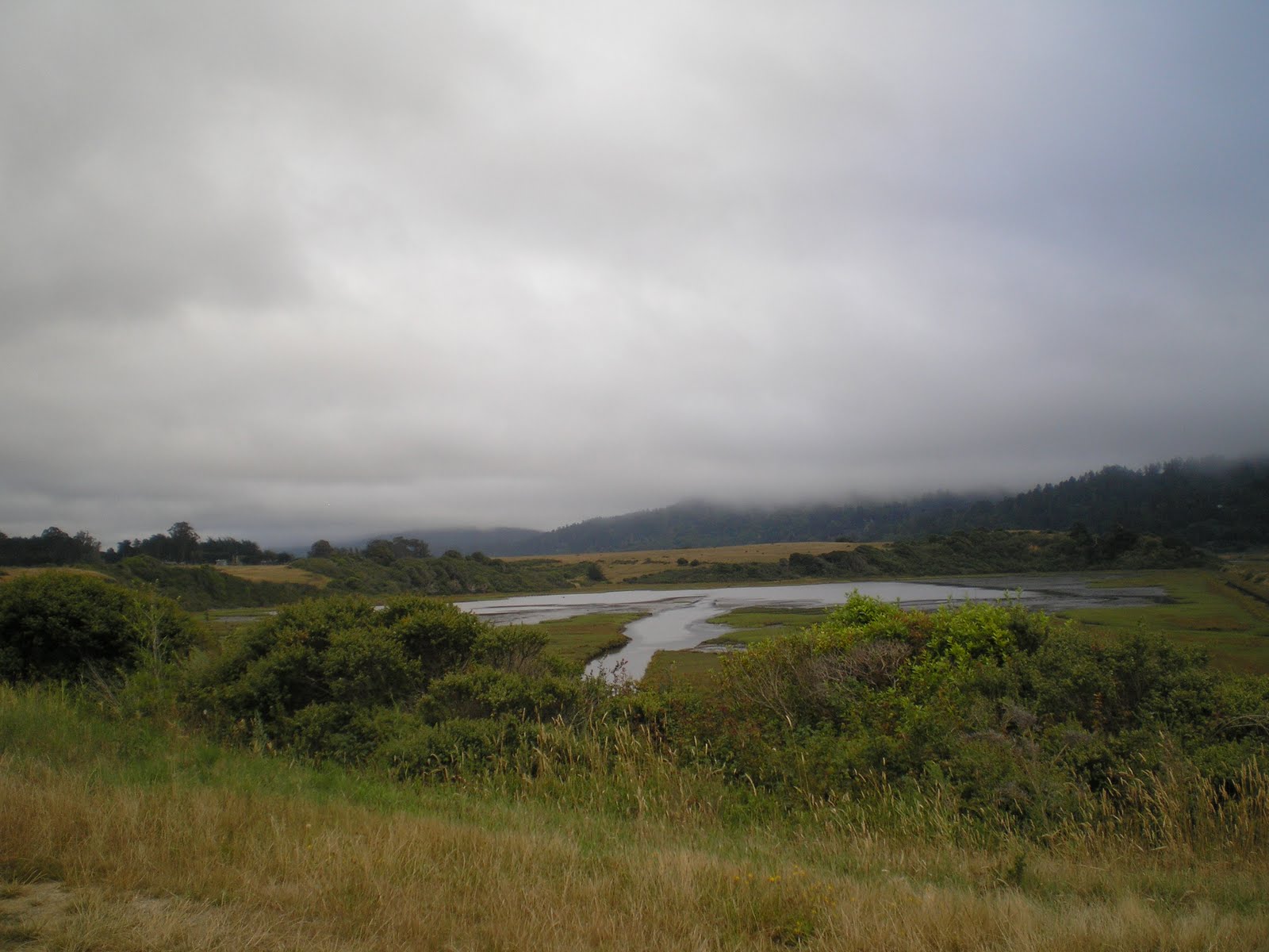
    First, my apologies for the moisture on the lens, but the fog was somewhat thick. However, this view reminds me of what I saw a few times in the late 40s and/or early 50s when we drove back to Santa Cruz from Fort Bragg along the coast. The road you see in this photo is the former Coast Highway, which was to the west or front of Fort Ross.


    A look through a grove of eucalyptus trees at the blockhouse on the northeast corner of the fort. Unlike the blockhouse in the previous photo, which 1s 8-sided, this one is 7-sided.


    A look over a plaque at the mouth of the cove where the commander of the Russian expedition landed as well as the site of the Aleutian Indian houses on the bluff to the right of the cove.


    The Aleutian Indians (from Alaska) brought kayaks with them; those very maneuverable craft were also called "baldarkas." [Not sure whether the term is Indian or Russian.]


    Sandy Beach Cove, where the commander of the Russian expedition north from Port Rumiantsev decided to put ashore and see if the location was suitable for a settlement. It was. [Incidentally, Port Rumiantsev is now know as Bodega Bay, a deep-water port.]


    A plaque explaining Sandy Beach Cove as well as international trade along the west coast of what later became California.


    The church at the southeast corner of the fort.


    A plaque explaining the Russian Cemetery; because burials included women and children, it is thought that the Fort became more of a trading post than a post manned by soldiers and conscripts.


    A close-up of the 8-sided blockhouse at the southwest corner of the fort. If the walls were breached by invaders, defenders retreated to the blockhouses, where it appears that only fire or eventual lack of water would dislodge them.


    The commandant's quarters on the left and the quarters for the other Russian soldiers on the right.


    Another look at the Russian Orthodox Church as well as a couple of cannons. Sometime after the Russians left in 1841 Governor Vallejo, whose headquarters was in Vallejo, sold many of the more serviceable cannons to the owner of another fort. The buyer? Johan Sutter of Sacramento.


    A view over a third cannon which remains of the northeast blockhouse as well as another building whose purpose escapes me. [Perhaps the State Park web pages for Fort Ross contain a map of the buildings within the fort; See Below!


    I took this photo again after finding a reflection of my camera's flash from the glass over this bulletin board, but didn't move far enough to the left. Here's my guess on what was obscured in the first three sentences
....
    The Rotchev House at Fort Ross State Historic Park was built circa 1836. This National Landmark building is the only original structure remaining from Russia's thriving settlement in California. It was the family home and office of the last administrator of Fort Ross, Alexander Rotchov.

    A view through a window at a piano which, although probably not that of the Rotchevs, likely dates back to the early to mid-1800s. Sheet music for a Mozart sonatta is waiting to be played.


    A silver samovar[?] on the table in the kitchen of the soldiers' quarters.


    I took this final photo mainly for the pelts in the room; note what appears to be a sheepsking on the bed. Also, to the left are either shelves or a ladder to the second story.


--
Links:

M 18 Jul Actual Route: Casini Ranch CG - Guerneville - Cazadero - Fort Ross - Reef CG (1.5 mi south of Ft Ross; Closed)- Ocean Cove Campground

T 19 Jul Actual Route: Ocean Cove Campground - Point Arena - Cuffy's Cove - Navarro Beach State CG

W 20 Jul Actual Route: Navarro Beach State CG - Mendocino - Cleone - Fort Bragg

Th 21 Jul Route: Fort Bragg - Willits - Clear Lake - Williams - Orland - Black Butte Resv CG

F 22 Jul Route: Black Butte Resv CG - Orland - Anderson - Shingletown

Sunday, July 17, 2011

Tunitas Crk to Golden Gate to Tomales Bay

Duncans Mills, CA, on Russian River

    After doing some things on-line at the Half Moon Bay Branch Library I drove SR92 and I-280 to the Golden Gate Bridge; traffic was slow because of construction of some new on-ramps at the southern end of the bridge. Had intended to take some photos from the Vista Point at the north end of the bridge, but the fog was so thick that barely anything was visible. Of course, once through the Waldo Tunnel and into Marin Conty there was no fog.

    Turned off of US101 at Sir Francis Drake Boulevard, bought some groceries at the San Anselmo Safeway, uploaded the blog post I had written while boondocking on Tunitas Creek Road, and finally arrived at Point Reyes National Seashore. Was surprised to learn that oaks in Marin County are dying from a spore or pathogen which causes "Sudden Oak Death" (SOD); it was first discovered in 1995. Apparently it only affects the coastal oaks since the much larger valley oaks, such as those at Indian Grinding Rock State Park, have not been affected.

    A shot across the southern end of Tomales Bay. The houses along the west side of the bay seem to be newer and bigger when compared to the much older fishing shacks along the eastern shore.


    More houses along the western shore of Tomales Bay. [Incidentally, there are four bays in the area: 1)Bolinas Bay, just north of Stinson Beach; 2)Drake's Bay, to the southeast of the Point Reyes Lighthouse; 3)Tomales Bay, the longest but narrowest bay as well as perhaps the most shallow; and 4)Bodega Bay, where there are many more boats moored at the docks.]


    The very southernmost end of Tomales Bay, where it appears that at one time someone attempted to drain a portion of the bay, much as had been done in the Sacramento-San Joaquin Delta, to provide some farmland.

    An Island Not Yet Obscured by Fog: Hog Island. Since the fog was thickening I parked next to a pickup belonging to three fishermen at the water's edge and walked quickly up the road to find a spot where I could shoot through the omnipresent weeds and brush.
    In fact, I turned around just past Hog Island and drove back to Marshall, near which I dry-camped for the night alongside a county road.

    The Shoreline Highway's (aka SR1, the Cabrillo Highway) bridge over the Russian River. Headed upstream to Duncans Mills, where the Casini Ranch Family Campground is located. [Unfortunately, their free WiFi is slower than a banana slug on downers; of course, if you'll pay $12.50, you have faster access. Hence, Monday I'll drive to Guerniville where I'm told there is a Sonoma County Branch Library near the firehouse.]
--
Links:

Sa 16 Jul Actual Route: Tunitas Creek Rd - Golden Gate Bridge - Fairfax - Samuel Taylor State Park - Point Reyes - [dry-camp near] Marshall on Tomales Bay

M 18 Jul Actual Route: Casini Ranch CG near Duncans Mills - Guerneville - Cazadero - Fort Ross - Ocean Cove CG

T 19 Jul Actual Route: Ocean Cove CG - Point Arena - Navarro Beach CG

W 20 Jul Route: Navarro Beach CG - Fort Bragg - Jackson State Demo Park, Dunlap CG