Monday, December 31, 2012

Top Twelve Photos of 2012

Gila Bend, AZ


    Here's what I feel is the best photo I took during 2012.
    Shoshone Falls, which is mispronounced as "Show-Shown" by the locals, is just up the Snake River from Twin Falls, Idaho.
    More Twin Falls Photos.


    Photo of the HooDoos at Bryce Canyon National Park in Utah; taken on 8 Apr 2012.
    More Bryce Canyon Photos.


    Mount Rainer, Washington, as seen from the north-east; taken on 10 Jun 2012.
    More Mt Rainier Photos and yet additional photos.


    Mount Lassen, California, the southern-most volcano in the Cascade Range, looks considerably different after the 2011/2012 winter than it did in 2011; this photo was taken on 18 Jul 2012. (Lassen NP did not open until August the previous year.) This photo was taken on 18 Jul 2012.
    More Lassen NP Photos.


    Grosvenor Arch in Utah south of Kodachrome Basin State Park; it is named for the founder of the National Geographic Society. Taken 7 Apr 2012. [Reached by a gravel road not advisable for travel by large RVs or 5th-Wheelers.]
    More Grosvenor Arch & Kodachrome Basin Photos.


    Strait of Juan de Fuca from Washington's Salt Creek County Park just after sunset. Photo taken 3 Jun 2012. [There are remnants of a former Coast Artillery Battery near the park as well as an RV Park.]
     Additional Juan de Fuca & Olympic Peninsula Photos.


    Rock formations at Kodachrome Basin State Park in Utah. Taken on 7 Apr 2012.
    Additional Photos of Kodachrome Basin State Park.


    Vista Point atop 9200' Sherman Pass with Olancha Peak just to the right of my rig. [N.B.Forest Service road not advised for large Class A RVs or large 5th-Wheelers.]


    Iconic Half Dome in Yosemite NP as seen from Olmstead Point along CA120, the Tioga Pass Road. Taken 7 Oct 2012.


    Devils Postpile NM, reached via Mammoth Lakes Road from US395. [N.B. There are travel restrictions during the summer and early fall on the Minaret Summit Rd to the Monument through the end of September.] Taken 5 Oct 2012.


    In an article in Century magazine John Muir spoke of a valley on the South Fork of the Kings almost as grand as that on the Merced River in Yosemite. The photo was taken from the Canyon View(point) on the way to Roads End past Cedar Grove. Taken on 21 Oct 2012.


    Number 12: you recommend one. Send me an e-mail with your recommendation for the 12th photo. If others send in photos which I prefer, will still keep a link to your recommendation along with your name.


    From Trevor Glenn of Mi-Wuk Village, CA: a photo of Shiprock in northwestern New Mexico.
--


Links:

--
Su 13 Jan Actual Route: Ajo Hwy bd - Tucson VA Hosp - Ajo Hwy & Mission Rd McD - Ajo Hwy bd
M 14 Jan Actual Route: Ajo Hwy bd - Mission Br Lib - Ajo Hwy bd
T 15 Jan Actual Route: Ajo Hwy bd - Mission Br Lib - Wilmont TJ's - Ajo Hwy bd
W 16 Jan Actual Route: Ajo Hwy bd - Mission Br Lib - So Tucson - Benson - Willcox - Sagebrush MH & RV Park
Th 17 Jan Actual Route: Sagebrush MH & RV Park
F 18 Jan Actual Route: Sagebrush RV Pk - Bowie - Lordsburg, NM, - Deming - Wagon Wheel RV Pk
Sa 19 Jan Actual Route: Wagon Wheel RV Pk - Deming - Wagon Wheel RV Pk
Su 20 Jan Actual Route: Wagon Wheel RV Pk - Las Cruces Walmart
M 21 Jan Actual Route: Las Cruces Walmart - Big Lots - Las Cruces Walmart
T 22 Jan Route: Las Cruces Walmart - Dollar Tree - Library - Las Cruces Walmart
--

Finding Campgrounds:
N.B. I receive nothing from Trailer Life, Woodalls, or FreeCampsites.net for including links to their free campground lookups.

Tuesday, December 25, 2012

Christmas Day in Salinas, CA

Salinas, CA


    Here are photos taken at my niece Lori and her husband Greg's home in Salinas.


    [From Left to Right:] Blaise DiGirolamo, Madison DiGirolamo, and Marco DiGirolamo.


    [From Left to Right:] Greg Voogd, Lori DiGirolamo Voogd, Tyler Voogd, and Nick Voogd.


    [From Left to Right:] Tyler Voogd, Marco DiGirolamo, Madison DiGirolamo, and Nick Voogd.


     [From Left to Right:] Phil DiGirolamo and Jane Lemmon DiGirolamo.


--

--

T 1 Jan Actual Route: Hesperia Walmart - Hisperia - Victorville Walmart

W 2 Jan Actual Route: Hesperia Walmart - Hisperia - Victorville - Appley Valley - Victorville - Hesperia Walmart

Th 3 Jan Actual Route: Hesperia Walmart - Hisperia - Victorville - Appley Valley - Lucerne Valley - Joshua Tree NP (Jumbo Rocks CG)

F 4 Jan Actual Route: Jumbo Rocks CG - Keys View - Cottonwood Sprs Dump Station - bd outside of southern boundary of JTNP

Sa 5 Jan Actual Route: bd outside of southern boundary of JTNP - Blythe - Mayflower [Riverside] County Park

Su 6 Jan Actual Route: Mayflower County Park - Blythe - Quartzite - EX 81, I-10 - boon-dock

M 7 Jan Actual Route: Salome Hwy bd - Tonapah - Palo Verde - Arlington - Gila Bend - Butterfield Trail bd

T 8 Jan Actual Route: Butterfield Trail bd - Gila Bend - Senfield - Casa Grande Lib - S Montgomery Rd bd

W 9 Jan Actual Route: S Montgomery Rd bd - Casa Grande Lib - Coolidge Walmart

Th 10 Jan Actual Route: Coolidge Walmart - Casa Grande Ruins NM - Florence - Catalina - Catalina State Park
--

Finding Campgrounds:

N.B. I receive nothing from Trailer Life, Woodalls, or FreeCampsites.net for including links to their free campground lookups.

Monday, December 24, 2012

Christmas Eve in Scotts Valley, CA

Santa Cruz, CA


    Because my late brother Warren had complained that I never spent Christmas with them I accepted an invitation from his widow Cynthia to spend Christmas Eve with her and her family.
    It was a very enjoyable evening with good food (especially the clam chowder) and much laughter.
....

bsp;

    Here are some photos of her, her two sons, and their families.
    [Click once to enlarge; press ESC to return here.]     [From Left to Right:] Sean Lemmon, Bailey Lemmon, Connor Lemmon, Traci Hamann Lemmon, and Cynthia Kaarsberg Lemmon.


    [From Left to Right:] Jarrod Lemmon, Emily Lemmon, Heather Sheard Lemmon, and Ian Lemmon.


--

--

T 18 Actual Dec Route: Santa Cruz - Scotts Valley - Santa Cruz

W 19 Dec Actual Route: Santa Cruz - Aptos - Watsonville - Pinto Lake RV Park

Th 20 Dec Actual Route: Pinto Lake - San Juan Bautista - Mission Farm RV Park

F 21 Dec Actual Route: Mission Farm RV Pk - Watsonville - Santa Cruz

Sa 22 Dec Actual Route: Santa Cruz

Su 23 Dec Actual Route: Santa Cruz

M 24 Dec Actual Route: Santa Cruz - Scotts Valley - Santa Cruz

T 25 Dec Actual Route: Santa Cruz - Castroville - Salinas

W 26 Dec Route: Salinas - Marina - Salinas - King City

Th 27 Dec Route: King City -
--

Finding Campgrounds:

N.B. I receive nothing from Trailer Life, Woodalls, or FreeCampsites.net for including links to their free campground lookups.

Saturday, December 8, 2012

The Writing of "The Christmas Song"

    Here's the story of the writing of "The Christmas Song" as related by the composer, Mel Torme, in his autobiography, It Wasn't All Velvet. [His lyricist was Bob Wells.]
....

    One excessively hot afternoon I drove out to Bob's house in Toluca Lake for a work session. The San Fernando Valley, always at least ten degrees warmer than the rest of [Los Angeles], blistered in the July sun. Bob lived with his parents in a beautiful Colonial type home, but even it was oppressive in those pre-air-conditioned days. I opened the door and walked in. (Before Charles Manson some people left their front doors unlocked.) I called for Bob. No answer. I walked over to the piano. A writing pad rested on the music board. Written in pencil on the open page were four lines of verse.

            Chestnuts roasting on an open fire
            Jack Frost nipping at your nose
            Yuletide carols being sung by a choir
            And folks dressed up like Eskimos

    When Bob finally appeared I asked him about the little poem. He was dressed sensibly in tennis shorts and a white T-shirt, but he still looked uncomfortably warm.

    "It was so damn hot today, I thought I'd write something to cool myself off," he said. "All I could think of was Christmas and cold weather."

    I took another look at his handiwork. "You know," I said, "this just might make a song."

    We sat down together at the piano, and, as improbable though it may sound, "The Christmas Song" was [completed] about forty-five minutes later. Excitedly, we called Carlos Gastel, sped into Hollywood, played it for him, then for Johnny Burke, then for Nat Cole, who fell in love with the tune. It took a full year for Nat to get into a studio to record it, but his record finally came out in the fall of 1946; and the rest could be called our financial pleasure.

    A humorous footnote: when Nat initially recorded "The Christmas Song," he sang the last line of the bridge: "To see if *reindeers really know/How to fly." After the first pressings were released, and the song became a hit, we pointed out his grammatical error. Nat, a true gentleman, and a dogged perfectionist, stewed over this mistake, and, sure enough, at the end of another recording session of his, with the same-sized orchestra at hand, he rerecorded our song, properly singing "reindeer." The second version is virtually indentical to the first, but those early first pressings have become collectors' items.
....
[Source: It Wasn't All Velvet. by Mel Torme, c1988, Viking Penguin Inc., New York, pp. 83-84.]
--
Links:

--

T 11 Dec Actual Route: PA VA Hosp - Palo Alto Branch Lib - Santa Cruz

W 12 Dec Actual Route: Santa Cruz - Capitola - Santa Cruz

Th 13 Dec Actual Route: Santa Cruz - Scotts Valley - Santa Cruz

F 14 Dec Actual Route: Santa Cruz - East S.C. P.O. - Santa Cruz

Sa 15 Dec Actual Route: Santa Cruz

Su 16 Dec Actual Route: Santa Cruz

M 17 Dec Actual Route: Santa Cruz

T 18 Actual Dec Route: Santa Cruz - Scotts Valley - Santa Cruz

W 19 Dec Actual Route: Santa Cruz - Aptos - Watsonville - Pinto Lake RV Park

Th 20 Dec Actual Route: Pinto Lake - San Juan Bautista - Mission Farm RV Park

F 21 Dec Actual Route: Mission Farm RV Pk - Watsonville - Santa Cruz
--

Finding Campgrounds:

N.B. I receive nothing from Trailer Life, Woodalls, or FreeCampsites.net for including links to their free campground lookups.

Friday, November 30, 2012

The Filming of "For Whom the Bell Tolls"

Skyline Wilderness RV Park, Napa, CA     During the summer of 1942 Paramount Studio largely "took over the Sonora Inn" in preparation for the filming of Ernest Hemmingway's novel based on the Spanish Civil War of the late 1930s, For Whom the Bell Tolls.
....
Gary Cooper, Akim Tamiroff Expected Here
--
Friday 19 June 1942 [Sonora, CA] Union Democrat, Page One
--
    The principal stars of the film, "For Whom the Bell Tolls," including Gary Cooper and Akim Tamiroff, are expected to arrive in Sonora within the next few days.
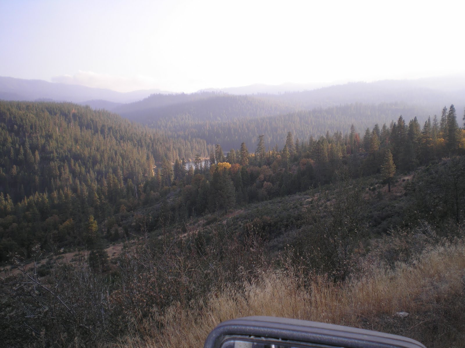
    Three camps have been established in the Sierras along the Sonora-Mono highway by the Paramount Studio unit now on location here. Director Sam Wood, assistant production manager Sid Street, together with assistant directors Joe Youngerman and Lonnie D'Orsay are busy directing the airplane sequences, which were interuppted last year by of the event of the war.
    Due to government regulations, the planes being used are stationed in Reno, Nevada, and are available for the film company through special permission from the War Department.
....
    My late father and one of his sisters got bit parts as extras in the film, for which they were paid $37 per day. As a low-paid schoolteacher who made only $1200 per year as teacher, principal, and janitor of Shaws Flat Elementary, the pay was big money
....
"For Whom The Bell Tolls" Cast Is Expected Here July 1
--
Friday 26 June 1942 [Sonora, CA] Union Democrat, Page One
--
Two Hundred Cast Members, One Hundred Extras To Be On Location Two Months
--
    A company of more than two hundred cast members from Paramount Studio and nearly one hundred local extras will go on location in the high Sierras about July first for the filming of the important exterior sequences of "For Whom the Bell Tolls." The company expects to remain at the mountain locations for at least two months.
    Members of the company, under the direction of Sam Wood, director, and Sidney Street, production manager, were engaged for several days this week in filming aeroplane bombing scenes, in which the top of a mountain was blown off in depicting the attack scenes of the story. The planes, U.S. Army bombers, used with special permission of the government, flew to the location from Reno Nevada.
    Additional filming of the picture was suspended for several days due to the illness of Gary Cooper, star of the Spanish revolution epic, who underwent a minor opeeration this week.
    During the lull in camera work, a crew of twenty-five laborers are engaged in building a cave set in Blue Canyon, near the Summit, and a sawmill set twenty miles distant on the Clark's Fork. The rocks of the cave set are bing made of plastic material to depict the rugged canyons of the mountain area.
    When filming is resumed, the company of over 300 persons will be housed at four mountain resorts, located at Bakers Station, the Dardenelles, Douglas Station and Kennedy's.
....
    Ingrid Bergman was working on another film in Hollywood when shooting in Tuolumne County was scheduled to begin, and Vera Zorina was chosen to play the part of Maria.
....
Vera Zorina Here For Lead in "For Whom The Bell Tolls"
--
Friday 3 July 1942 [Sonora, CA] Union Democrat, Page One
--
Principals, Cast On Location For 120 Days Filming Schedule in Mountains
--
    To Vera Zorina, prominent motion picture actress of Hollywood, goes the honor of having her head shaved in order to play the leading feminine role of Maria Elliott in the historic story of the Spanish Civil war, "For Whom The Bell Tolls,' now being filmed in the mountains east of Sonora by Paramount Studios. Zorina was chosen for the difficult role after several other candidates had been typed and tested.
    She, with other members of the cast, arrived in Sonora Wednesday and continued directly to the mountain locations, where three summer resorts have been taken over by the studio for the housing of more than two hundred members of the company and one hundred local extras.
    Gary Cooper holds the male lead in the characterization of Jordan Raymond. Other leading characters of the [film] are: Akim Tamiroff as Pable Johns; Katina Paxinou as Pilar Ballantyne; Joseph Callela as El Sordo; Mikhail Rasumny as Rafael; Vladimir Sokoloff as Anselmo; Eric Feldary as Andre; Lilo Yarson as Joaquin; and Feodor Chaliapin as Kashkin.
    Other members of the case include Edward Clannelli, Fortunio Bonanova, Duncan Reynaldo, Victor Varconi, Leonid Snegoff, Alesander Granach, Martin Garralaga and Leo Bulgakoff.
    Shooting of the picture started at the mountain locations Thursday and will continue for 120 work days. Samuel Wood is in charge of the direction, aided by Lonnie d'Orsa and Joe Youngerman as first assistant directors; and Clem Jones as second assistant. Production Manager Sidney Stree is assisted by Don Robb, and Sherman Todd is handling the film editing. The Technicolor photography will be under the direction of Ray Rennehan, assisted by Stuart Thompson and James Grant.
....
    Sierra weather and wildlife both delay and "animate" the filming in the Sonora Pass area.
....
Rain, Wind At Higher Elevations Delay Filming of Hemingway Story
--
Friday 17 July 1942 [Sonora, CA] Union Democrat, Page One
--
    About twenty local extras are working in scenes now being filmed on location in the mountains east of Sonora by Paramount Studios for the forthcoming production of "For Whom The Bell Tolls." The extras are depicted as Spanish troops in the famed story of the Spanish Civil war by Ernest Hemmingway.
    Rain and wind curtailed the company's activities Monday when a heavy wind blew down tarpaulins and camera equipment and swept away one side of Zorina's dressing room. The star of the picture, Zorina, who plays Maria, had left the dressing room less than ten minutes before the gale struck.
    Extreme difficulty is being met in filming various angles, due to the roughness of the terrain where the scenes are located. Camera angles in some instances are almost impossible to manage as no moving derricks or cranes can be employed on the mountainous countryside. The location of Pablo's cave is such that shooting on that set is reserved for afternoons only when the light is of sufficient brilliance to secure the desire results.
    In order to obtain the characters need for the Spanish film it was necessary to have actors of many different nationalities. While almost all are citizens of the United States, about ten or more countries are represented by the actors on location.
    Sam Wood is director of the film, assisted by Lonnie d'Orsa, Joe Youngerman and Clem Jones. Sid Street, production manager, is aided by Don Robb and Sherman Todd. Ray Rennehan, Stuart Thompson and James Grant are in charge of the Technicolor photography.
....
    After Ingrid Bergman finished a film in Hollywood, Vera Zorina was dropped as Maria -- especially since Ms Bergman had been recommended for the part by Hemmingway.
....
Ingrid Bergman Replaces Zorina In "For Whom The Bell Tolls"
--
Friday 7 August 1942 [Sonora, CA] Union Democrat, Page One
--
Actress is Hemmingway's Choice To Play Role Of Maria In Spanish War Epic
--
    Ingrid Bergman, star of "Intermezzo," arrived at the Parmount location site in the Sierras east of Sonora yesterday to replace Vera Zorina in the role of Maria in Ernest Hemingway's "For Whom The Bell Tolls."
    Miss Bergman, noted Swedish actress, was the author's first choice for the title role in the film, but, until a few days ago, had been busy in another picture in Hollywood. Zorina, who left for Hollywood last week, was replaced, according to studio officials, because she did not photograph correctly in Technicolor.
    Until the arrival of Miss Bergman Wednesday the location unit was occupied with filming battle sequences. A number of tanks, trucks, cannons, motorcycles, and machine guns were used for these scenes. About one hundred local extras were employed during the past week, working as Spanish soldiers and guerillas. One of the most thrilling shots in the two million dollar production was taken this week when a blazing army tank was shown falling over a steep cliff. Forest rangers and helpers stood by to prevent any danger of fire [in] the brush on the mountainside during the filming of this sequence.
    A night watchman of the company reported a bear had been bothering one of the sets, seeking food.
    Diversions for members on location has included fishing in nearby streams and baseball games. Last Sunday a game between the Buckmans and Nelsons resulted in a nine to eight victory for the Nelson players. No decision has been reached over a game between the Nelsons and Kurzis, played later the same day.
....
    Hemmingway's main character in For Whom the Bell Tolls, Robert Jordan, was likely patterned after Robert Hale Merriman, a 1925 graduate of Santa Cruz High School in California, who took ROTC at the University of Nevada in Reno before doing post-graduate work studying agriculture in some European countries, principally Russia. Prio to the Spanish Civil Ware he taught at the University of California at Berkeley. [See the Links below]
....
    On Th 13 Dec I shall insert a photo of the bridge over the main fork of the Stanislaus River which was used in the film. While I did read that the Lumdsen over the Tuolumne River was also used, I can no long find a link to that on a U.S. Forest Service website.
--
Links:

--

Th 6 Dec Actual Route: Ukiah Walmart - Hopland - Cloverdale - Healdsburg - Westside Rd bd

Sa 8 Dec Actual Route: Petaluma - Napa - Skyview Wilderness RV Park

Su 9 Dec Actual Route: Skyview RV Park - Napa - Martinez - Danville - Milpitas - Mountain View - PA CA Hosp

M 10 Dec Actual Route: PA VA Hosp - Palo Alto Branch Lib - PA VA Hosp

T 11 Dec Actual Route: PA VA Hosp - Palo Alto Branch Lib - Santa Cruz

W 12 Dec Actual Route: Santa Cruz - Capitola - Santa Cruz

Th 13 Dec Actual Route: Santa Cruz - Scotts Valley - Santa Cruz

F 14 Dec Actual Route: Santa Cruz - East S.C. P.O. - Santa Cruz

Sa 15 Dec Actual Route: Santa Cruz

Sa 15 Dec Route: Santa Cruz
--

Finding Campgrounds:

N.B. I receive nothing from Trailer Life, Woodalls, or FreeCampsites.net for including links to their free campground lookups.

Saturday, November 10, 2012

Tuolumne Hose Company No. 1 Obituaries

Sonora, CA, Library

    Here is an index to 19 obituaries of the volunteers of Tuolumne Hose Company No. 1 as well as one which was not previously posted. [Note: You may have to scroll down to find a particular obituary.]
   7Theater until 1959.

Walter E. DUNGAN
--
Obituary
--
Thursday 26 December 1985 [Sonora, CA] Union Democrat, p.3A
--
    Lifelong Tuolumne resident Walter E. Dungan, 75, died Tuesday at a local hospital after a short illness.
    Mr. Dungan was born on Aug. 28, 1910, just two blocks from the Carter St. home where he lived until the time of his death.
    Known as "Walt Dun-i-gan" by members of the community, he was the former manager of the Tuolumne Grocery (now the Tuolumne Hardware store) and the former owner of The Club, a tavern he ran for 40 years.
    In addition to his work, he volunteered his time on a number of committees and organizations.
    "I've been president of everything in Tuolumne, except the board of trustees at the schools," he once said.
    He also served as director of the sanitary and park and recreation districts and as commissioner of the fire district. He was the fire chief for several years.
    He also acted as committee presient of the Tuolumne City Lumber Jubilee for a number of years. After participating in the celebration's famous tug-of-war as a young man, he took over coaching duties. More recently, in 1981, he was the Jubilee parade marshal.
    In addition to his activities in Tuolumne, Mr. Dungan was a 28-year member of the Sonora Elks Lodge.
    He is survived by his wife, Margaret of Tuolumne; two sons, Robert of Las Vegas and Rod of Gottingen, West Germany; a daughter, Charlene Hansen of Arroyo Grande, and four grandchildren.
    A service is pending at the Terzich-Wilson Funeral Home.
    The family prefers that memorial donations be made to the Tuolumne City Memorial Museum or the Tuolumne Hose Co. No. 1.
--
Additional Links:

--

M 3 Dec Actual Route: Oroville - Butte City - Williams - Almond Grove MH & RV Park

T 4 Dec Actual Route: Almond Grove MH & RV Park - Williams - Clearlake

W 5 Dec Actual Route: Clearlake - Ukiah - Ukiah Walmart

Th 6 Dec Actual Route: Ukiah Walmart - Hopland - Cloverdale - Healdsburg - Westside Rd bd

F 7 Dec Actual Route: Westside Rd bd - Healdsburg - Santa Rosa - Petaluma

Sa 8 Dec Actual Route: Petaluma - Napa - Skyview Wilderness RV Park

Su 9 Dec Actual Route: Skyview RV Park - Napa - Martinez - Danville - Milpitas - Mountain View - PA CA Hosp

M 10 Dec Actual Route: PA VA Hosp - Palo Alto Branch Lib - PA VA Hosp

T 11 Dec Actual Route: PA VA Hosp - Palo Alto Branch Lib - Santa Cruz

W 12 Dec Actual Route: Santa Cruz - Capitola - Santa Cruz
--

Finding Campgrounds:

N.B. I receive nothing from Trailer Life, Woodalls, or FreeCampsites.net for including links to their free campground lookups.

Friday, November 2, 2012

Canyon Views - Kings Canyon National Park, CA

Sonora, CA, Library


    As one drives from Grant Grove toward Cedar Grove it pays to wait for clearer spots from which to take photos. Nonetheless, these photos, taken on 20 Oct, give a hint of things to come. [These photos were taken on 20 Oct.]


    A view of the higher peaks to the east of the South Fork of the Kings River.


    The clouds were also a hint of something to come since there was an approaching front.


    There appears to be a better vantage point down the road.


    Because of the steepness of these canyons, it's likely that the old "Put Everything Out" policy of 50+ years ago was not followed.


    Note the lack of trees on many of these ridges.


    Kings Canyon Lodge, which is next to the road, was apparently still open; it's located on the right in one of the few flat spots in this valley and is one of the few spots to buy high-priced gas if you forgot to buy lower-priced gas outside of the park.


    Probably the Middle Fork of the Kings River, which drains the majority of the northern part of Kings Canyon National Park. [Click once to enlarge; press ESC to return here.]


    Click once to enlarge; press ESC to return here.] The South Fork of the Kings.


    Panning further up the South Fork from the above photo.


    A look downstream at a section of the South Fork which likely is fished much -- except perhaps by mountain climbers with ropes.


    A vari-colored cliff on the other side of the South Fork.


    Panning up and to the right, a sharp ridge catches the sun's late afternoon rays.


    A shot up the South Fork of the Kings on 21 Oct from where I parked [for free] in Sequoia National Forest.


    Looking downstream, I saw a fish rise in the sunlight just below the large rock. For those who are familiar with the Clark Fork of the Stanislaus River, the S.F. of the Kings is about twice the size of the Clark Fork. Many holes can't be reached unless you're adept at rock-hopping.


    This viewpoint, one of the best in the park, is called Canyon View.


    Click once to enlarge; press ESC to return here.] John Muir was certainly right when he said that the Valley of the Kings rivaled Yosemite's Valley on the Merced.


    Zooming in on the headwaters of the S.F. of the Kings from the Canyon View vista point.


    North Dome (8717') as seen from Roads End, the end of the road from Grant Grove past Boyden Cave and Cedar Grove to the start of where one's pedal extremities get a work-out.


    Grand Sentinel (8518') on the south side of Roads End.


    The clouds up the canyon were caused by an approaching front; it rained overnight and the rain turned to snow at the Azalea Campground near Grant Grove.


    Click once to enlarge; press ESC to return here.] A view of Hume Lake from the road thereto.


    Click once to enlarge; press ESC to return here.] The story of Hume Lake's transition from a lumber mill pond to a part of Sequoia National Forest.


    The left, or north-east end, of the lake.


   Panning right....


   Panning right....


   Panning right....


   Panning right....


   Panning right to the southwest or inlet end of the lake.


   Zooming in on the Christian Camps, which appears to occupy the property where the Hume-Bennett Lumber Mill stood. A 72-mile flume sent finished lumber to Sanger in the Central Valley.
--


Links:

--

Th 8 Nov Actual Route: N.F. Tuolumne Riv bd - Sonora Lib - Sonora Walmart

F 9 Nov Actual Route: Sonora Walmart - Sonora Lib - Sonora Walmart

Sa 10 Nov Actual Route: Sonora Walmart - Sonora Lib - Sonora Walmart

Su 11 Nov Actual Route: Sonora Walmart - Sonora Lib - Junction Shopping Ctr - Sonora Walmart

M 12 Nov Actual Route: Sonora Walmart - Sonora Lib - Sonora Walmart
--

Finding Campgrounds:

N.B. I receive nothing from Trailer Life, Woodalls, or FreeCampsites.net for including links to their free campground lookups.

Tuesday, October 30, 2012

Grant Grove - Kings Canyon National Park

Sonora, CA, Library


    The dam across the Kings River as seen from Elwood Road not too far from Phiedra. [Click once to enlarge; press ESC to return here.]


    The road along the north shore of Pine Flat Lake/Reservoir.


    From CA180, the northern entrance road to Kings Canyon National Park, a photo of the country to the south of Squaw Valley.


    A sequoia (sequoia giganteum) near the entrance to the Grant Grove Trail. [Photos taken 20 Oct.]


    Because of their thick bark and very resinous wood, sequoias are rarely, if ever, killed by a forest fire.


    While a tree this size may cause some timber fallers to "salivate," Sequoias, likely because of their weight, tend to shatter when they hit the ground.


    I eschewed a walk through the "Tunnel Tree."


    [Click once to enlarge; press ESC to return here.] The General Grant tree is 268 ft tall and 40 feet wide -- at an age of 1700 years; it is the 3rd largest sequoia (by volume) in the 17 or so groves in the Sierra Nevada.


    The base of the General Grant Sequoia, which was so-named in 1867. Kings Canyon became the third national park after Yellowstone and Sequoia.


    Looking upward....


    [Click once to enlarge; press ESC to return here.]


    "Silent Cal," President Calvin Coolidge, spoke up in 1926, naming the General Grant Tree the Nation's Christmas Tree.


    With a diameter of 40 feet the General Grant Tree is the widest sequoia in the world.


    One of the branches of this sequoia is reputed to have a diameter of 4.5 feet, which is about the size of a large red fir tree.


    General U.S. Grant smoked cigars; so it's fitting that his tree has a fire scar. :-)> And...no...the fire was not extinguished with several barrels of whiskey.


    A side view of the Gen. Grant Sequoia.


    The Gamlin Cabin -- at one time spartan quarters for the park's first ranger.


    If necessary, click once to enlarge.
--


Links:

  • Sequoia & Kings Canyon National Park website
  • Wikipedia article on the General Grant Grove
  • Yelp.Com reviews of the park
--

F 2 Nov Actual Route: N.F. Tuolumne Riv bd - Sonora Lib - Standard - Tuolumne - N.F. Tuolumne Riv bd

Sa 3 Nov Actual Route: N.F. Tuolumne Riv bd - Sonora Lib - Tuolumne - N.F. Tuolumne Riv bd

Su 4 Nov Actual Route: N.F. Tuolumne Riv bd - Tuolumne Lib - N.F. Tuolumne Riv bd

M 5 Nov Actual Route: N.F. Tuolumne Riv bd - Tuolumne Lib - Sonora Walmart - Tuolumne Lib - N.F. Tuolumne Riv bd

T 6 Nov Actual Route: N.F. Tuolumne Riv bd - Sonora Lib - Tuolumne Lib - N.F. Tuolumne Riv bd

W 7 Nov Actual Route: N.F. Tuolumne Riv bd - Tuolumne P.O. - Sonora Lib - N.F. Tuolumne Riv bd

Th 8 Nov Actual Route: N.F. Tuolumne Riv bd - Sonora Lib - Sonora Walmart bd
--

Finding Campgrounds:

N.B. I receive nothing from Trailer Life, Woodalls, or FreeCampsites.net for including links to their free campground lookups.