Wednesday, June 29, 2011

Napa to Milpitas to Henry Coe State Park

Morgan Hill, CA


    When I got to the Vista Point overlooking the Benicia Harbor it became clear that a trip to the top of Mt Diablo would not produce many photos, for the top 1000' of this rather prominent mountain was obscured by clouds -- as you can see to the right.


    Here's a view of the Martinez/Benicia Bridge.


    And here's a view of Benicia's watery "parking lot."

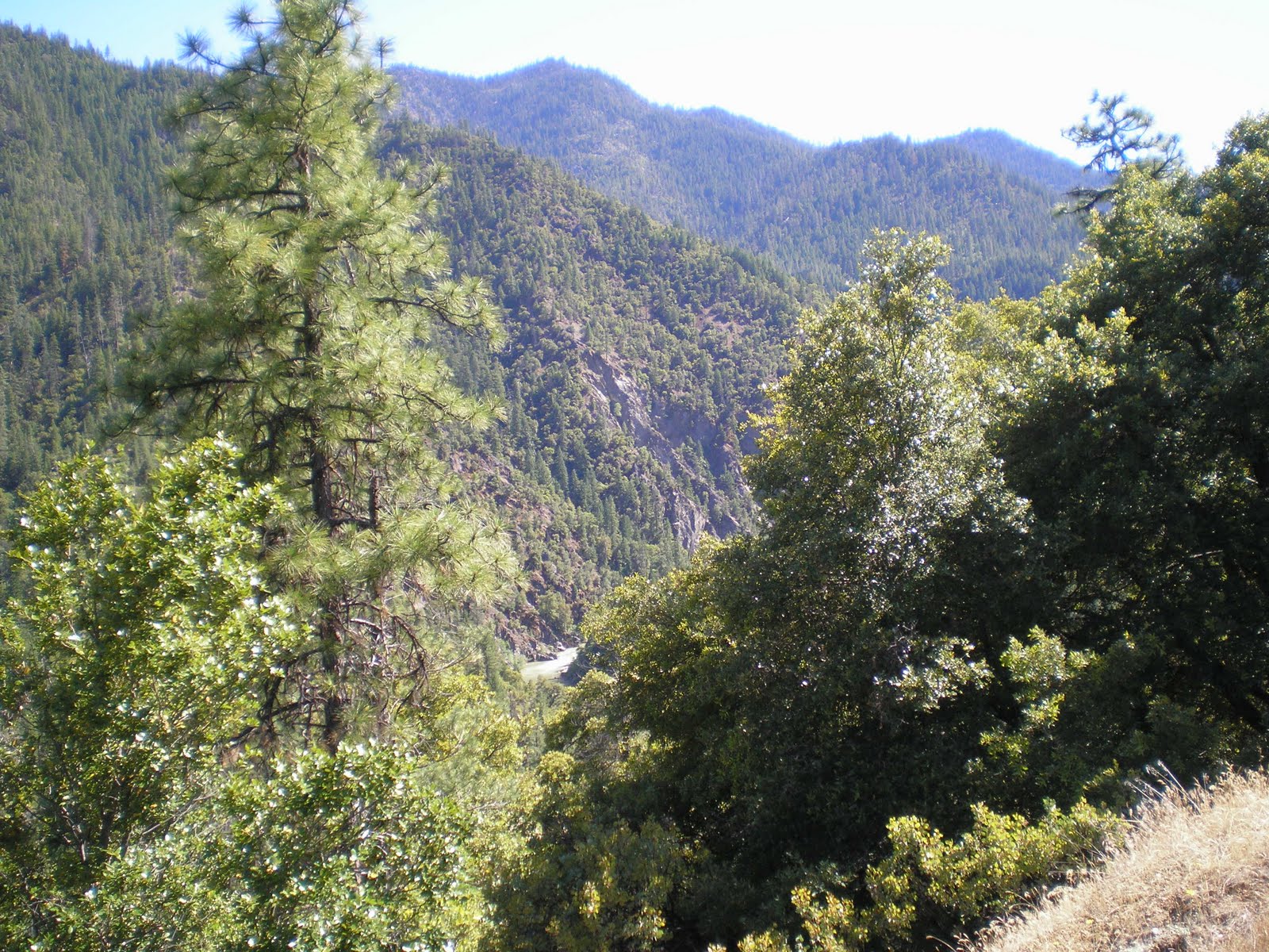
    While watching the traffic on I-680 I forgot to take I-580 towards Stockton so that I could drive through Livermore to Del Valle County Park. Evenutally exited I-680 at Milpitas, found their library, and then, after failing to find an RV park with appealing reviews, drove south during heavy, rush-hour traffic to Morgan Hill, where I took East Dunne Avenue. It's not a road for a rig much larger than a 3/4-ton with a camper; and taking a trailer up that road would be an invitation to disaster. Here's a 1st view of something other than the oaks and brush on the east side of the southern Santa Clara Valley.


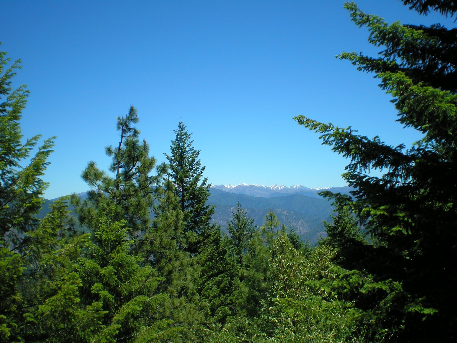
    As the shadows lengthened I took a shot to the east from my campsite at the Henry Coe [Ranch] State Park campground.


    A view to the south.


    A shot to the southwest.


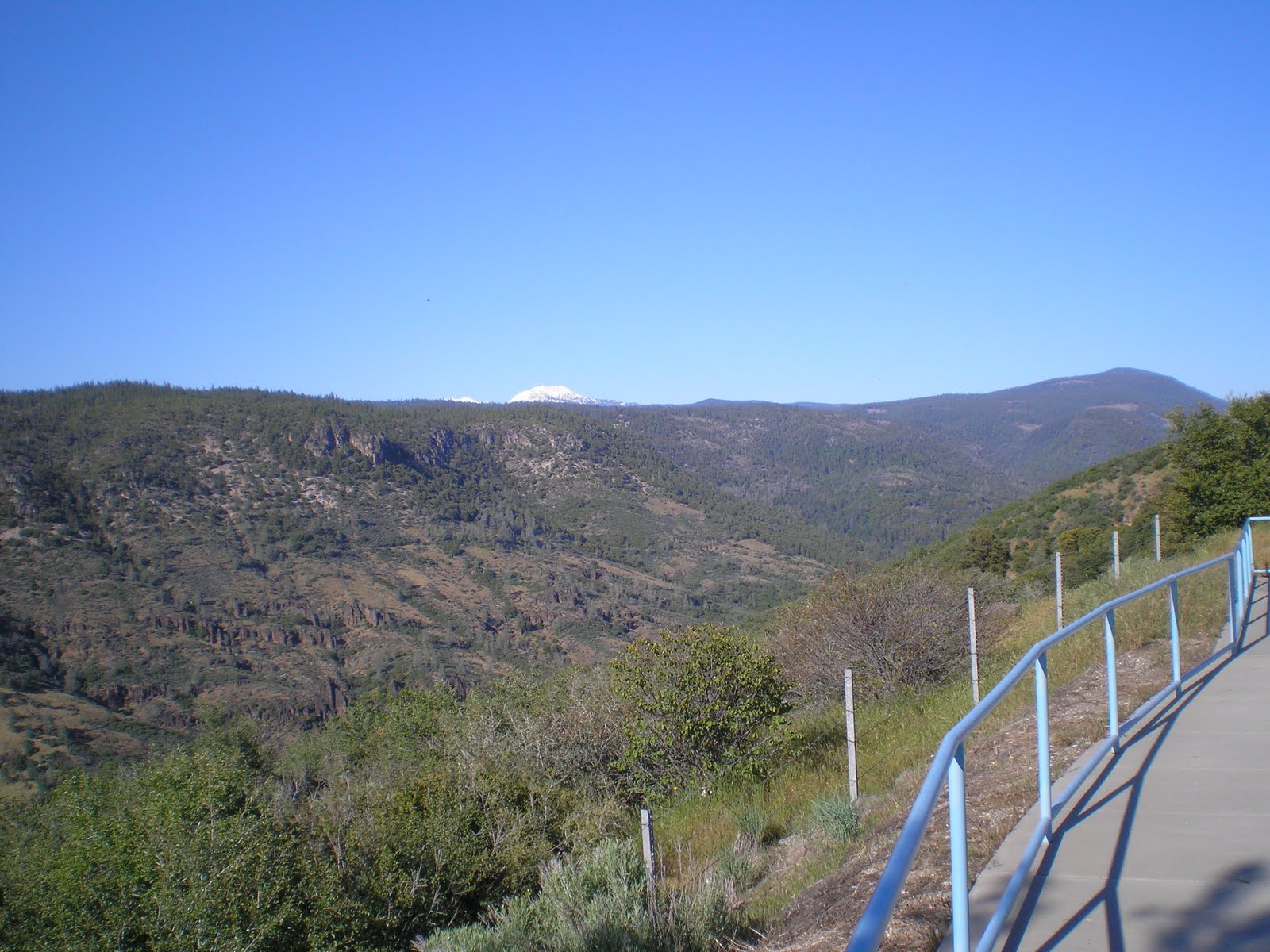
    A morning photo of the clouds which remained in the Morgan Hill/Gilroy area overnight.


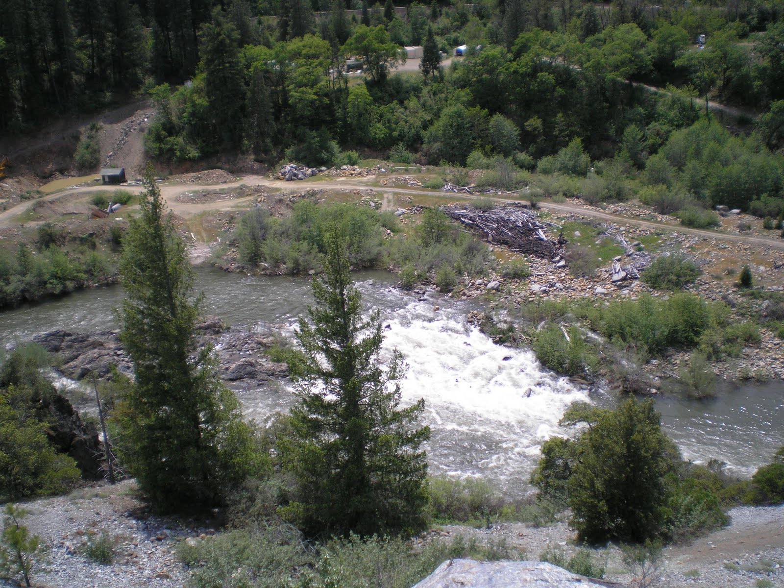
    Coyote Reservoir at or near the dam on its northern end.


    Morgan Hill in the morning sun.


    The upper (southern) end of Coyote Reservoir with mid-day water-skiers.


--
Links:

W 29 Jun Actual Route: Napa - Benicia/Martinez Bridge - Danville - Milpitas - Morgan Hill - Henry Coe State Park

Th 30 Jun Actual Route: Henry Coe State Park - Morgan Hill Palo Alto VA Hosp

F 1 Jul Actual Route: Palo Alto VA Hosp - Portola Redwoods State Park - Pelican Point RV Park (Half Moon Bay)

F 1 Jul Actual Route: Palo Alto VA Hosp - Portola Redwoods State Park - Pelican Point RV Park (Half Moon Bay)

Sa 2 Jul Actual Route: Pelican Point RV Park - Butano State Park - [San Mateo] County Memorial Park - Portola Redwoods SP - Alpine Rd (boondock)

Su 3 Jul Actual Route: Alpine Rd - Skyline Blvd - Woodside - Portola Valley - Redwood City - Half Moon Bay - Tunitas Crk Rd (boondock)

M 4 Jul Actual Route: Tunitas Crk Rd - Half Moon Bay - Pacifica - Pilar Pt - Tunitas Crk Rd (boondock)

T 5 Jul Actual Route: Tunitas Crk Rd - Half Moon Bay - Redwood City - Palo Alto - VA Hospital (boondock)

Sunday, June 26, 2011

Weaverville to Hyampom to Willow Creek

Fort Bragg, CA

    Though this trip was made from Monday 20 June to Wednesday 22 June I've decided to make it the top post since it includes a visit to a cousin who lives a bit off of the main highways as well as an attempted visit to another who lives at the junction of two well-traveled highways.

    After spending Sun 19 Jun at the Eagle Creek USFS Campground I drove south to Weaverville; however, Trinity Lake was partially obscured by the trees which have grown up all its shores.


    This is another view from the Vista Point on Trinty Lake north of Trinity Center.


    Click 1 or 2 time to enlarge this plaque and read a story of how the Trinity County gold-mining sites have now become the site of a 21st century goldmine: recreation.


    A view to the east from just below Hayfork Summit on SR3.


    My rig at the Hayfork Summit, whose elevation is c4500', on SR3.


    While I had expected something like a miner's cabin for Dennis Lemmon's abode, his house appears to be only 25-30 years old. That's Dennis, oldest offspring of Loyal Jr & Lillian Ikola Lemmon, in front of his house near the mountain metropolis of Hyampom.


    And in front of the back porch, from the right, Dennis, Giselle/Gisele, lady friend of Dennis, and Linda, from San Diego and a friend of Gisele.


    While I thought I might have to retrace my tracks back through Hayfork, where the road is closed for up to 30 minutes while they work on the climb over Hayfork Summit to Douglas City & Weaverfille, Dennis suggested I take USFS #66 to Burnt Ranch on US299; he had checked the route for snow a couple of weeks ago using one of his motorcycles.


    A view to the northeast from USFS66 at the Trinity Alps.


    As I walked back to my rig from taking the above photo of the Trinity Alps I noticed an orchid-like flower in the shade.


    A view toward the coast from the ridge-top from which I took the two previous photos.


    A better view of the Trinity Alps.


    A more distant view of Trinity County's mountains.


    A view of the South Fork of the Trinity about 10 miles east of Willow Creek (town & creek
--
    N.B.The Salyer Dump Station on US299 is located in the Rest Area about 2 miles east of Salyer.
--


Links:

Sa 25 Jun Actual Route: Ft Bragg

Su 26 Jun Actual Route: Ft Bragg - Camp One, Jackson Demo State Forest - Dunlap CG, Jackson Demo State Forest

M 27 Jun Actual Route: Dunlap CG, Jackson Demo State Forest - Willits - Ukiah - L Mendocino, Che-ka-ka CG

T 28 Jun Actual Route: L Mendocino, Che-ka-ka CG - Ukiah - Geyserville - Calistoga - Yountville - Napa

W 29 Jun Actual Route: Napa - Benicia/Martinez Bridge - Danville - Milpitas - Morgan Hill - Henry Coe State Park

Th 30 Jun Route: Henry Coe State Park - Morgan Hill Palo Alto VA Hosp

Saturday, June 25, 2011

Scotia to Willits to Fort Bragg

Fort Bragg, CA

    After talking with Nancy Holberg-Caster Wednesday using the cell phone of one of the Willow Creek librarians, I decided to head for Fort Bragg. Had planned to spend the night at the Jackson Demonstration Forest, Camp One campground, but I either didn't read the directions in Tom Stienstra's Guide to West Coat RV Camping correctly or I was too slow to set my whiz-bang mileage guage for Trip B from Willits to Camp One.
    Before I realized it I was out of the Jackson Demo Forest and near enough to Fort Bragg to continue on to Eleanor Lemmon Dahl Holberg's place off of Simpson Lane. Here's what her daughter Nancy had sent regarding a serious leg infection or wound.
....
    Guess you hadn't heard about Mom's leg. Sorry, I've lost track of who knew about the leg incident.
    In January she scraped her leg on the metal hospital bed she sleeps in. The abrasion was about the size of a quarter and scabbed over but didn't heal so Don took her to her MD. The MD called in an associate surgeon to take a look and that MD decided to scrape the scab off.
    Home Health began visits to the house to clean and dress the wound 3x/week. They insisted upon a tight bandage and when Don asked about the tight wrap they said it would encourage healing. After two weeks of that and an open sore that had grown to about 2x5" Don brought Mom to the emergency room on 2/4/11. They didn't know what to do about the non-healing open wound and tried to get her into one of the larger Bay Area hospitals, but, nobody wanted a 95 year old lady.
    So, they stuck her into a room in the Mendocino Coast Hospital in FtBragg. Several MD's visited her room and looked at the wound (it looked like a topographic map of a valley, with the valley floor being her shin bone and ligaments). Finally about 3 days there a wound-care nurse visited and called in an orthopedic surgeon and he did a large skin graft. The graft took and she spent one month in the hospital, going home on her 96th birthday. There were two small holes still present when she went home, but, in comparison, much better.
    The source of her problem is that her heart isn't pumping the blood with enough pressure to reach her feet and back up again. The sore couldn't heal because she was sitting most of the day in her wheelchair. In order to heal she's had to stay in the bed with short stints in a recliner.
....

    The good news now is that her wound is only about the size of a couple of dimes. In fact, here's a photo of her saying "Cheese!" for the cameraman. [Click 1 or 2 times to zoom in!]
--
Links:

F 24 Jun Actual Route: Scotia - Garberville - Leggett - Laytonville - Willits - Ft Bragg

Sa 25 Jun Actual Route: Ft Bragg

Su 26 Jun Route: Ft Bragg - Camp One, Jackson Demo Forest

Saturday, June 18, 2011

Sara Totten USFS CG to Fort Jones to Greenview to Happy Camp

Happy Camp, CA

    In 1955 & 1956 Explorer Post 71 adviser Ray Sutliff took the post to Sawyers Bar and the trailhead on the North Fork of the Salmon River to the Marble Mountain Wilderness Area. We passed through both Fort Jones and Etna on the way. [I particularly remember buying a Chicken-Fried Steak Dinner for $1.20, including soup or salad and, perhaps, also a dessert; obviously today's dollar would just barely cover a Whopper Jr these days for slightly more than that.]
--

    But since I had never driven SR96 along the Klamath, I chose to approach Ft. Jones from the north via a route up the Scott River after checking with my sister Eloise, who former lived in Ft Jones while teaching in Siskiyou County. This first photo is of the Klamath at the Sara Totten USFS CG just east of Hamburg.


    And as a reminder that Ol' Man Winter has yet to loosen his grip on the higher peaks here's a view to the south-west from the campground.


    The Scott River as seen from the Scott Bar to Fort Jones road; while there are several access points where rafters, kayakers, and other boaters can put in, it may be that the stream flows are still too high except for the more experienced (or foolish) boaters.


    A view of the Scott Valley with snow on the Marble Mountains to the right and on the Trinity Alps peaks to the south.


    An afternoon view of the increasingly-muddy Scott River on my way back down to the Klamath.


    What one can't see in this shot is that there was a well-tended lawn on flat land within a good-sized bend in the Scott River; hopefully those who built in that area had some evidence that the stream had not changed course for many years. A bit further downstream, at Tompkins Creek, the Scott River Lodge is located. And while it's not right at the river's edge, the road at that point is only 40-50 feet above the river.


    At the top of a somewhat vegetation-free mountain on the north side of the Klamath River either a house or, more likely, a fire lookout.
--
Links:

  • Wikipedia article on Happy Camp, CA

Sa 18 Jun Actual Route: Elk Creek RV CG - Happy Camp Lib - Somes Bar - Sawyers Bar - N.F. Salmon River

Su 19 Jun Actual Route: N.F. Salmon River - Etna - Eagle Crk USFS CG

M 20 Jun Actual Route: Eagle Crk USFS CG - Weaverville - Hayfork - Hymampom - Big Slide USFS CG

T 21 Jun Actual Route: Big Slide USFS CG - Hyampom - Dennis Lemmon's House

W 22 Jun Actual Route: Dennis Lemmon's House - Burnt Ranch - Willow Crk - Boise Crk USFS CG

Th 23 Jun Actual Route: Boise Crk USFS CG - Willow Crk - Arcata - Scotia

F 24 Jun Actual Route: Scotia - Garberville - Leggett - Laytonville - Willits - Ft Bragg

Sa 25 Jun Route: Ft Bragg

Wednesday, June 15, 2011

Klamath Falls, Oregon, to Hyatt Lake

Hyatt Lake, OR

    Hyatt Lake is located 3 miles north of OR66, a mountain route between Klamath Falls and Ashland. And because the Bureau of Land Management charges more ($15 instead of $12) for camping on weekends (F-Su) many people apparently flee the Ashland/Medford area to Hyatt Lake -- especially during the heat of the summer.


    Here are two shots from the parking lot in front of a former landing across West Hyatt Lake Road from what is likely one of the two private resorts on the lake (the other being the Hyatt Lake Resort closer to the dam).


    In this shot toward the south end of the lake there are several Canadian Geese and two ducks, though I think both were feeding on the bottom when I snapped this photo -- or the one on the left was swimming directly toward me.
--
Links:

W 15 Jun Actual Route: Merrill - Klamath Falls - Pinehurst - Hyatt Lake BLM CG

Th 16 Jun Actual Route: Hyatt Lake BLM CG - Ashland - I-5 @ CA's North Border - Sarah Totten USFS CG (on SR96)

F 17 Jun Actual Route: Sarah Totten USFS CG - Fort Jones - Hamburg - Seiad Valley - Happy Camp - Elk Creek RV CG

Sa 18 Jun Route: Elk Creek RV CG - Happy Camp Lib - Somes Bar - Sawyers Bar

Monday, June 13, 2011

Alturas to Canby to Lava Beds Natl Monument

Lava Beds National Monument


    Add another county without free WiFi in it county libraries: Modoc. I had intended to post the photos I took during the drive from Lake Almanor, but they will have to wait.
    This shot to the west on SR139 not too far from Canby is of Mt Hoffman and the mtns surrounding Medicine Lake, which played a large part in the creation of the [Mono] Lava Beds. [Click 1 or 2 times to enlarge.]

    In this view to the west from further north Mt. Hoffman is the tallest peak and the partially snow-covered mtns are those surrounding Medicine Lake. A CHP officer pulled alongside as I prepared to continue the drive north, but I told him I was OK and had stopped to take a photo as well as answer the call of nature.


    Near the small town of Tionesta I took a photo of the Lava Beds NM sign with the above-described mtns on the left side of the photo. While the sign warned of a rough road, only 2 or 3 miles of the 14 had potholes.

....
Note: had problems uploading the many Lava Beds photos at the Klamath Falls Library on W 15 & was forced to abort due to time constraints; hwr, I saved much of what I had done to the point where I got error messages and should be able to resurrect the post with all of the photos I took during the two days at Lava Beds N.M.
--
Links:

W 15 Jun Actual Route: Merrill - Klamath Falls - Pinehurst - Hyatt Lake BLM CG

Th 16 Jun Route: Hyatt Lake BLM CG - Ashland - I-5 @ CA's North Border - Klamath River (on SR96)

Wednesday, June 8, 2011

Shingletown to Manton to Battle Creek Campground

Battle Crk Campground, CA


    After helping my sister unpack some things following her move from Portola in Plumas County to Shingletown in Shasta County I headed for the high country by driving south to Manton, south-west to Dales, & east past Paynes Creek toward Mineral. This 1st shot was the clearest view I've had of Lassen Peak since I made the circumlocution of it on Sa 28 May.
    The peak on the left is Lassen but the seemingly-higher peak on the right is likely Brokeoff Mtn. [Because of the small size of the horses in the foreground I'm reminded of a book by the late Lewis Grizzard: Shoot Low Boys -- They're Riding Shetland Ponies.]


    Here's a closer view of Lassen Pk taken further up SR36, which takes one from I-5 at or near Red Bluff to Mineral, which is on SR89, the principal route through Lassen N.P. [Click 1 or 2 times to zoom in.]


    Here's a view of the mouth of the Battle Creek Canyon; note the road (probably dirt) on the other side of the canyon from the Vista Point where this photo was taken.


    And here's a glimpse toward the upper end of Battle Creek Canyon, which is where the US Forest Service's Battle Crk CG is located. [Click 1 or 2 time to zoom in.] Note that the volcanic rock columns and the digger pines are the most visible survivors or a forest fire 20-30 years ago. While Digger pinecones do open every year, it's likely that they may open earlier in the case of a forest fire. (Of course, some pinecones such as those of Knob-Cone Pines only open during a fire.)
--
Links:

W 8 Jun Actual Route: Shingletown - Manton - Paynes Crk - Battle Crk CG

Th 9 Jun Actual Route: Battle Crk CG - Mineral - Chester - Lake Almanor

F 10 Jun Actual Route: Lake Almanor - Chester - Susanville - N. Eagle Lake CG

Sa 11 Jun Actual Route: N. Eagle Lake CG - Adin - Canby - Alturas - Big Sage Resv

Su 12 Jun Actual Route: Big Sage Resv - Alturas

M 13 Jun Actual Route: Alturas - Canby - Lava Beds NM

T 14 Jun Actual Route: Lava Beds NM - Tulelake - Merrill, OR

W 15 Jun Route: Merrill, OR - Klamath Falls - Pinehurst - Hyatt Lake BLM CG

Friday, June 3, 2011

Oroville to Quincy to Portola

Redding, CA


    On Su 22 May I drove from Oroville to Portola. This shot is of North Fork of the Feather River. Note that both SR70 (descending on the right) and the Western Pacific RR share the canyon. In fact, they are often on opposite sides of the river. There is one notable spot where the road crosses from the south side of the river to pass under a much large RR bridge from the north side to the south side of the stream.


    Upstream California State Historical Marker #337 indicated an early gold-mining location, Rich Bar, along the river.


    As you can see there still appears to be some mining activity along the river. [Click 1 or 2 times to zoom in on that activity.]


    50 Church Street, home of the Plumas County Offic of Education.


    The historic Quincy School, either built, opened, or both in 1905.


    Looking down Court Street to the Qunincy Lumber Company and the mountains to the north in the distance.


--
Links:

  • Plumas County Visitors Bureau website
  • Wikipedia article on Portola's Western Pacific RR Museum, where you can drive a RR locomotive

F 3 Jun Actual Route: Sacto Riv RV Pk - Redding VA Clinic - Shingletown

Sa 4 Jun Actual Route: Shingletown - Anderson - Sacto Riv RV Pk

Su 5 Jun Actual Route: Sacto Riv RV Pk

M 6 Jun Actual Route: Sacto Riv RV Pk - Anderson

T 7 Jun Actual Route: Anderson - Shingletown

W 8 Jun Actual Route: Shingletown - Manton - Paynes Crk - Battle Crk CG

Th 9 Jun Actual Route: Battle Crk CG - Mineral - Chester - Lake Almanor

F 10 Jun Route: Lake Almanor - Chester - Susanville - N. Eagle Lake CG

Wednesday, June 1, 2011

Dunnigan to Orland to Black Butte Reservoir

Black Butte Reservoir, CA

    After spending the night at the Happy Time RV Park at Road 8 and former Highway 99W[est], where I only paid $10 for parking my 3/4-ton truck and camper in a tent site, I drove north on I-5 to Orland to use the Orland Free Library.
    While the library has free WiFi they change their passcode from time to time on their secured network; because of that I had to delete the entry made by my laptop's operating system (Vista) last December in order to enter a new passcode. [Incidentally, while I do sometimes park in front of McDonalds or Starbucks outlets to use their WiFi's from the cab of my pickup, I prefer libraries since most of them allow one to plug the laptop's power cord into an AC outlet.]

    As I was catching up on e-mail after a day off-line [except to check driving directions at a Suisun City McDonalds] I learned that the current Orland Community Center was originally a Carnegie Grant Library opened in 1920 and designed by William H. Weeks, a longtime resident of Watsonville in Santa Cruz County.


    After taking 3 photos of Orland's earlier Carnegie Library I drove west to Black Butte Revervoir, a Corps of Engineers project constructed from 1959 to 1963.


    Here's a view from the overlook area to the left of the dam looking east toward Orland. To the southeast about 30 minutes prior to the time this photo was taken a tornado touched down north of Yuba City.


    A shot of the measuring station at the reservoir.


    A small butte near one of the many arms of the reservoir.


    In addition to camping areas for RVs, truck campers like mine, and tents, there are also day-use areas for which the fee is $4. [Incidentally, becuase I have a Golden Age Pass, the $14 fee was cut in half to $7, the 2nd-lowest price I've paid to dry-camp; the posted price is $18 before such discounts. I stayed at the Buckhorn Campground.]


    The back or western side of the bigger (southernmost) of the two buttes; also called Orland Buttes. [Click 1 or 2 times to zoom in on the antenna.] The northernmost butte near the dam is the basis for the name of the reservoir.
--
Links:

T 31 May Actual Route: Lathrop - Manteca - Stockton - Rio Vista -Suisun City - Vacaville - Dunnigan

W 1 Jun Actual Route: Dunnigan - Orland - Black Butte Reservoir

Th 2 Jun Actual Route: Black Butte Reservoir - Orland - Sacto Riv RV Pk

F 3 Jun Route: Sacto Riv RV Pk - Redding - Shingletown