Thursday, April 28, 2011

Woodward Reservoir to Fleming Mdws (Don Pedro)

Fleming Mdws CG, Don Pedro Reservoir, CA


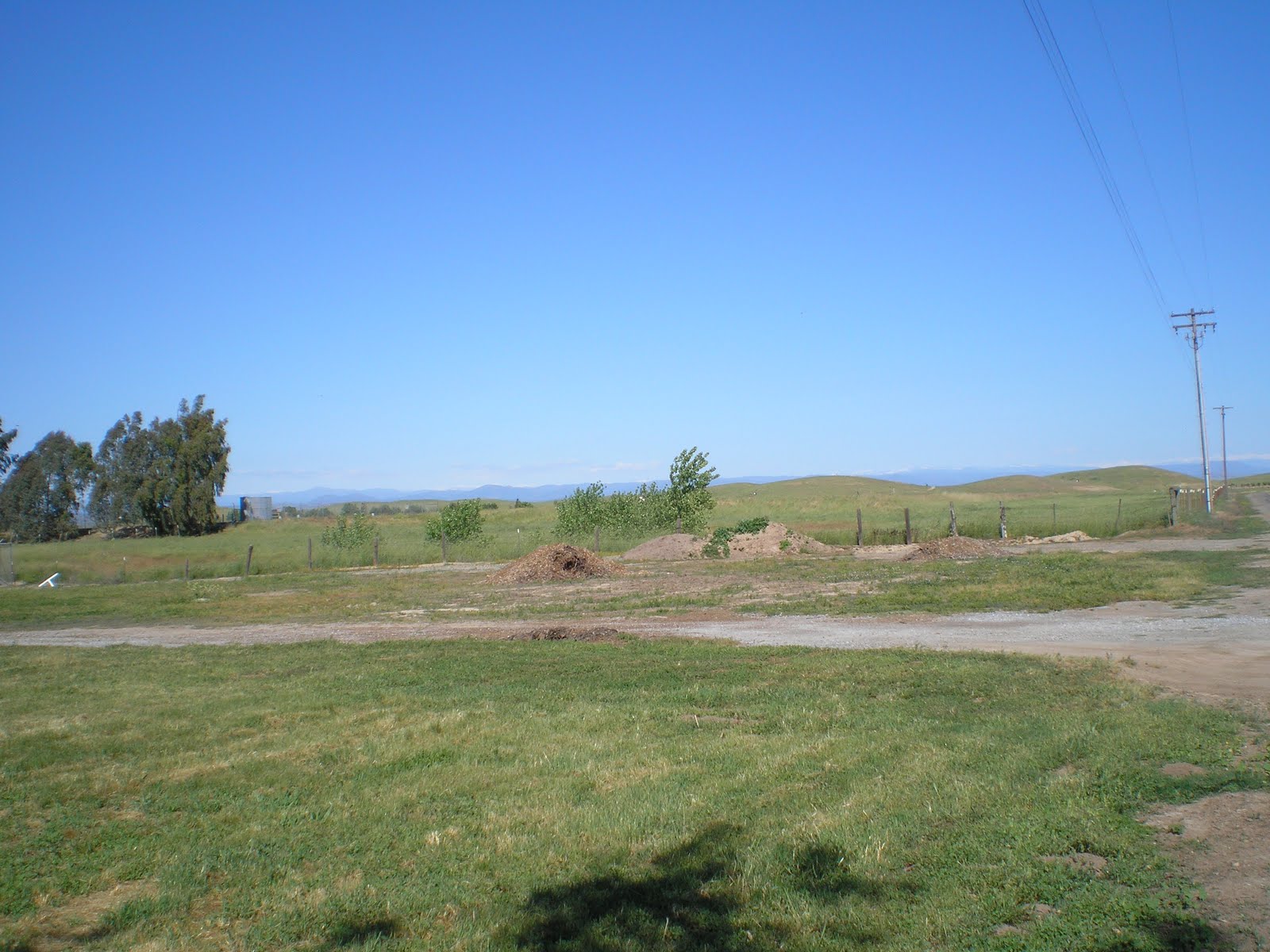
    Before leaving Woodward Rerervoir Campground I walked out the road to the pennisula where I have driven when I arrived yesterday hoping to spend the night there; but, alas, there were no electrical junction boxes. Indeed, there were very few people there since most prefer to have juice to run their TVs.


    And since the terrain is rather flat around Oakdale, it's highly likly that one can pick up at least a few Modesto stations. And with the roof-top antennas that even my truck camper has, one ought to be able to pick up some Sacramento RV stations as well.


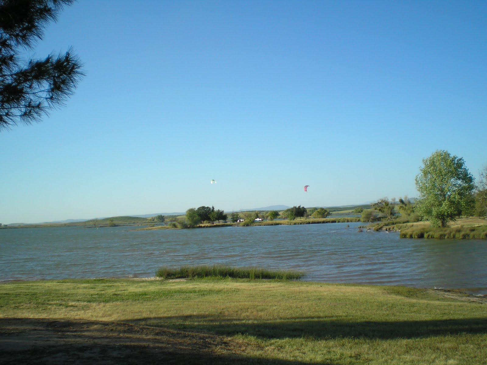
    Yet another photo of the upper end of Woodward, this one perhaps taken with my hat shadding the lens.


    One of the many marinas at Don Pedro Reservoir, with this shot taken from the Tent Only Camping area of Fleming Mdws Campground. Decided I didn't want to pay $35 or a full hook-up (water, sewer, & electricity) so I opted to dry-camp; as it turns out there is water, presumably potable, here in Block A.

    Here's a view toward what appears to be the upper end of the lake, but the main Tuolumne River makes several twists and turns before passing the former site of Jacksonville and then continuing up stream to the powerhouse and fish hatchery at Moccasin and Moccasin Creek. [Believe Jacksonville was buried under 70' of water.]

    Used to drive from my grandparents' place in Tuolumne back to the Groveland District Ranger Station of the Stanislaus Nation Forest and primarily used the main highway: 108 from Sonora and 120 after taking the Chinese Camp cutoff. There was a steep hill down to Jacksonville where one could really roll if he didn't use his brakes. And there was quite a resort near the bridge over the North Fork of the Tuolumne River near its junction with the main fork.
    The photo above was of a rental fleet of houseboats. When full Don Pedro has 13,000 surface acres and 160 miles of shoreline. By way of comparison, Lake McClure, which is like a Giant H, has 82 miles of shorline. The elevation of the latter is 900' while Don Pedro's elevation isn't listed in either of my guidebooks; but I'd guess it's perhaps 150' higher. [Wrong! It's 60' lower than McClure at 840'.]
....


    If you noted some blue in the above foreground, it was the typical lupin color: blue, as you can see in the photo to the right.


    Actually took this photo of a houseboat anchorage near the dam as I was leaving Don Pedro. Unfortunately, there was not a place near the dam to take a photo looking up the lake or down the new outlet canyon. Also, there are no sidewalks and several "Do Not Stop on Dam" signs.
--


Links:

Th 28 Apr Actual Route: Woodward Reservoir - Oakdale - Fleming Mdws CG (Don Pedro Reservoir)

F 29 Actual Apr Route: Fleming Mdws CG -Jamestown - Sonora

Sa 30 Actual Apr Route: Sonora - Columbia - Murphys - Arnold - Dorrington - Murphys - Angels Camp -Frogtown RV Park

Su 1 May Actual Route: Frogtown RV Pk (Calaveras County Fairgrouds) - New Melones Campgrounds

M 2 May Route: New Melones Campground (Big Oak) - Sonora - Big Oak CG

Tuesday, April 26, 2011

Lake McClure to Waterford to Modesto Reservoir

Modesto Reservoir

    After rinsing the dishes this morning at the Bagby Recreation Area on the inlet arm of Lake McClure I opened the door of the camper to let in the sun and saw a Tom turkey in site #1; I was in site #3 but using the 30amp connection from #2. He gave me a double gobble, took off, flapped his wings a few times, and then glided to the other shore. Once on the other shore he fanned his tail and called for the hens in his harem. Unfortunately that all happened so fast that I wasn't able to get any photos.


    Once underway I stopped part-way up the hill to take a shot of the Bagby Bridge as well as SR49 south toward Mariposa. You can see the area where I stopped yesterday to shoot in the opposite direction; I stopped took a photo of the E Clampus Vitus Plaque on Fremont's Fort as well as the bridge.


    Where I took the previous photo of the bridge I notice a white lupine; usually the majority of the lupines are blue. Note also the beetle on a soon-to-open bud. And the background appears to be red clover.


    To the right of the white lupin and red clover were some yellowish wildflowers which I assumed were poppies; but a poppy is usually orange rather than yellow. Note also the wild oats [yes, the ones which stick to your sox when you walk through them later in the year] as well as a couple of other wild grasses. Don't know what turkies, quail, and doves eat, but they all feed mainly on grass seeds.

    I took this snap with one hand while holding my hat in my left hand since I was shooting into the sun. [Need to see if my Olympus camers has a dot-matrix background to help one take "level" photos; Van Ness Neighbor Tom Pennello's camera does.] This is the Horshoe Bend portion of Lake McClure viewed from SR132, the road from Coulterville to Modesto.

    After driving into Waterford to buy 10 gallons of gas and send some e-mail from the library, drove east on SR132 again to Reservation Road and then north c1.5 miles to the Modesto Reservoir County Park. [Stanislaus County treats seniors better than either Merced, which I believe operates the CGs on L McClure, and Mariposa Counties; only cost $10 for a full hookup while Bagby cost $25.] The view east toward the Sierras confirms what we all know already: a plethora of snow. [Click 1 or 2 times to zoom in.]


    This shot is just to the left of the previous; zoom in so that you can distinguish between clouds (there are a few) and snow.


    While putting down the back steps and conneting to the electrical junction box, I saw 2 families of Canadian geese: male, female, and 6-10 offspring or goslings. After lunch & an unsuccessful attempt at a nap, I took the picture above from the camper door.


    As you can see from this next shot, single geese without a family to protect ventured further from the reservoir into the newly-planted orchard to the south. Generally, they were ganders.


    But here's a switch: Two ganders and the 10 offspring of one of them; and one of the ganders chased off a female when she tried to get close to what were likely her kids.


    Since it was windy, the wind-surfers were out using their parachute-like devices to drive them across the surface of the reservoir. [Believe they may be called para-sailors.]


    As you can see the Modesto Reservoir is of moderate size; and island like the one on the left likely help the geese avoid predations by land-based mammals.


    Think the surfer-dude is supposed to slalom back and forth between the white floating buoys, but when the wind is as strong as today, you likely go wherever the wind pushes or pulls you.
--
Links:

  • Wikipedia article on Waterford, CA
  • Link to Stanislaus County Parks web site

T 26 Apr Actual Route: Bagby Rec Are (L McClure) - Coulterville - Waterford - Modesto Reservoir CG

W 27 Apr Actual Route: Modesto Reservoir CG - Waterford - Oakdale - Woodward Reservoir CG

Th 28 Apr Route: Woodward Reservoir - Oakdale - Fleming Mdws CG (Don Pedro Res)

Th 29 Apr Route: Don Pedro Res - Jamestown - Mother Lode Fairgrounds RV Pk (Sonora)

Monday, April 25, 2011

Mariposa to Bagby Recreation Area (Lake McClure)

Bagby Rec Area (L McClure), CA


    Reputed to be the longest continuously-used courthouse west of the Rockies the Mariposa Courthouse somehow survived that scourge of all historic wooden building: FIRE!


    After driving through Bear Valley on SR49 I reached an overlook which had a view of the bridge over the Merced River at the Bagby Recreation Area; but it also had the plaque you see to the right describing a bit of the history of Gen John Charles Fremont, West Point Grad, one of the leaders of the Bear Flag Revolt here in California, explorer, miner, and the first Republican candidate for President. [See Links below.]
....


    As for the road down to McClure Lake, which is shaped like a large "H" at an elevation of 900', think of SR120 from Moccasin up Priest's Grade to Big Oak Flat -- but designed to hold less than half the traffic of that highway.


    What's left of Bagby? A restroom and a fish-cleaning station. The original dam was built c1926, if memory serves, and both the dam and the reservoir were know as Exchequer. But in the early 1960s a new dam was built and the name of the larer reservoir McClure (after a California Dept of Water & Power offical). [See Links below.]


    The 130' Bagby Bridge from the entrance to the Bagby Recreation Area to the right when traveling north on SR49.


    A look up the Merced River arm from just above the Bagby bridge. Why isn't this reservoir full since many others are? It may be that some reserve capacity is being kept at foothill reservoirs to prevent flooding in the Central Valley during May & June.
....

    Finally, as I drove the half mile to the campgroud I began to think of Thanksgiving dinner when I arrived -- mianly because a semi-wild turkey hen crossed the campgroud road in front of me as I idled around the loop. And when I picked a site and got out to connect up to the 30amp electrical box, 3 "honkers" (ie., Canadian geese) took off from the lake. [Click 1 or 2 times to zoom in on the turkey hens.]
--
Links:

M 25 Apr Actual Route: Mariposa - Bear Valley - Bagby Rec Area (L McClure)

T 26 Apr Actual Route: Bagby Rec Area (L McClure) - Coulterville - Waterford - Modesto Reservoir

W 27 Apr Actual Route: Modesto Reservoir - Waterford - Oakdale - Woodward Reservoir CG

Th 28 Apr Route: Woodward Reservoir - Oakdale - Fleming Mdws CG (Don Pedro Res)

Sunday, April 24, 2011

Hensley Lake to Bass Lake to Mariposa

Mariposa County Fairgrounds, CA


    Have moved this post to the top even though the photos and events occurred on Good Friday, 22 Apr. All of these photos were taken along either the county or state routes from Madera to Raymond or from Raymond to Coarsegold.
    Click 1 or 2 times to zoom in on snow-caps in the distance.

    After shopping at the Oakhurst Vons, which has no WiFi and is owned by Safeway, I moved to the McDonalds parking lot to handle my e-mail. Then I drove roughly across the street, SR41, and went to the library just before it closed. They were shutting down their workstations and, like many counties in the San Joaquin Valley, have no WiFi.

    Incidentally, I've found that most Safeway & Vons stores built in 2007 or later have WiFi even thought the Safeway Store Locator may not list it. [For instance, the Sonora Safeway has WiFi.] Because of that, it's best to ask one of the baggers or checkers if the store has WiFi. And even if the store has an in-house Starbucks, it may not have WiFi if it's more than 5 yrs old.

    After leaving the Oakhurst Library I headed for Bass Lake, which is only 8 miles further; staying to the left I drove down the east side of Bass Lake on Road 274. Turned out the Bass Lake RV Resort is almost exactly opposite Beashore Mdw Rd, which I've used since the late 60s. One of the fellows in the office greeted me as "Santa Claus." [Told him I was early this year.]
    When he saw the size of my rig, a truck camper on a 3/4 ton pickup, he said he thought I could squeeze into a tent site. When I asked the price, I thought he had said 50, but he said it was $60. Told him that was too much and that I'd stay in a US Forest Service CG -- provided I could find one which was open. As I walked out he warned me about drug dealers in USFS campgrounds.
    I drove back to the sheriff's sub-station near the intersection or Roads 222 & 274 and ate lunch in my camper. While eating I thought I should go inside and report an attempted "Highway Robbery," but since it was Good Friday & the Bass Lake RV Resort was nearly full, prices are whatever the traffic will bear.

    I also looked at my guidebooks while eating and discovered that most Yosemite campgrounds did not open until May -- after a normal winter; it will be later this year. Concluded I shud stick to "The Golden Highway," SR49, which runs through the heart of the Mother Lode. After lunch, I drove back to Oakhurst for 10 gallons of that precious sustance called gasoline & headed north past the Vons store on SR 49.
    As I got near Mariposa I was surprised to see a sign which said Fairgounds RV; checked it out & found that not only can you get limited hookups, elec & water in all but 2 sites in grassy Lots 1 & 2, but they had WiFi. And it turned out to be a pleasant surprise: rock-solid with high speed. And when there was a slight dimming of the lights, the router re-booted & was back on the air within a couple of minutes.
    While not as low-priced as some other Fairground RV parks (eg., the Tuolumne Fairgrounds in Sonora), at $25/night from Oct - Apr and $30 from May to Sep, it seems reasonbly-priced. [Good Friday was indeed a good Friday!]
--
Links

  • Brief Wikipedia article on Mariposa
  • Excellent review of the history Central California Counties near Mariposa County

Su 24 Apr Actual Route: Mariposa County Fairgrounds

M 25 Apr Actual Route: Mariposa - Bear Valley - Bagby Rec Area (Lake McClure)

T 26 Apr Actual Route: Bagby Rec Area - Coulterville - LaGrange - Waterford - Modesto Reservoir CG

W 26 Apr Route: Modesto Reservoir - Waterford - Oakdale - Woodward Reservoir CG

Saturday, April 23, 2011

Yosemite National Park

Mariposa County Fairgrounds, CA

    The still-considerable amount of snow above the 5500' level was both a blessing and a curse. That is, while the snow melt produced bigger name waterfalls as well as smaller waterfalls, which are usually only seen in late winter and early spring, the evaporation contributed to cloud cover, which obscured such prominent Yosemite features as Half Dome (and dropped some light rain on park visitors).


    The late snow melt also kept the rafters away from such stretches of the Mercerd River as that to the right -- though it may be that the portion I photographed as I approached the Arch Rock Entrance on SR140 is simply too rough every season of the year.


    Because of a large gathering of people and cars around the Bridalveil Fall Parking Lot as well as the turnoff for Yosemite Valley I turned right and headed toward the Wawona Entrance and SR41. Note that the top of El Capitan is obscured.


    Clearly a forest fire made a shot from the road toward Wawona of the foothills and Central Valley beyond easier. I doubt if this is the fire which burned from Yosemite to near the eastern outskirts of Tuolumne [City] during the 1990s, but part of the reason for that massive fire was the policy of both the USPS and USFS during the 50s & 60s when we put everything out. [I say we because I worked for the USFS during the summers of 58-61 while attending San Jose State.] That policy was clearly a failure, as many native Americans could have told us, for smaller frequent fires stop the build-up of undergrowth, dead trees, etc. which fuel massive fires. Indeed, the 2 gvt agencies actually start forest fires now where Mother Nature has not done her job with lightning strikes in overgrown areas.


    While stopped for lunch I realized that the vehicles headed south toward the Wawona exit out-numbered those headed north toward Yosemite Valley. Hence I turned around and headed back toward the Valley. The shot through the trees caught El Capitan with "its hat off."


    If you click 1 or 2 times on this photo, you'll see a small 3-stream waterfall to the right of the granite outcropping. The numerous black stains you see on the rocks are caused largely by water flow.


    Bridalveil Fall to the right of the ponderosa pine and the eastern flank of El Capitan to the left of the pine; these two prime attractions are virtually opposite one another at the western end of Yosemite Valley. And the tourists this time seemed to be Indian, Latino, and college kids using their spring breaks whereas there were tours of Germans and Chinese at Sequoia N.P.


    While I thought I elevated my shot enough to avoid other tourists, note that the shot of the snow on the north side of the southern rim of the Valley is marred by a few sight-seers.


    A view of Northside Drive along the Merced River from the higher Southside Drive.


    El Capitan from the floor of Yosemite Valley. While working for the US Forest Service, we provided mutual aid for a fire which started near Briceburg on the Merced River virtually due west of Yosemite Valley. I worked a 12-hour shift on the eastern perimeter at the top of the canyon. Two things about that shift were unforgettable: 1)Seeing the sun come up directly over El Capitan and 2)burning my left wrist on the muffler of the flame thrower we were using to set backfires -- in the same place where I burned it with a soldering iron when we lived on California St. in Santa Cruz.


    I believe this is Ribbon Fall to the west of El Capitan. I let a young Indian couple take photos with her standing in front of a plaque listing the falls of Yosemite. When they finished I discovered that my batteries were dead. [Don't know if they were just married or to be married; but if she gets copies of all the photos, she almost certainly could sue him for breach of promise -- especially if he turns out to be a successful Silicon Valley entrepreneur.]
--
Links:

Sa 23 April Actual Route: Mariposa - Briceburg - El Portal - Yosemite - Mariposa

Su 24 April Route: Mariposa County Fairgrounds

Thursday, April 21, 2011

Chowchilla to Hensley Lake Campground

Hensley Lake, Madera County, CA


    Here's a shot of Hensley Lake at sunset. And here's what Tom Stienstra wrote about it in his 2010 Guide to West Coast RV Camping.

    "Hensley Lake is popular with water-skiers and personal watercraft users in spring and summer, and it has good prospects for bass fishing as well. Hensley covers 1,500 surface acres with 24 miles of shoreline and, as long as water levels are maintined, makes for a wonderful water playland. Swimming is good, with the best spot being at Buck Ridge on the east side of the lake, where there are picnic tables and trees for shade. The reservoir was created by a dam on the Fresno River. A nature trail is also here. The elevation is 540 feet."


    While the snowpack this year is about 1.5 x normal, I don't think the Fresno River reaches far enough into the Sierra Nevada to stay full well into summer -- as such lakes like Pine Flat on the Kings and Lake Millerton on the San Joaquing likely will. In fact, it's highly likely there will be some flooding along some streams later this spring and perhaps last nearly til the start of summer.


    This 3d shot shows a cove were a bass took something floating on the surface. [Click 1 or 2 times to zoome in.] Near the island in the first shot I saw a fish come out of the water to take something, but couldn't tell whether it was a bass or a rainbow trout. In addition to those two type of fish, the lake also contains catfish and such sunfish as crappies and bluegills. [And my flyrod is still in storage in Santa Cruz. :-(>]

    One appeal of the COE [US Army Corps of Engineers] campgrounds is that they are usually either in the Central Valley or foothills of the Sierra Nevada, where electricity may be available. The US Forest Service camprounds rarely have more than firerings, picnic, and drinking water. But COE (or USACE as they prefer to abbreviate it) and USFS, and USPS all honor the Golden Age Pass I obtained in 1995 as well as newer versions thereof for senior; one receives a 50% discount on campsites; so I paid $15 for this site whereas the person who reserved it for Friday & Saturday nights will have to pay $30 unless he too is a senior. And, after a one-time fee of $10 when you present a photo-ID, you get a free ride through all National Parks, Monuments, Historic Sites, etc.

    The only glitch is if a campground is run by a contractor rather than the USPS/USFS. It used to cost $10 ($5 with the Golden Age Pass) for a tent site at Pinnacles Natl Monument, but now that it's run by a contractor the cost is $36, if mem serves -- and that's without electricity.
--
Links:

Th 21 Apr Actual Route: Chowchilla - Madera - Chowchilla - Hensley Lake

F 22 Apr Actual Route: Hensley Lake RV CG - Coarsegold - Oakhust - Bass Lake - Oakhurst - Mariposa

sa 23 Apr Route: Mariposa - Briceburg - Yosemite NP - Mariposa

Wednesday, April 20, 2011

The World's Biggest Tree: the General Sherman Sequoia

Chowchilla, CA


    It isn't often that one gets to visit physical things which are the largest, tallest, oldest, etc. But the General Sherman Sequoiadendrum gigantea is the largest tree by weight in the world. [What follows are several paragraphs from the Sequoia/Kings Canyon park brouchure.]

    In volume of total wood the giant sequoia stands alone as the largest living thing on Earth. Its nearly conical trunk -- like a club, not a walking stick -- shows why. At least one tree species lives longer [bristlecone pines in the White Mtns near the CA/NV border], one has greater diameter, three grow taller [coastal redwoods and 2 other types of trees], but none is larger. In all the world, sequoias grow naturally on the west slope of the Sierra Nevada, most often between 5,000 and 7,000 feet of elevation. There are some 75 groves in all. The General Sherman Tree is an estimated 2,200 years old. Its largest branch is almost seven feet in diameter. Every year the General Sherman grows enough new wood to make a 60-foot-tall tree of usual proportions.


    "Most of the Sierra trees die of disease, fungi, etc.," John Muir wrote, "but nothing hurts the Big Tree. Barring accidents, it seems to be immortal." Muir was partially right. Chemicals in the wood and bark provided resistance to insects and fungi, and thick bark insulates them from most fire. The main cause of sequoia deaths is toppling. They have a shallow root system with no taproot. Soil moisture, root damage, and strong winds can lead to toppling.
    Sequoia, America's Second Oldest National Park. San Joaquin residents and others urged Congress to protect Sierra tracts from logging in the 1880s. Some park proponents sought to protect water supplies for irrigation; others, the Big Trees. Preserving land for scenic and recreational values was an infant idea then.

    Sequoia and Redwood Compared. The giant sequoia has a massive trunk, hugh stout branches, and cinnamon-colored bark. Also called "Sierra Redwood" and "Big Tree," it scientific name is Sequoiadendron giganteum. Sequoia sempervirens, is more conifer-like in profile.

Redwood facts:

  • Height: to 367.8 feet
  • Age: to 2,000 years
  • Weight: to 1.6 million lbs.
  • Bark: to 12 inches thick
  • Branches: to 5 feet diameter
  • Bases: to 22 feet dimeter
  • Reproduce: by seed or sprout
  • Seed size: like tomato seeds
  • Cone size: like a large olive
--
Sequoia facts:
  • Height: to 311 feet
  • Age: to 3,200 years
  • Weight: to 2.7 million lbs.
  • Bark: to 31 inches thick
  • Branches: to 8 feet diameter
  • Bases: to 40 feet dimeter
  • Reproduce: by seed only
  • Seed size: like oat flakes
  • Cone size: like chickens' eggs

    [Click on photo 1 or 2 times to zoom in.]Note that there are free shuttles from the Lodgepole Visitor Center to the Gen Sherman Tree.
--
Links:

Th 21 Apr Actual Route: Chowchilla - Merced - Chowchilla - Hensley Lake RV Campground

Fresno County CG (Lost Lake) to Madera to Chowchilla

Arena RV Park, Chowchilla, CA


    Here's an apparently-historic house next to one of California's larger rivers, the San Joaquin. Not only does it have a river view, but it also has a fireplace. Granted, it's rather small, but it's sturdy. In fact, it's sturdiness will likely be tested during the spring runoff in May and early June.


    And, as you can see, there's even a window. Yes, both the mesh on window and and heavy grate on the door appear to be those used by jails, but you can rest assured that one one will break in at night while you're sleeping.


    And you'll be well-supplied with water at this riverside location; yes, it's a little murky at times, but run it through a coffee filter a few times and it may even look potable.
--
Links:

W 20 Apr Actual Route: Lost Lake CG - Madera - Chowchilla