Friday, September 30, 2011

Lower Little Truckee CG to Bucks Lake

Grizzley Crk CG, Bucks Lake

    Another attempt to capture a sunset from the door of my camper looking west from my campsite at the Tahoe National Forest Lower Little Truckee River[/Creek?] along CA89 about 12 miles north of Truckee. Guess I'll wait until there's a really spectactular sunset before trying again.


    I don't know what the record is for the biggest nugget from the 49er Gold Ruch, but the 52-pound nugget must be among the biggest. This historical landmark as well as Johnsville/Johnstown are west of Portola on the south side of CA70.


    According to a fellow returning a book to the Quincy Library just after they closed this is the catalpa. If memory serves, this tree was introduced to the Sierra Nevada by the Chinese; according to to Storer & Usinger in their Sierra Nevada Natural History it is the only tree to become "naturalized" and survive long after the miners gave up their search for gold.

    Looking east from just below Bucks Summit, elev: 5531'. [The peak in the distance is likely Smith Pk in the Game Refuge north of Portola and south of Lake Davis.] The trees here are primarily red firs. Further down the road where it was somewhat drier, the mix was of white firs and incense cedars.


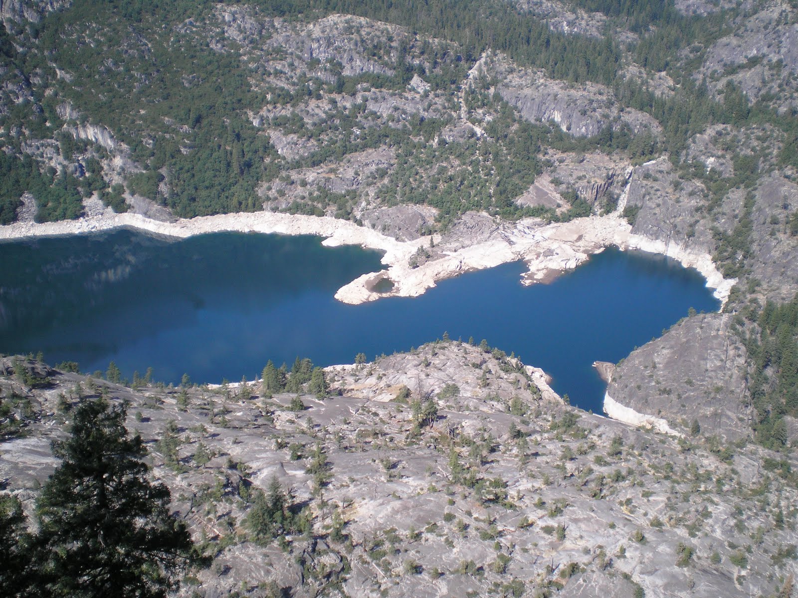
    A first look through the trees at Bucks Lake (elev: 5227'), which is shaped like a fat boomerang.


    Panning left to just to the right of the bend in the boomerang.


    Panning left again, the bend and part of the bottom of the boomerang.


    Finally, a view toward the dam at the bottom of the boomerang.


    Driving toward the dam I eventually found a break in the trees along the shore.


    A clearer view of the bend in Bucks Lake.


    Here I'm very close to the dam. If you zoom in by clicking 1 or 2 time, you'll see quite a few houses along the shore. Bucks lake reminds me of Pinecrest Lake in Tuolumne County, which is also surrounded by private houses -- though built on property subject to 99-year leases, if memory serves.


    The lower portion of the Bucks Lake near the dam, where there are still quite a few houses.


    Water gushing forth from a large pipe near the bottom of the dam, which is partially visible.


    Lower Bucks Lake (sometimes called the Forebay by others). While I saw some youngsters fishing here, they didn't get any strikes while I walked by nor did I see any fish as I scanned the shallow water near the shore.
--
Links:

Th 29 Sep Actual Route: Fernley - Wadsworth - Reno - Truckee - Lwr Little Truckee USFS CG

F 30 Sep Actual Route: Lwr Little Truckee USFS CG - Portola - Quincy Lib - Bucks Lake

Sa 1 Oct Actual Route: Bucks Lake - Quincy - Lake Almanor

Su 2 Oct Actual Route: Lake Almanor - Chester - Mineral - Lassen NP - Shingletown

M 3 Oct Actual Route: Shingletown

T 4 Oct Route: Shingletown

W 5 Oct Route: Shingletown
--
Finding Campgrounds:

N.B. I receive nothing from Trailer Life or Woodalls for including links to their free campground lookups.

Wednesday, September 28, 2011

Lemmon Valley & Pyramid Lake

Fernley, NV

    For many years I've either seen Lemmon Valley near Reno on a map or seen signs to it as I drove by. My main question has always been the source of the name. A few days ago I was able to spend some time at three of the Washoe County Libraries where I located the following in a book titled Nevada Place Names by Helen S. Carlson.
....
    LEMMON VALLEY (Washoe). The valley, north of Reno and NE of Peavine Mtn, and the site of Stead AFB (phased out in 1965), was named for the Fielding Lemmon family, who had a ranch there. In 1861, Mr. Lemmon's ranch was an overnight stopping place for teamsters and travelers. He apparently was a member of the first convention called to frame a state constitution in 1863 (HNS, p. 89; OPN, p 67; 1893 Map; NJ 11-1)
....
[Source: Nevada Place Names: A Geographical Dictionary by Helen S. Carlson, p.154; UNV Press, 1974.]
--


    Washoe Valley sits between Carson City and Reno along US395, which is being rebuilt in the area. Here's a dusk photo of Washoe Lake from David Creek County Park.


    Plaque on Old 395 placed by the DAR indicating the site of the Ophir Mill and surrounding town during the Comstock Silver Mining Era.


    A first view of Pyramid Lake looking toward the southeast.


    Panning left and looking more or less east.


    Panning further left for a first view of the rock formation which caused John C. Fremont to name the lake Pyramid Lake. [Click 1 or 2 times to enlarge.]


    A little clearer view of the "pyramid rock."


    Plaque with facts on the lake, such as its size: 27 miles long and 4-11 miles wide.


    The junction of NV446 & NV447 with the lake in the background.


    A view from the bottom of the lake looking north. [Note: the lake runs from NNW to SSE; also note the prominence of the "pyramid rock."]


    One last look at Nevada's largest natural lake (assuming Tahoe is exempt because of its two-state location).


    The main source for Pyramid Lake's water: the Truckee River. Just as Hawthorne Lake is the terminus for the Carson River, Pyramid Lake is the end of the line for the Truckee River.
--


Links:

M 26 Sep Actual Route: Crystal Sprs CG - Minden - Garnderville - Davis Crk RV Park

T 27 Sep Actual Route: Davis Crk RV Park - Reno - Lemmon Valley - Panther Valley RV Park

W 28 Sep Actual Route: Panther Valley RV Park - Reno - Sparks - Pyramid Lake - Wadsworth - Fernley

Th 29 Sep Actual Route: Fernley - Wadsworth - Reno - Truckee - Lwr Little Truckee USFS CG

F 30 Sep Actual Route: Lwr Little Truckee USFS CG - Portola - Quincy Lib - Bucks Lake

Sa 1 Oct Route: Bucks Lake - Quincy - Lake Almanor
--
Finding Campgrounds:

N.B. I receive nothing from Trailer Life or Woodalls for including links to their free campground lookups.

Sunday, September 25, 2011

A Loop Past Lake Tahoe

Minden, NV

    While taken on the way north from Bridgeport on US395 in a broad pass called Devils Gate (elev: 7519'), it includes information on a future Presidential candidate as well as U.S. and California history.


    A great many of the north-south valleys on the eastern side of the Sierra Nevada look like this one next to SR89 as it climbs toward Monitor Pass.


    A lightning-caused fire to the east of Colville. It's difficult to shake what I learned with the US Forest Service in the late 50s and early 60s: "Put Everything Out." [The Indians knew better; and in the last 20 or so years the USFS has decided to follow their examples.]


    Note the dedication date for Monitor Pass: 9-12-54 -- and that's 1954, not 1854. Incidentally, the climb from the east to the pass is not for the faint-of-heart, for there are only snow-season markers to stop one from rolling a long ways if he veers off of the road.


    Heenan Lake, where there are apparently four species of trout in fairly large numbers. There was one party of two out on a small rubber raft.


    As you can see from this whiteboard, there are not only quite a few fish in this modest-sized lake, but they are c20". It would appear that Heenan has a high growth rate as do Crowley and Eagle Lakes, both of which are know for large trout.


    This photo was taken on Sunday morning as I motored toward Carson Pass (elev: 8573'), which is just to the right of the mountain with snow in the distance.


    After driving over the top of Carson Pass and discovering no parking places (there's a USFS Ranger Station on the west side just short of the top), I returned to a Vista Point and took the photo to the right of Red Lake.


    Panning to the left one can see not only the gradual ascent to Carson Pass but signs of more work. Assuming the west side of Carson Pass is similar, it appears to be the best rout across the Sierra Nevada from Beckwourth Pass on the north to Tioga Pass in Yosemite on the south.


    With no RV parks in the Carson Valley near Gardnerville or Minden, I drove NV207 toward Lake Tahoe. Here's a shot near Stateline into the setting sun of the lake and the mountains on the far side in California. [Click 1 or 2 times to zoom in.]


    On SR89 not too far from Luther Pass (elev: 7735') looking toward a couple of peaks I had not photographed earlier in the day. They look a bit like watch caps that have not been folded; call it the "Brown Smurf Look."
    Even though it was closed for the season, I spent the night near the Crystal Springs USFS CG; should have had ear plugs, for the gravel trucks hauling rocks to/from the top of Carson Pass were only c75 yards from the level ground where I parked.
--
Links:

M 26 Sep Actual Route: Crystal Sprs CG - Minden - Garnderville - Davis Crk RV Park

T 27 Sep Actual Route: Davis Crk RV Park - Reno - Lemmon Valley - Panther Valley RV Park

W 28 Sep Actual Route: Panther Valley RV Park - Reno - Sparks - Pyramid Lake - Wadsworth - Fernley

Th 29 Sep Route: Fernley - Wadsworth - Reno - Truckee
--
Finding Campgrounds:

N.B. I receive nothing from Trailer Life or Woodalls for including links to their free campground lookups.

Saturday, September 24, 2011

Over Sonora Pass

Bridgeport, CA

    Because the USFS Mill Creek Campground was closed I was forced to boon-dock (aka dry-camp) on Lower Mill Creek Road; I had car-camped there many times in the past once I had caught enough fish for a meal from Kennedy Creek. The sunset which I attempted to capture escaped!


    As seen from the trail at Donnell's Vista, here are the Dardanelles: that is, Dardanelle's Cone and associated volcanic formations.


    Donnell's Dam and Reservoir as seen from the Vista Point at the end of an asphault trail. (Though I had stopped at the parking lot many times, this was the first time I bothered to walk to the end of the trail.)


    Looking almost straight down at the upper end of Donnell's Reservoir.


    [Click 1 or 2 times to zoom in].Panning to the right , a view of the fast water entering the lake. [Donnell's is the uppermost of 3 reservoirs created by the Turlock Irrigation District: Donnell's, Beardsley, & Tullock as you travel down the Middle Fork of the Stanislaus River.]


    The 1923 bridge over the Middle Fork of the Stanislaus River just above The Dardanelles Resort and Eagle Creek. It was one of two sites used in the movie "For Whom the Bell Tolls," starring Gary Cooper and Ingrid Bergman. [My late father, who made $37/day in 1941 as an extra, made $1200/year as teacher, principal, and janitor of Shaw's Flat Elementary School; he said $37 was big money in those days.]


    A look from the 1923 bridge down the M.F. of the Stanislaus; spent a minute or so looking for fish, but didn't see any.


    The New Kennedy Meadows Lodge, which replaces the original one destroyed by javascript:void(0)fire in 2007.


    A view of the lower end of Kennedy Meadows from just a short distance up the "serious" portion of Sonora Pass.


    A view generally to the east from SR108 about 100 yards below the Sonora Pass. There were no parking places -- perhaps because day-hiker, backpackers, & deer-hunters were too lazy to walk a little bit further from the trailhead parking a short ways down the road from the top.


    A view from a switchback of the falls, whose name I can't remember, but it's in the next drainage to the north of Leavitt Creek and Lake.


    Leavitt Falls from the Vista Point created by the USFS.


    Leavitt Meadows and the West Fork of the Walker River.


    Also from the Leavitt Falls Vista Point a view of a lake just below the deepest notch in the background ridge; think it may be Poole Lake.


    Another view of Leavitt Meadows and the West Fork of the Walker River from a somewhat lower elevation.


    The US Marine Corps training base at Pickel Meadows. Formerly it was known as the Cold-Weather Training Base, but it's now called the Mountain Warfare Training Center. (Met a former Marine on my last long backpack in 2006 who went through its "freeze-your-buns" training.) I saw troops on the north side of SR108 from just below the pass to Pickel Mdw.
--


Links:

Th 22 Sep Actual Route: Long Barn - Sonora - Three Links Camp

F 23 Sep Actual Route: Long Barn - Tuolumne - Lwr Mill Creek Rd

Sa 24 Sep Actual Route: Lwr Mill Creek Rd - Kennedy Mdws - Sonora Pass - Bridgeport - Sonora Jcn - Monitor Pass - SR89 near SR4

Su 25 Sep Actual Route: SR89 Near SR4 - Markleeville - Carson Pass - Woodfords - Minden/Gardnerville - South Lake Tahoe - Crystal Sprs CG

M 26 Sep Actual Route: Crystal Sprs CG - Minden - Garnderville - Davis Crk RV Park

T 27 Sep Actual Route: Davis Crk RV Park - Reno - Lemmon Valley - Panther Valley RV Park

W 28 Sep Route: Panther Valley RV Park - Reno - Sparks - Pyramid Lake - Wadsworth
--
Finding Campgrounds:

N.B. I receive nothing from Trailer Life or Woodalls for including links to their free campground lookups.