Tuesday, February 26, 2013

Amistad Dam & Reservoir, Texas

Cotulla Library


    A zoom in on the Amistad Dam, a joint project of the U.S. and Mexico, from near the Southwinds Marina, a U.S. Air Force marina built principally to benefits those station at Lackland AFG near Del Rio.


    In the center, the Union Pacific RR bridge. [Click once to enlarge; press ESC to return here.] The water levels, as with most of the western U.S. are near historically low levels.


    Panning left....


    Looking over several prickley pear cacti, more of Armistad Reservoir, which, at high levels, extends 81 miles up the Rio Grande, 14 miles up the Pecos, and 25 miles up Devils River.


    One of the photos of more open water. Water temperatures in the winter drop to 54 degrees Fahrenhit and rise to 85 degrees in the summer.


    One final look at "Friendship" Reservoir -- which is what Amistad means in Spanish.
--


Links:

  • Wikipedia article on Amistad Dam & Reservoir
  • Brief piece on Amistad Reservoir by the Texas State Historical Association
--

T 26 Feb Actual Route: Potranco Rd Walmart - Guerra Br Lib - 210 Geeks - Potranco Rd Walmart

W 27 Feb Actual Route: Potranco Rd Walmart - Guerra Br Lib - Potranco Rd Walmart

Th 28 Feb Actual Route: Potranco Rd Walmart - Lytle - Devine - Pearsall Walmart

F 1 Mar Actual Route: Pearsall Walmart - Devine - Cotulla - TX133 bd

Sa 2 Mar Actual Route: TX133 bd - Cotulla Lib - Laredo - US83S bd

Su 3 Mar Actual Route: US83S bd - Laredo - Lake Casa Blanca Intl State Park

M 4 Mar Actual Route: Casa Blanca Intl SP - Bruni - Hebbronville - TX389 bd

T 5 Mar Actual Route: TX389 bd - Hebbroncille P.O. - Zapata Lib - Falcon Lake bd

W 6 Mar Actual Route: Falcon Lake bd - Zapata Lib - Roma - Rio Grande City Walmart

Th 7 Mar Route: Rio Grande City Walmart - La Joya - McAllen Lib - McAllen/Pharr Walmart
--

Finding Campgrounds:

N.B. I receive nothing from Trailer Life, Woodalls, or FreeCampsites.net for including links to their free campground lookups.

Saturday, February 23, 2013

Langtry to Armistad National Recreational Area, Texas

Guerra Branch Library, San Antonio, TX


    Eagle Nest Creek [bed] on US90 just east of the Langtry loop. Taken from the current US90 bridge the lower bridge is the old US90 highway bridge while higher bridge is the Union Pacific trestle.


    Looking down the creekbed from the other side of the current bridge, the white you see is sand and not whitewater.


    Zooming in farther down the canyon, one can see Langtry in the background.


    A Texas Historical Marker on the completion of Southern Pacific's route from New Orleans to San Francisco. [Click once to enlarge; press ESC to return here.]


    After Vinegarroon was abandoned in 1883 Roy Bean moved his saloon/courtroom to Langtry.


    The three bridges Southern Pacific built over the Pecos River.


    The most recent Pecos River Bridge, completed in 1957, after bridge #3 and two temporary bridges built in 1954 and 1955 were destroyed by Hurricanes Alice and Gladys, both Category 1 hurricanes.


    A plaque updating the bridges over the Pecos. In 1957 this was the highest bridge in Texas; however, with the completion of Amistad Reservoir, that may no longer be true.


    Looking down the Pecos from the picnic area, which is downstream from the high 1957 bridge above.


    A plaque on the Pecos in literature and folklore -- the latter mentioning Pecos Bill.


    A plaque on the 1875 skirmish which resulted in Medals of Honor for three black Seminole Indian scouts.
--


Links:

--

W 20 Feb Actual Route: Ft Clark Sprs RV Pk

Th 21 Feb Actual Route: Uvalde Walmart - Uvalde Lib - Walmart

F 22 Feb Actual Route: Uvalde Walmart - Uvalde Lib - Walmart

Sa 23 Feb Actual Route: Uvalde Walmart - Uvalde Lib - Hondo Walmart

Su 24 Feb Actual Route: Hondo Walmart - Las Palmas Br Lib - Walmart

M 25 Feb Actual Route: Potranco Rd Walmart - Guerra Br Lib - Walmart

T 26 Feb Actual Route: Potranco Rd Walmart - Guerra Br Lib - 210 Geeks - Potranco Rd Walmart

W 27 Feb Actual Route: Potranco Rd Walmart - Guerra Br Lib - Potranco Rd Walmart

Th 28 Feb Route: Potranco Rd Walmart - Lytle - Devine - Pearsall Walmart

F 1 Mar Route: Pearsall Walmart - Devine - Cotulla - I-35 Rest Area
--

Finding Campgrounds:

N.B. I receive nothing from Trailer Life, Woodalls, or FreeCampsites.net for including links to their free campground lookups.

Wednesday, February 20, 2013

Judge Roy Bean: Law West of the Pecos

Guerra Branch Lib, San Antonio, TX
    The Jersey Lillie, where Roy Bean ran a saloon and dispensed justice to miscreants who felt there was no law "west of the Pecos."
    The establishment also housed a billiard table and was named for British actress Lillie Langtry, who was known as the "Jersey Lily." [Perhaps the sign-painter had a few too many belts before incorrectly painting "Jersey Lillie" instead of "Jersey Lily."]


    Here's the bar where Justice Bean dispensed both justice and "joy juice." In fact, he was known to interrupt proceedings to serve a customer.
    While some think of Roy Bean as a "hanging judge," there's no record of a single "necktie party." Instead he fined a law-breaker everything he had: cash, horse, and firearms, telling him to hit the road and not come back or there would be a hanging!


    The Opera House at Langtry where Judge Roy Bean had invited Lillie Langtry to perform several times to perform; she finally accepted, but Judge Bean died before she eventually made her way to Texas.


    The original Jersey Lillie burned in 1896; Bean had a smaller version rebuilt (which explains why there was no room for both a billiard table and his bed.) The "Opera House & Town Hall" actually served as his home thereafter until he died on 16 Mar 1903.


    A authentic pot-bellied stove typical of the late 19th century as well as a closeup of the contruction of the walls of the Opera House.


    While not the exact bed in which Roy Bean slept, it is similar to what my maternal grandmother used well into the 20th century.


    A Texas Historical Marker explaining Roy Bean service as Justice of the Peace near the Pecos, where a Silver Spike was driven in Dead Man's Gulch upon completion of the bridge over the Pecos River Canyon. [Click once to enlarge; pres ESC to return here.]


    Another historical marker -- this one on the town of Langtry.
--
Links:

--

Sa 16 Feb Actual Route: San Pedro CG, Amistad NRA - Amistad Dam - San Pedro CG, Amistad NRA

Su 17 Feb Actual Route: San Pedro CG, Amistad NRA - Del Rio Lib - Walmart

M 18 Feb Actual Route: Del Rio Walmart - Home Depot - Del Rio Lib - Walmart

T 19 Feb Actual Route: Del Rio Walmart - Home Depot - Brackettville Lib - Ft Clark Sprs RV PK

W 20 Feb Actual Route: Ft Clark Sprs RV Pk

Th 21 Feb Actual Route: Uvalde Walmart - Uvalde Lib - Walmart

F 22 Feb Actual Route: Uvalde Walmart - Uvalde Lib - Walmart

Sa 23 Feb Actual Route: Uvalde Walmart - Uvalde Lib - Hondo Walmart

Su 24 Feb Actual Route: Hondo Walmart - Las Palmas Br Lib - Walmart

M 25 Feb Actual Route: Potranco Rd Walmart - Guerra Br Lib - Walmart

T 26 Feb Actual Route: Potranco Rd Walmart - Guerra Br Lib - 210 Geeks - Potranco Rd Walmart
--

Finding Campgrounds:

N.B. I receive nothing from Trailer Life, Woodalls, or FreeCampsites.net for including links to their free campground lookups.

Saturday, February 16, 2013

Big Bend National Park - Part II

Ft Clark Springs RV Park, TX


    Here's what the plaque says.       Chisos Mountains: Volcanic Heart of Big Bend
    The mountain mass rising out of the desert was once molten rock. Study the shapes of the peaks to make sense of the geologic battleground, this jumble of eruptions and underground flows.
    Angular blocks like Casa Grande [center background] are stratified layers of lava and ash - remnants of blows from nearby volcanoes. Rounded features like Ward Mtn [far right] were subterranean domes of magma that became prominent as erosion scraped aways thousands of feet of overlying sedimentary layers.


    Note that these mountains have been around a bit longer because of their rounded shapes -- like the above-mentioned Ward Mtn.


    A close-up of the rounded peak on the left of the above photo.


    A small spire on the left side of the road around to the north (and only) entrance to the Chisos Mtns.


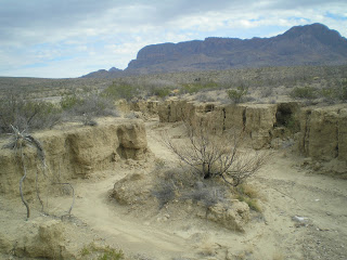
    A dry wash near where I stopped for lunch; there were tire tracks on its floor.


    Reminds me of the sterling silver cover over a turkey or roast beef. [Yes, it's getting close to dinner time. :-)>]


    My guess is that the agaves in Big Bend blossom more often than every 100 years; further north they're called century plants because they take so long to blossom.


    Mountains are beginning to look a bit more rugged as I drove uphill toward the entrance to the Chisos Basin.


    A look back down the approach to the "Basin," as it's called. Because there are several hairpin turns, RVs over 24' and trailers over 20' are not recommended on this road.


    The plaque states that those continuing up the road will encounter more trees -- starting with junipers, oaks, and Mexican pinyon [pines]; and hikers to yet-higher elevations will find Arizona pines and Douglas firs. [The latter are usually found along streams in some parts of the Sierra Nevada in CA because they require more water than, for example, ponderosa (or yellow) pines. Incidentally, the pines I saw in Arizona looked like ponderosas to me.]


    A look past my rig up the road to The Basin.


    The top of Casa Grande (7325'), from the saddle through which one enters The Basin. Though it's not the highest, Emory Peak at 7832' is, its shape sets it apart.


    The Basin Campground on the right, the "Window" to the left and slightly above it, and Visitor Center and Lodge to the left.


    A plaque titled "Camp Life." It reads as follows. "Two Civilian Conservation Corps (CCC) camps stood here from 1934 to 1942. The 200 men of the Big Bend CCC were organized in military fashion, subject to military discipline, and pair one dollar per day. After five days of bashic training, they began life in the Chisos Basin, marching in formation, living in open bay barracks, and performing backbreaking work. Although Spartan, camp life provided some of the recreation, camarderie, and rest the men longed for after a hard day's work. Often grueling, the work provided income and self-esteem for a generation that had endured economic hardship."


    The early evening sun, red from shining through a thin layer of clouds, hits the mountains to the north of The Basin.


    Panning left, more filtered red rays on the Chisos Mtns.


    Casa Grande from my site, #4. There are no hookups, but there is potable water and restrooms with electricity. Yes, one fellow was charging up his cell phone in the restroom. And I liked the hand-dryer since it warmed up my hand much more than a dry paper towel would.


    More mountains to the right on the road from Panther Junction north. [It becomes US385 outside of the park; "panther" is what locals call mountain lions.]


    The road heads north toward the gap in the mountains known as Prsimmon Gap.


    One last geologic feature: Dog Canyon. It appears to be a bit more than a mile to its mouth, but there is a trail up it. [Carry plenty of water -- especially if you insist on making the hike in mid-August. You'll go out in a blaze of Gore-ee, and the coyotes will be thankful for the meal. :-)>]
--


Links:

--

Sa 16 Feb Actual Route: San Pedro CG, Amistad NRA - Amistad Dam - San Pedro CG, Amistad NRA

Su 17 Feb Actual Route: San Pedro CG, Amistad NRA - Del Rio Lib - Walmart

M 18 Feb Actual Route: Del Rio Walmart - Home Depot - Del Rio Lib - Walmart

T 19 Feb Actual Route: Del Rio Walmart - Home Depot - Brackettville Lib - Ft Clark Sprs RV PK

W 20 Feb Actual Route: Ft Clark Sprs RV Pk

Th 21 Feb Actual Route: Uvalde Walmart - Uvalde Lib - Walmart

F 22 Feb Actual Route: Uvalde Walmart - Uvalde Lib - Walmart

Sa 23 Feb Actual Route: Uvalde Walmart - Uvalde Lib - Hondo Walmart

Su 24 Feb Actual Route: Hondo Walmart - Las Palmas Br Lib - Walmart

M 25 Feb Route: Potranco Rd Walmart - Guerra Br Lib - Walmart
--

Finding Campgrounds:

N.B. I receive nothing from Trailer Life, Woodalls, or FreeCampsites.net for including links to their free campground lookups.

Tuesday, February 12, 2013

Big Bend National Park, Texas - Part I

San Pedro Flats CG, Amistad Reservoir, TX
    Big Bend Natl Park is a mix of three major components: 1)River, 2)Mountains, and 3)Desert.
    And since the Rio Grande makes up 118 miles of the park's southern border from NW of Santa Elena Canyon to Mariscal Canyon at the bottom of the "U" and then to c4 miles north of Boquillas Canyon at the eastern tip of the park, many assume the River is the main story.


    But I think that the big story is the mountains -- and not just stand-alone buttes like Cerro Castellan (3293') to the right but the Chisos Mtns in the center of the park.
    Most national parks have lodges to cater to the more affluent visitors. Where is Big Bend's? Not on the Rio. Rather -- in the Chisos Mtns.


    But let's return to the one canyon on the Rio Grande which I visited: Santa Elena. Here's a close-up of the left corner of the canyon. The analogy used in the park brochure for explaining the three deep canyons is that the heavy sediment in the river makes it like a "belt sander" -- which is always ON.


    Here's a plaque explaining the evolution of Santa Elena Canyon.


    And here's a look at the canyon from a somewhat elevated overlook.


    Look like pigs from a distance, don't they?


    This fellow was brave enought to cross the road where the grass was literally and figuratively "greener." He [she?] is a Collared Peccary, which is also called a javelina. When I told a ranger at the Panther Juncion station that they appearded to be eating grass, he said they eat a little of everything. [A woman in the campsite next to mine cautioned me not to leave anything out; told her that the 2.5 ft. step up into my camper is tough enough for me to negotiate let along a javelina.]


    From 1918 to the end of the Mexican Revolution these adobe buildings were La Harmonia store -- serving residents of both side of the river border.


    Heading north on the Ross Maxwell Scenic Drive. [Mr. Maxwell was the park's first superintendent.]
    Don't believe the white material is salt, but the combination of colors caught my eye. [Turns out the white material is volcanic ash; see the next photo.]


    In this close-up of Cerro Castellan note the middle layer of the top: more ash.


    Mule Ears. They're both listed at the same elevation.


    A closer view of Mule Ear Peaks, which are both listed at 3881 ft.


    Google has made a change in Blogger's Image Upload Function which may limit the number of photos I'll have tine to upload; hwr, it also gave me an idea on displaying photos of plaques as larger images -- like the next explanation of Goat Mtn.
    Alas, the experiment to enlarge the NPS explanatory plaque did not work because an enlarged image is not magnified when you click on it once as are smaller images.


    Goat Mtn.


    In the distance just to the right of the top of a small spire, the top of Santa Elena Canyon.


    A photo of Santa Elena Canyon from an even greater distance.


    A nearby mesa from Soltol Vista.


    A plaque with a view from the south of the heart of the Chisos Mtns. ("Chisos" is pronounced "CHEESE-Ohs" -- as though it were a Frito-Lay snack.) [Click once to enlarge; press ESC to return here.]


--
Links:

--

Th 14 Feb Actual Route: Picnic Area SE of Sanderson - Sanderson Lib - Langtry - 8mi SE of Langtry bd

F 15 Feb Actual Route: 8mi SE of Langtry bd - Langtry - San Pedro CG, Amistad Natl Rec Area

Sa 16 Feb Actual Route: San Pedro CG, Amistad NRA - Amistad Dam - San Pedro CG, Amistad NRA

Su 17 Feb Actual Route: San Pedro CG, Amistad NRA - Del Rio Lib - Walmart

M 18 Feb Actual Route: Del Rio Walmart - Home Depot - Del Rio Lib - Walmart

T 19 Feb Actual Route: Del Rio Walmart - Home Depot - Brackettville Lib - Ft Clark Sprs RV PK

W 20 Feb Actual Route: Ft Clark Sprs RV Pk

Th 21 Feb Actual Route: Uvalde Walmart - Uvalde Lib - Walmart

F 22 Feb Actual Route: Uvalde Walmart - Uvalde Lib - Walmart

Sa 23 Feb Route: Uvalde Walmart - Uvalde Lib - Walmart - Hondo
--

Finding Campgrounds:

N.B. I receive nothing from Trailer Life, Woodalls, or FreeCampsites.net for including links to their free campground lookups.