While attending San Jose State I worked during the summers for the US Forest Service in the Stanislaus Natl Forest; the first two summers, '58 & '59, were in the Groveland District.
....
This first photo [click on it 1 or 2 times for a bigger photo] was taken from a hilltop to the left of SR120 a few miles past the Groveland Ranger Station and was an attempt to capture a view to the NE including the snow on the higher Sierra peaks.

The second shot was taken from a slightly different spot on the same hilltop -- but looking to the SE.

One of the shortcuts to following SR120 to the Groveland RS which locals told me about was the Ferretti Ranch - Big Creek Rd (now Ferretti Rd). The first shot was taken about 1.5 - 2 miles past the junction with the Lumdsen Bridge Rd looking NNE.


Moved further back up Ferretti Rd to take another shot through the break in the tall roadside brush and trees.

Don't know if this is true or not, but Priest's Grade from just below Big Oak Flat down to Mocasin was reputed to have 166 turns in its six miles -- but there are plenty of turns.
....
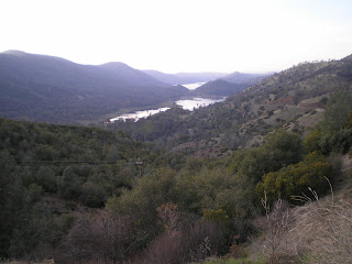
This view is of the northeastern arm of Don Pedro Reservoir and Mocasin Creek.

Houseboats on Don Pedro taken from near a boat ramp below the Mocasin Point RV Campground.

RIP Jacksonville, CA! When the New Don Pedro Dam was built the enlarged reservoir buried Jacksonville under c70 feet of water, a fate suffered by several other Mother Load gold-mining towns.
Sunday's Route: Mocasin Pt RV CG - Chinese Camp - Red Hills - Waterford - Turlock - Los Banos - Hollister
--
Monday's Route: Hollister - Watsonville - Santa Cruz
No comments:
Post a Comment