Pagosa Springs Library, Colorado
[Due to a health problem I spent 3 days in the Albuquerque VA Medical Center; will have more to say about it in a separate post, now one-half complete, to this blog.]

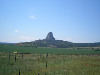
As one approaches Devils Tower from the south on WY24 & WY110 there are very few places to take a photo of tower until you are very close. But the woman who managed the campground said there were much better spots when one approached the tower from Hulett to the north-east. [These photos were taken on 26 & 27 July.]

Colonel Richard Dodge, who, like Lt Col George Custer, was leading an expedition to investigate reports of gold discovery in the Black Hills, named this monolith Devils Tower while Indian tribes had several names for it, among which was Bear Lodge.

It easy to see why plains Indians felt Devils Tower was unique -- mainly because it stands out in the flat lands of Wyoming, Montana, and South Dakota.

The first view from WY24 when approaching from the south.
When Theodore ["Don't call me Teddy!"] Roosevelt made Devils Tower the first National Monument, Wyoming had two important firsts: 1)the world's 1st National Park & 2)the world's first National Monument.

Scientists initially felt Devils Tower was the core of a former volcano; but new research indicates that it was an igneous intrusion [of magma] between layers of sedimentary rock. This view is from the Belle Fourche Campground, which is located in a U-shaped area next to the Belle Fourche River.

There's a prairie-dog colony in field between the road and the ampitheater/campground. [Click once to enlarge; press ESC to return here.]

The brochure says not to feed the "dogs" since they bite; however, most run for their holes if you get within 75 feet of them.

Now you have some idea why cattlemen don't particularly like prairie-dogs.

A view from the north-west of Devils Tower from Joyner Ridge Road.

Zooming in....
Here are some numbers on Devils Tower. "It rises 867 feet from its base and stands 1,267 feet above the river and 5,112 ft above sea level. The area of its tear-drop-shaped top is 1.5 acres and the diameter of its base is c1000 ft."

Another view of DT while driving back to the campground, which is to the right of the monolith.

One final look at Devils Tower as seen from the road from Hulett.
Links:
- National Park Service web pages on Devils Tower
- Wikipedia article on Devils Tower
- Trip Advisor Photos of Devils Tower
Return to Top of Page
M 16 Sep Actual Route: Broadway Blvd Walmart - Dollar Tree Erna Fergusson Br Lib - Cedar Ridge - Moriarty Lib - Moriarty Trk Stp
T 17 Sep Actual Route: Moriarty Trk Stp - Moriarty Lib - Santa Rosa McDs - Santa Rosa Trk Stp
W 18 Sep Actual Route: Santa Rosa Trk Stp - Santa Rosa McDs - Tucumcari McDs - Tucumcari Lib - Tucumcari Trk Stp
Th 19 Sep Actual Route: Tucumcari Trk Stp - Tucumcari Lib - Dalhart, TX - US54 Picnic Area
F 20 Sep Actual Route: US54 Picnic Area - Stratford Lib - Guymon, OK, Lib - Corral Driv-In RV Park
Sa 21 Sep Actual Route: Corral RV Pk - Liberal, KS, McDs - Lib - P.O. - Walmart
Su 22 Sep Actual Route: Liberal Walmart - McDs - Meade - Dodge City W/M
M 23 Sep Actual Route: Dodge City W/M - P.O. - Lib - State Farm Agent - John's Body Shop - Walmart
T 24 Sep Actual Route: Dodge City W/M - John's Body Shop - DC Lib - Bucklin Lib - Sitka bd
W 25 Sep Actual Route: Sitka, KS bd - Buffalo, OK - Woodward McDs - P.O. - Lib - Walmart
Finding Campgrounds:
- RV Campgrounds from TrailerLifeDirectory.com
- Family Camping Directories from Woodalls.com
- Free campsites website
- Info on finding BLM Campgrounds

No comments:
Post a Comment