Showing posts with label Moab. Show all posts

Thursday, April 10, 2014

Arches National Park, Utah

Arches National Park, Utah

San Pedro Library, Albuquerque, NM
26 Apr 2014: Some State High Points now contains the high points for TX & AZ


    A view of the snow-capped La Sal Mountains not too far from the Park Avenue Viewpoint/Trailhead.


    Looking up up the Park Ave trail. The vertical slabs to the right are know as fins.


    Estrada sandstone which has been eroded away to leave nature's version of city skyscrapers. The fins are the first step in forming arches.


    A look "down Park Ave." That is, a look at the Park Ave Trail, which is a one-way shortcut of about a mile.


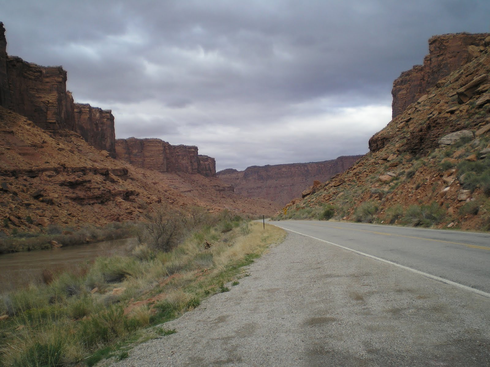
    A view down the road toward Courthouse Towers.


    But first a photo of the Petrified Dunes.


    The Organ -- not too far from the Courthouse Towers.


    While this may not be the formation called Balanced Rock, it does show a capstone somewhat precariously perched atop a skinny pillar.


    "Will the real Balanced Rock please stand up."


    At last...some arches. Actually there were more to my back, but there were also a lot of people and their vehicles.


    The fins look almost like castles in the distance.


    Perhaps the most photographed arch in the park: the Delicate Arch from about a mile to the south.


    The plaque explains that the Delicate Arch is 45 ft wide and 33 ft high. It's one of the photos on the page for Utah in my Rand-McNalley Road Atlas.


    More photos through the links below.


[Return to the top of the page]
Links:
Routes:

F 2 May Actual Route: Wyoming Blvd W/M - Peytroglyph NM - Taylor Ranch Br Lib - High Desert RV Pk

Sa 3 May Actual Route: High Desert RV Pk - Peytroglyph NM - Taylor Ranch Br Lib - Radio Shack - Family Dollar - Wyoming Blvd W/M

Su 4 May Actual Route: Wyoming Blvd W/M - Juan Tabo Br Lib - Best Buy - San Pedro Br Lib - Wyoming Blvd W/M

M 5 May Actual Route: Wyoming Blvd W/M - Erna Ferusson Br Lib - San Pedro Br Lib - Belden W/M

T 6 May Actual Route: Belden W/M - Belden Lib - Salinas Pueblo (Abo) Mission - Mountainair - Manzano Mtns SP

W 7 May Actual Route: Manzano Mtns SP - Mountainair Lib - Salinas Pueblo (Quarai) Msn - Salinas (Gran Quiviria) Msn - Carrizozo - Socorro W/M

Th 8 May Actual Route: Socorro W/M - Old San Miguel Msn - Truth or Consequences - Las Cruces W/M

F 9 May Actual Route: Las Cruces W/M - Memorial Medical Ctr - Truth or Consequences W/M

Sa 10 May Actual Route: Truth or Consequences W/M - Ralph Edwards Civic Ctr - Socorro W/M

Sa 10 May Actual Route: Truth or Consequences W/M - Ralph Edwards Civic Ctr - Socorro W/M

Su 11 May Route: Socorro W/M - Lib - ABQ San Pedro Br Lib - Wyoming Blvd W/M


Finding Campgrounds:

N.B. I receive nothing from Trailer Life, Woodalls, or FreeCampsites.net for including links to their free campground lookups.

Tuesday, April 3, 2012

Up the Colorado River

Green River Library*, Utah


    Along Utah Highway 128, which runs from Moab north-east toward I-70.


    Cliffs on the other side of the Colorado River, which always seems to be muddy; presumably, if one goes far enough upstream, he'll find clear water.


    Rushed this sloped shot a bit since there were a lot of 4x4 vehicles on the road. Apparently this happens every year during the Easter holidays.


    There is apparently a rock outcropping called Fisher Tower to my left, but the road looked a bit too "funky" for me to drive up it -- especially after rain and snow.


    Panning to the left, one can see the early-morning snow on the higher mesas in the distance.


    Don't know if using Paint Shop Pro to lighten up the darker colors would improve this shot or not.


    Bad place to be during an earthquake.


    The canyon walls seemed to be getting shorter as I traveled up the Colorado.


    Forget the name of the bridge, but once the road crossed to the NW shore, the country opened up. Only problem? Range cattle -- who might run across the road in front of you.


    Using the camper as a windshield from the north wind I tried to capture the [wind-worn?] mesas to the northeast.


    Normally a storm clears from the southwest, but the clouds remain over the mountains there, and blue sky is appearing to the north. The hills to the north are on the far side of I-70.


    The broad valley to the north through which both I-70 and the railroad run.


    Mountains [La Sal?] to the south of Moab with fresh snow.
--
Links:

--
    * Green River Library. Though small, the Green River Library has a fairly fast WiFi along with five work stations. The librarians, Cheri and Jolene, are willing to answer any questions you have.
    Location: 85 S. Long St., which is on the left as you drive west. (It's on the same street as the Sheriff's Dept Office.)
    Hours: Monday-Friday: 9:30 to 5:30.
--

M 2 Apr Actual Route: Lone Mesa BLM CG - Moab - near Cisco

T 3 Apr Actual Route: near Cisco - Thompson Sprs - Green River - Green River State Park

W 4 Apr Actual Route: Green River SP - Hanksville - near Hanksville bd

Th 5 Apr Actual Route: near Hanksville bd - Capitol Reef Natl Park - Torrey - Wonderland RV Park

--

Finding Campgrounds:

N.B. I receive nothing from Trailer Life, Woodalls, or FreeCampsites.net for including links to their free campground lookups.