Wednesday, May 20, 2015

Flood Waters

Flood Waters Sevierville, TN, Library


    Each time I checked the weather forecast for Texarkana, AR, there were Flood Watches or Flood Warnings along with the forecast because of flooding on the Red River. But finally I decided to head east, crossing into Arkansas on 8 Jun 2015, which is when these photos were taken.


    When I crossed the Red River my camera was still in my camper and I missed a chance to take photos of a business near the Red River bridge where the water was between the tops of the windows and the roof.

    But when I crossed the Ouachita River I used the next extra lanes near a wildlife refuge to retrieve my camera from my camper. I drove back to the bridge and took some photos while driving and a few others while there was no traffic and I was able to stop at the top of the bridge.


    The flooding is most clear in this photo, which I'm guessing was taken from the crest of the bridge.


[Return to the top of the page]
Links:
  • Felsenthal National Wildlife Refuge website


  • Routes:

    Su 21 Jun Actual Route: Hendersonville W/M - Hm Depot -Big Lots - Walmart

    M 22 Jun Actual Route: Hendersonville W/M - Four Seasons Ford - Waynesville W/M

    T 23 Jun Actual Route: Waynesville W/M - Ashville, NC, VA Hosp - Blue Ridge Parkway - Marshall, NC, W/M

    W 24 Jun Actual Route: Marshall, NC, W/M - Ashville - Blue Ridge Parkway - Waynesville W/M

    Th 25 Jun Actual Route: Waynesville W/M - Lowe's - Gt Smoky Mtns NP, Pigeon Forge, TN, W/M - Gt Smoky Mtns NP

    F 26 Jun Actual Route: Gt Smoky Mtns NP - Pigeon Forge, TN, W/M - Sevierville Lib - Walmart

    Sa 27 Jun Actual Route: Sevierville, TN, W/M - Lib - Walmart

    Su 28 Jun Actual Route: Sevierville, TN, W/M - Lib - Greeneville, TN, W/M

    M 29 Jun Actual Route: Greeneville, TN, W/M - Lowe's - Johnson City, TN, VA Med Ctr - Lowe's - Johnson City W/M

    T 30 Jun Route: Johnson City, TN, W/M - Lowe's - Johnson City, TN, Bristol, TN - Bristol, VA, Lib - Bristol, VA, W/M


Finding Campgrounds:

N.B. I receive nothing from Trailer Life, Woodalls, or FreeCampsites.net for including links to their free campground lookups.

Friday, May 15, 2015

Return to San Angelo, Texas

Return to San Angelo, Texas San Angelo, TX, Library


    On 14 May in Cocoa, Florida, I exchanged an empty propane tank for a full one at the Cocoa Walmart; after switching the tanks around I concluded that the propane system was NOP [Non-OPerational]. A sheriff deputy drove up as I was walking back to my camper; he told me where an RV park was located; I initially felt those who ran the park would know of a reliable RV repairman.
    By morning I had concluded that since the stove & fridge are the two most important parts of the camper it would be prudent (but expensive) to return to San Angelo where I trusted an RV repairman who had done previous work on my rig.
    Because I did not stop to take photos I've used links to photos others have taken in this post.
    Cocoa Beach Photo Gallery
--
    Though Orlando is only a short distance from Cocoa a heavy thunderstorm slowed the trip. And, like most of Florida, there are numerous toll roads. Indeed, Florida State Route 55 (which may also be known as Colonial Road) was being upgraded along most of its 15-20 miles through the city, which slowed the heavy traffic even more. (What better reason to to switch to a toll road -- though I did not.)
    Inside Florida Photos of Orlando & Vicinity
--
    After spending a night at an I-75 Rest Area near Ocala I opted to move west to US Highway 441 in hopes that there would be less traffic. There was less traffic; and the music on the local radio stations confirmed that not all seniors are living in the Miami Metroplex Area.
    Ocala Photos
--
    I returned to Monticello again (see first link below) and crossed into Georgia. At Cuthbert, GA, I also returned to US Hwy 82, which I had used in Nov 1961 to drive from Amarillo, TX, into Georgia. A heavy thunderstorm in Montgomery forced me to eat in a McDonalds [which delighted my siblings, who want me to "pork out."]
    Trip Advisor Photos for Montgomery starting with the Capitol Building.
--
    Most of the tourists in Selma were African-Americans who likely were visiting sites key to the Civil Rights Movement, starting with the March to Selma led by Martin Luther King, Jr.
    The Mississippi I-20 Rest Area at the eastern border of the state was one of the best state rest areas I've seen or used.
    Natchez Trace Travel Photos of Vicksburg, MS
--
    Eschewing the interstates again I followed TX55 to the southwest. For some reason the name Corsicana seemed familiar. As I was driving to the Walmart I passed the downtown store of the Collins Street Bakery.
    Our maternal grandmother used to send us their Deluxe Fruitcakes every year for many years. Yes, I know fruitcakes are known for their longevity; however, with seven of us, they never seemed to last that long. [See links below.]
    City of Corsicana, TX, Photo Gallery
--
    I thought about Whacko Waco as I drove through that city; but since I didn't bring a sidearm with me I skipped looking for biker bars and kept moving. While I thought I knew where both the library and Walmart were in Brownwood, I was mistaken.
    Fortunately, when I got to Ballinger there was a Walmart, for my left eye was sore from the amount of driving I had done. The 36-mile the next day to San Angelo was a "piece of cake."
    The two San Angelo RV Repair services I've used are in the links below.
        San Angelo, TX, Photos by Trip Advisor
[Return to the top of the page]
Links:
  • 15 Apr 15 Monticello post
  • Corsicana's Collins St Bakery
  • West Texas RV Repair/Freudiger RV Service; Contact Justin Salinas
  • American Truck & RV website

  • Cocoa, FL to San Angelo, TX, Routes:

    F 15 May Actual Route: Cocoa W/M - Orlando - Lady Lake W/M

    Sa 16 May Actual Route: Lady Lake W/M - Williston McDs - Perry W/M - I-10 Rest Area

    Su 17 May Actual Route: I-10 Rest Area - Monticello, FL - Thomasville,GA,- Albany - Eufala, AL, - Montgomery W/M

    M 18 May Actual Route: Montgomery W/M - Selma - Demopolis - I-20 - Mississippi Rest Area

    T 19 May Actual Route: Miss Rest Area - Meridian - Jackson - Vicksburg - Monroe, LA

    W 20 May Actual Route: Monroe, LA, W/M - Shreveport, LA - Tyler, TX - Corsicana W/M

    Th 21 May Actual Route: Corsicana, TX, W/M - Fairfield - Mexia - Waco - Brownwood - Ballinger, TX, W/M

    F 22 May Actual Route: Ballinger, TX, W/M - San Angelo - WTX RV Rpr


    Routes:

    W 17 Jun Actual Route: ??

    Th 18 Jun Actual Route: Greenwood, SC, W/M - Calhoun Falls - Anderson - Greenville, SC, W/M

    F 19 Jun Actual Route: Greenville, SC, W/M - Easley - Perkins - Sassafras Mtn - Brevard, NC, - Hendersonville Big Lots

    Sa 20 Jun Actual Route: Hendersonville Big Lots - Lowe's - Four Seasons Ford - Mud Crk Baptist Church - Walmart

    Su 21 Jun Actual Route: Hendersonville W/M - Hm Depot -Big Lots - Walmart

    M 22 Jun Actual Route: Hendersonville W/M - Four Seasons Ford - Waynesville W/M

    T 23 Jun Actual Route: Waynesville W/M - Ashville, NC, VA Hosp - Blue Ridge Parkway - Marshall, NC, W/M

    W 24 Jun Actual Route: Marshall, NC, W/M - Ashville - Blue Ridge Parkway - Waynesville W/M

    Th 25 Jun Actual Route: Waynesville W/M - Lowe's - Gt Smoky Mtns NP, Pigeon Forge, TN, W/M - Gt Smoky Mtns NP

    F 26 Jun Actual Route: Gt Smoky Mtns NP - Pigeon Forge, TN, W/M - Sevierville Lib - Walmart

    Sa 27 Jun Route: Sevierville, TN, W/M - Lib - Walmart


    Finding Campgrounds:

    N.B. I receive nothing from Trailer Life, Woodalls, or FreeCampsites.net for including links to their free campground lookups.

Sunday, May 10, 2015

Key Largo, Florida

Key Largo, Florida San Angelo, TX, Library


    On the 8th of May with a full gas tank I decided to make a day trip to and from Key West. However, an increasingly sore left eye caused me to revise my plans, particularly after I saw the Key Largo Library in a shopping center on the island. [Photos taken 8 May 2015]


    Though I likely did not find the marina one of the librarians recommended for some photos (as you can see space is at a premium -- both for boats and cars) this is typical of what you'll see on Key Largo.


    One final quick shot along this basin or marina confirms what I had noticed while looking for a parking spot: many people live on their boats.
    For photos taken by others see the Links immediately below.


[Return to the top of the page]
Links:

Routes:

M 25 May Actual Route: Sherwood Way W/M - Visitor Ctr - Dollar Tree - Big Lots Sherwood Way W/M

T 26 May Actual Route: Sherwood Way W/M - Am Truck & RV [Rpr] - Lib - Visitor Ctr - Sherwood Way W/M

W 27 May Actual Route: Sherwood Way W/M - Lib - Visitor Ctr - Sherwood Way W/M

Th 28 May Actual Route: Sherwood Way W/M - Am Truck & RV - VA Clinic - Lib Visitor Ctr - Sherwood Way W/M

F 29 May Actual Route: Sherwood Way W/M - Wash Pot - Visitor Ctr - Lib - Sherwood Way W/M

Sa 30 May Actual Route: Sherwood Way W/M - Lib - Visitor Ctr - Lib - Dollar Tree - Sherwood Way W/M

Su 31 May Actual Route: Sherwood Way W/M - Visitor Ctr - Sherwood Way W/M

M 1 Jun Actual Route: Sherwood Way W/M - Lib - San Angelo State Park

T 2 Jun Actual Route: San Angelo State Park - Lib - Visitor Ctr - Sherwood Way W/M

W 3 Jun Route: Sherwood Way W/M - Lib - Visitor Ctr - Sherwood Way W/M


Finding Campgrounds:

N.B. I receive nothing from Trailer Life, Woodalls, or FreeCampsites.net for including links to their free campground lookups.

Thursday, April 30, 2015

Driving Across the Everglades

Driving Across the Everglades San Angelo, TX, Library

    There are two routes across the Everglades. The northernmost, which is a toll-road extension of I-75 and is also know as "Alligator Alley." The southernmost, which is a continuation of US41, the main highway south along the western coast of Florida, runs from Naples to the Miami Metropolitan Area. I chose the latter hoping to get better photos than from Alligator Alley. [Photos taken 6 May 2015]


    I thought I saw some fish; so I took another photo. A school of about 10 brownish fish is barely visible to the lower left of the reflected cloud just above the top of the white tules on this side of the canal or waterway.


    There aren't a lot of trees in the everglades, but here's a shot taken farther along US41 which does include a small tree.
    But the everglades are the only place where you'll see panther or crocodile crossings!!


    Here's all that's left of Monroe Junction; it apparently didn't keep pace with other similar enterprises which drew tourists to see their live alligator(s).


[Return to the top of the page]
Links:

Routes:

Su 17 May Actual Route: I-10 Rest Area - Monticello, FL - Thomasville,GA,- Albany - Eufala, AL, - Montgomery W/M

M 18 May Actual Route: Montgomery W/M - Selma - Demopolis - I-20 - Mississippi Rest Area

T 19 May Actual Route: Miss Rest Area - Meridian - Jackson - Vicksburg - Monroe, LA

W 20 May Actual Route: Monroe, LA, W/M - Shreveport, LA - Tyler, TX - Corsicana W/M

Th 21 May Actual Route: Corsicana, TX, W/M - Fairfield - Mexia - Waco - Brownwood - Ballinger, TX, W/M

F 22 May Actual Route: Balliner, TX, W/M - San Angelo - WTX RV Rpr

Sa 23 May Actual Route: WTX RV Rpr - Sherwood Way W/M - Visitor Ctr Sherwood Way W/M

Su 24 May Actual Route: Sherwood Way W/M - Visitor Ctr - Sherwood Way W/M

M 25 May Actual Route: Sherwood Way W/M - Visitor Ctr - Dollar Tree - Big Lots Sherwood Way W/M

T 26 May Route: Sherwood Way W/M - W TX RV Rpr - Lib - Visitor Ctr - Sherwood Way W/M


Finding Campgrounds:

N.B. I receive nothing from Trailer Life, Woodalls, or FreeCampsites.net for including links to their free campground lookups.

Saturday, April 25, 2015

Florida's West Coast

Florida's West Coast Naranja, FL, Library

    Because of its heavier population the east coast of Florida seems to receive the most publicity. However, parts of the west coast are just as scenic.


    I stopped for lunch in my camper near Palmetto at a Manatee County Park. Although I did drive north on US41 during the Christmas holidays in 1961 while on a three-day pass, I'm certain the multi-story buildings were not there then.


    Panning right, there are a few more high-rise buildings on the coast.


    Panning right again, there don't appear to be more beach-front condos. However, I did see a sign as I left the parking area for the baseball diamond which spoke of yet another high-rise. Though it's unlikely it would be built this far from the beach, that was the impression I got.


    At Port Charlotte I made a spur-of-the-moment trip to the water's edge even though there wasn't much room to park. It's unclear whether the property owner has to maintain the vegetation from his property to the water. As you can see, some of those areas are quite large.


    Panning right...


    Panning right again I discovered afterward that the earth might have tilted. [:-)>]


    A final shot of the Port Charlotte Bay.


    Fort Myers offered a scenic view as US41 ran along one of its beaches.


    Panning right includes some picturesque clouds.


    More clouds.


    One final look from a Fort Myers beach. If you're plush, my guess is that the high-rises are hotels; and if your wallet is as thin as mine, you can always have a picnic lunch at one of the tables in the foreground when the weather is good.


[Return to the top of the page]
Links:

Routes:

F 15 May Actual Route: Cocoa W/M - Orlando - Lady Lake W/M

Sa 16 May Actual Route: Lady Lake W/M - Williston McDs - Perry W/M - I-10 Rest Area

Su 17 May Actual Route: I-10 Rest Area - Monticello, FL - Thomasville,GA,- Albany - Eufala, AL, - Montgomery W/M

M 18 May Actual Route: Montgomery W/M - Selma - Demopolis - I-20 - Mississippi Rest Area

T 19 May Actual Route: Miss Rest Area - Meridian - Jackson - Vicksburg - Monroe, LA

W 20 May Actual Route: Monroe, LA, W/M - Shreveport, LA - Tyler, TX - Corsicana W/M

Th 21 May Actual Route: Corsicana, TX, W/M - Fairfield - Mexia - Waco - Brownwood - Ballinger, TX, W/M

F 22 May Actual Route: Ballinger, TX, W/M - San Angelo - WTX RV Rpr

Sa 23 May Actual Route: WTX RV Rpr - Sherwood Way W/M - Visitor Ctr - Sherwood Way W/M

Su 24 May Actual Route: Sherwood Way W/M - Visitor Ctr - Sherwood Way W/M

Su 25 May Route: Sherwood Way W/M - Visitor Ctr - Sherwood Way W/M


Finding Campgrounds:

N.B. I receive nothing from Trailer Life, Woodalls, or FreeCampsites.net for including links to their free campground lookups.

Wednesday, April 15, 2015

Jefferson's Monticello

Jefferson's Monticello North Port, FL, Library

    The title of this post is deliberately misleading; that is, the post is not about Jefferson's estate in Virginia but rather about Monticello, the county seat of Jefferson County on the northern border of Florida.
    I was particularly impressed by not only the newer houses in and around Monticello were but also by how well-kept the older houses were. In other words, I saw no lawns with every vehicle the owner ever owned and used. [I'm sure a neighbor would have said, "John, parking your tractor and old Dodge Dart there looks so schlock.]


    Here's the Jefferson County Court House as seen from the east.


    Directly across the street from where I took the above photo was Farmers & Merchants Bank.


[Return to the top of the page]
Links:

Routes:

Su 26 Apr Actual Route: Quincy W/M - Tallahassee W/M - I-10 Rest Area

M 27 Apr Actual Route: I-10 Rest Area - Live Oak Lib - P.O. - Walmart

T 28 Apr Actual Route: Live Oak Walmart - Lowe's - Live Oak W/M

W 29 Apr Actual Route: Live Oak Walmart - Lowe's - Gainesville, FL, VA Hosp - Walmart

Th 30 Apr Actual Route: Live Oak Walmart - VA Hosp - Ocala I-75 Rest Area

F 1 May Actual Route: Ocala I-75 Rest Area - Inverness Lib - Floral City Lib - Lutz Walmart

Sa 2 May Actual Route: Lutz W/M - Lutz Br Lib - Walmart

Su 3 May Actual Route: Lutz W/M - Lutz Br Lib - Tampa - North Port Walmart

M 4 May Actual Route: North Port W/M - North Port Br Lib - Tampa - North Port W/M

T 5 May Actual Route: North Port W/M - Port Charlotte - Fort Myers - Naples W/M

W 6 May Actual Route: Naples W/M - Monroe Jcn - Homestead - Florida City W/M - Hm Depot


Finding Campgrounds:

N.B. I receive nothing from Trailer Life, Woodalls, or FreeCampsites.net for including links to their free campground lookups.

Tuesday, March 31, 2015

Newly Updated State High Points

Newly Updated State High Points

Quincy Library, Florida

    Some of you may laugh when I tell you that my new state high point is here in Florida; the perception is that the state is as "flat as the proverbial pancake." But when I and two other Signal Corps Lieutenants signed out for a three-day pass during the Christmas holidays in 1961 it was clear on the third day that the stretch from Tampa/Saint Petersburg to Gainesville was slightly uphill.

    [As an aside, the two memorable things about the three-day trip are both associated with 17; that is, regular gasoline was 17.9 cents/gallon and, even better, a one-pound bag of tangerines only cost 17 cents. Don't know if any of the many seeds we spit out of the windows ever germinated, but we tried to expand the tangerine crop!]


    The sign in front of the small, but well-kept park reads "Lakewood Park, Walton County, Florida's Highest Point 345 Feet."


    Another sign within the park states that Lakewood Park is funded by the Walton County Board of Commissioners and the Florida Recreation Development Assistance [Agency]."


    While the two photos immediately above of Britton Hill (aka Lakewood Park) don't look like a hilltop, here's a photo looking to the left in front of the park. Note that the road drops from view (since it's downhill in virtually every direction).

In case you're driving a Class-A RV or large 5th Wheeler I suggest U park your rig in Paxton and use your toad; as I was heading back to Paxton a garbage truck appeared; both it and my F250 had their rt wheels on the grass shoulders as we passed each other.


    One of my goals during my travels has been to take photos of the highest peaks in each state I visit; what follows are the High Points in most of the western states as well as Texas and the Rocky Mtn states north to the Canadian border. The previous post of State High Points was on 20 Sep 2014; it's the bottom link below. Since that post I got as far north as Fargo, ND, before heading south through parts of the Mid-West and South-East.

    OOPS!! Forgot the drive I made to to Kenton, OK, near Black Mesa, Oklahoma's high point; it's the 5th photo in Link# 12 below.


    North Dakota's White Butte (3,506') roughly 30 miles north of Bowman in the SW corner of the state. See Link # 9 below.


    Since my backpacking days are over here's a link to the Wikipedia article on Eagle Mountain (2,301') in Minnesota.


    Since there was no sign pointed toward the clump of trees just inside the Iowa border I wasn't certain I had a photo of Hawkeye Point (1,671'); but a woman at the Magazine Mtn Ranger Station in Arkansas had a book which had the same barn or silo you see in this photo. See Link #10 below.


    Looking north from the top of Taum Sauk Mountain (1,772') in Missouri's St. Francois Mtns toward St. Louis; Cape Girardeau on the Mississippi is to the south-east. See Link #11 below.


    Arkansas' Magazine Mountain (2,753') complete with sign and a rock replica of the state. See my previous post on Magazine Mountain here.


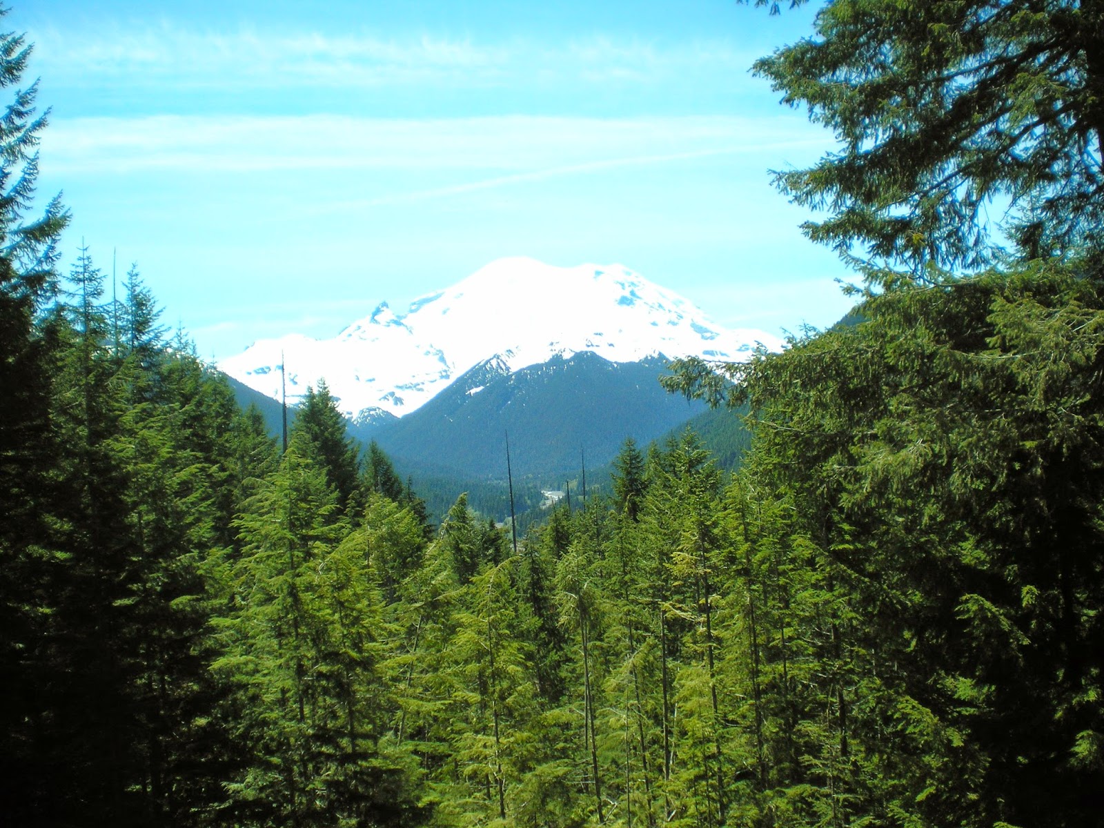
    A view of Washington's Mt. Rainier (14,414') taken on 12 Jun 2012.
    Natl Park Service website.


    The highest peak in Oregon is Mt. Hood at 11,249'; I have no photo of it yet; see the 1st link below.


    California's Mt Whitney (14,494') as seen from Inyo County's Portagee Joe Campground. For more info see the 2d entry in the Links below; it has an excellent photo on a National Park Service page called "Climbing Mt. Whtiney."


    Nevada's Boundary Peak (13,147') as seen from US Hwy 6 not too far from Montgomery Pass.


    More info.


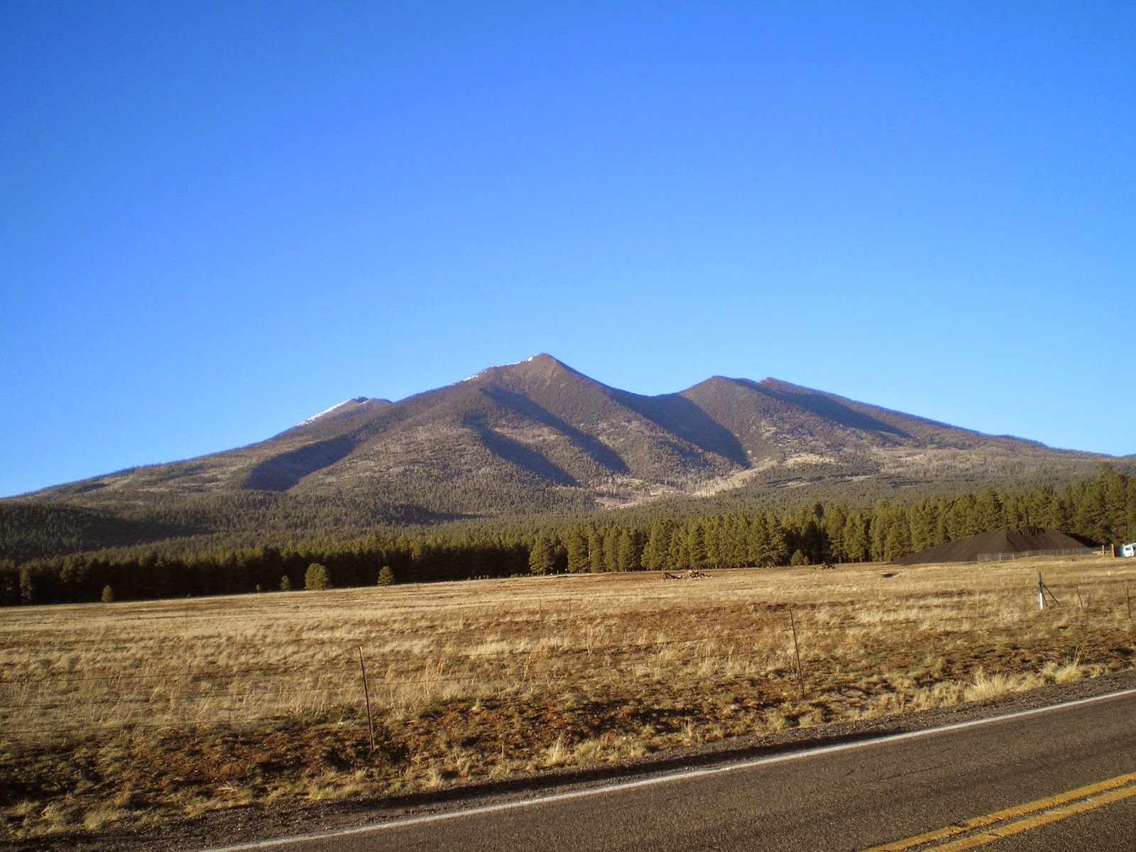
    Arizona's Humphrey's Peak (12,637') in the San Francisco Mtns just north of Flagstaff.
    See the 3d link below for more info.


    New Mexico's Wheeler Peak (13,159') to the north-east of Taos.

    More info.


    I drove around the Ashley Natl Forest hoping for a clear view of Utah's Kings Peak (13,534'), but there was never a clear shot until I was back on the nearest highway. See the 4th link below for a good photo.


    See 5th link below for a photo of Idaho's Borah Peak (12,662 or 12,668')


    See the 6th link below for a photo of Colorado's Mt Elbert (14,440')


    And Wyoming's Gannett Peak (13,809') is the 7th link below.


    Montana's Granite Peak (12,807') as seen from the Beartooth Highway.

    More info.


    Guadalupe Mtn (8,751'), TX, in Guadalupe Mtns Natl Park.


More info


    While reading my 2008 World Almanac I noted Mt Harney, the highest point in South Dakota and realized I had a photo of it taken after I visited Mt. Rushmore. See Link #8 below for more info.


[Return to the top of the page]
Links:
  1. Wikipedia article on Mt. Hood, OR
  2. Climbing Mt. Whitney
  3. Wikipedia article on Arizona's Humphrey's Peak
  4. Wikipedia article Utah's Kings Peak
  5. Wikipedia article on Idaho's Borah Peak
  6. Wikipedia article on Colorado's Mt Elbert
  7. Wikipedia article on Wyoming's Gannett Peak
  8. Wikipedia article on South Dakota's Harney Peak
  9. Wikipedia article on North Dakota's White Butte
  10. Wikipedia article on Hawkeye Point
  11. Wikipedia article on Taum Sauk Mountain
  12. My Clayton Lake, NM, to Black Mesa, OK, post on 14 May 2013; 5th photo is of Black Mesa
  13. Wikipedia list of states by elevation
  14. 20 Sep 2014 post titled Updated State High Points

Routes:

M 27 Apr Actual Route: I-10 Rest Area - Live Oak Lib - P.O. - Walmart

T 28 Apr Actual Route: Live Oak Walmart - Lowe's - Live Oak W/M

W 29 Apr Actual Route: Live Oak Walmart - Lowe's - Gainesville, FL, VA Hosp - Walmart

Th 30 Apr Actual Route: Live Oak Walmart - VA Hosp - Ocala I-75 Rest Area

F 1 May Actual Route: Ocala I-75 Rest Area - Inverness Lib - Floral City Lib - Lutz Walmart

Sa 2 May Actual Route: Lutz W/M - Lutz Br Lib - Walmart

Su 3 May Actual Route: Lutz W/M - Lutz Br Lib - Sarasota Walmart

M 4 May Actual Route: Sarasota W/M - North Port, FL, W/M

T 5 May Actual Route: North Port W/M - North Port Br Lib - Punta Gorda Lib - Naples W/M

W 6 May Actual Route: Naples W/M - Naples McDs - Monroe Jcn - Homestead Hm Depot

Th 7 May Route: Homestead Hm Depot - MurphyUSA Gas - Key Largo - Homestead


Finding Campgrounds:

N.B. I receive nothing from Trailer Life, Woodalls, or FreeCampsites.net for including links to their free campground lookups.