I had planned to drive over the Diablo Range to Mercey Hot Springs, but as their web site makes clear [see Links below] the signs on I-5 are misleading. And to make matters worse, when traveling north there is no specific sign for Little Panoche Road -- just that it's the next exit -- which, if memory serves, was either Mees or Vees Road or Avenue.
Will perhaps drive to Mercey Hot Springs from Hollister on my way back to the Sierra foothills.
--
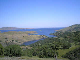
But it did give me a chance to take some photos of San Luis Reservoir, which is about as full as I've ever seen it since it was built. Granted, my trips by it were often during the summer or fall when water levels had been drawn down, but I'd guess that the reservoir is within 2% of full. The photo above was taken from the Dinosaur Point Access Road (which old-timers will remember used to be SR152 down the east side of Pacheco Pass before the reservoir was created).
More text to follow later.
--
Links:
- Mercey Springs web site
W 13 April Actual Route: Hollister - Santa Cruz - Pinto Lake RV CG
Th 14 April Actual Route: Pinto Lake - Mont VA Clinic - Salinas - Castroville - Pinto Lake
F 15 April Route: Santa Cruz - Hollister - Paicines - Mercey Hot Sprs


No comments:
Post a Comment