Sagebrush RV Park*, Willcox, AZ
In 1924 President Calvin Coolidge created Chiricahua National Monument, an area of southeast Arizona once inhabited by Chiricahua Apache Indians as well as some ranchers, miners and other settlers. Among the settlers were a Swedish couple, Neil and Emma Erickson, who homesteaded in Bonita Canyon in 1888. As one travels up the canyon there is increasing evidence of previous volcanic action in what the Apaches called "The Land of Standing Up Rocks."
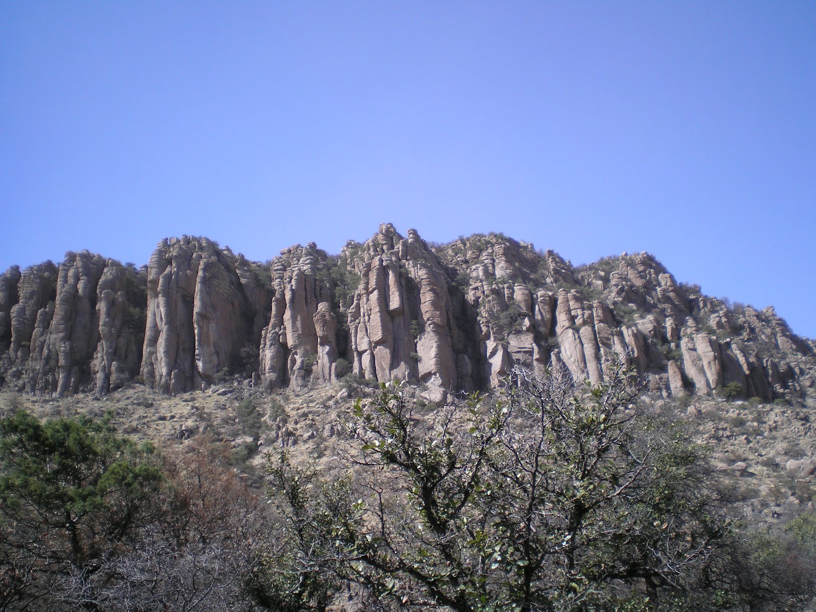
This first shot, taken from near the Bonita Canyon Campground, looks up at some of the "standing-up" rocks.

The rocks in the park started as ash from the Turkey Creek Volcano roughly 27 million years ago. The superheated ash particles melted together to form what is known as rhyolite. Over time the rocks were fractured and some were uplifted. Through the years, ice, and wind wore away the weaker portions leaving many spires, balanced rocks, and other shapes.

These rocks are called organ pipes. While they're somewhat like formations in Zion National Park in Utah their color is more like what you find in Pinnacles National Monument in California. [See links below.]

Might not be a good place to be driving during a strong earthquake!

Because of strong winds I decided not to wear my hat; it's clear I can no longer run fast enough to retrieve it during such windy weather. Hence, this photo was taken with my left hand shading the camera lens while shooting toward the sun. (I made a mental note to stop at this spot, called Sea Captain, on my way back down Bonita Canyon.)

While it's not that evident in this shot, a fire, Horseshoe 2, burned through the park in May and June of 2011. (The Visitor Center has extensive information on that fire, which, in most cases was allow to burn itself out; see also links below.)

I had hoped to get a view to the southeast, but blowing dust obscures most of the landscape outside of the park.

A photo of Sugarloaf Mountain from the Echo Canyon. While there is apparently a road to the top of Sugarloaf, I eschewed making the drive in order to eat lunch in my camper.

A view to the south, where snow still remains on the north side of most ridges even in sunny Arizona in early March.

Rock formations in what is called the Echo Canyon Grotto.

Panning left to the columns nearly on top of the ridge.

A plaque which you may or may not be able to enlarge by clicking on this photo once or twice. As you'll see in the next photo, the formation does indeed look like an indian. Since there are no photos of Cochise, who died of natural causes in 1876, it's difficult to tell how great the resemblance is.

Yes, it does look like the face of an indian lying on his back. And given the difficulties the U.S. Army had with him and his warriors in this part of Arizona, calling the rock formation Cochise Head seems appropriate.

A plaque explaining the fate of the Harris family in 1873 when they attempted to take a shortcut through Chiricahua territory. A daughter was discovered in Mexico with Apaches and led the U.S. Army to the site of her parents demise, where bones that could be found were buries and marked with a wooden gravemarker.

Harris Mountain is in the center of this shot; it appears to have a road to its top. Beyond it is San Simeon Valley.

On the way back down from Massai Point, which was named for a Chiricahua Apache who jumped off of a railroad train Missouri to avoid being taken to a reservation in Florida or Oklahoma, I noticed this rock formation in the waning sunlight.

An explanation of the process by which ash from a glowing cloud is deposited, congeals, & is weathered to create the unique rock formation at the park.

Ah Ha! This can only be the so-called China Boy.

A formation still in the sun.

Sea Captain -- which is more viewable without the sun directly above it.
--
*:Stayed three nights at Sagebrush RV Park (or Sagebrush Mobile Home & Rv Park). Level gravel sites, full hookups, and the best shower I've encountered in my 15 mos on the road -- two knobs instead of one. All of my life the showers I used in jr hi, hi school, college, the army, and at home had 2 knobs. Seem to have trouble with one-knobbers, either being scalded or hit in the tropic zone with a blast of cold water. Clean clubhouse with a laundry room, which I used. And the price is only $21/night. Use this link to reach their web site. The owner/manager will go out of his way to make your stay enjoyable.
Links:
- U.S. Park Service web pages on Pinnacles Natl Monument
- Wikipedia article on Chiricahua National Monument
- Park Service web pages on Chiricahua NM
- Principal U.S. Park Developers: The Civilian Conservation Corps
- Wikipedia article on the Civilian Conservation Corps
- Wikipedia article on Cochise
- Horseshoe 2 Fire; for a complete story read from the bottom to the top
W 7 Mar Actual Route: Whitewater Draw WMA - McNeal - Elfrida - Sunizona - Chiricahua Natl Monument
Th 8 Mar Actual Route: Chiricahua Natl Monument - Ft Bowie NM - Bowie - Willcox (Sagebrush RV Park)
F 9 Mar Actual Route: Willcox (Sagebrush RV Park)
Sa 10 Mar Actual Route: Willcox (Sagebrush RV Park)
Su 11 Mar Actual Route: Sagebrush RV Park - Roper Lake State Park
M 12 Mar Actual Route: Roper Lake State Park - Safford - Clinton - dry-camp 8 mi past Morenci
T 13 Mar Route: dry-camp 8 mi past Morenci - Hannagan Mdw - Alpine - Eagar - Bear Paw RV Park
--Finding Campgrounds:
- RV Campgrounds from TrailerLifeDirectory.com
- Family Camping Directories from Woodalls.com
- Free campsites website
No comments:
Post a Comment