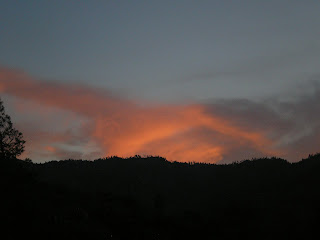
Troy Mdw CG, Kern Plateau, CA
[Links added to Monterey to Cambria to Paso Robles post immediately below.]

A late afternoon look down on the foothill valley where California Hot Springs is located. Parts of the same settlement have been around 100+ years while other parts appear relatively new.

Panning left, the hills appear somewhat dark -- which probably means they're oak-covered despite the ponderosa pine in the middle of this photo.

Zooming in just to the right of the pine tree, note several white buildings around a clump of large oak tree on a hilltop at 10 o'clock from the center of the photo.

From a switchback in the Parker Pass Rd a look to the SE; note possibly greener hills in the distance as well as a nearly-full moon over a ponderosa in the foreground.

A nearly-level stretch of the Parker Pass Rd. That's solid granite on the right rather than the sandstone I saw in the interiors of most western states.

Looking down into the canyon it's clear we're not past the upper elevation for oak trees. And the fir just to the left of the oak is perfect for those who have two Christmas Tree Top Ornaments! [My guess is that it's a red fir, but I'm not certain.]

Leaving the Parker Pass Rd and heading down past Johnsondale to the North Fork of the Kern River and Kernville, where I had an empty propane tank filled.

As you can see, numerous wildfires have wiped out all large trees, leaving the soil clear for such hardy species as manzanita.
Also, to the right of one of the few remaining ponderosas you can see the Sherman Pass Rd at it works its way to an eventual pass at 9200 feet.

Two notable rock outcroppings, which, when viewed from the Sherman Pass Rd are on opposite sides of the N.F. of the Kern River.

When I got down from my camper to head for the rest room at a Kern River CG I quickly turned and scrambled to find my camera; although it was a brighter orange a few minutes previously, this photo is probably the brightest sunset I've captured since an out-of-focus one at Clear Lake in 2011.
--
Links:
- Wikipedia article on California Hot Springs in Tulare County
- Wikipedia article on Kernville, CA
- Kernville Fish Hatchery on Kern River Fly Fishing Forum site
Su 23 Sep Actual Route: W Santa Cruz bd - StateWide Storage - Aptos Lib - Monterey - Big Sur - Kirk Crk USFS CG - Plaskett Crk USFS CG
M 24 Sep Actual Route: Plaskett Crk USFS CG - Gorda - Ragged Pt - San Simeon - Cambria Lib - San Simeon State Park CG
T 25 Sep Actual Route: San Simeon State Park CG - Cambria Lib - Paso Robles - Shandon Rest Area (CA46) - Blue Pt bd (CA41)
W 26 Sep Actual Route: Blue Pt bd (CA41) - I-5 (near Kettleman City) - Alpaugh - Colonel Allensworth State Park - Delano - California Hot Sprs - Sequoia N.F. bd
Th 27 Sep Actual Route: Sequoia N.F. bd - Johnsondale - Kernville - Fairview USFS CG
F 28 Sep Actual Route: Fairview USFS CG - Sherman Pass - Troy Mdws USFS CG
Sa 29 Sep Actual Route: Troy Mdws USFS CG
Su 30 Sep Actual Route: Troy Mdws USFS CG - Fish Crk CG - Kennedy Mdws - Olancha - Lone Pine - Portagee Joe Inyo County CG
M 1 Oct Actual Route: Portagee Joe Inyo County CG - Lone Pine - Independence - Big Pine - Big Pine Crk bd
T 2 Oct Actual Route: Big Pine Crk bd - Big Pine - Ancient Bristlecone Pine Forest - Grandview USFS CG
W 3 Oct Route: Grandview USFS CG - Big Pine - Bishop - Bishop Crk USFS CG --
--Finding Campgrounds:
- RV Campgrounds from TrailerLifeDirectory.com
- Family Camping Directories from Woodalls.com
- Free campsites website
- Info on finding BLM Campgrounds
No comments:
Post a Comment