Tuesday, November 5, 2013

Comanche County Courthouse, Texas

Comanche County Courthouse, Texas

San Angelo Library, TX

    In driving to Livingston, Texas, which is roughly 100 miles north of Houston, I noticed a sign in Brownwood stating that Comanche was c35 miles to the north-east. Since I had the time I made a detour to it and parked at the Comanche County Courthouse. I asked one of the women in the Clerk's [Clerk-Recorder in other states] Office if she could find a recording of the birth of my maternal grandmother, Mary Cordelia Shackelford.
    Two of the women looked, but, alas, they could find nothing. However, the older of the two got back on-line and visited the LDS site [FamilySearch.Org] and told me that in 1900 both my grandmother and her mother were in an adjacent county. I thanked her and told her I'd check it out when I got back to San Angelo, which is where both my grandmother and her mother grew up -- even though each was born elsewhere.


    As I left I took a couple of photos of the Comanche Courthouse. This first is the back entrance which I used to get to the Clerk's Office.


    And this is a view from the front where the trees didn't block out too much of the building.


    This final photo from the front lawn of the Comanche Courthouse is of a memorial to those who lost their lives during the Civil War fighting for the Confederate States of America.
    Because I could not think of any Civil War battle sites in Texas, I thought there must not have been many Texas casulties.
    The Wikipedia article (1st link below) indicates that were 140,414 Union combatants killed in action, and a total of of c365,000, including non-combatants, who died while 72,524 CSA combatants were killed in action, with c260,000 total dead.
    Historian John Huddleston estimates that during the War Between the States 10% of all Northern males 20-45 years of age were killed and 30% of all Southern white males 18-40 years of age died. The 2d link below for the 37th Texas Calvary indicates that "more than 70,000 Texans served in the Confederate army." Using Huddleston's percentage for CSA deaths yields 21,000.
    The National Park Service, which has made most Civil War battlefields National Historic Sites lists five such battlefields or battle areas in Texas in the 3d link below, the most important of which was the second battle of Sabine Pass. [N.B. a break in the offshore islands to a calmer route nearer the coast of Texas along the Gulf Coast is called a "pass."]
    Finally, when Gov. Sam Houston refused to pledge allegiance to the CSA, he was deposed as governor and replaced by the Lietenant Governor. Before he left for his home in Huntsville, TX, he said that the war would be costly both financially and in terms of human life. While the CSA might gain it freedom, he said, "I doubt it." [See the Texas State Historical Association piece just below (4th link).]


[Return to the top of the page]
Links:

Routes:

W 1 Jan - T 28 Jan Actual Route: Big Spr VA Hosp

W 29 Jan Actual Route: Big Spr VA Hosp - Texas Dept of Publ Safety (Driver Lisc Div) - Big Spr VA Hosp

Th 30 Jan - Su 2 Actual Feb Route: Big Spr VA Hosp

M 3 Actual Feb Route: Big Spr VA Hosp - Sterling City - San Angelo Lib - Sherwood Way W/M

T 4 Actual Feb Route: Sherwood Way W/M - San Angelo VA Clinic - San Angelo Lib - Sherwood Way W/M

W 5 Actual Feb Route: Sherwood Way W/M - Freudiger RV Services - San Angelo VA Clinic - San Angelo Lib - Sherwood Way W/M

Th 6 Feb Actual Route: Sherwood Way W/M - TX Dept Publ Safety - San Angelo Lib - GM Welding Supply - Sherwood Way W/M

F 7 Feb Actual Route: Sherwood Way W/M - Hm Depot Pk Lot - San Angelo VA Clinic - San Angelo Lib - Sherwood Way W/M

F 7 Feb Actual Route: Sherwood Way W/M - Hm Depot Pk Lot - San Angelo VA Clinic - San Angelo Lib - Sherwood Way W/M

Sa 8 Feb Route: Sherwood Way W/M - San Angelo Lib - O'Reilly Auto Parts - Sherwood Way W/M


Finding Campgrounds:

N.B. I receive nothing from Trailer Life, Woodalls, or FreeCampsites.net for including links to their free campground lookups.

Saturday, November 2, 2013

How I Find Free WiFi

How I Find Free WiFi

[Last Revised: 28 Feb 2014]

San Angelo Library, TX
    On Thanksgiving I decided to check some of the "Big Six" here in San Angelo to see how many left their WiFis running while they were closed. As I write this, only one, Home Depot turned their WiFi off while they were closed; and their WiFi is not yet operating as of M 2 Dec.
    Also, I finally found a map where all 12 of the Texas Visitor Centers are located; here's a link to a list of the Texas Visitor Centers.
    After spending Halloween Eve in Austin, Texas, during a couple of strong thunderstorms, I was reminded of another source of free WiFI: FedEx. While it's usually not as strong as any of the Big Four listed below, it has the advantage of numerous locations -- especially in big cities such as Austin.
    After hunkering down at a 7/11, eating a sandwich for dinner, and watching the run-off from the roof of the attached Chrvron gas station, I finally drove to the McDonalds further up Jollytime from the 7/11. However, because there was a Humana office also using AT&TWiFi, it was impossible to log on to Mcdonald's WiFi. When I stopped in at the 7/11 again, the previous clerk had been replaced. While we were talking, a woman who came in to buy some wine mentioned that Krispy Kreme Donuts had free WiFi.
    In driving up Jollytime I missed the Krispy Kreme, but found another McDonalds; however, I wasn't able to park near enough to log on due to the heavy business they were doing. As I drove around the shopping center I noticed a FedEx. A young fellow in San Antonio had told me that all of their offices have free WiFi. You generally need to be nearer their office than with those which follow in the next paragraph. I'm now adding FedEx to those with nationwide stores and changing the name I used in the next paragraph.

    Just found out yesterday that WiFi at Sam's Club is a permanent fixture expected to be in all of their outlets by the end of this month (Nov 2013). See Links below.

    Since libraries are most likely to have WiFi I often look up the website of the next county seat's library along my planned route. But if I neglect to do that, there are now six national chains from which either to look up a library or each other. Here are The Big Six.

  • McDonalds
  • Starbucks
  • HomeDepot
  • Lowe's
  • Sam's Club
  • FedEx

    While Lowe's has the strongest WiFi, mainly because that's needed to cover their large parking lots, I've listed McDonalds first since one often sees their billboards when approaching a new town or city.
    Also, you can sometimes see the "Golden Arches" in case you missed their billboard.

    While Starbucks parking lots are often crowded around noon and again in the evening and they usually have two handicapped parking spots in front of their stores, their WiFi is usually as strong as McD's, if not stronger.

    While I've used HomeDepot's WiFi the least of the four, their large buildings sometimes have parking alongside where one can avoid parking in the hot sun.
--
    Prior to some point in 2012 one could download a list of all of a state's McDonalds restaurants with WiFi by clicking on "Find WiFi Hotspots" on their homepage.
    Now, however, if one wants such a list, he has to "roll his own" by looking up restaurants with WiFi at the following link and then saving them to a text file.
....
McDonalds' Restaurant with Free WiFi
....

    While I've not made such lists for the other members of "The Big Four," I sometimes look them up ahead of time if I'm headed for a city which is large geographically.

--

    But there are substitutes for the Big Four which I'll call the "Big Four Subs." They include the following.
  • Visitor Information Centers
  • Some Grocery Store Chains
  • Senior Centers
  • Some Regional & National Restaurant Chains
  • Some Hotels & Motels

    I was told at Judge Roy Bean's Visitor Center in Langtry, Texas, that all of their Vistor Centers have WiFi. Colorado's Ft Collins Visitor/Info Center had a desktop one could use for 20-30 min but no WiFi for my laptop. Utah's Visitor Center at Dinosaur Rd and US40 had WiFi, but I only learned that by asking -- which is what I suggest you do when you stop at a Visitor Info Ctr in any state.

    Safeway is the dominant grocery store chain in California and on the west coast. Their stores built or remodeled in the last 6-7 years usually have WiFi -- especially if they have a Starbucks counter/kiosk in the store. Ditto for their Vons stores in Southern Calif. & Arizona.(It may be that Albertsons stores with Starbuck counters or kiosks also have WiFi.) Finally, only about 5% of Safeway/Vons' stores have 110v a.c.; if, like me your laptop battery is nearly comatose, you'll have to look elsewhere.

    The advantage of Senior Centers is that you're just as likely to find them in a small town as in a bigger city. For instance, I've used the Baggs Senior Ctr WiFi twice while they were closed. Of course, you may have to "come in through the back door" by logging onto their router, usually Linksys or NetGear. In both Grand Coulee, WA, & Kemmerer, CO, I didn't use their WiFi but asked them where the library was.

    While I have gotten on-line while parked outside a Wendys, Burger King, Dennys, Hardees, WhatABurger, & Golden Chick, I don't believe any of those have a policy of WiFi at every restaurant.

    The last two are chains in Texas or the southeast where the franchisee decides whether or not to offer free WiFi.

    A contractor named Tim Kelly, whom I met in Las Cruces, NM, told me about the WiFi at HomeDepot & Lowe's. He also pointed out that not all motels or hotels have passcodes. [In fact, recently I parked behind one to get the address of the Gunnison, CO, Library; then I used Mapquest to find my way there.]

Veterans Day 2011 Field Check

    Driving around San Angelo on Mon 11 Nov I checked as many fast food & restaurant chains as possible. Scholtzkey's, which was recommended by one of the librarians, has a program which blocks those without passcodes; hence, it's not free; however, their website (Find Your Schlotzkey's) has the ability to show only those outlets(c300) with WiFi. One might categorize their restaurant as at the upper end of the casual dining restaurants.

    Many of the fast food restaurants either had passcodes or their WiFi was too weak for me to log on. When I stopped at Wendy's on Sherwood Way between a Walmart Supercenter and a Sam's Club, I was able to long onto the free WiFi of the 3d largest burger purveyor (by sales); and their web site allows one to search for only those Wendy's with WiFi.

    But when I first tried to log in at Wendy's, WiFi for its neighbor, Sam's Club, barged in. Have never tried other Sam's Clubs for free WiFi, but I shall when I begin traveling again. Sam's Club WiFi did not work 2 days ago, but it did on Su 17 Nov eve.

    One technique I've used is to search for a "store locator" using a restaurant chain's name; there are 2 links below to fast food and casual dining restaurants. Some, such as Wendy's, allow you to search for only those outlets which have WiFi.

Texas Visitor Centers [aka "Texas Travel Information Centers" on the TDOT "Safety Rest Area" map]
  1. Amarillo
  2. Austin
  3. Denison
  4. El Paso
  5. Gainsville
  6. Harlingen
  7. Langtry
  8. Laredo
  9. Orange
  10. Texarkana
  11. Waskom
  12. Wichita Falls

    The San Angelo Chamber of Commerce runs a Visitor Center with rest rooms which are open until 4 or 5 p.m., depending on the day of the week. Thanks to my complaints, it appears that all of the volunteers who man the Center now know the passcode for the San Angelo Chamber of Commece router, whose name is SACOC. Hwr, when the Visitor Center and Chamber of Commerce office are closed, there is a Netgear router which is not passcode-protected. I've used it several times by parking in one of the 30-min parking spots to the right. [This paragraph revised on 28 Feb 2014.]


A Few Words about Libraries

    It would be convenient if all libraries left their WiFi's on 24/7 and did not use passcodes. But, skinflint that I am, I would likewise turn the routers off when the library closed if I were the librarian.

    And why is it that the smaller towns have libraries with passcodes whereas libraries of larger cities rarely use them? As I told the librarian at the Big Pine, TX, library, "You would think the libraries in larger cities have more secrets to hide than do those in small towns." And why is it that I arrive in small towns with closed libraries which have passcode-protected WiFi on Sundays when some big-city libraries are open?


    Do you have corrections, suggestions, or additions? Send them to my Hotmail e-mail address and after I check them out I shall add them to this article giving you credit. Especially want to find more companies like "The Big Six."
Return to Top of Page
Links:

Routes:

Sa 9 Nov Actual Route: Sherwood Way W/M - San Angelo Lib - Sherwood Way W/M

Su 10 Nov Actual Route: Sherwood Way W/M - Home Depot - San Angelo VA Clinic - Sherwood Way W/M

M 11 Nov Actual Route: Sherwood Way W/M - Home Depot - Tom Green County Offices Parking Lot - Schlotzkey's - Outback - Wendy's - Sherwood Way W/M

T 12 Nov Actual Route: Sherwood Way W/M - Freudiger RV Services - San Angelo Lib - Sherwood Way W/M

W 13 Nov Actual Route: Sherwood Way W/M - San Angelo Lib - Sherwood Way W/M

Th 14 Nov Actual Route: Sherwood Way W/M - Freudiger RV Services - San Angelo Lib - Sherwood Way W/M

F 15 Nov Actual Route: Sherwood Way W/M - Freudiger RV Services - San Angelo VA Clinic - San Angelo Lib - Sherwood Way W/M

Sa 16 Nov Actual Route: Sherwood Way W/M - Home Depot - San Angelo Lib - Sherwood Way W/M

Sa 17 Nov Actual Route: Sherwood Way W/M - Home Depot - SW Blvd McDs - Tom Green County Pk Lot - Sam's Club -Sherwood Way W/M

M 18 Nov Route: Sherwood Way W/M - Freudiger RV Services - San Angelo Lib - Sherwood Way W/M


Finding Campgrounds:

N.B. I receive nothing from Trailer Life, Woodalls, or FreeCampsites.net for including links to their free campground lookups.

Monday, October 7, 2013

Mesa Verde National Park, Colorado

Mesa Verde National Park, Colorado

San Angelo, TX, Library


    Despite problems on both my previous trip to Mesa Verde Natl Park in 2012 [see links below] as well as this year, I don't consider this park haunted. [These photos were taken on 6 Sep 2013.]
    This is the most well-preserved cliff dwelling in the park: the Spruce Tree House.


    Though the sandstone blocks were the principal building material held together by a dirt & water mortar, there were wooden reinforcements as one can see at the left side of The Spruce Tree House.


    Almost all of the vertical lines in this shot are very regular. One can infer that they had an equivalent of twine to which they could tie a heavy rock to act as a plumb bob.


    The black on the overhanging cliff was from two sources: 1)wood-smoke & 2)seeping water.


    Not sure of the purpose of the protruding timbers just below the roofs, but that "architecture" is carried on today in many building in the Southwest.


    This circular underground, sometimes with a roof, chamber was a community multi-purpose room.


    Note in this closeup that many, if not most, of the openings are framed with wood.


    The "roof" above the roofs; that is, the overhanging cliff.


    As the Anasazi found that they could supplement things they gathered with crops they grew, they begain to build more permanent places to live. This plaque was on the site of a pithouse built in 575 AD. (The so-called "Classic Pueblo Period of the cliff-dwellers was from 1150 to 1300 AD.)
      The Antechamber


      Pithouse Likely Burned


Links:

Th 24 Oct Actual Route: Brownwood W/M - Comanche Court House - Hamilton - Waco W/M

F 25 Oct Actual Route: Waco W/M - Marlin - Centerville - Madisonville - Huntsville W/M

Sa 26 Oct Actual Route: Huntsville W/M - Point Blank - Onalaska - Livingston W/M

Su 27 Oct Actual Route: Livingston W/M - Livingston Lib - Escapees HQ & RV Pk - Livingston W/M

M 28 Oct Actual Route: Livingston W/M - Escapees HQ & RV Pk - Polk County Tax Assessor - Livingston Lib - Onalaska - Huntsville W/M

T 29 Oct Actual Route: Huntsville W/M - Navasota - Brenham - Giddings W/M

W 30 Oct Actual Route: Giddings W/M - Giddings Lib - Elgin - Austin McDs - Austin Br Lib - Austin Shopping Ctr

Th 31 Oct Actual Route: Austin Shopping Ctr - Austin FedEx Office - Lampasas W/M - San Saba - Brady W/M

F 1 Nov Actual Route: Brady W/M - Brady Lib - Eden P.O. - Eden Lib - San Angelo VA Clinic - Sherwood Way W/M

Sa 2 Nov Route: Sherwood Way W/M - Freudiger RV Services - San Angelo Lib - Sherwood Way W/M


Finding Campgrounds:

N.B. I receive nothing from Trailer Life, Woodalls, or FreeCampsites.net for including links to their free campground lookups.

Saturday, October 5, 2013

Black Canyon of the Gunnison National Park, Colorado

Black Canyon of the Gunnison National Park, Colorado

San Angelo, TX, Library

    When most canyons are formed they are V-shaped -- like the Feather River in California or parts of the Snake River along the Idaho/Washington border. But if they've undergone glaciation, they become U-shaped -- like the Merced River in Yosemite Valley. But's there's one river which is neither V- or U-shapped; the Black Canyon of the Gunnison River in Colorado is I-shaped! [These photos were taken on 15 Aug 2013.]


    You'll note that you cannot see the river in either of these first two photos. One reason is the deepness of the canyon (2772' at Warner Point). And the lack of sunlight is why it's known as the Black Canyon of the Gunnison.


    As the park brochure states, "in just 48 miles in Black Canyon the Gunnison River loses more elevation than the 1,500-mile Mississipi River from Minnesota to the Gulf of Mexico.


    The river drops an average of 96 feet/mile over the 14 miles inside the park.


    One of the few spots where the sunlight illuminates the river.


    Don't lean over too far when taking this photo.


    Wonder if Evel Knevel ever considered jumping this canyon?


    This section of the river looks so docile that one wonders if it's still the Gunnison.


    Doubt that many fishermen have fished these holes.


    Though I was shooting into the sun, here's a view of the Painted Wall, at 2300' it is apparently the highest cliff in Colorado.
    Met an Italian couple, Diego & Tiziana, though I believe they both have been living, perhaps on opposite coasts, in the U.S. for at least a couple of years. Since I'm Irish and my two sisters married three Italians, we talked for quite a while.


    A plaque which points out that if the Empire State building were placed on the bottom of the canyon, it would not reach half-way up the Painted Wall.


Links:

F 11 Oct Actual Route: Sherwood Way Walmart - San Angelo Lib - Sherwood Way Walmart

Sa 12 Oct Actual Route: Sherwood Way Walmart - San Angelo Lib - Sherwood Way Walmart

Su 13 Oct Actual Route: Sherwood Way Walmart - San Angelo Lib - Sherwood Way Walmart

M 14 Oct Actual Route: Sherwood Way W/M - San Angelo Lib - Wash Pot Laundromat - Sherwood Way W/M

T 15 Oct Actual Route: Sherwood Way W/M - San Angelo P.O. - San Angelo Lib - Sherwood Way W/M

W 16 Oct Actual Route: Sherwood Way W/M - San Angelo Lib - Sherwood Way W/M

Th 17 Oct Actual Route: Sherwood Way W/M - San Angelo Lib - Sherwood Way W/M

F 18 Oct Actual Route: Sherwood Way W/M - San Angelo VA Clinic - San Angelo Lib - Sherwood Way W/M

Sa 19 Oct Actual Route: Sherwood Way W/M - San Angelo Lib - Sherwood Way W/M

Su 20 Oct Actual Route: Sherwood Way W/M - SW Rd McD's - Sherwood Way W/M

M 21 Oct Route: Sherwood Way W/M - San Angelo Lib San Angelo State Park


Finding Campgrounds:

N.B. I receive nothing from Trailer Life, Woodalls, or FreeCampsites.net for including links to their free campground lookups.

Thursday, October 3, 2013

Glacier National Park - Part III

Glacier National Park, Montana - Part III

San Angelo Library, Texas


    On the NE side of Logan Pass headed for Lake St Mary. (Links to Part I & II below.) [All Glacier NP photos taken on 7 July.]


    Since the east side cooled down faster, clouds which had disippated earlier began reforming.


    More clouds forming.


    Panning left....


    A waterfall nestled in the trees.


    Like Lake McDonald, St Mary Lake is also quite large.


    The mountains at the upper end of St Mary Lake have "the typical Rockies look" even though they also had much glaciation as did the more volcanic Cascades or the Sierra Nevada near the west coast.


    Wind and water erosion much like what one sees in the U.S. Southwest.


    One of the many ferries or excursion boats cuts across a seemingly-calm St Mary Lake.


    The boat approaching its mooring place in the bay to the left looks rather small in comparison to St Mary Lake.


    No simple two-ocean divide for Triple Divide Peak; rather, its slopes drain into Hudson Bay, the Pacific Ocean and the Gulf of Mexico.


    Even after sundown the view is still spectacular.


    One careless cigarette or match....


    Looking back toward Glacier Natl Park from near St Mary the next morn.


    Panning right....


    The back side of the burn seen the previous evening.


    The upper end of St Mary Lake.


    The north-eastern end (or outlet) of St Mary Lake.


    Whatever (deer?) has been nibbling on the sunflower petals decided the seed pod in the center is not as tasty.


Links:
Return to Top of Page

<

Tuesday, October 1, 2013

A Lemmon Obituary: Richard Mark Lemmon

A Lemmon Obituary: Richard Mark Lemmon

San Angelo, TX, Library

--
Obituary
--
circaFriday 24 September 2012 Pendleton, OR, Pioneer Chapel Website
--
    Richard Mark Lemmon was born August 26, 1926 in Baker, Oregon to Warren Mac Lemmon and Vera Virginia Schlaefer.
     Dick attended schools in Baker and graduated from Baker High School in 1944. Basketball was his favorite sport. He played on a team in 1943 that won second place in the State Basketball Tournament. He enjoyed spending summers at his Grandfather Lemmon's cabin on Granite Boulder Creek.
    Dick joined the Naval Aviation Cadet program in March 1944-near the end of World War II. He was discharged October 1945 at the end of the war.
    In the fall of 1945 he went to work for the U.S. Forest Service and worked for them seasonally while attending Oregon State College where he obtained a degree in Forestry, graduating in 1950. He worked at various places for the Forest Service - Blue Mtn. Ranger Station, Seneca, Unity, Portland and Pendleton spanning a career of 33 years. He served as District Ranger in two different districts - Unity and Pendleton and the Regional Office in Portland. He thoroughly enjoyed working for the Forest Service in the outdoors.
    Dick married Mona Jean Mitchell, September 1949 in the Salt Lake Temple of The Church of Jesus Christ of Latter-Day Saints. Mona Jean passed away and he married Dona Marie Jeffords September 1976 in the Logan Temple of The Church of Jesus Christ of Latter-Day Saints. He was an active member of The Church of Jesus Christ of Latter-Day Saints serving in many capacities - Scout Master, Sunday School Teacher, High Counselor, Bishop, Temple Worker and Stake Patriarch. Dick and Dona served a mission in Nigeria. Dick loved serving the Lord and his fellowman.
    In his retirement years he enjoyed traveling to visit family, picking huckleberries and spending time at Diana's cabin, cutting wood and being in the mountains. Dick was preceded in death by his wife, Mona Jean, his parents, brothers Boyd and Jack and a son-in-law Steve Frazier.
    He is survived by his wife, Dona; sons, Andrew (Cathy), Scott (Kathy), Kevin, John (Melinda); daughters, Rhonda Gardner (Gil), Elaine Fresh (Stephen), Diana, Jolene Simpson (John); brother, John (Jeanette); 44 grandchildren, 44 great-grandchildren and many nieces and nephews.
    The family will greet friends at a viewing on Friday, September 28, 2012 from 7:00pm to 8:30pm at The Church of Jesus Christ of Latter-Day Saints, corner of 12th and Gilliam in Pendleton. Funeral services will be held Saturday, September 29, 2012 at 10:00am at the same location as the viewing.
    Memorial contributions may be made to the Humanitariam Program of The Church of Jesus Christ of Latter Day Saints, c/o Pendleton Pioneer Chapel, Folsom-Bishop, 131 SE Byers Ave., Pendleton, Oregon 97801. ....................................................................................................................
Source: http://www.pioneerchapel.com/obits/obituary.php?id=208498 ....................................................................................................................


Links:
Return to Top of Page

T 1 Oct Actual Route: Abilene Walmart - Mockingbird Ln Br Lib - Sweetwater McDs - Walmart

W 2 Oct Actual Route: Sweetwater Walmart - McDs - Big Spring VA Hosp - Howard County Lib - US87 bd

Th 3 Oct Actual Route: US87 bd - Sterling City, TX, - San Angelo Lib - 29th St Walmart

F 4 Oct Actual Route: 29th St Walmart - San Angelo VA Clinic - San Angelo Lib - Sherwood Way Walmart

Sa 5 Oct Actual Route: Sherwood Way Walmart - San Angelo Lib - Sherwood Way Walmart

Su 6 Oct Actual Route: Sherwood Way Walmart - Big Lots - Sherwood Way Walmart

M 7 Oct Actual Route: Sherwood Way Walmart - San Angelo Lib - Sherwood Way Walmart

T 8 Oct Actual Route: Sherwood Way Walmart - San Angelo Lib - Sherwood Way Walmart

W 9 Oct Actual Route: Sherwood Way Walmart - Jim Noland State Farm Office - San Angelo Lib - Sherwood Way Walmart

Th 10 Oct Actual Route: Sherwood Way Walmart - San Angelo Lib - Sherwood Way Walmart


Finding Campgrounds:

N.B. I receive nothing from Trailer Life, Woodalls, or FreeCampsites.net for including links to their free campground lookups.

Monday, August 26, 2013

A Shackelford Obituary: Alice Dorothy Shackelford Fowler Wofford

Alice Dorothy Shackelford Fowler Wofford

San Angelo, TX, Library

--
Obituary
--
Monday 25 November 1985 The Lawton Constitution, p. 6A
--
    [The] funeral for Alice Dorothy Wofford, 72, of 620 E, is pending with Ritter Dalton Funeral Home.
    Mrs. Wofford died Sunday in a Lawton hospital after a lengthy illness.
    She was born July 10, 1913, in San Angelo, Texas. Shw was married to the late Paul Wofford in 1945, in Kingville, Texas. She was a retired beautician. She grew up in Corpus Christi, Texas, and moved to Alice, Texas in 1935. She had lived in Lawton since January 1985. She was a member of the First Christian Church and the VFW Ladies Auxiliary.
    Survivors include two daughters, Sylvia A. Rogers, Lawton, and Alice D. Chisholm, Portland, Texas, three grandchildren and four great-grandchildren. .......................................................................


Links:
Return to Top of Page

T 24 Sep Actual Route: Dodge City W/M - John's Body Shop - DC Lib - Bucklin Lib - Sitka bd

W 25 Sep Actual Route: Sitka, KS bd - Woodward, OK, McDs - Lib - Walmart

Th 26 Sep Actual Route: Woodward W/M - Lib - Clinton McDs - Jcn OK33/US183 bd

F 27 Sep Actual Route: Jcn OK33/US183 bd - Clinton - Hobert Lib - Synder - Lawton Walmart

Sa 28 Sep Actual Route: Lawton W/M - Wichita Falls W/M

Su 29 Sep Actual Route: Wichita Falls, TX, W/M - Wichita Falls Visitor Ctr - Seymour - Throckmorton - Ft Griffin SP CG

M 30 Sep Actual Route: Ft Griffin SP CG - Albany Lib - P.O. - Abilene Lib - Walmart

T 1 Oct Actual Route: Abilene Walmart - Mockingbird Ln Br Lib - Sweetwater McDs - Walmart

W 2 Oct Actual Route: Sweetwater Walmart - McDs - Big Spring VA Hosp - Howard County Lib - US87 bd

Th 3 Oct Route: US87 bd - Sterling City, TX, - San Angelo Lib - Sherwood Way Walmart


Finding Campgrounds:

N.B. I receive nothing from Trailer Life, Woodalls, or FreeCampsites.net for including links to their free campground lookups.

Monday, August 19, 2013

A Surprise Heart Attack?

A Surprise Heart Attack?

Johns Body Shop*, Dodge City, Kansas

    [If you'd like to skip the story on my heart attack but read my recommendations, scroll to the last section below just above the Links.]
    Because I inherited most of my mother's maladies, including Raynald's Disease [formerly Rayneaux Disease] and cellulitis, and had been fit enough to backpack in the mountains of California for 53 years, I assumed I had not inherited my father's congestive heart failure, which led to his death via aspiration pneumonia after he fell and broke his hip in 2005.
    After my father had a triple bypass the day before his 85th birthday in 2001 I learned that 3 of my 4 siblings were taking heart medications -- each a different type.

    On Friday 6 September I returned to Mesa Verda National Park, where I had nearly run out of gas in March 2012 and had only taken one photo of the cliff dwellings. [See links below.]
    The Spruce Tree House is perhaps the best of the 13th century dwellings; so I walked down the paved path to it. After talking with 3 different park rangers, in part about the summers I worked for the U.S. Forest Service while attending college, I headed back up the path out of the canyon. Never was "gassed" even though I have the equivalent of slightly less than one lung; paused as necessary and to take advantage of any shade.
    Also toured the Visitor Center and particularly enjoyed the dendrochronology display, which explained how tree rings could be used to approximate the date some of the cliff dwellings were built. Since a ranger down in the canyon has said that the Mesa Loop provided many photo opportunities without much walking, I headed there.

    After taking a few photos I parked my camper to eat lunch. While eating my favorite snack, Rice Crackers, a sharp pain hit me in the middle of the chest. And my arms and hands became numb. Massaging my chest or clinching my fingers into a fist did not seem to have much of an effect on the chest pain or numbness. After 5-6 minutes I began breathing deeply. That caused the pain to abate somewhat.
    Finally decided I didn't want to eat and continued on around the Mesa Loop. By the time I got to a what I thought was a smaller sub-loop off of the Mesa Loop, I was feeling considerably better. So I turned onto that sub-loop. That was a mistake, for the loop was longer than I realized and, though the chest pain did not return, the numbness in my arms and hands waxed and waned. While I did see a couple of Park Service vehicles, I saw no rangers. So I decided to drive to the Far View Visitor Center.

    As it turned out, the Far View Visitor Center closed the day after Labor Day. I walked around a bit, and the fresh air seemed to help. When a couple parked at the other end of the parking lot, I drove down and explained what had happened. The fellow doubted that his cell phone would work there and suggested I go to the the Far View Lodge and have them call paramedics. But the longer I talked in the fresh air, the better I felt. Finally I told them I'd drive down to the Mayfield Village, which has WiFi and in whose campground I stayed the night of the 5th.
    While there was occasional numbness as I drove to the lower elevation, the chest pain never returned. The girl who had checked me into a campsite the night before offered to call paramedics for me. However, since Cortez was only 14 miles away, I asked her for the name of the hospital so that I could use Mapquest to get driving directions.

    As I approached the Emergency Entrance to the Southwest Memorial Hospital a doctor and a nurse were leaving. I explained what happened and said that I thought my mycobacterium avium might have been the cause of the chest pains. She was a bit of a comedienne and claimed she had never heard of it. After a bit, she got serious and took me inside to where I could be admitted to the ER.

    The male nurse, Keith, was born in Augusta, Ga, near my first duty station in the army; and he had also been to Ft Monmouth, my second duty station. A nurse came in with and EKG/ECG, which showed no evidence of a heart attack. Dr. Zajchowski [Call me Dr Z] seemed to buy my explanation that my lungs were the cause of the chest pains. Eventually, however, a blood test came back and Dr Z said that I had indeed had a heart attack. But since they had no cardiologist on their staff, he was recommending that I be transferred to the Durango, CO, Hospital.
    I balked for four reasons: 1)I felt I would receive better care at a VA Hospital than a for-profit hospital; 2)costs would be lower at the former; 3)my F250 and slide-in camper would be with me at a VA Hospital; and 4)the chest pains had not returned.

    I had to wait until Monday 9 Sep to pick up some forwarded mail at the Cortez Post Office -- though I could have either had it returned to the Escapees Mail Service or forwarded to the Albuquerque Post Office. Became somewhat concerned on Su 8 Sep when my upper arms became somewhat numb while I ate lunch in the empty Cortez Library parking Lot. But after cutting a 325mg aspirin in half and swallowing one-half, that + a walk for a couple of loops about the parking lot made me feel better.

    Finally, after picking up my forwarded mail on M 9 Sep I was on my way to the Albuquerque VA Hospital. After boondocking near Cuba, NM, Monday night I continued on to Albuquerque. It took a while to find the VA Hospital, in part because their VA logo on one of their taller buildings was not that visible through the rain. I ran into a VA police officer on my way to the Business Office; he assured me that my rig would not be a problem as long as it was parked properly. After completing the paper work at the Business Office, I was admitted to the ER. And then the "fun" began.
    The ER nurse wasn't kidding when she said that the diuretic she gave me was very effective. My bladder was full in less than 7 or 8 minutes. And the next four hours, until a "pulley catheter" was installed, were the most painful I've ever spent in any hospital. As those of you who have been in ERs know, it's difficult to sleep because the nurses keep waking you up to take measurements, draw blood, etc.

    Eventually, after a few more preliminaries, Paul, the nurse for the cardiology unit wheeled me from the hospital room where I had been staying. While wheeling me he stated the obvious, "You know, you could have died [while driving here]." My retort was that I had been a commodity broker for 28 years and thought I was fairly capable of assessing risk. Of course, with my life at stake I put a lot of faith in aspirin to keep my blood thin until the cause of the chest pain was determined.
    To make a long story short, there was a build-up of plaque in the Left Anterior Descending Artery near the top of my heart. Dr Sheldon, reputedly the best surgeon, removed the build-up and installed a stent. I remained in Albuquerque for 3 days to see if there were any after-effects, but other than some slight numbness in my hands and arms, which used to occur when the weather was cold because of my Raynald's Disease, there were no problems.

    Conclusion: I should have had a stress-test of my cardiovascular system after I quit backpacking in 2008. Even if neither of your parents had heart disease, I strongly suggest that you have such a test if you are 55 or older. And, as you can see from my experience, when one of your parents had heart disease, you may be at risk even if you think, as I did, that you are in good physical condition, don't smoke, aren't overweight, or do not have diabetes.


     * = John Trabert of John's Body Shop in Dodge City, KS, did an excellent job of bending the top of my right door back in position after I hit the bottom of that door on an old concrete light standard.
Links:
Return to Top of Page

T 24 Sep Actual Route: Dodge City W/M - John's Body Shop - DC Lib - Bucklin Lib - Sitka bd

W 25 Sep Actual Route: Sitka, KS bd - Woodward, OK, McDs - Lib - Walmart

Th 26 Sep Actual Route: Woodward W/M - Lib - Clinton McDs - Jcn OK33/US183 bd

F 27 Sep Actual Route: Jcn OK33/US183 bd - Clinton - Hobert Lib - Synder - Lawton Walmart

Sa 28 Sep Actual Route: Lawton W/M - Wichita Falls W/M

Su 29 Sep Actual Route: Wichita Falls, TX, W/M - Wichita Falls Visitor Ctr - Seymour - Throckmorton - Ft Griffin SP CG

M 30 Sep Actual Route: Ft Griffin SP CG - Albany Lib - P.O. - Abilene Lib - Walmart

T 1 Oct Actual Route: Abilene Walmart - Mockingbird Ln Br Lib - Sweetwater McDs - Walmart

W 2 Oct Actual Route: Sweetwater Walmart - McDs - Big Spring VA Hosp - Howard County Lib - US87 bd

Th 3 Oct Route: US87 bd - Sterling City, TX, - San Angelo Lib - Sherwood Way Walmart


Finding Campgrounds:

N.B. I receive nothing from Trailer Life, Woodalls, or FreeCampsites.net for including links to their free campground lookups.

Monday, August 12, 2013

Devils Tower National Monument, Wyoming

Devils Tower National Monument, Wyoming

Pagosa Springs Library, Colorado


    [Due to a health problem I spent 3 days in the Albuquerque VA Medical Center; will have more to say about it in a separate post, now one-half complete, to this blog.]

    As one approaches Devils Tower from the south on WY24 & WY110 there are very few places to take a photo of tower until you are very close. But the woman who managed the campground said there were much better spots when one approached the tower from Hulett to the north-east. [These photos were taken on 26 & 27 July.]


    Colonel Richard Dodge, who, like Lt Col George Custer, was leading an expedition to investigate reports of gold discovery in the Black Hills, named this monolith Devils Tower while Indian tribes had several names for it, among which was Bear Lodge.


    It easy to see why plains Indians felt Devils Tower was unique -- mainly because it stands out in the flat lands of Wyoming, Montana, and South Dakota.


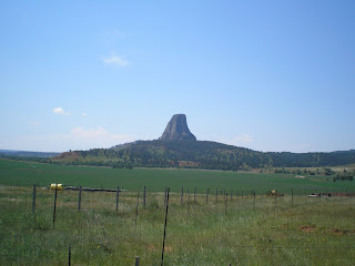
    The first view from WY24 when approaching from the south.
    When Theodore ["Don't call me Teddy!"] Roosevelt made Devils Tower the first National Monument, Wyoming had two important firsts: 1)the world's 1st National Park & 2)the world's first National Monument.


    Scientists initially felt Devils Tower was the core of a former volcano; but new research indicates that it was an igneous intrusion [of magma] between layers of sedimentary rock. This view is from the Belle Fourche Campground, which is located in a U-shaped area next to the Belle Fourche River.


    Zooming in....


    There's a prairie-dog colony in field between the road and the ampitheater/campground. [Click once to enlarge; press ESC to return here.]


    The brochure says not to feed the "dogs" since they bite; however, most run for their holes if you get within 75 feet of them.


    Now you have some idea why cattlemen don't particularly like prairie-dogs.


    A view from the north-west of Devils Tower from Joyner Ridge Road.


    Zooming in....
    Here are some numbers on Devils Tower. "It rises 867 feet from its base and stands 1,267 feet above the river and 5,112 ft above sea level. The area of its tear-drop-shaped top is 1.5 acres and the diameter of its base is c1000 ft."


    Another view of DT while driving back to the campground, which is to the right of the monolith.


    One final look at Devils Tower as seen from the road from Hulett.


Links:
Return to Top of Page

M 16 Sep Actual Route: Broadway Blvd Walmart - Dollar Tree Erna Fergusson Br Lib - Cedar Ridge - Moriarty Lib - Moriarty Trk Stp

T 17 Sep Actual Route: Moriarty Trk Stp - Moriarty Lib - Santa Rosa McDs - Santa Rosa Trk Stp

W 18 Sep Actual Route: Santa Rosa Trk Stp - Santa Rosa McDs - Tucumcari McDs - Tucumcari Lib - Tucumcari Trk Stp

Th 19 Sep Actual Route: Tucumcari Trk Stp - Tucumcari Lib - Dalhart, TX - US54 Picnic Area

F 20 Sep Actual Route: US54 Picnic Area - Stratford Lib - Guymon, OK, Lib - Corral Driv-In RV Park

Sa 21 Sep Actual Route: Corral RV Pk - Liberal, KS, McDs - Lib - P.O. - Walmart

Su 22 Sep Actual Route: Liberal Walmart - McDs - Meade - Dodge City W/M

M 23 Sep Actual Route: Dodge City W/M - P.O. - Lib - State Farm Agent - John's Body Shop - Walmart

T 24 Sep Actual Route: Dodge City W/M - John's Body Shop - DC Lib - Bucklin Lib - Sitka bd

W 25 Sep Actual Route: Sitka, KS bd - Buffalo, OK - Woodward McDs - P.O. - Lib - Walmart


Finding Campgrounds:

N.B. I receive nothing from Trailer Life, Woodalls, or FreeCampsites.net for including links to their free campground lookups.