Hawley's Landing, Heyburn State Park, ID

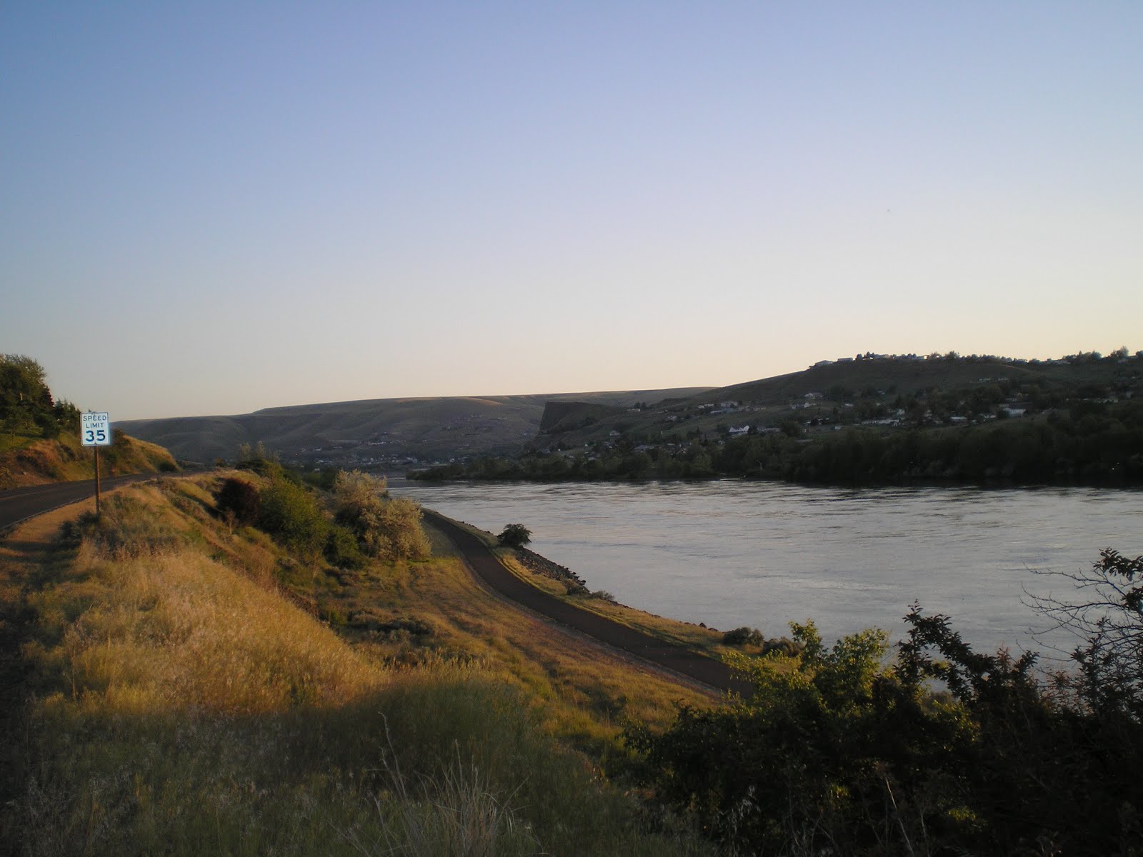
The confluence of the Snake and Clearwater Rivers; the Snake is flowing north directly at you while the Clearwater joins it from the east. Since the two Idaho town at this confluence are named Lewiston and Clarkston you can likely guess who camped here in 1805.

Zooming in, you're looking at Idaho's only seaport (there are eight locks to pass through on the way to Portland) as well as the lowest point in the state at 710'.

Panning right you're looking at the eastern edge of the state of Washington.

Panning left your can see a bridge over the Clearwater toward the south and another across the Snake; I crossed both, the first intentionally and the second when I was in the wrong lane to drive up the Snake (ie., south) to Hells Gate State Park.
You can assume that wherever you see trees, there are also houses -- especially since trees are largely absent from the hills further south.

A large paper plant on the south bank of the Clearwater River; I smelled it before ever seeing it.


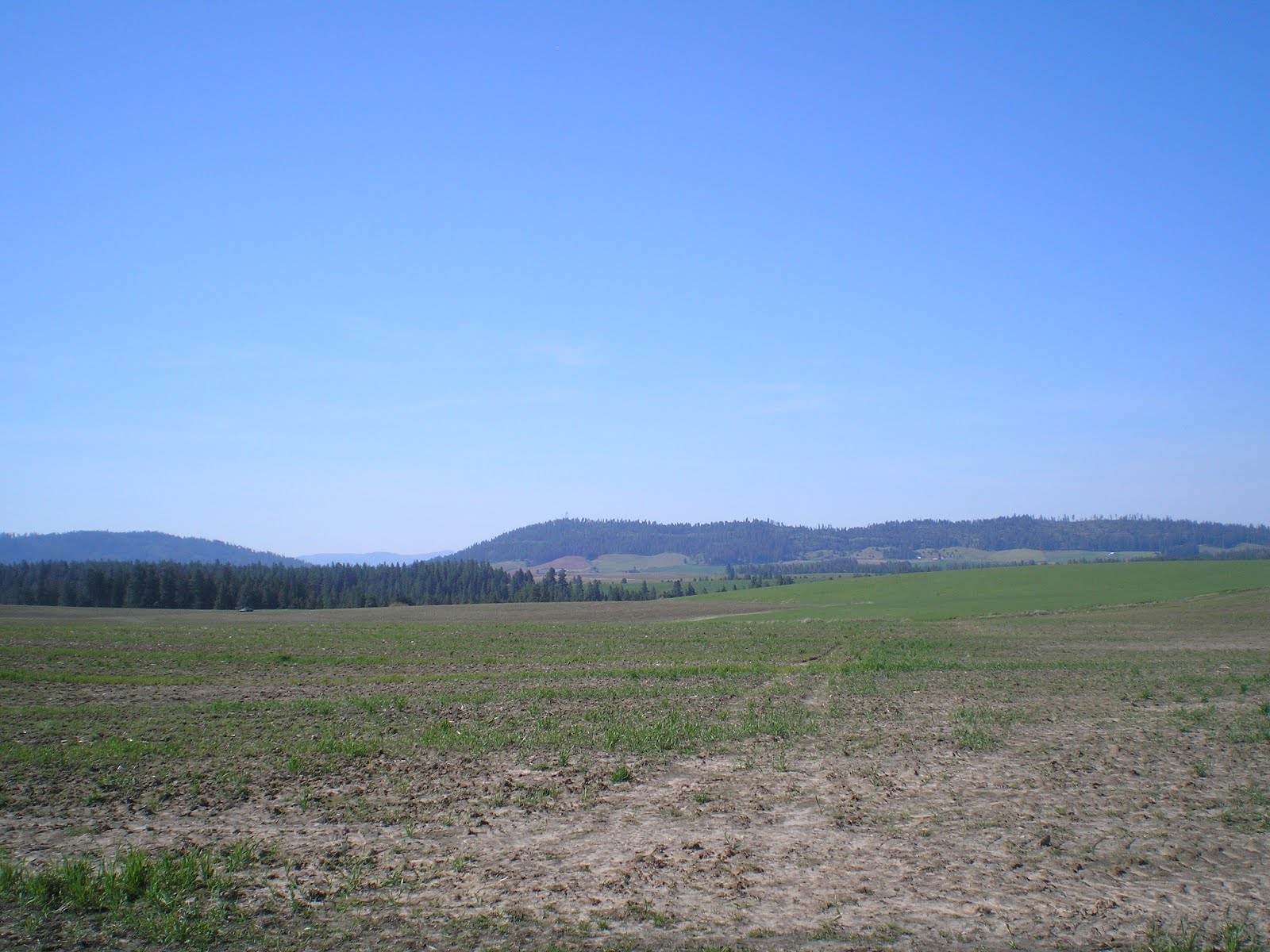
While it appears I had too much to drink before I took this photo, the hills become smaller as one drives north from Boise. In fact, from the Grangeville on the Camas Pairie to Moscow and even to Plummer, where I turned east to Heyburn State Park, it's "hill and dale" through newly planted wheat fields. [Don't know where Idaho stands among the spring wheat states such as the Dakotas and Minnestoa, but it's clear the wheat is a major crop in the "Gem State."]
Though the Nez Perce Indians were willing to learn more about the white men's ways, they changed their tunes once gold was discovered and those seeking it claimed their land.

This view reminded me of the drive from Petaluma, California, toward Bodega Bay -- mainly because the rounded hills looked similar.

Here's the bridge to Oscolia, WA, which I was forced to cross.
A young woman was walking her dog on the path you see below next to the river. Felt like yelling, "Smile....You're on Candid Camera," but the angel on my right ear convinced me otherwise.
Looking south along (or up) the Snake River a few miles from Hells Gate State Park.

Houses in or near Asotin, WA, on the Snake River bluff.

Most farmers cut down the ponderoas pines and Douglas firs in order to plant wheat. Clearly, Virgil T. McCrosky "marched to a different drummer."

Hope to visit the Sacred Heart Mission in the Coeur d'Alene area; Father Cataldo also established Gonzaga University in the Spokane area.

The snow-capped Bitterroot Mountains along the Montana/Idaho border from just east of Plummer, Idaho.

Note the small hill in the center of the photo; it was almost certainly given a "haircut" by the first farmers in the area.
This field was not plowed and planted this spring -- though there is some wheat growing here; my guess is that the plants came from spillage during last fall's harvest.

While the map says that Heyburn State Park is at the southern end of Coeur d'Alene Lake, the park's website mentions three different and smaller lakes: Charcolet?, Benwah, & ?. [Think the southern end of Lake Coeur d'Alene is also know as Benwah Lake.]

Because the lake appears to extend to the left at the far end of this view past a railroad bridge, my guess is that this is part of Coeur d'Alen Lake.

Zooming in, the RR bridge appears to be a "swing bridge" rather than a drawbridge. [There are several swing bridges on the Sacramento/San Joaquin delta in California.]
--
Links:
- Heyburn State Park, oldest park in Idaho and the NW
- Wikipedia article on Moscow, Idaho
- Palouse Country History of Moscow
Sa 12 May Actual Route: Moscow Walmart - Moscow - Tensed - Plummer - Heyburn State Park
Su 13 May Actual Route: Heyburn State Park - Plummer - Coeur d'Alene - Post Falls - PF Walmart
M 14 May Actual Route: Post Falls Walmart - Idaho Veneer Co - Post Falls Library - Coeur d'Alene - bd 5 mi up Beauty Creek USFS CG Rd
T 15 May Actual Route: bd 5 mi up Beauty Creek USFS CG Rd - Beauty Crk CG - Old Mission State Park - Old Mission Landing - Pinehurst - Cataldo - Kahnderosa RV Park
W 16 May Actual Route: Kahnderosa RV Park - Coeur d'Alene - Hayden Lib - Athol Lib - Farragut State Park
Th 17 May Actual Route: Farragut State Park - Athol Lib - Sandpoint - Ponderay Walmart
F 18 May Route: Ponderay Walmart - Sandpoint Lib - Clark Fork
Finding Campgrounds:
- RV Campgrounds from TrailerLifeDirectory.com
- Family Camping Directories from Woodalls.com
- Free campsites website
- Info on finding BLM Campgrounds
No comments:
Post a Comment