Bridgeport, CA

Because the USFS Mill Creek Campground was closed I was forced to boon-dock (aka dry-camp) on Lower Mill Creek Road; I had car-camped there many times in the past once I had caught enough fish for a meal from Kennedy Creek. The sunset which I attempted to capture escaped!

As seen from the trail at Donnell's Vista, here are the Dardanelles: that is, Dardanelle's Cone and associated volcanic formations.

Donnell's Dam and Reservoir as seen from the Vista Point at the end of an asphault trail. (Though I had stopped at the parking lot many times, this was the first time I bothered to walk to the end of the trail.)
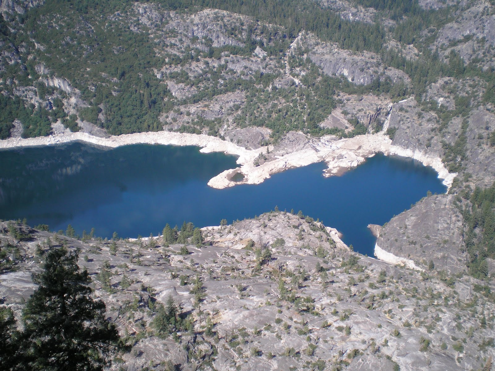
Looking almost straight down at the upper end of Donnell's Reservoir.

[Click 1 or 2 times to zoom in].Panning to the right , a view of the fast water entering the lake. [Donnell's is the uppermost of 3 reservoirs created by the Turlock Irrigation District: Donnell's, Beardsley, & Tullock as you travel down the Middle Fork of the Stanislaus River.]

The 1923 bridge over the Middle Fork of the Stanislaus River just above The Dardanelles Resort and Eagle Creek. It was one of two sites used in the movie "For Whom the Bell Tolls," starring Gary Cooper and Ingrid Bergman. [My late father, who made $37/day in 1941 as an extra, made $1200/year as teacher, principal, and janitor of Shaw's Flat Elementary School; he said $37 was big money in those days.]

A look from the 1923 bridge down the M.F. of the Stanislaus; spent a minute or so looking for fish, but didn't see any.

The New Kennedy Meadows Lodge, which replaces the original one destroyed by javascript:void(0)fire in 2007.

A view of the lower end of Kennedy Meadows from just a short distance up the "serious" portion of Sonora Pass.

A view generally to the east from SR108 about 100 yards below the Sonora Pass. There were no parking places -- perhaps because day-hiker, backpackers, & deer-hunters were too lazy to walk a little bit further from the trailhead parking a short ways down the road from the top.

A view from a switchback of the falls, whose name I can't remember, but it's in the next drainage to the north of Leavitt Creek and Lake.

Leavitt Falls from the Vista Point created by the USFS.

Leavitt Meadows and the West Fork of the Walker River.

Also from the Leavitt Falls Vista Point a view of a lake just below the deepest notch in the background ridge; think it may be Poole Lake.

Another view of Leavitt Meadows and the West Fork of the Walker River from a somewhat lower elevation.

The US Marine Corps training base at Pickel Meadows. Formerly it was known as the Cold-Weather Training Base, but it's now called the Mountain Warfare Training Center. (Met a former Marine on my last long backpack in 2006 who went through its "freeze-your-buns" training.) I saw troops on the north side of SR108 from just below the pass to Pickel Mdw.
--
Links:
- Kennedy Meadows Lodge Back in Business
- Pickel Meadows Mountain Warfare Training Center
F 23 Sep Actual Route: Long Barn - Tuolumne - Lwr Mill Creek Rd
Sa 24 Sep Actual Route: Lwr Mill Creek Rd - Kennedy Mdws - Sonora Pass - Bridgeport - Sonora Jcn - Monitor Pass - SR89 near SR4
Su 25 Sep Actual Route: SR89 Near SR4 - Markleeville - Carson Pass - Woodfords - Minden/Gardnerville - South Lake Tahoe - Crystal Sprs CG
M 26 Sep Actual Route: Crystal Sprs CG - Minden - Garnderville - Davis Crk RV Park
T 27 Sep Actual Route: Davis Crk RV Park - Reno - Lemmon Valley - Panther Valley RV Park
W 28 Sep Route: Panther Valley RV Park - Reno - Sparks - Pyramid Lake - Wadsworth
--
Finding Campgrounds:
- RV Campgrounds from TrailerLifeDirectory.com
- Family Camping Directories from Woodalls.com
No comments:
Post a Comment