Lower Little Truckee CG, Tahoe NF, CA
The spillway at Oroville Dam, the largest (ie. tallest) earth-fill dam in the United States.
Not quite sure why the automatic focus did perform better on this shot of a parking area c9 miles west of LaPorte; perhaps I was afraid of backing into the small tractor whose tracks you can make out amongst the gravel and rocks.
Red fir and a small ponderosa pine [aka, yellow pine] along the left side of the road while the somewhat less symmetric, scraggily tree on the right side of the road is a sugar pine, even though there are no cones, big or little, at the ends of the branches. Elevation here is in the 4000-6000' zone where sugar pines thrive in the Sierra Nevada.
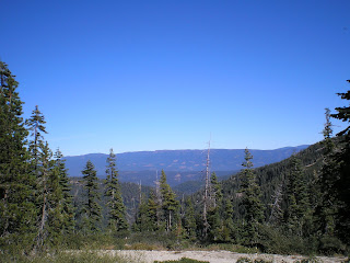
As I got back into the pickup I noticed a mountain in the distance in the side-view mirror. Not sure what it is, but it is likely one of the higher mtns to the north of Oroville. Note, however, that there are a lot of sugar pines with cones on the left side of the road.
A plaque on the western outskirts of LaPorte. Gold was discovered in the area in 1850, but the name was changed from Rabbit Creek to LaPorte in 1857. [Check the Links below for an explanation/history.]
Just outside the eastern edge of LaPorte is a junction. The left road takes one to Little Grass Valley Reservoir while the road on the right had this plaque by it. The fact that bankers in LaPorte rather than Quincy handled the financing may mean that LaPorte was experiencing a boom at the time. [Again, check below for more on the history of the town.]
Clearly, timber country! My cousin in Oroville, a timber faller, is well-located.
Pilot Peak (elev: 7457'), which has a USFS lookout atop it. The Quincy-LaPorte Road crosses the ridge near the bare spot on this photo.
A look down into the valleys of the Feather River and it tributaries. The deepest canyon is the one in the istance, the Middle Fork of the Feather River where there are numerous small towns along CA70 & CA89.
Two bridges over Nelson Crk, 1890 & ?
A look from the other end of the older Nelson Crk bridge.
Went back to P/U & got a can of white spray paint & left the following graffiti. [Actually, this is one name I do not consider graffiti.] Looking at the name again, it was probably done with a brush, perhaps before spray cans of paint became available.
--
Links:
- Wikipedia article on Oroville Dam
- Tallest Dams in the U.S.
- Things to do and history of La Porte, CA
Su 16 Oct Actual Route: Martis Crk Reservoir - Kings Beach - Lake Forest - Tahoe City
M 17 Oct Actual Route: Tahoe City (Wm Kent CG) - Meeks Bay - Inspiration Point - South Lake Tahoe - Minden - Carson City - Washoe City (Davis Crk Pk)
T 18 Oct Actual Route: Davis Crk Pk - Carson City - Minden - Topaz Lake - Sonora JunctionW 19 Oct Route: Sonora Junction - Bridgeport - Lee Vining - Yosemite
--
Finding Campgrounds:
- RV Campgrounds from TrailerLifeDirectory.com
- Family Camping Directories from Woodalls.com


No comments:
Post a Comment