Burley Library*, Idaho, Library

While using all three hands to take a photo of the Howell Opera House in Oakley I managed to add slope to a level street. [:-)>]

A side view of the Opera House in Oakley, which was founded in 1882. Saw another bldg with 1882 on it as well as a store which stated "Since 1923."

A hint of things to come in the saddle through which the road traveled. [See the post below for routes & CG finders.]

The road throughout the National Reserve is dirt and not suited for large RVs.

[Click once to enlarge this, or any other photo.]

While the snow was almost gone on the broad peak above my rig, more fell Monday night -- though not in large amounts. But that's what provides Idaho with more water than most of the other western states I've visited.

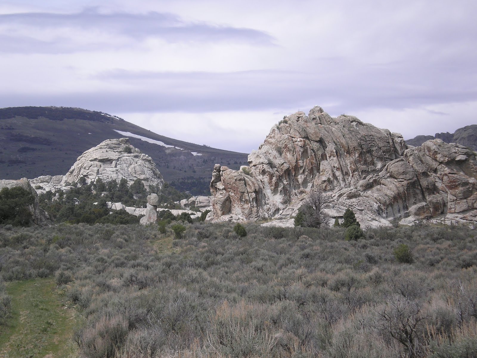
Look closely between the trees in the middle of this photo.

Can't recall if these rock formations were called the "bread loaves" -- or if that name was given to formations closer to the Oakley entrance.

Many of those who visit the City of Rocks are rock climbers.


Here are the two formations shown on the plaque in the photos above. There was someone on the formation to the right, but he didn't seem to be a very experience climber.

Thought for a while that the weather forecast was wrong; but by the time I got to the Visitor Center in Almo, the sky had become overcast.

The green valley in the center of the photo is where Almo, a cattle-raising area, is located.

It's clear from some of the plaques that the Reserve is open during the winter time.

Skipped Bath Rock since I wanted to stay in the warm cab of my pickup -- California Surfer Dude that I am!

Some of the material on the bulletin boards is repetitive.

Ditto!!

The camera was level -- but the terrain sloped from right to left into Circle Creek or Valley.
Double Ditto!!

This is a look back toward the Emery Canyon Entrance (which I called the Oakley Entrance above).

A view into the Circle Creek Valley (or Basin).

A plaque next to Treasure Rock, where the overland travelers thought it was a "Pleasant Place" to camp.

A look up at Treasure Rock -- though it looks more like Turtle Rock from where I took this photo.

What's left of the William E. Tracey ranch house, which was started in 1896 but gutted by a fire in 1967.

Another view of the Tracey ranch house.

In the distance, the mountains of Northern Nevada in the Sawtooth National Forest.

Panning left, the valley where Almo is located. The Visitor Center for the City of Rocks NR sits almost exactly on top of the California Trail.

Panning further left....

At the Visitor Center, a plaque which explains that the Conestogas used in movies were not used by travelers intent on crossing even the most minor mountain ranges.

"Camped...." Stops at noon were for relief from the sun and heat; but the real camp was made at night, perhaps after obtaining water from the springs near Almo.

Two replicas of the ligther-weight wagons used on both the California and Oregon Trails.

The California Trail, which was very near this plaque, existed for a little over 20 years: from the discovery of gold on the American River at Colma in 1848 until the completion of the the transcontinental railroad by the Central & Union Pacific Railroads in 1869.

Looking up from the plaque, here's a photo of some of the key peaks or mountain ranges noted in the illustrations on the plaque.
A marker not far from the Raft River, which starts in the valley where Almo is located. It mentions many of the routes which branched off of the California Trail in this area.
If you're interested, read The California Trail by George R. Stewart, author of Ordeal by Hunger, one of the better accounts of the Donner Party.
--
* The Burley, ID, Library changes its WiFi passcode every day they are open. If, as I did, you arrive on a Sunday, you are SOL. Here's a link to their hours of operation.
Links:
- City of Rocks Natl Reserve pages on NPS website
- Wikipedia article on the California Trail
- The Oregon Trail by Todd Underwood
T 1 May Actual Route: Burley bd - Burley Lib - Kimberley - Twin Falls - Perrine Memorial Bridge - Twin Falls Walmart
W 2 May Actual Route: Twin Falls Walmart - Twin Falls Lib - Shoshone Falls - Buhl - Miracle Hot Springs RV Park
Th 3 May Actual Route: Miracle Hot Springs RV Park - Hagerman Fossile Beds Natl Monument - Bliss - Gooding - Glenns Ferry - Three-Island Crossing State Park
F 4 May Route: Three-Island Crossing State Park - Mountain Home
Finding Campgrounds:
- RV Campgrounds from TrailerLifeDirectory.com
- Family Camping Directories from Woodalls.com
- Free campsites website
- Info on finding BLM Campgrounds
No comments:
Post a Comment