Sunset Beach State Park Campground, Oregon
A view of a jetty partially obscured by trees or brush on the right and a triangular area which is probably some sort of sea-farm. As a guess I told one couple it might be an oyster farm. But, assuming there are otters along the Oregon coast, how do you keep the hungry little devils from devouring your "crop"?
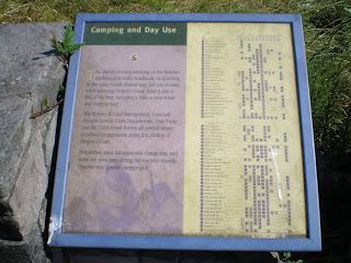
[Click 1 or 2 times to enlarge.] A list of recreational areas in Douglas and Coos Counties.
A few specifics on things to do. Because I skipped spending any time in and around Winchester Bay, I missed the Umpqua Lighthose; you'll find a link to it below.
Note the presence of sand dunes at the upper end of the northern-most arm of Coos Bay; they apparently extend, though perhaps not continuously, from just south of Florence to Coos Bay.
A Veterans Memorial to David Dewett with the iconic bridge designed by Conde B. McCullough in the left background.
You can see another lower bridge to the right. Also, the McCullough Bridge takes one to North Bend. The center of Coos Bay is 3 miles south along the arm under the high bridge.
--
Links:
- LighthouseFriends.Com website on the Umpqua Lighthouse
- Wikipedia article on Coos Bay
- Oregon State Park website for Sunset Beach State Park
M 15 Aug Actual Route: Florence - Reedsport - North Bend - Charleston
T 16 Aug Actual Route: Charleston - Bandon - Port Orford - Gold Beach - Indian Crk RV Park
W 17 Aug Route: Indian Crk RV Pk - Gold Beach - Brookings
--Finding Campgrounds:
- RV Campgrounds from TrailerLifeDirectory.com
- Family Camping Directories from Woodalls.com


No comments:
Post a Comment