Lake Sonoma, CA

With the temperature for Ukiah today predicted to be 98 I decided to head for a large body of water which might provide some coolness if there were a wind over the lake's surface toward whichever campsite I chose. But, alas, the Liberty Glen sites are at widely-varying elevations above the lake (elev: 517') in the coast range just off of a back-country road to Stewart's Point.
The photo above was taken at a viewpoint just above the dam on Dry Creek just below it's confluence with Warm Springs Creek.
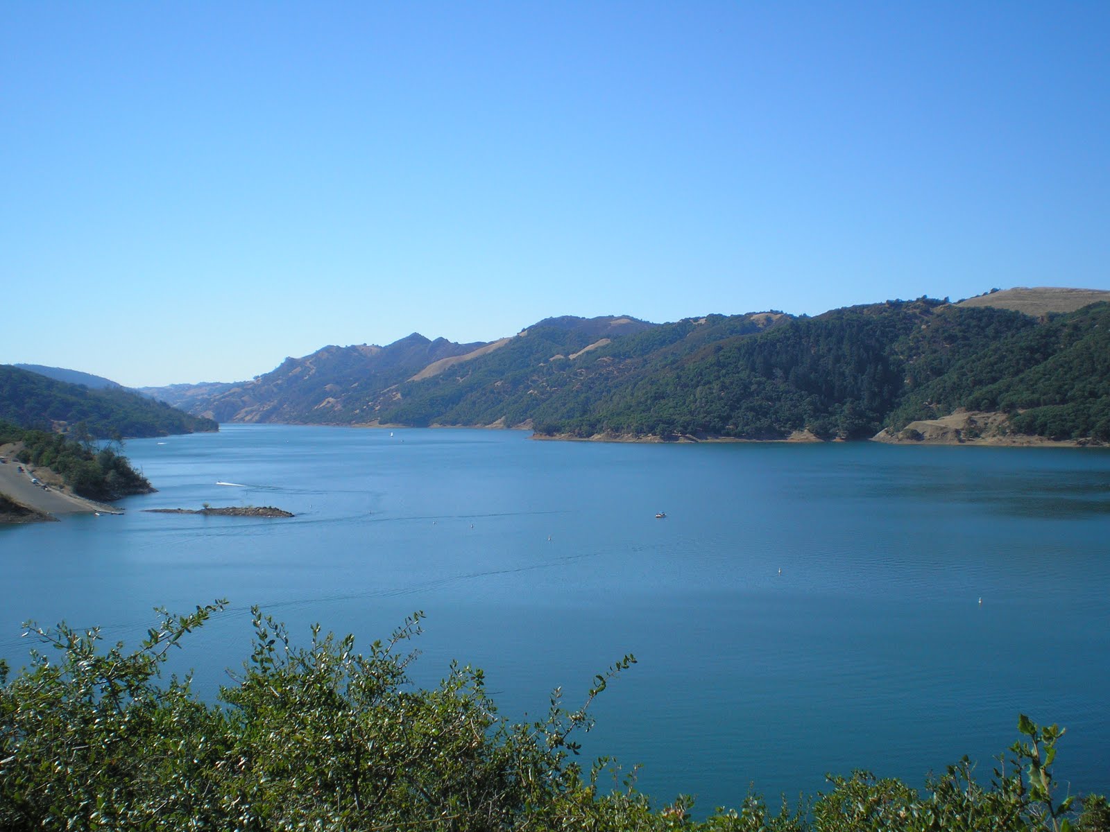
Here's a look up the lake, which extends for 8 miles along Dry Creek. You can see the large boat landin on the left.

Panning to the left from the landing you see one of Corps of Engineers specialties during war-time: bridges -- with this bridge over the Warm Springs arm, which extends for 4.5 miles from either the dam or the landing.

As I was leaving the viewpoint I noticed a flower bed to the right framed with old railroad ties.

I was surprised to find that the memorial was to a man who lost his life on Lake Sonoma rather than someone who was instrumental in designing, creating, or campaigning for the lake.

Behind the memorial bench and flower bed I found a window in the trees and vegetation where I could photograph the principal occupation of some of those along Dry Creek: growing grapes and making wine.

The upper end of the Warm Spring Creek arm of Lake Sonoma.

A large, dead oak tree on a point where a steep but dry tributary drops down to Warm Springs Creek. [Click 1 or 2 times to zoom in.] Note that even some new growth from the top of some of the nearly horizontal branches is also dead.

Some kids had taken paddle-boats (or perhaps boats powered by small outboard motors) up the Warm Springs arm. I heard their loud radio before I saw the boats. I never saw them, but judging by the commotion below they may have been skinny-dipping.

Panning left here's more of the Warm Springs arm.

A shot of my rig in site #90. Note that many small redwoods have been planted; if they're not pruned too high, they will eventually provide shade for the hot summer months.
One thing I've noticed about Corps of Engineer campgrounds is that not every site is nearly level; in fact, one has to do a great deal of searching if you don't wish to use blocks or jacks. [The US Forest Service campground sites are usually very close to level, especially those which have recently been resurfaced. Even the Bureau of Land Management sites which have ashphalt pads are often nearer to level than those at CoE sites. (Guess if a landing craft or jeep looks nearly level on a site, that's good enough for the Combat Engineers!)]
--
Links:
- Brief Wikipedia article on Lake Sonoma
- Wikipedia article on Cloverdale, CA
- Wikipedia article on Healdsburg, CA
- Healdsburg History Home website
T 23 Aug Actual Route: Chekaka CG - Ukiah - Cloverdale - Lake Sonoma
W 24 Aug Actual Route: Lake Sonoma - Healdsburg - Guerneville
Th 25 Aug Route: Guerneville - Sebastopol - Petaluma
--
Finding Campgrounds:
- RV Campgrounds from TrailerLifeDirectory.com
- Family Camping Directories from Woodalls.com
No comments:
Post a Comment